
1HappyHiker
Well-known member
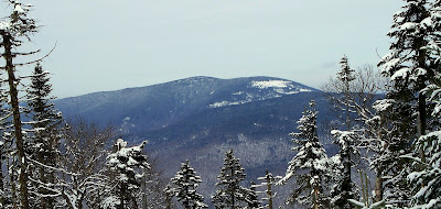
Using the Bunnell Notch Trail as our initial approach route, my friend Steve and I did a bushwhack off the Mt. Cabot/Kilkenny Ridge Trail to the large talus field that is high up (at about 3,800 ft.) on the southern end of Mt. Cabot. You’ve probably seen this talus field from one location or the other. In the PHOTO BELOW (taken from a large blowdown area near the summit of Mt. Waumbek), the talus field shows up as the large patch of snow on the end of Cabot.
Before I go any further, I should explain about the “Sheep-Pen” used in the title of this report. Thanks to some excellent research by Steve, he discovered that in the 1880s AMC explorers had been to this spot and they dubbed this area as the "Sheep-fold", presumably for its resemblance to the rock enclosures called sheepfolds that are used to huddle sheep together.
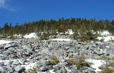
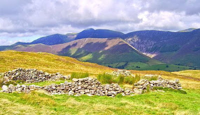
Below are 2 photos. The photo on the left shows a small portion of the massive talus field (“sheepfold”) on Cabot. And, the photo on the right shows the ruins of a sheepfold in Scotland. I know, I know! Both photos show piles of rock, but I think I can see why the early explorers might have likened this area to a “Sheep-fold”.
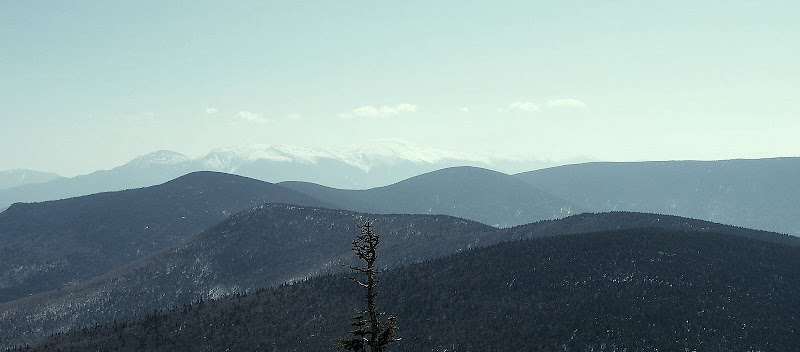
The above photo of the “sheepfold” on Cabot was taken looking northward, and you’ll notice a deep-blue sky overhead. Well, unfortunately, there was nothing but hazy views in all other directions (as you’ll see in the photos below). But, even though the views were hazy, we could still see the entire Mahoosuc Range, and Carter-Moriah Range, plus the northern Presidentials, and many distant peaks could be seen through the haze in the Franconia Range and Twins-Bond Range. Probably on a clear day, even more distant peaks could be seen such as the Osceolas, Kinsmans, Moosilauke, etc.
All the more reason to return to this spot sometime in the future on a bluebird day!")
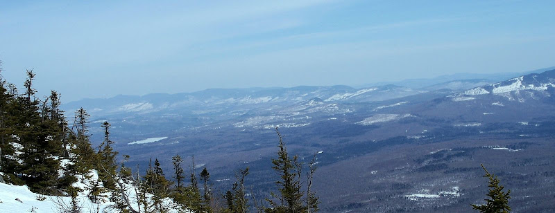
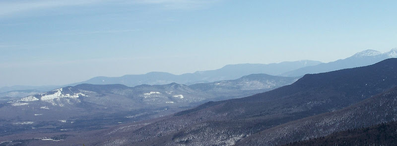
So, presented below are 3 hazy photos which perhaps might at least give you some flavor of the many, and expansive views from the talus field at the southern end of Cabot.
Northern Presidentials as seen looking over sprawling ridges of Terrace, Weeks and Waumbek
The Mahoosuc Range
Peaks in Carter-Moriah Range in background on the horizon, with Crescent Range in front of them
1HappyHiker
Before I go any further, I should explain about the “Sheep-Pen” used in the title of this report. Thanks to some excellent research by Steve, he discovered that in the 1880s AMC explorers had been to this spot and they dubbed this area as the "Sheep-fold", presumably for its resemblance to the rock enclosures called sheepfolds that are used to huddle sheep together.
Below are 2 photos. The photo on the left shows a small portion of the massive talus field (“sheepfold”) on Cabot. And, the photo on the right shows the ruins of a sheepfold in Scotland. I know, I know! Both photos show piles of rock, but I think I can see why the early explorers might have likened this area to a “Sheep-fold”.
The above photo of the “sheepfold” on Cabot was taken looking northward, and you’ll notice a deep-blue sky overhead. Well, unfortunately, there was nothing but hazy views in all other directions (as you’ll see in the photos below). But, even though the views were hazy, we could still see the entire Mahoosuc Range, and Carter-Moriah Range, plus the northern Presidentials, and many distant peaks could be seen through the haze in the Franconia Range and Twins-Bond Range. Probably on a clear day, even more distant peaks could be seen such as the Osceolas, Kinsmans, Moosilauke, etc.
All the more reason to return to this spot sometime in the future on a bluebird day!
So, presented below are 3 hazy photos which perhaps might at least give you some flavor of the many, and expansive views from the talus field at the southern end of Cabot.
Northern Presidentials as seen looking over sprawling ridges of Terrace, Weeks and Waumbek
The Mahoosuc Range
Peaks in Carter-Moriah Range in background on the horizon, with Crescent Range in front of them
1HappyHiker
Last edited: