1HappyHiker
Well-known member
When thinking about short hikes to low altitude destinations, perhaps names like Wocket Ledge and Dream Lake don't roll off the tip of your tongue quite as readily as say Mt. Willard or Sawyer Pond.
Anyway, this past Sunday (23-May), I headed up the Peabody Brook Trail to access Wocket Ledge and Dream Lake. These are two places I'd never visited. Perhaps I'm mistaken, but I think the Peabody Brook Trail was once part of the Appalachian Trail, serving as the "bridge trail" between the Carter-Moriah Range and the Mahoosuc Range prior to the Centennial Trail being built in 1976.
Since I'd already been to Giant Falls, I decided to bypass the spur path to the waterfalls on this particular trek. Instead, I continued northward to the point where the trail crosses Peabody Brook and begins to head more easterly toward Dream Lake. At this point, I opted to go off-trail and bushwhack northward for a few tenths of a mile to intersect the Mahoosuc Trail just a bit east of Wocket Ledge.
A few hundred feet before intersecting the Mahoosuc Trail I came upon a trail that was oriented in the same east/west direction as the Mahoosuc Trail. At first I thought it was the Mahoosuc Trail. However, it didn't feel right, and there were no white AT blazes in sight. So I continued northward just a bit farther and soon arrived at the real Mahoosuc Trail. In thinking about this later, I wonder if the first trail that I came upon was perhaps a former segment of the Mahoosuc Trail before a re-route? Or, possibly could it have been part of that buffering corridor which is located on either side of the AT??
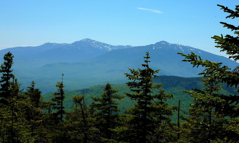
Okay, to get back to my hike, I finally arrived at Wocket Ledge (a rather odd-sounding name that could've been coined by Elmer Fudd). There might have been a good view from here at one time, but now it's a bit overgrown and so the view is somewhat restricted by trees. Below is a slightly zoomed snapshot of the Presidentials taken from this ledge.
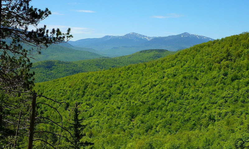
It's not my intent to be disrespectful to Wocket Ledge, but I think the trailside views from the Peabody Brook Trail are just as good as the views from this ledge. Below is a photo of one of the trailside views that are located just a bit north of the spur trail to Giant Falls.
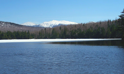
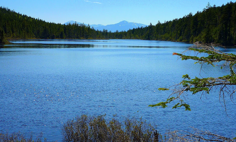
From Wocket Ledge I headed eastward on the Mahoosuc Trail to get to my next destination which was Dream Lake. In my opinion, the view from the northeast end of this lake is exceptional. Seen "floating" on the horizon is Mt. Washington on the left with Mt. Adams on the right, with a portion of Mt. Clay in between. About the only thing to dislike about Dream Lake is that there's no really comfortable place to sit and enjoy the views.
I wish that the lighting had been better when I was there, but hey . . . you can't have everything. Below is one slightly zoomed photo from the northeast shore of Dream Lake.
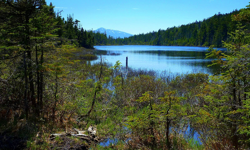
Below is yet another Dream Lake photo, but taken from a different location along the northeast shore.
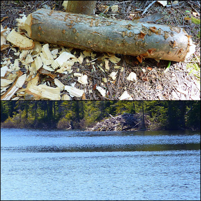
After admiring the views from Dream Lake, I returned to the trailhead via the Peabody Brook Trail. There are a lot of bog bridges all along the eastern shore. They are all in good shape and appear to be no more than a few years old.
Even though the bog bridges are in good shape, the Peabody Brook Trail has a few issues which begin roughly where the trail has a short ladder (about 1.8 miles or so from the trailhead). From that point forward to the beginning of the bog bridges, there are multiple blowdowns, and the trail is in major need of brushing. I wouldn't go so far as to say that this segment of trail is a "war-zone", but it certainly could be described as the sight of a minor skirmish! This wasn't a problem for me since many of my bushwhacks take me through similar conditions, but it might be an issue for those who prefer a well-groomed trail.
Overall, I found this relatively short hike to be very pleasant. It was made even nicer by interspersing a bushwhack between the Peabody Brook Trail and the Mahoosuc Trail which transformed this into a loop-hike of sorts. I was impressed enough with Dream Lake to make a return visit sometime. I'll likely consider doing it as a completely on-trail hike by using the Peabody Brook Trail, Dryad Falls Trail, and Austin Brook Trail. This would require a short road walk between trailheads (or I'd possibly do a bike-spot).
1HappyHiker
Anyway, this past Sunday (23-May), I headed up the Peabody Brook Trail to access Wocket Ledge and Dream Lake. These are two places I'd never visited. Perhaps I'm mistaken, but I think the Peabody Brook Trail was once part of the Appalachian Trail, serving as the "bridge trail" between the Carter-Moriah Range and the Mahoosuc Range prior to the Centennial Trail being built in 1976.
Since I'd already been to Giant Falls, I decided to bypass the spur path to the waterfalls on this particular trek. Instead, I continued northward to the point where the trail crosses Peabody Brook and begins to head more easterly toward Dream Lake. At this point, I opted to go off-trail and bushwhack northward for a few tenths of a mile to intersect the Mahoosuc Trail just a bit east of Wocket Ledge.
A few hundred feet before intersecting the Mahoosuc Trail I came upon a trail that was oriented in the same east/west direction as the Mahoosuc Trail. At first I thought it was the Mahoosuc Trail. However, it didn't feel right, and there were no white AT blazes in sight. So I continued northward just a bit farther and soon arrived at the real Mahoosuc Trail. In thinking about this later, I wonder if the first trail that I came upon was perhaps a former segment of the Mahoosuc Trail before a re-route? Or, possibly could it have been part of that buffering corridor which is located on either side of the AT??
Okay, to get back to my hike, I finally arrived at Wocket Ledge (a rather odd-sounding name that could've been coined by Elmer Fudd). There might have been a good view from here at one time, but now it's a bit overgrown and so the view is somewhat restricted by trees. Below is a slightly zoomed snapshot of the Presidentials taken from this ledge.
It's not my intent to be disrespectful to Wocket Ledge, but I think the trailside views from the Peabody Brook Trail are just as good as the views from this ledge. Below is a photo of one of the trailside views that are located just a bit north of the spur trail to Giant Falls.
From Wocket Ledge I headed eastward on the Mahoosuc Trail to get to my next destination which was Dream Lake. In my opinion, the view from the northeast end of this lake is exceptional. Seen "floating" on the horizon is Mt. Washington on the left with Mt. Adams on the right, with a portion of Mt. Clay in between. About the only thing to dislike about Dream Lake is that there's no really comfortable place to sit and enjoy the views.
I wish that the lighting had been better when I was there, but hey . . . you can't have everything.
Below is one slightly zoomed photo from the northeast shore of Dream Lake.
Below is yet another Dream Lake photo, but taken from a different location along the northeast shore.
After admiring the views from Dream Lake, I returned to the trailhead via the Peabody Brook Trail. There are a lot of bog bridges all along the eastern shore. They are all in good shape and appear to be no more than a few years old.
Even though the bog bridges are in good shape, the Peabody Brook Trail has a few issues which begin roughly where the trail has a short ladder (about 1.8 miles or so from the trailhead). From that point forward to the beginning of the bog bridges, there are multiple blowdowns, and the trail is in major need of brushing. I wouldn't go so far as to say that this segment of trail is a "war-zone", but it certainly could be described as the sight of a minor skirmish!
This wasn't a problem for me since many of my bushwhacks take me through similar conditions, but it might be an issue for those who prefer a well-groomed trail.Overall, I found this relatively short hike to be very pleasant. It was made even nicer by interspersing a bushwhack between the Peabody Brook Trail and the Mahoosuc Trail which transformed this into a loop-hike of sorts. I was impressed enough with Dream Lake to make a return visit sometime. I'll likely consider doing it as a completely on-trail hike by using the Peabody Brook Trail, Dryad Falls Trail, and Austin Brook Trail. This would require a short road walk between trailheads (or I'd possibly do a bike-spot).
1HappyHiker
Last edited: