1HappyHiker
Well-known member
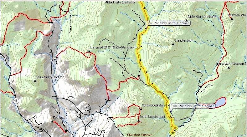
Looking at a topographic map, there is a 2,941 ft peak that is situated nearly due east of the Wildcat Ridge and nearly due west of North Baldface. It is unnamed on topographic maps, but some peak-baggers refer to this mountain as "West Peak, North Baldface". However, I think of it as simply West Baldface.
I decided to go to this little mountain not for peakbagging purposes, but rather because it looked like a spot to get some interesting views, particularly of the Baldfaces. My trek was launched from the end of East Branch Road (Jackson/North Conway area). I hiked northward along the East Branch Trail for several miles before turning eastward to follow old logging roads for another mile or so. Eventually, I left the logging roads and bushwhacked up the west slope of West Baldface. It was an easy whack through ferns, birch and other hardwoods.
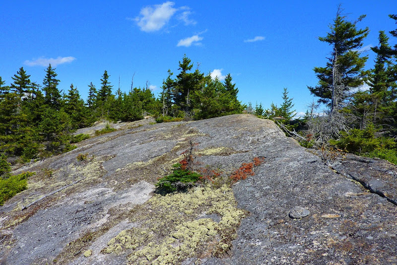
There is no single spot on the summit where there is a 360 degree view, but views in all directions are available by moving around from spot to spot on the summit area.
Below are some photos from this trek.
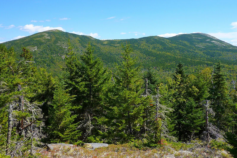
Looking eastward toward North & South Baldface
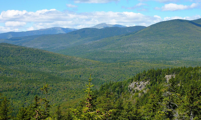
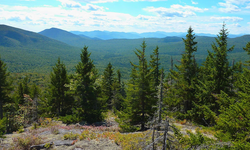
Looking westward over Wildcat Ridge toward Mt. Washington (Slightly zoomed photo)
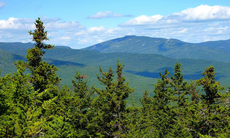
Looking northward toward the rocky ridge of Mt. Moriah that extends into the Wild River Valley
Looking southward toward peaks in the Sandwich Range and other surrounding mountains
Summit area of West Baldface
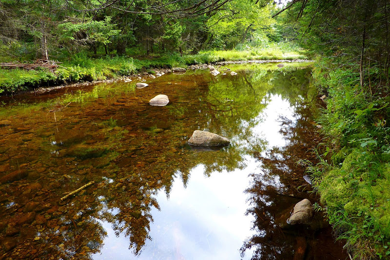
The East Branch was gently flowing in many spots, but at other spots, it was still and "reflective".
This was a quick & easy trek since most of it was on-trail and on logging roads, both of which were relatively flat with only an occasional slight pitch here & there. The only significant climb was the short buswhack to the top of West Baldface. I'd guesstimate the hike to be about 10 miles round trip.
Just as a side note, the portion of the East Branch Trail which I hiked was marked with the metal blue-diamonds used for XC trails. I'm assuming that during the winter months this portion of the trail is part of the trail system maintained by the Jackson Ski Touring Club?
1HappyHiker
I decided to go to this little mountain not for peakbagging purposes, but rather because it looked like a spot to get some interesting views, particularly of the Baldfaces. My trek was launched from the end of East Branch Road (Jackson/North Conway area). I hiked northward along the East Branch Trail for several miles before turning eastward to follow old logging roads for another mile or so. Eventually, I left the logging roads and bushwhacked up the west slope of West Baldface. It was an easy whack through ferns, birch and other hardwoods.
There is no single spot on the summit where there is a 360 degree view, but views in all directions are available by moving around from spot to spot on the summit area.
Below are some photos from this trek.
Looking eastward toward North & South Baldface
Looking westward over Wildcat Ridge toward Mt. Washington (Slightly zoomed photo)
Looking northward toward the rocky ridge of Mt. Moriah that extends into the Wild River Valley
Looking southward toward peaks in the Sandwich Range and other surrounding mountains
Summit area of West Baldface
The East Branch was gently flowing in many spots, but at other spots, it was still and "reflective".
This was a quick & easy trek since most of it was on-trail and on logging roads, both of which were relatively flat with only an occasional slight pitch here & there. The only significant climb was the short buswhack to the top of West Baldface. I'd guesstimate the hike to be about 10 miles round trip.
Just as a side note, the portion of the East Branch Trail which I hiked was marked with the metal blue-diamonds used for XC trails. I'm assuming that during the winter months this portion of the trail is part of the trail system maintained by the Jackson Ski Touring Club?
1HappyHiker
Last edited: