12/7/12 Mt Wantastiquet and the Madame Sherri Forest

vftt.org

Help Support vftt.org:

This site may earn a commission from merchant affiliate links, including eBay, Amazon, and others.

grouseking

Well-known member
Joined
Feb 20, 2005
Messages
2,023
Reaction score
272
Location
Lebanon, NH Avatar: Philosopher?
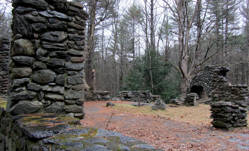
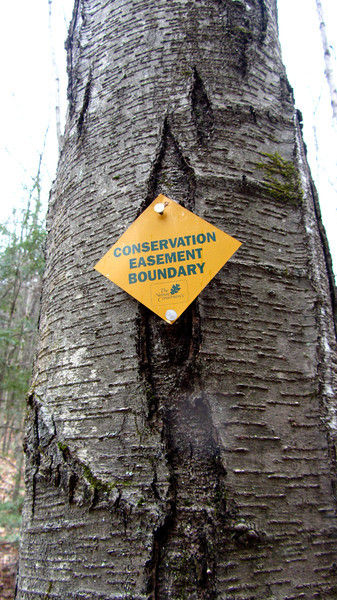
I went on one of the most unique hikes on Friday, 12/7....Mt Wantastiquet in Chesterfield, NH. This is very close to the VT border, in the extreme SW corner of NH. The beginning started in a Society for the protection of NH forests easement called the Madame Antionette Sherri forest. This eccentric lady built a french style chateau when she lived in NH back in the roaring twenties. As the years went by, she ended up going poor, and her chateau burned down, possibly because of arson. Madame Sherri ended up dying at a Brattleboro nursing home on welfare a couple years after her place burned down. The property is haunted. More information can be found here.
http://www.forestsociety.org/ourproperties/guide/?block=71

The story is, if you put your hand on the staircase, you can hear music playing from one of Madame Sherri's parties.
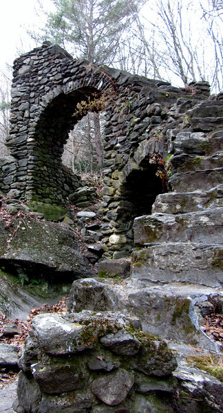
IMG_3933-L.jpg


foundation

IMG_4051-L.jpg


With that out of the way, it was time to go for a hike! I've been wanting to hike in this part of NH for quite some time. Promise for big views considering the low elevation (no higher than 1350 feet) perked my interest. So off we go!

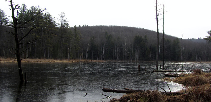
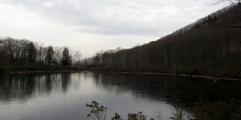
Small pond very close to the trailhead-a small film of ice beginning to form
IMG_3944-L.jpg


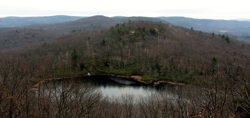
Indian Pond. It was surrounded by mountain laurel bushes...I need to keep this hike filed away as a "must" for next June when the flowers are out!

IMG_3951-L.jpg


view over the pond on our way to Mt Wantastiquet (pronounced wan-tas-kit)
IMG_3952-L.jpg


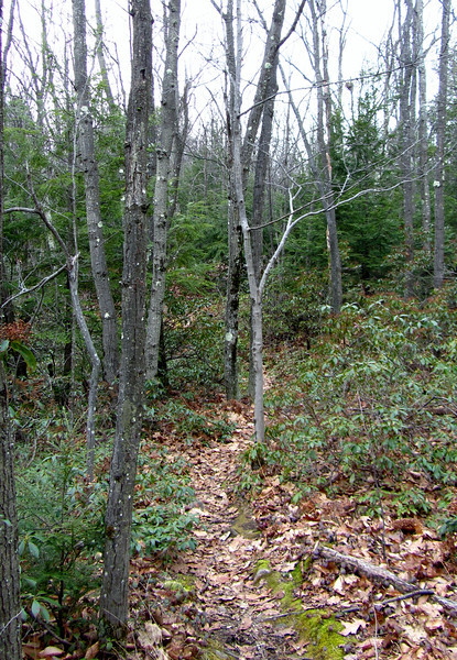
not a great trail pic...but note the profusion of mountain laurel plants....this has me salivating at the picture opportunities next summer
IMG_3964-L.jpg


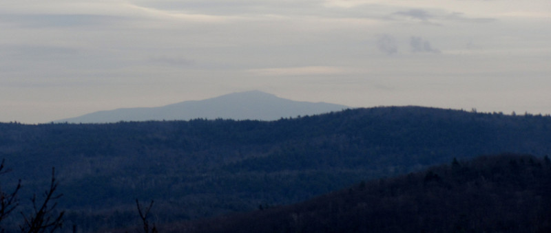
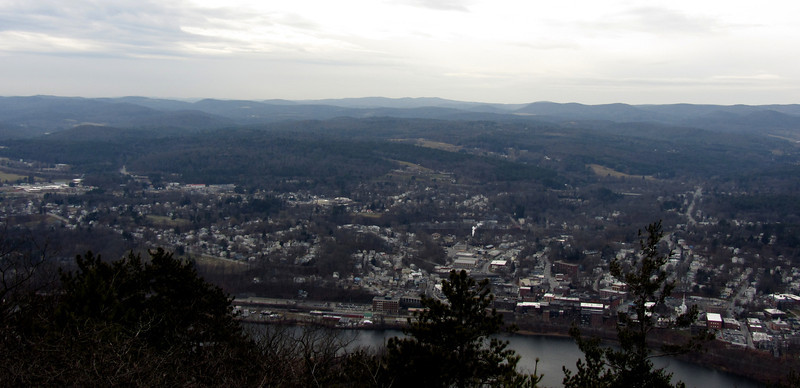
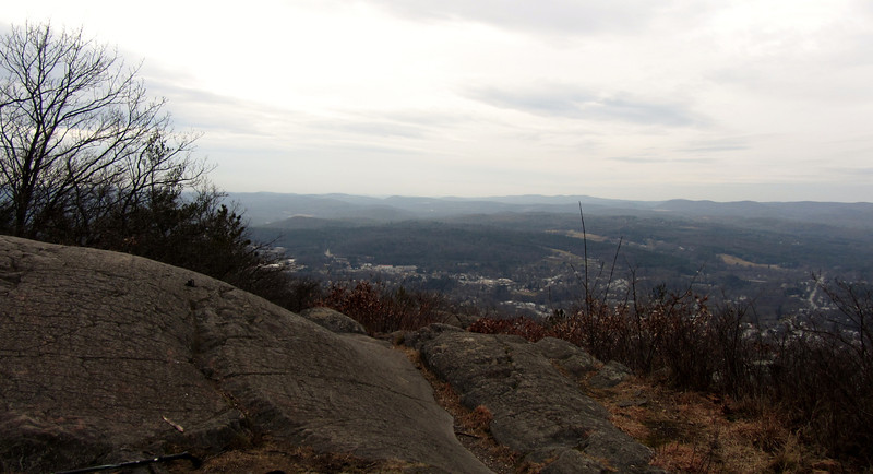
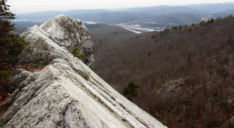
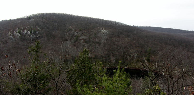
Mt "Want" summit, nice view of Brattleboro!
IMG_3970-L.jpg


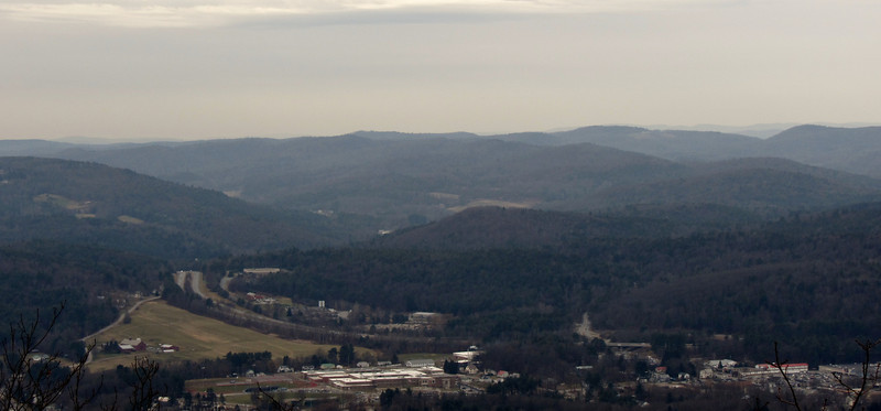
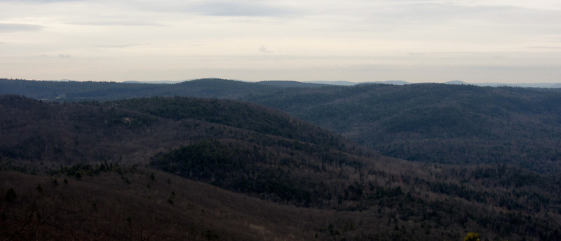
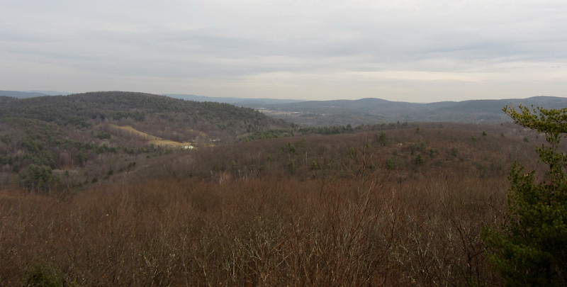
surrounding countryside
IMG_3977-L.jpg


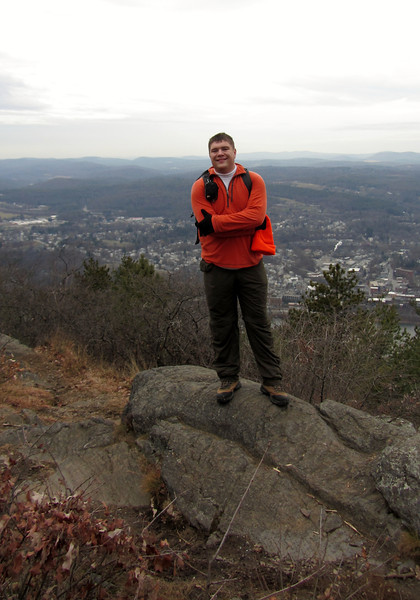
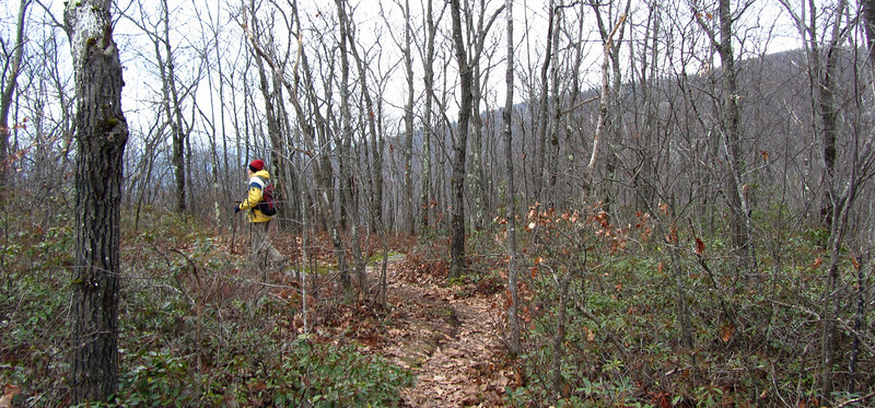
If a hunter doesnt see me, there is a problem.
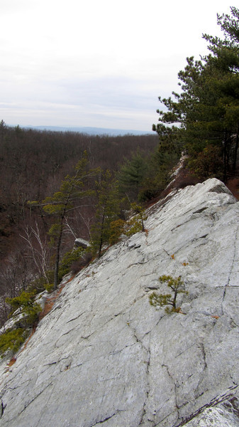
IMG_3984-L.jpg


summit scene
IMG_3993-L.jpg


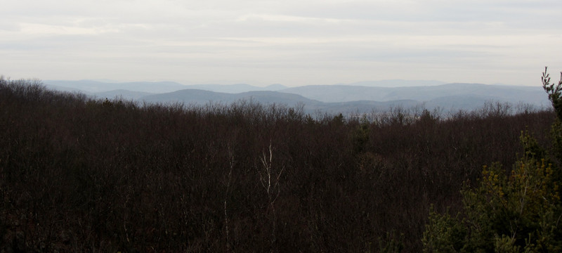
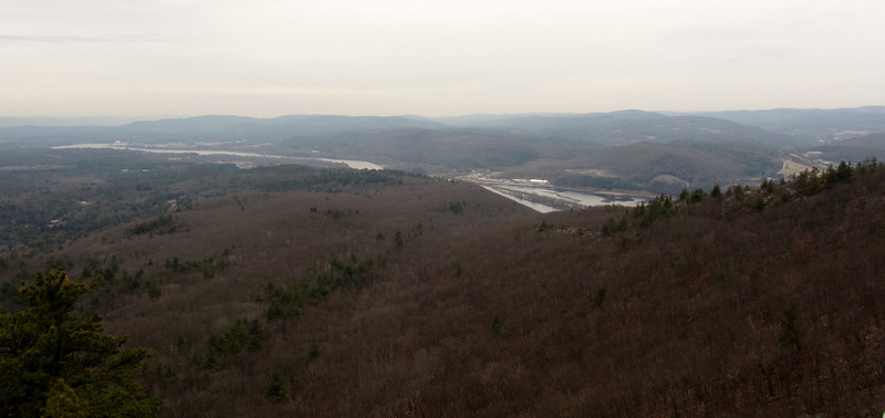
More interesting views from near the summit of the northern peak
IMG_4005-L.jpg


cont in a min
 
Part two...

the northern peak was the highlight of the trip. The views were great, and there was a neat rock outcropping. This is where the timber rattlers supposedly live (or used to live) in NH.

IMG_4031-L.jpg


IMG_4010-L.jpg


Ct River
IMG_4019-L.jpg


Don't slip!!
IMG_4027-L.jpg


After playing on Mt "Want" we headed back to Indian Pond, and then climbed up the hill on the other side. Here is a small view from there....
IMG_4036-L.jpg


more views along the corner!
IMG_4040-L.jpg


the scene from atop the loft 1080 foot summit
IMG_4043-L.jpg


A big THANK YOU to SPNHF for conserving this area. It is a gem, and I can't wait to visit during a prettier time of year!
IMG_4045-L.jpg


http://grouseking.smugmug.com/New-H...orest/26985528_g8Z3sm#!i=2262260787&k=ZdWGnfP
 
So the question begs to be askedn did you here the music playing?

Looks like a neat place, too bad it is so far away from where I am. However I'm adding this to my 2013 list, maybe I can combine it with a bike ride when I go. Great pics, looks interesting!
 
Awesome rockwork on the stairs.
I'd love to go try and spot a rattler on those ledges sometime.

Yea, me too!

So the question begs to be askedn did you here the music playing?

Looks like a neat place, too bad it is so far away from where I am. However I'm adding this to my 2013 list, maybe I can combine it with a bike ride when I go. Great pics, looks interesting!

Very interesting place, indeed!! And as for the music? I heard stuff in my head. :)

Not the actual summit which is a viewless bump E of the radio tower
http://mapper.acme.com/?ll=42.85599...85599,-72.53839,1.7 km ExNE of Brattleboro VT

And I wonder if what you are calling the "northern peak" is actually the E bump which may be called Mine Ledge, you can explore the bottom from a faint trail down the gully

Yes, I hit pretty much every little rocky high point along the way, searching for other views. And you are right, its more of an eastern bump for the Mine Ledge. I was confused with all the different sources I was reading. In the southern NH guidebook, I think they call the North Peak the one with the view out to Brattleboro, but I would consider that a western viewpoint.

I saw that faint trail...I think it might be on this map.

http://www.forestsociety.org/ourproperties/guide/071/071_map.pdf
 
Furthermore, on the Acme map, they call Mine Ledge the side that views Indian Pond...is it that area? Or the nice viewpoint with the steeply slanting rock? Confused....
 
Living near here I have been to the house ruins, but never done the rest of the hike. It would be good when I don't have the time to head up north. Does the trail for the hike start at the same parking spot as for the ruins?
 
I saw that faint trail...I think it might be on this map.

http://www.forestsociety.org/ourproperties/guide/071/071_map.pdf
Yup, note SPNHF map also shows correct location of summit which is wooded knoll well off trail

Furthermore, on the Acme map, they call Mine Ledge the side that views Indian Pond...is it that area? Or the nice viewpoint with the steeply slanting rock? Confused....

The Acme map is the USGS 7.5' quad

Note that the 15' quad is ambiguous: http://docs.unh.edu/VT/brtl54se.jpg

The open ledge is certainly an old mine site which you will see from the bottom, but I don't know if it is Mine Ledge
 
Some history which still doesn't answer question:
http://brattleborohistory.com/connecticut-river-wantastiquet/mine-mountain.html

Anybody ever climb Pistareen Mtn?
"Pistareen mountain, situated on the eastern shore of Spafford's lake, is next in importance. It is formed like a sugar loaf, and is almost inaccessible--large rocks projecting from its sides. It is called Pistareen mountain from having once been sold for a pistareen, or 20 cents. To see it, one would think that a fair price."

Interesting info here

http://peakery.com/pistareen-mountain/
 
Nice Grouse! I've been wanted to visit those ruins for a while, the kids love anything that's haunted. Those pics give me inspiration to make the trip. Question, is there good access during winter, is the area snowshoe-able?
 
Living near here I have been to the house ruins, but never done the rest of the hike. It would be good when I don't have the time to head up north. Does the trail for the hike start at the same parking spot as for the ruins?

Yup, the ruins are no more than 100 yds in from the parking lot.

Nice Grouse! I've been wanted to visit those ruins for a while, the kids love anything that's haunted. Those pics give me inspiration to make the trip. Question, is there good access during winter, is the area snowshoe-able?

I think the area is snowshoeable...nothing steeper than tough stuff in the whites. There are a few stiff climbs. The parking lot is quite large, and its along Gulf Rd in Chesterfield. The road is dirt, and a bit narrow in some places. I'm not sure how well the road is taken care of during winter, but I'm sure it is at least somewhat maintained.
 

Looking at the writings, I believe the Mine Mtn highpoint is the peak 1/2 mile (trail distance) from the Wantastiquet viewpoint of Brattleboro.

The view from the pinnacle to the south is very fine. The Connecticut river can be seen beyond across the river at South Vernon. Farther to the left Monadnock rears its rocky head above the neighboring summits.

This is the exact description of the view from Mine Mtn, and the only place I could spot Monadnock.

IMG_4009-L.jpg


I think the entire mass of mtn is prob called Mt Wantastiquet, except since there was the "mining" at that one area, that was renamed Mine Mtn.
 
Last edited:
Yup, the ruins are no more than 100 yds in from the parking lot.

I think the area is snowshoeable...nothing steeper than tough stuff in the whites. There are a few stiff climbs. The parking lot is quite large, and its along Gulf Rd in Chesterfield. The road is dirt, and a bit narrow in some places. I'm not sure how well the road is taken care of during winter, but I'm sure it is at least somewhat maintained.
My recollection is that the ruins are off to the R and the main hike is the woods road ahead to the pond, which becomes a steeper trail up to the peaks

I have never been there in the winter and don't know if the lot is plowed, unless you have 4wd I would avoid the area in mud season as both approaches had issues
 
It was surrounded by mountain laurel bushes...I need to keep this hike filed away as a "must" for next June when the flowers are out!
We were out here a month before you in November and this is indeed a great hike. We intend to also revisit this area this summer when everything will be in bloom. Did you go into the mine below the cliffs? It was extremely cool! :) We took video of our hike that day including the mine if you're interested in seeing it...
http://www.youtube.com/watch?v=uCrRTenUF7E
 
My recollection is that the ruins are off to the R and the main hike is the woods road ahead to the pond, which becomes a steeper trail up to the peaks

I have never been there in the winter and don't know if the lot is plowed, unless you have 4wd I would avoid the area in mud season as both approaches had issues

Yes; upon entering the parking lot on Gulf Road, the ruins are perhaps 20-30 yards up the main trail (leading to the Ann Stokes Loop), across a small foot bridge, and then up a side path -- they're partly visible now from the parking lot, given that there are no leaves on the trees.

The town of Chesterfield does maintain Gulf Road in the winter. And yes, in mud season a few sections of the road are dicey -- they showed signs of that a few days ago, after the rainfall and high temperatures.

Also, the parking lot had been plowed -- as evidenced by the plow berms around the perimeter. Again, after the rains and thaw from a few days ago, there's not much more than some patchy snow (and a bit of ice) in the woods on that property.
 
Neat video. Had read about that geocache but decided not to try it alone.

Thanks. The mine was very impressive, we were thrilled to find it as there was not much info available on it, all we had was a GPS coordinate. The ropes that are there were more than strong enough to hold us. I can understand not wanting to do it alone though, it's not a place I want to be stuck in in by myself.
 
Top