
sdways01
New member
Carter Dome & South Carter Mtn. & Middle Carter Mtn.
11-18-12
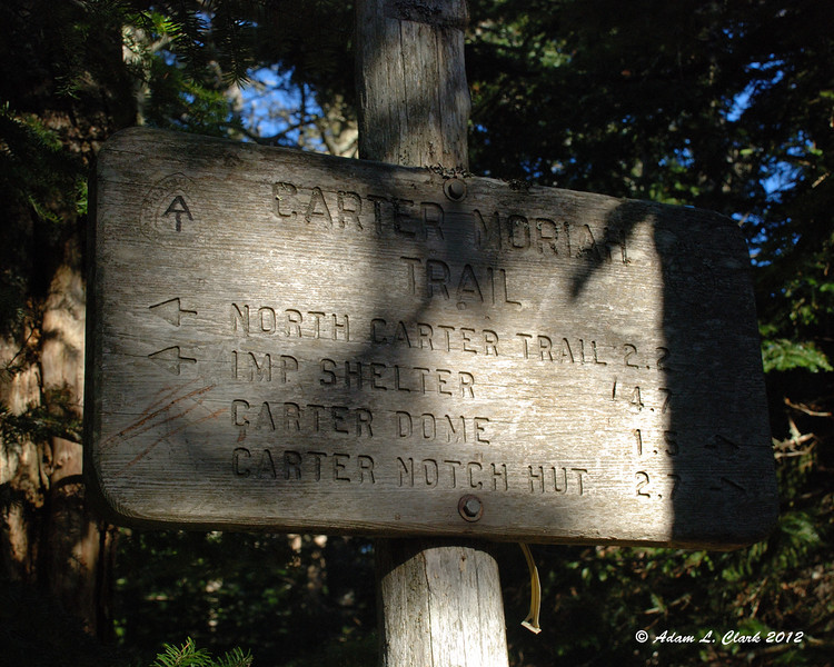
Nineteen Mile Brook Trail --> Carter Dome Trail --> Carter-Moriah Trail --> North Carter Trail --> Imp Trail --> Small Bushwhack --> Route 16
Distance: 11.5 mi. (Mtn) 0.4 mi. (Road) 11.9 mi. (Total)
Elevation Gain: 3,396 ft. (Overall) 4,665 ft. (Total)
Time: 3:39 (Carter Dome) 4:44 (South Carter) 5:31 (Middle Carter) 7:52 (Total)
The trail is gentle and easy to start. It follows the brook and shows signs of erosion from Tropical Storm Irene, but work has been done to make it easy to walk up. There was one patch of ice on some bare rock early on, then nothing for a while longer. The bridge that was half washed away in the storm didn't have the planks over the remainder of the brook that it did in June, but the crossing was still pretty easy. We took a few different routes all with no problems.
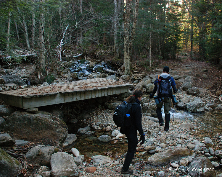
Partial bridge crossing
We turned left up the Carter Dome Trail. This trail certainly shows signs of wash out as well. But again, work has been done to fix it back up. After a while of gradual climbing, the trail starts into some switchbacks and gets a bit steeper. There were a few small brook crossings in here, but nothing bad. We just had to look first for ice before choosing a route across. Before long, we were at Zeta Pass and took a break.
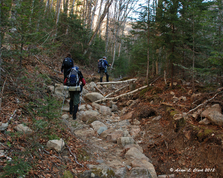
Carter Dome Trail
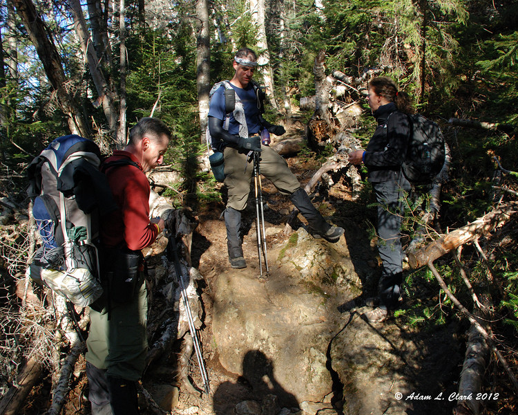
Group break
With the patches of ice this morning, we decided we should go up the steep trail to Mt. Hight first, rather than come down it. Being the slower hiker today, I led up this section so we wouldn't get spread out at different paces. Taking a few short breathers on the way up, we were soon to Mt. Hight without any issues. There really wasn't any ice in this section. We took in the great views in all directions and had time for a snack and gear adjustment.
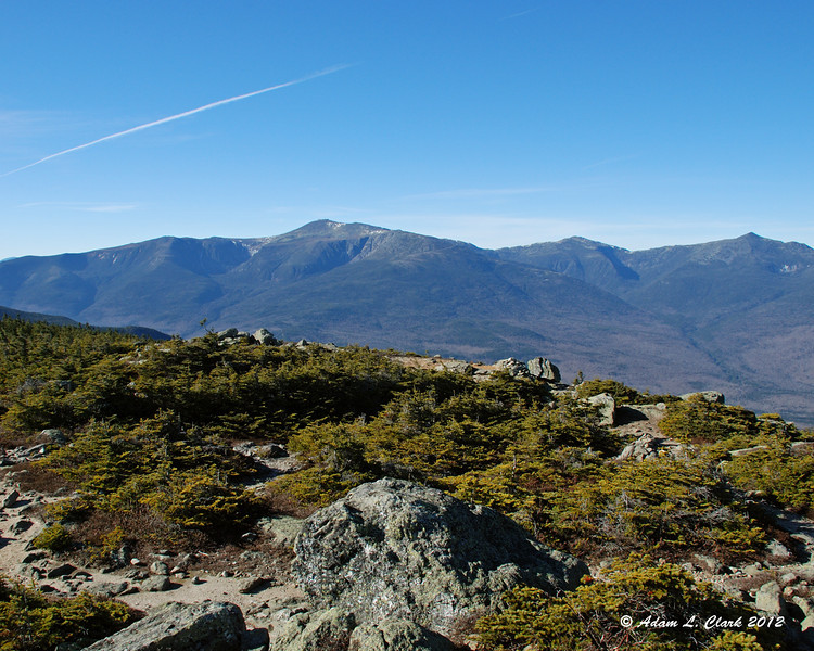
Presidential Range from Mt. Hight
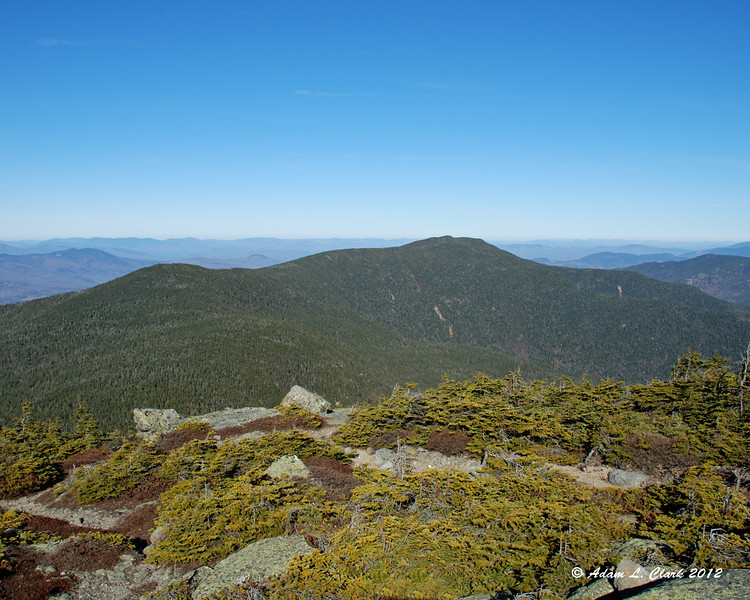
South and Middle Carters from Mt. Hight
To keep on schedule, we soon headed out to Carter Dome. The easy trek to the first 4K peak of the day took only 30 minutes more. We discussed the fire tower remains some and all enjoyed the view from the look out at the top. Soon we were off and headed back to Zeta Pass. The trail was a bit rocky and places and had some small patches of ice. It went by quick though as we were carrying a good pace. Once into the pass, we headed up towards South Carter keeping a decent pace. We took a few short breaks on the way up. Again, before long, we were at the summit of South Carter.
Carter Dome view point
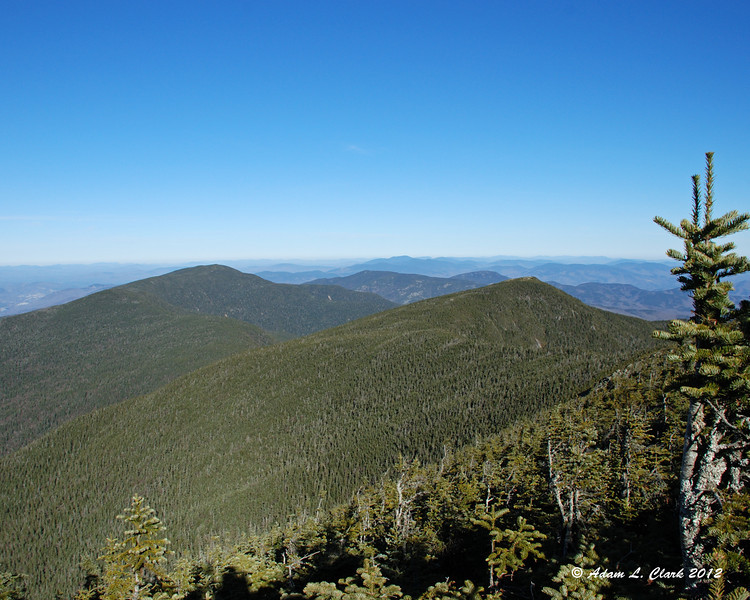
North up the range from Carter Dome
Zeta Pass
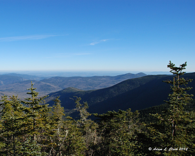
The last time I was here it was raining at this point and I was in the clouds. I didn't even notice the small view point right off the trail. Today I went out to it and took in the views into Maine. Another short break later, and we were off again. We gradually worked down into the col between the peaks (which still doesn't look like 200 feet from a distance).
View from South Carter
Working up towards Middle Carter, the trail is a series of nearly flats stretches with quick steeper climbs between. In here my thighs were starting to get a bit tight, so I took a couple quick breaks before we all took one within sight of the summit. Even with the breaks, my legs started to cramp up pretty bad just before the summit. I pushed through it and eventually caught back up to the group at the summit. After a break there, I was good to go the rest of the way.
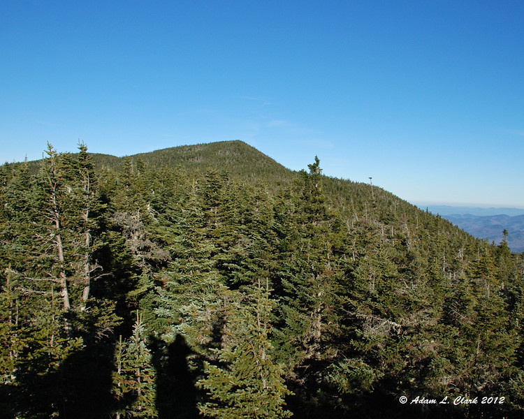
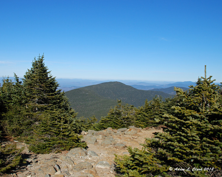
View up to Middle Carter
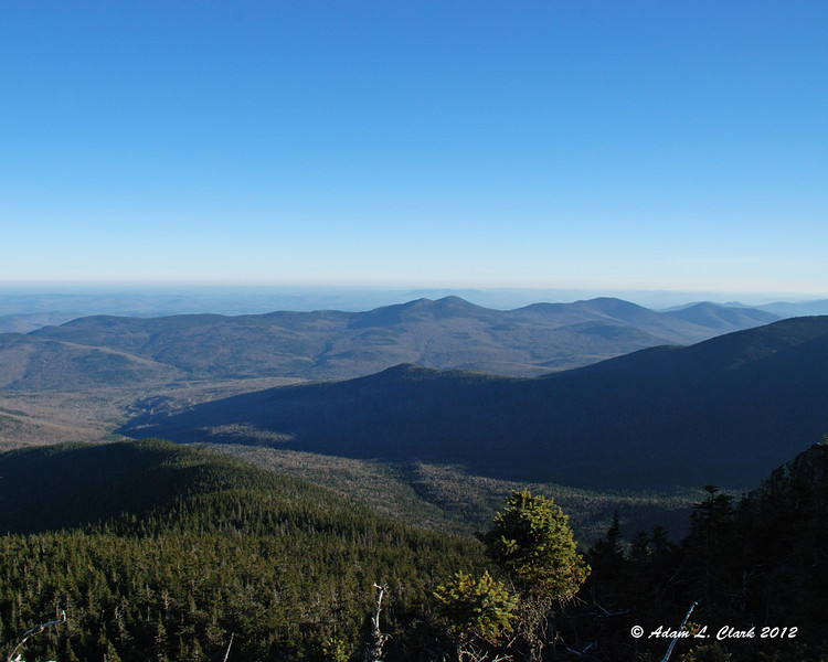
View from Middle Carter
We headed out quickly as we expected to be getting back to our cars, or maybe the road, about the time we were going to want headlamps. On our way to the North Carter Trail and going down it, we came across more patches of ice. Most were small, but a couple took some planning to get down on the North Carter Trail. This trail was a stream this summer when I was here, so I honestly expected more ice. The Imp Trail was mostly clear of ice with more running water. We cleared one blow down on this trail that would be a problem come winter. As it neared dark, we finally got to the cutoff to Joe Dodge Camp and cut through. We walked up the road the distance to our cars and were back where we started without seeing any hikers ouside of our group.
This hike was different for me as it was with another group of hikers. Normally I hike alone and go at my own pace. This hike was a little faster pace than I normally would have gone and we didn't take as much time for pictures as I normally do. But it was also good pushing faster and doing this hike almost an hour quicker than this summer. I would certainly hike with any of this group again.
For all the pictures from the hike, just go HERE
11-18-12
Nineteen Mile Brook Trail --> Carter Dome Trail --> Carter-Moriah Trail --> North Carter Trail --> Imp Trail --> Small Bushwhack --> Route 16
Distance: 11.5 mi. (Mtn) 0.4 mi. (Road) 11.9 mi. (Total)
Elevation Gain: 3,396 ft. (Overall) 4,665 ft. (Total)
Time: 3:39 (Carter Dome) 4:44 (South Carter) 5:31 (Middle Carter) 7:52 (Total)
The trail is gentle and easy to start. It follows the brook and shows signs of erosion from Tropical Storm Irene, but work has been done to make it easy to walk up. There was one patch of ice on some bare rock early on, then nothing for a while longer. The bridge that was half washed away in the storm didn't have the planks over the remainder of the brook that it did in June, but the crossing was still pretty easy. We took a few different routes all with no problems.
Partial bridge crossing
We turned left up the Carter Dome Trail. This trail certainly shows signs of wash out as well. But again, work has been done to fix it back up. After a while of gradual climbing, the trail starts into some switchbacks and gets a bit steeper. There were a few small brook crossings in here, but nothing bad. We just had to look first for ice before choosing a route across. Before long, we were at Zeta Pass and took a break.
Carter Dome Trail
Group break
With the patches of ice this morning, we decided we should go up the steep trail to Mt. Hight first, rather than come down it. Being the slower hiker today, I led up this section so we wouldn't get spread out at different paces. Taking a few short breathers on the way up, we were soon to Mt. Hight without any issues. There really wasn't any ice in this section. We took in the great views in all directions and had time for a snack and gear adjustment.
Presidential Range from Mt. Hight
South and Middle Carters from Mt. Hight
To keep on schedule, we soon headed out to Carter Dome. The easy trek to the first 4K peak of the day took only 30 minutes more. We discussed the fire tower remains some and all enjoyed the view from the look out at the top. Soon we were off and headed back to Zeta Pass. The trail was a bit rocky and places and had some small patches of ice. It went by quick though as we were carrying a good pace. Once into the pass, we headed up towards South Carter keeping a decent pace. We took a few short breaks on the way up. Again, before long, we were at the summit of South Carter.
Carter Dome view point
North up the range from Carter Dome
Zeta Pass
The last time I was here it was raining at this point and I was in the clouds. I didn't even notice the small view point right off the trail. Today I went out to it and took in the views into Maine. Another short break later, and we were off again. We gradually worked down into the col between the peaks (which still doesn't look like 200 feet from a distance).
View from South Carter
Working up towards Middle Carter, the trail is a series of nearly flats stretches with quick steeper climbs between. In here my thighs were starting to get a bit tight, so I took a couple quick breaks before we all took one within sight of the summit. Even with the breaks, my legs started to cramp up pretty bad just before the summit. I pushed through it and eventually caught back up to the group at the summit. After a break there, I was good to go the rest of the way.
View up to Middle Carter
View from Middle Carter
We headed out quickly as we expected to be getting back to our cars, or maybe the road, about the time we were going to want headlamps. On our way to the North Carter Trail and going down it, we came across more patches of ice. Most were small, but a couple took some planning to get down on the North Carter Trail. This trail was a stream this summer when I was here, so I honestly expected more ice. The Imp Trail was mostly clear of ice with more running water. We cleared one blow down on this trail that would be a problem come winter. As it neared dark, we finally got to the cutoff to Joe Dodge Camp and cut through. We walked up the road the distance to our cars and were back where we started without seeing any hikers ouside of our group.
This hike was different for me as it was with another group of hikers. Normally I hike alone and go at my own pace. This hike was a little faster pace than I normally would have gone and we didn't take as much time for pictures as I normally do. But it was also good pushing faster and doing this hike almost an hour quicker than this summer. I would certainly hike with any of this group again.
For all the pictures from the hike, just go HERE

")