TrailwrightBratt
Active member
Sat. the 4th. Six Trailwrights (Hal and Peggy, Ray, Bill, Darrell, and Bruce) and Jason Berard met for a day working on the Dan Doan Trail.
In the past 5 years the Doan family and a few friends have been working hard to maintain this eroded,wet and rocky trail. Trailwrights has been involved the last 4 years and together have installed a good deal of drainage.There is a considerable amount left to do. Unfortunately the family has had trouble finding lodging for this week as the usual location was booked up. Also with graduations and other family members not able to make it we knew we would only be able to do the Level 1 (Basic) adoptor work and knowing that the trail is in bad shape we headed to the top to asses future work first and worked our way down clearing all the smaller trees and limbs and one large birch that we did not get on the way up. We did manage to clear all the waterbars and drainages except for a few ditches on the road portion near the bottom as we ran out of time.
This leads me into commenting on some of the problems that this trail has. Due to the Doan family coming from as far away as N.Y. it becomes clear that a twice a year as an adoptor should do, is very difficult for them and unfortunately the trail needs more than they have time for. Sat. is an example. All we had time for was to maintain what has been installed the last 4 years, which means the reconstruction and repair it needs badly does not get done.
In addition with only one day a year being worked on, it cannot possibly be enough to stabilize this 3 mile trail.
That raises the question who will do it. Also is part of the problem that it does not get a lot of use worth the effort ?.Or does it's current condition be the reason why it does not get a lot of traffic.
I personally think it is both worth it and a lot can be done to make it a nice trail if we can find the help needed. We may possibly have an adopter for this trail as of this writing, and a possible October crew workday. Maybe we can find additional help from you reading this report.
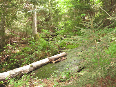
Section of eroded trail, steep and slippery, just below summit of Smart's Mountain
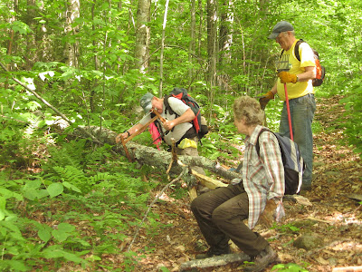
Removing blowdown
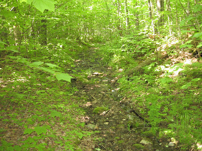
Lower portion of the muddy road
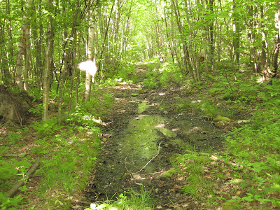
Same road, a wetter section
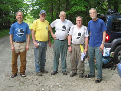
Remaining Trailwrights taken by Peggy. Jason had to leave for a commitment
In the past 5 years the Doan family and a few friends have been working hard to maintain this eroded,wet and rocky trail. Trailwrights has been involved the last 4 years and together have installed a good deal of drainage.There is a considerable amount left to do. Unfortunately the family has had trouble finding lodging for this week as the usual location was booked up. Also with graduations and other family members not able to make it we knew we would only be able to do the Level 1 (Basic) adoptor work and knowing that the trail is in bad shape we headed to the top to asses future work first and worked our way down clearing all the smaller trees and limbs and one large birch that we did not get on the way up. We did manage to clear all the waterbars and drainages except for a few ditches on the road portion near the bottom as we ran out of time.
This leads me into commenting on some of the problems that this trail has. Due to the Doan family coming from as far away as N.Y. it becomes clear that a twice a year as an adoptor should do, is very difficult for them and unfortunately the trail needs more than they have time for. Sat. is an example. All we had time for was to maintain what has been installed the last 4 years, which means the reconstruction and repair it needs badly does not get done.
In addition with only one day a year being worked on, it cannot possibly be enough to stabilize this 3 mile trail.
That raises the question who will do it. Also is part of the problem that it does not get a lot of use worth the effort ?.Or does it's current condition be the reason why it does not get a lot of traffic.
I personally think it is both worth it and a lot can be done to make it a nice trail if we can find the help needed. We may possibly have an adopter for this trail as of this writing, and a possible October crew workday. Maybe we can find additional help from you reading this report.
Section of eroded trail, steep and slippery, just below summit of Smart's Mountain

Removing blowdown

Lower portion of the muddy road

Same road, a wetter section

Remaining Trailwrights taken by Peggy. Jason had to leave for a commitment

Last edited:
