Heavy Rain Forecast

vftt.org

Help Support vftt.org:

This site may earn a commission from merchant affiliate links, including eBay, Amazon, and others.
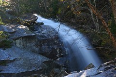
...I just got back from Kinsman Notch area, and 112 where 6+inches of rain have left large mudslides along 112 in Stillwater.

-Matt

There might have been more than one landslide in that area. I drove thru that area this morning shortly after a slide, and was able to drive around it by going up on the shoulder as it occurred nearly across from a pullout, and it doesn't look like you could drive around the one in your photo. A few miles before (to the east) the water was coming over the road - along with debris - to a depth of 3-4", from the hillside above it. Wild day.
 
Ammonoosuc gage at Bethlehem Junction broke the 8' flood stage mark but is receding.

Pemi gage in Woodstock broke the 9 foot flood mark twice to reach 9½ feet, receding in between.

Can you imagine 9 feet of water in the Pemi? That's combined East & North branches, but still...

Or 6½ feet in the Wild River? That's a place where you can lie on the flat rocks in the middle of the river on a dry day.
 
Last edited:
did an owlie trip with the pemi guage in the upper 500s, used bp bushwack, big rivers were thigh level on me, just under the knee on taller folk -- was ok -- hit it 24 hr after when the peak is passing and the waters are coming down and you will be ok -- use your head like always, don't believe everything you read on the internet, hikers look back in time through rose colored glasses! happy safe hiking to you. :)
 
Here's the Liberty Brook crossing corresponding to the gauges posted earlier. The first step was a stretch, but otherwise it was doable with caution. I'm not asserting that it is doable today.


Tim
 
did an owlie trip with the pemi guage in the upper 500s

Reading 3,000 cfs right now, so if anyone's actually daring enough to be out there today, please post pics so we can continue to get a good idea of how the numbers compare to the hiking reality.
 
Informal report - Saturday 9 AM Benton Trail stream crossing. Over knee deep in the AM, calf deep at 2:30 PM.
 
These streams are of the flashy type, and the rain was extremely heavy in a short amount of time, so the water could not soak into the ground, hence the mean rivers Friday.

I would think things are much better today...maybe not normal, but better.
 
A comparison of stream levels from Sep 5 and today:

Downstream from Georgiana Falls:
5049051804_97672ef13b_m.jpg
5049060182_74db097122_m.jpg


Georgiana Falls:
5049060162_b011163232_m.jpg
5049060190_1e89e89e37_m.jpg


Bridal Veil Falls today. I don't have any comparison photos to share but from other photos of the falls I have seen, there's a lot of water up there today.
5048493227_af84b26e5f_m.jpg
5049060214_72061a728e_m.jpg


JohnL
 
Last edited:
Top