
Jazzbo
Well-known member
- Joined
- Jan 1, 2005
- Messages
- 1,197
- Reaction score
- 163
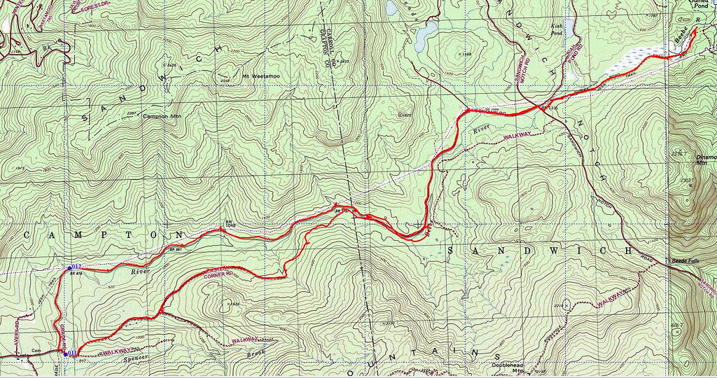
I have strong interest in logging railroad history so I rode my mountain bike last Sunday to explore the route of the Beebe River Railroad from its junction with Eastern Corner Road to Sandwich Notch and beyond to junction with Mead Trail below Mt Israel. It was a very interesting trek.
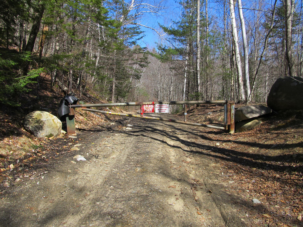
There is a gate short distance in with a sign that proclaims "Open to foot traffic only. No Vehicles." I assumed MTB's are ok.
I encountered some dog walkers, but that was all I saw about that day. I like the area and want to go back to explore it some more. I found ruins from a couple of logging camps. The power lines parallel the road here and there. They don't bother me too much. I called the Saco ranger district and the place was a mystery to the person I spoke to although it borders on WMNF up at Sandwich Notch. I only spotted 1 or 2 fire rings looking like they hadn't been used in long time. Does anyone know what restrictions on usage this area has? The river is clean and beautiful. Looks like would be good place to fish. I didn't see any no fishing signs. In fact I didn't see much of any signs or litter for that matter. I came across 2nd bridge crossing near a big bend in the Beebe River not showing up regular maps which enabled me to cross over and catch a fairly rough section of logging road that ultimately connected to east end of Eastern Corner Road thereby making my trek a loop. Area is definitely open to snow machine traffic as there was many snow mobile trail signs all over.