
Kevin Judy and Emma
Well-known member
View Towards Evans Notch from Black Cap
Cranmore Mtn. 1667' / Black Cap 2369' / Hurricane Mtn. 2101'
Mt. Cranmore Trail / Black Cap Trail / Hurricane Mtn. Trail
5.4 Miles 1350' Elevation gain
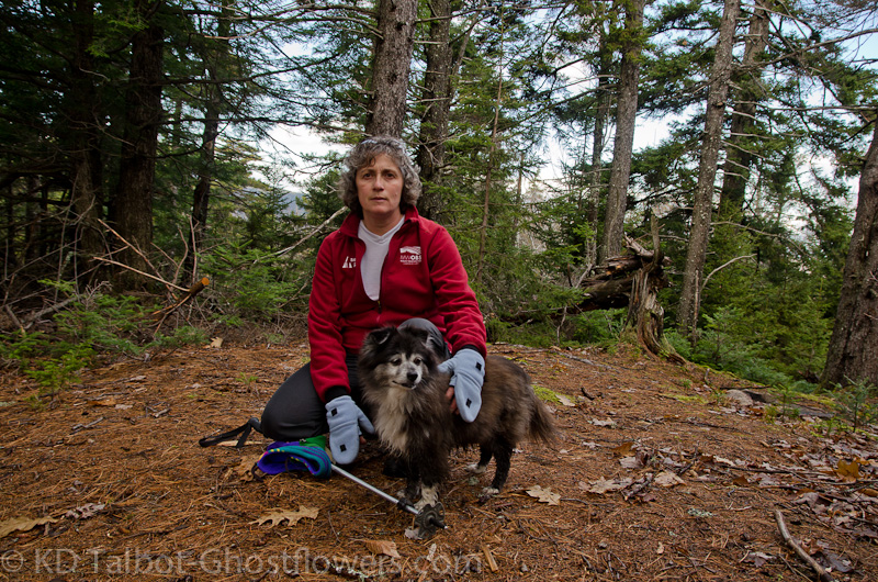
Kevin, Judy and Emma
Although we had planned to knock off a couple more 4k's this day, the drive up through miserable, cold rain sort of knocked the sense of adventure out of us. The sky teased and occasionally looked like it was going to clear, but skies further north where we were heading stayed thick and threatening so we opted to stay further south and at lower elevation. This was probably a good move as it allowed us to save up some energy for backpacking to Unknown Pond the next day.
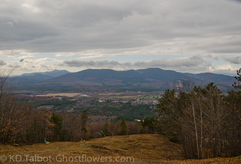
View From Cranmore
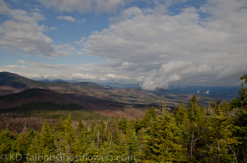
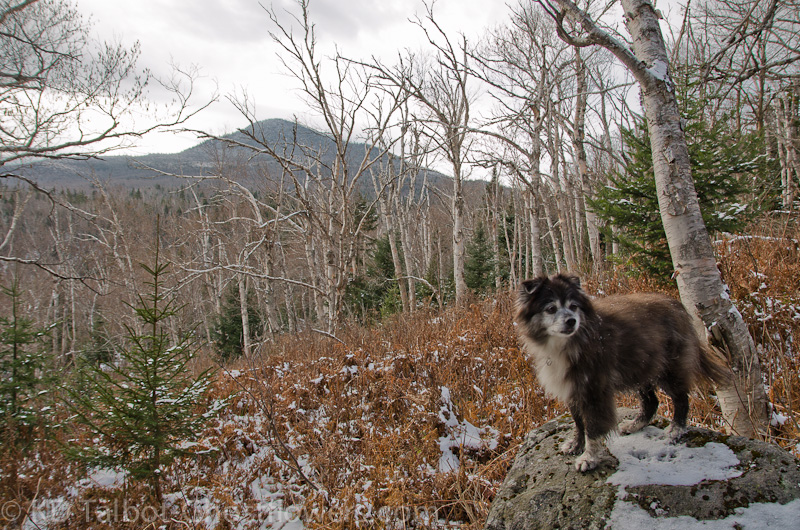
The "hike" up to Black Cap is a stroll in the park. On our last visit we decided if we returned we would explore the trail over to Cranmore Mountain, so about half way up to Black Cap we took the Mount Cranmore Trail. Why it is labeled Cranmore Mountain, but it's the Mount Cranmore Trail is one of those White Mountain Mysteries I can't explain. Anyway, it's a nice easy trail through open woods that brings you to the top of the ski area. There are good views across the Saco River Valley to Mount Chocorua and the Moat Range. Like Black Cap it must be an excellent sunset spot.
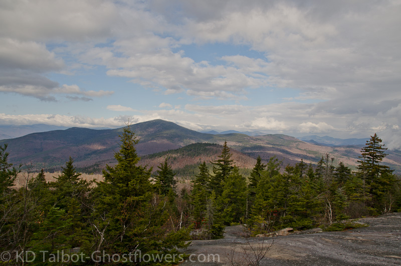
View North From Black Cap
The climb back up to the Black Cap Trail, then up to Black Cap is easy with good footing. As per usual we had a snack and a drink at the top and enjoyed the views. The sun did peek out of the overcast sky, and it was unseasonably warm. To the north the clouds obscured the ridge we would have hiked if not for the weather. At the kiosk along the trail on our way back down I noticed on the map there seemed to be an unnamed trail to the summit of Hurricane Mountain. In the parking lot another hiker asked us if we knew about it and where it started. It appeared on the map to be directly across from the parking area. There was what seemed to be a trail there, but it soon petered out into an expanse of blow downs.
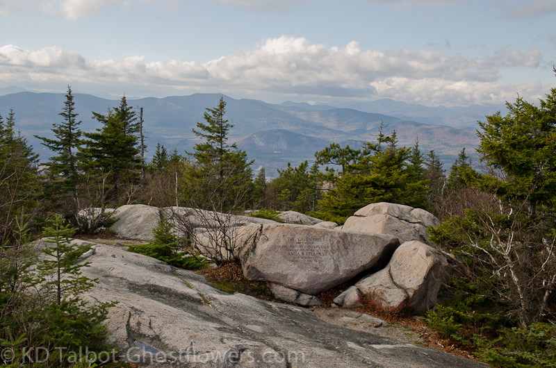
Green Hills Preserve
The other hiker searched further east along the road for a trailhead to no avail, then we all went a little further west, again to no avail. Finally Judy and I just decided we would bushwhack to the top and look for the trail there and then follow it down if it was not completely obscured by the blowdowns that seemed so fitting considering the mountain's name. We knew it couldn't be more than 3/10th's to the top and maybe 200' elevation, so off we went. The other hiker followed for a bit, but turned back. We continued on and soon crested the hill.
Viewless Summit of Hurricane Mountain
We followed relatively open woods from there northwest. We kept heading for what looked like a high-point and eventually we came to a small cairn, looked up and saw blazes. We now followed the trail to a viewless high-point deep in the spruce. There were places along the short trail that appeared to have been quarried, or dug in search of something, perhaps a particular mineral or type of rock, not sure what. Maybe some of the more knowledgeable on these boards could shed some light on this. Following the trail back down it widened into a logging or fire road that could easily be driven by jeep at least 2/3rd's of the way up. When we got back to Hurricane Mountain Road we were about 150' west of the parking area, very obvious if you know where to look.
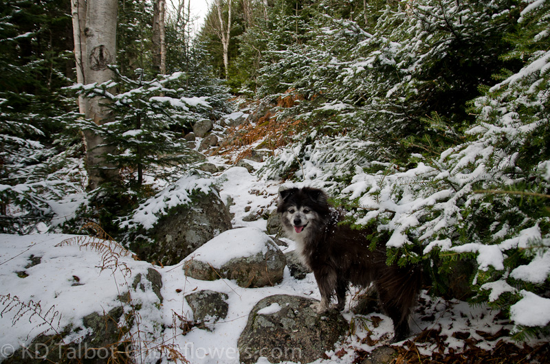
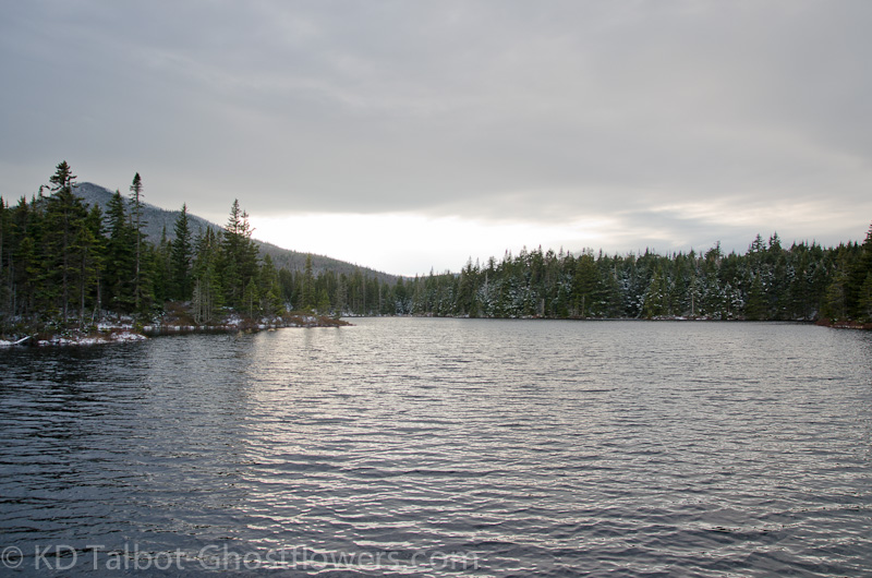
Along Unknown Pond Trail
After a night indoors at T&C in Shelburne that included an excellent meal from their excellent restaurant, we headed north again. Once you pass out of Berlin on Rte. 110 you start to get that feeling of remoteness the Great North Woods gives you. We remembered why we love it up here above the notches. The sun shone in a silver sky and it still felt unseasonably warm considering there had been a trace to a couple of inches of snow overnight, depending on elevation. A recent report had warned me that the trail would be muddy, and it was. After getting all my overnight gear ready and hoisted on my back I realized I hadn't put on my gaiters. I paid for it.
Birch Glades
Along the way there were several places where it was difficult to skirt around the mud, but with caution we managed to stay relatively dry and mud free. There are several easy brook crossings and we handled those with without difficulty. At the last crossing of the main brook, where it turns right and starts the climb in earnest, I didn't use enough caution and hopped out onto a rock that I didn't realize was covered in ice. Of course I slipped and slid backwards, both boots in over the ankles and filling with water. While I shifted my load I had to stick a gloved hand into the water to get back up, then I was across. Wet and disgusted with myself. Of course the gaiters would have made this more manageable.
View of the Northern Presis From Our Tentsite
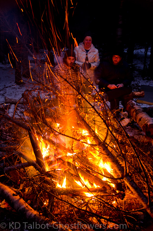
I somehow kept myself from swearing. Military training: Handle the situation and when it's over, then you can swear. Another half mile along I slipped in the mud. I swore then. Before long we got to camp. I went right about setting up the tent, climbed in and got my wet socks and boots off. Eventually I put on everything I had with me and I was fine. I walked down to the fire pit through an inch or two of snow in my Teva's and two pairs of wool socks, toasty! If you can figure out from the pictures who was there, then you know we had a roaring fire all night! The wind blew until well after midnight, and chased the fire all over the pit. I had to constantly change where I was standing or sitting to endure the smoke. I don't think anyone, including Emma, survived without a few wind-blown sparks finding them. The sun disappeared into a cloud bank and night fell even earlier than usual for November. We turned in early.
Late Afternoon on Unknown Pond
With two people and a dog the close quarters of the tent kept us warm enough against the wind which continued to howl above us. Unlike my last night in this tent the wind stayed above and didn't whip the tent, so there was some sleep during the night. The moon eventually rose and came out of the clouds and cast enough light to read by, but the combined wind and cold at 3200' kept me in the sleeping bag, and not outside trying to capture the night with a camera. Dawn came, but by the time the sun crested the hills and reached us and the pond, the color had gone, but it brought with it warmth. The winds had died down early before daylight and now with the rising sun, it was a beautiful, unseasonably warm morning.
Boot Dryer
The fire the night before had done a good job to dry my boots. With no wind or weather to deal with we broke down camp at a leisurely pace. We spent some time talking to our compadres as we ate and had hot tea before hoisting the packs again. We would have liked to stay and hike to Unknown Pond Peak with them, but we had to get going as there was a long drive home and things to do when we got there. We wished we could stay another night as it would have been even warmer, but we know there will be a next time...
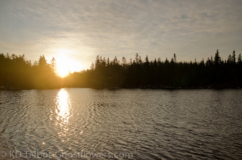
Sunrise On Unknown Pond
Full set of pics HERE:
KDT
Last edited:
