
Kevin Judy and Emma
Well-known member
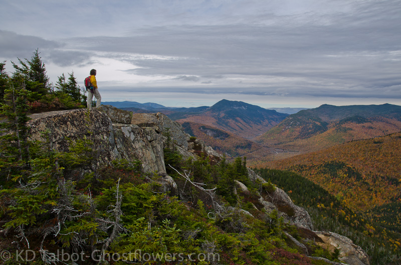
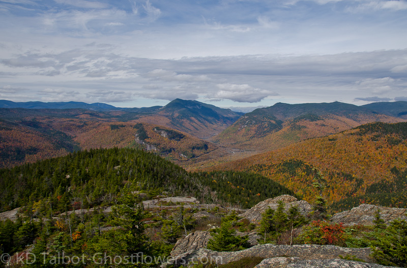
Crawford Notch from Mount Crawford
Mount Crawford 3119' and Mount Resolution 3415'
8.5 miles 2750' Elevation gain
Davis Path to spur trail to Mount Crawford / Davis Path to Mount Parker Trail to Mount Resolution
Kevin, Judy and Emma
Knowing it would be our last chance to camp at Sugarloaf this season we headed to the north end of Crawford Notch despite a less than encouraging forecast for Columbus Day Weekend. With cold temps and rain in the forecast we also guessed it would be the last chance for foliage above the notches. This turned out to be partially true as most of the reds and oranges were washed out in Saturday night's rain. It rained hard, too, but not hard enough to wash away all the yellows and there were still some good patches of orange just south of the notch.
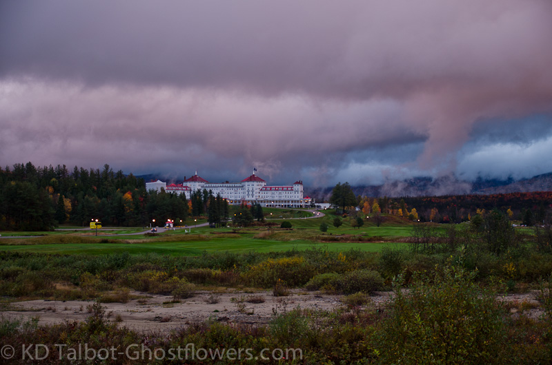
Overcast Sunset at Bretton Woods
After setting up camp Saturday afternoon we took a drive around in the pouring rain looking at some different parcels of land around the area. We got some food to go and headed down the notch a ways and had supper in the car where it was nice and dry while sitting at the pull out in front of the Mount Washington Hotel. The sky cast an eerie orange light on the shrouded Presidentials at sunset and I was able to snap a few pictures in what was now a light rain. Back at camp we crawled into the tent, then into the bags as the temp dropped and the rain picked up again.
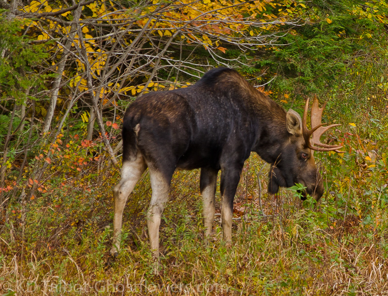
Young Bull
Overnight the Colman kept us dry as it had on its Maiden Voyage a month or so earlier. Someday we'll have to camp in it when the weather is good! After a quick breakfast of tea and Banana Bread we headed south through the Notch. The trip was punctuated by a stop again at Bretton Woods where the Presidentials had cleared to reveal a coating of rime ice at the higher elevations. This was no surprise as it had been quite cold in the tent the night before! Next on the list to catch our interest on the trip through Crawford Notch was a traffic jam which usually means a moose or a bear. A young bull moose crossed Rte. 302 right in front of our stopped car and continued into the grass on the other side where he casually began to graze again, oblivious to the crowd of paparazzi that was gathering.
Where the Reds Are
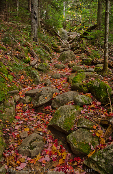
Finally we arrived at the Davis Path trailhead where we began our hike. The Davis Path crosses the Saco River on the beautiful Bemis Bridge, passes between some camps on the eastern shore and soon enters the Dry River Wilderness. Despite being in a wilderness area it is well maintained with many rock stairs in steep sections and for now still well blazed. It climbs steeply for two miles rising 1900' to the spur path that takes you another 3/10ths across ledges with great views before arriving at the summit. Mount Crawford offers great 360* views from different points on the summit.
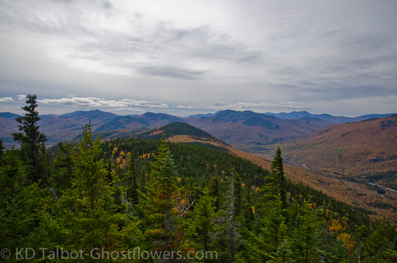
First Views South
The views include but are not limited to The Moats, Mount Chocorua and The Sisters, Attitash and Bear Peak, The Sandwich Range, The Sleepers, Tripyramids, Tecumseh, the Osceolas, Signal Ridge, Carrigain, Vose Spur, the Bemis Range, Franconia Ridge, the Bonds and Zealand, the Twins, Frankenstein Cliffs and Mount Willey, the Southern Presidentials, Washington and Boott Spur, Mount Davis, Isolation, and Stairs Mountain along Montalban Ridge, Mount Resolution and southeast to Kearsarge North.
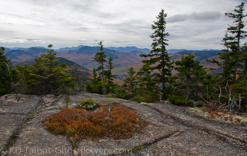
South from Ledges Near the Summit
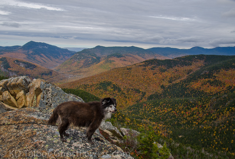
On the summit we had a nice lunch and I helped other hikers pick out the various peaks. Emma had fun barking at what in her mind must have been tiny moose in the valley which whizzed along the thin ribbon of road visible far below. Though the sky was varying degrees of overcast most of the day the sun managed a brief appearance as we ate. The warmth felt good after the cold, wet night before. The views were very good in all directions, though the highest Presidentials kept their heads in the fog. Hmmm, sort of like this year's Presidential candidates... I see a pattern here.
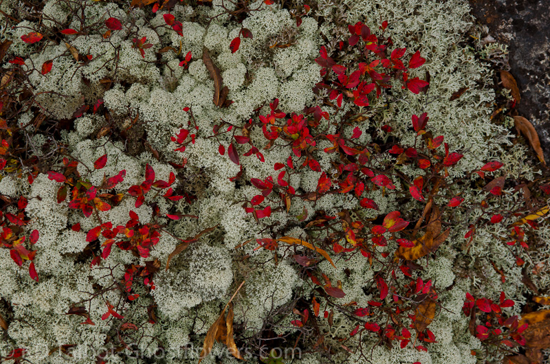
Reindeer Lichen and Alpine Bilberry
After lunch and much gawking at the marvelous colors and expanses we dropped back down the spur trail to the Davis Path where we turned northeast and headed towards Mount Resolution. As hikes between two mountains go this may be one of the smoothest, nicest two miles there is in the Whites. At the junction with the Parker Mountain Trail we turned southeast again and made the easy half mile climb to the summit of Mount Resolution where we could find no definitive highpoint. If indeed we should have found one we didn't, so it may be a good excuse to return at some future date.
Emma Takes Notes for Her Foliage Report
The chill of early October in the mountains was certainly in the air as we scarfed down a little more food and began the trek back towards Mount Crawford. The Davis Path flowed easily under our feet as we made our way along it and we were soon warmed again by the effort. Back at the spur trail to Mount Crawford we turned southwest and began the descent back to the southern end of Crawford Notch. The sun made its longest appearance as we descended and it lit the bright yellows and oranges that surrounded us as it dropped towards the horizon.
Looking North into Crawford Notch
The campsite had dried during the day and we were able to eat our take out supper at the picnic table in camp. The temps dropped as the sun set, but the overnight was warmer than the previous night even though this night brought snow to the high summits. We had rain again where we were camped, but much less and less furious than the night before, lasting only a few hours. When we awoke we broke down camp and made our way through the notch again stopping at Bretton Woods to try to catch a glimpse of the snow covered Presidentials. Again they kept their summits hidden.
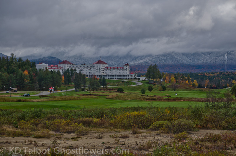
Summer-Fall-Winter
The scene offered interesting contrasts as we gazed across the green golf course, seemingly still deeply ensconced in summer, to the forest beyond ablaze with the brilliant colors of autumn and finally to the lower slopes which were dusted with the season's first snow before they disappeared into the thick cloud cover which shrouded the summits. As always we nodded in agreement that Crawford Notch was high on our list of favorite places in New Hampshire.
LOTS more pics HERE:
KDT
Last edited: