
Amicus
Well-known member
- Joined
- Aug 28, 2005
- Messages
- 1,145
- Reaction score
- 112
For those who may be interested in canoe camping, I supply this account of my Memorial Day weekend, paddling with seven friends a beautiful 65-mile stretch of the Upper Potomac in western Maryland. Some of us have been spending our Memorial weekends exploring rivers in this fashion since the mid-'80s, and it never gets old.
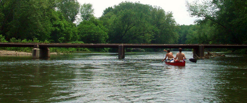
We started Friday morning at Spring Gap, about 10 miles east of Cumberland, where the old Chesapeake and Ohio Canal ended. The Canal's towpath is a National Historical Park, converted into a smooth dirt track used mostly by bicyclists, with campsites accessible only by that path or from the River, at regular intervals. We faced just one possible portage for our entire trip - the Low-Water Bridge at Oldtown, 5 miles from our start. (It is said to be one of the last privately-owned toll bridges for cars in the US - 50 cents a pop). Fortunately, while we had to lean a bit, the River was low enough for us to paddle through:
The River rose about three feet over our three days, I believe from heavy rains around its Allegheny headwaters, so I think we would have had to portage (not a tough one) two days later.
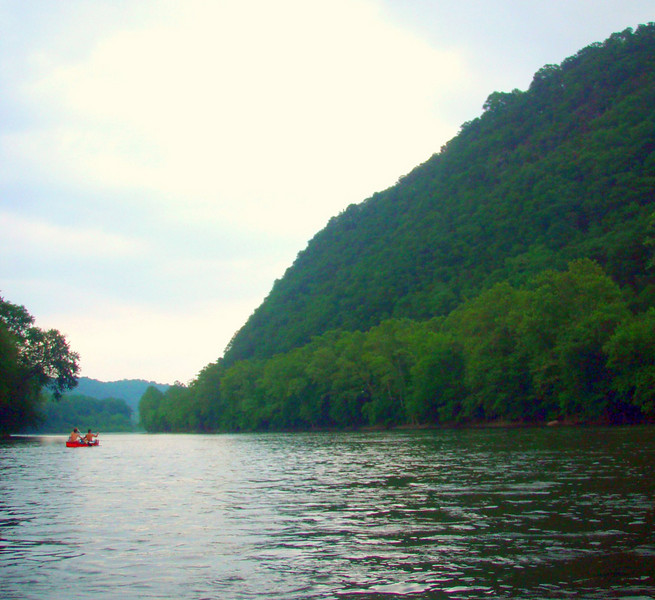
There were no significant towns and no commercial or industrial development along any of our route. The topography contributes to this, as the River has carved its way through some striking hills on both sides, over the Millennia, such as Devil's Nose in West Virginia:
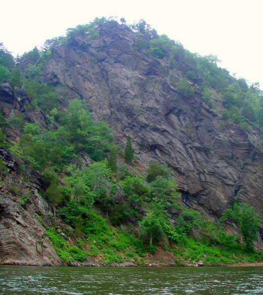
The Paw Paw Bends, where the River twists like a snake for five miles through tilted shale cliffs that rise from the water's edge, were strikingly wild:
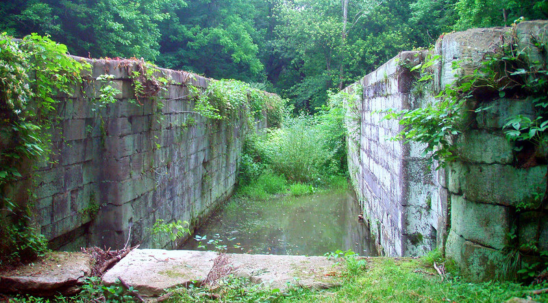
We camped Friday night at the downstream tip of an uninhabited island, identified by a piratical sign left by previous campers as Black Pearl Island, while Saturday night found us at one of the official Canal campsites - Leopards Mill, which is next to the remains of Lock 53:
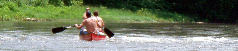
There are no rapids on this stretch, but regular riffles and quickwater, especially over the first 40 miles, wherever the River narrows, and at many bends:
A few spots had standing waves that were high enough to dump a little water into three of our four canoes.
Canoe camping lets you carry loads of gear, including comestibles and potations, specially where portages are not an issue, and we make full use of that. Our band includes some talented and ambitious camp chefs, one of whom grilled both ribeyes and bacon-wrapped filets just for one of our lunches, for instance. One dinner comprised grilled butterflied leg of lamb, with curried vegetables and Ethiopian sponge-bread, washed down by a decent cabernet from a box. For dessert that night, our chef prepared chocolate-raspberry crepes flavored with Grand Marnier. Most of the other meals, if it a bit less elaborate, were of similar quality.
So, this part of the Potomac is a gem, suitable for all but the least experienced paddlers. All of my pictures are here.
We started Friday morning at Spring Gap, about 10 miles east of Cumberland, where the old Chesapeake and Ohio Canal ended. The Canal's towpath is a National Historical Park, converted into a smooth dirt track used mostly by bicyclists, with campsites accessible only by that path or from the River, at regular intervals. We faced just one possible portage for our entire trip - the Low-Water Bridge at Oldtown, 5 miles from our start. (It is said to be one of the last privately-owned toll bridges for cars in the US - 50 cents a pop). Fortunately, while we had to lean a bit, the River was low enough for us to paddle through:
The River rose about three feet over our three days, I believe from heavy rains around its Allegheny headwaters, so I think we would have had to portage (not a tough one) two days later.
There were no significant towns and no commercial or industrial development along any of our route. The topography contributes to this, as the River has carved its way through some striking hills on both sides, over the Millennia, such as Devil's Nose in West Virginia:
The Paw Paw Bends, where the River twists like a snake for five miles through tilted shale cliffs that rise from the water's edge, were strikingly wild:
We camped Friday night at the downstream tip of an uninhabited island, identified by a piratical sign left by previous campers as Black Pearl Island, while Saturday night found us at one of the official Canal campsites - Leopards Mill, which is next to the remains of Lock 53:
There are no rapids on this stretch, but regular riffles and quickwater, especially over the first 40 miles, wherever the River narrows, and at many bends:
A few spots had standing waves that were high enough to dump a little water into three of our four canoes.
Canoe camping lets you carry loads of gear, including comestibles and potations, specially where portages are not an issue, and we make full use of that. Our band includes some talented and ambitious camp chefs, one of whom grilled both ribeyes and bacon-wrapped filets just for one of our lunches, for instance. One dinner comprised grilled butterflied leg of lamb, with curried vegetables and Ethiopian sponge-bread, washed down by a decent cabernet from a box. For dessert that night, our chef prepared chocolate-raspberry crepes flavored with Grand Marnier. Most of the other meals, if it a bit less elaborate, were of similar quality.
So, this part of the Potomac is a gem, suitable for all but the least experienced paddlers. All of my pictures are here.
")