Took this trip a few years ago, but you can pretend it's new ")
Plus, it's mud season, and we're sorely lacking trip reports.
Who: Five of us
What: Five day backpacking trip
Where: Grand Canyon (starting at Grandview Point and ending at Bright Angel Trail on the South Rim)
When: April 5th thru 9th
Why: Because it's not there
Day 0: Day before starting hike, we bought last minute supplies such as cooking fuel. We visited the Backcountry Office to get info on how the creeks were running; this is vital info as the distances between water sources for our route ranged two to eight miles from each other. And then we drove out to the Grandview trailhead (our starting point) to see how much snow/ice was on the trail; luckily it was minimal, so we wouldn't need crampons or any other type of traction.
Day 1: Grandview trailhead to Horseshoe Mesa to Cottonwood Creek (~3500 ft elevation loss)
Day 2: Cottonwood Creek to Grapevine Canyon (minimal net elevation gain/loss)
Day 3: Grapevine Canyon to Lonetree Canyon (minimal net elevation gain/loss)
Day 4: Lonetree Canyon to Bright Angel Campground at the bottom of the canyon (~1500 ft elevation loss)
Day 5: Bright Angel Campground to Plateau Point to Bright Angel trailhead (~4800 ft elevation gain)
Overall hiking distance was about 35 miles, plus the 3 mile side trip to Plateau Point on day 5.
Perfect weather all five days. Clear blue skies. Nights ranged from high 30s to low 50s. Days ranged from 60s to 80s. The deeper into the canyon you go, the hotter it gets. First three and a half days we saw a total of about 20 people. Last day and a half we were on the hiking highways (South Kaibab Trail and Bright Angel Trail), so we saw probably a couple hundred people.
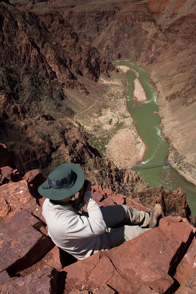
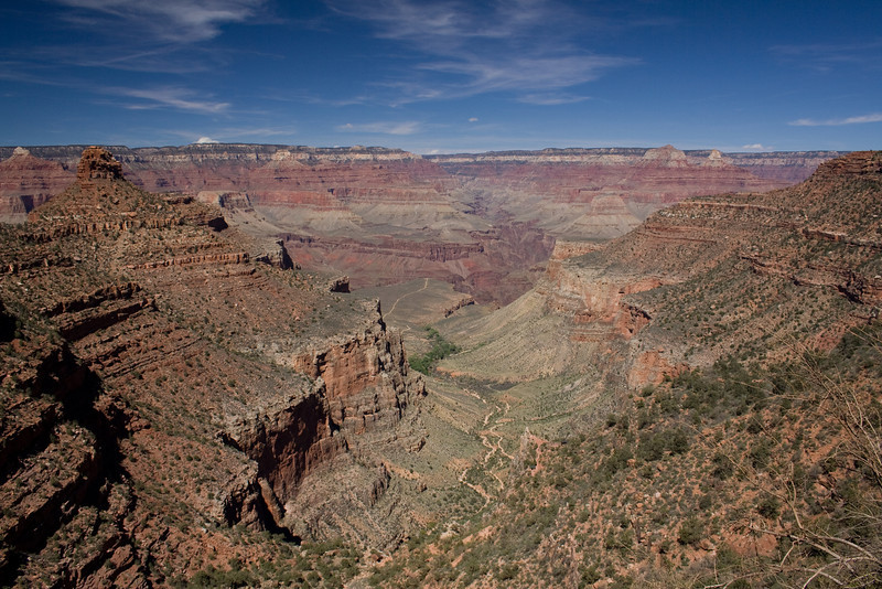
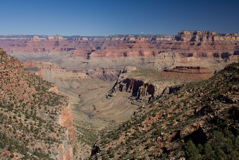
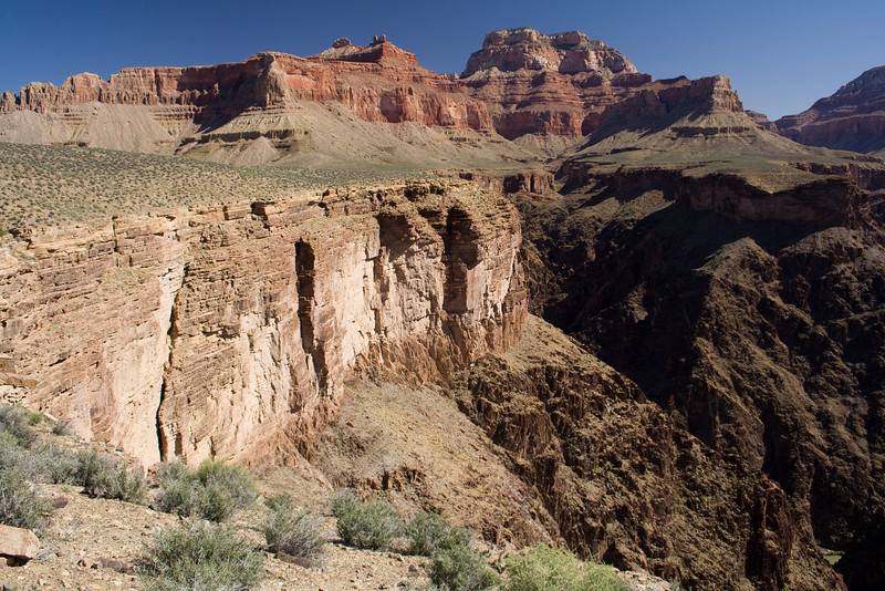
First day, hiking down Grandview Trail. We would camp that night at Cottonwood Creek, which is the long thin trench seen left of center in this photo.
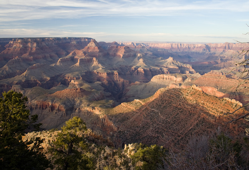
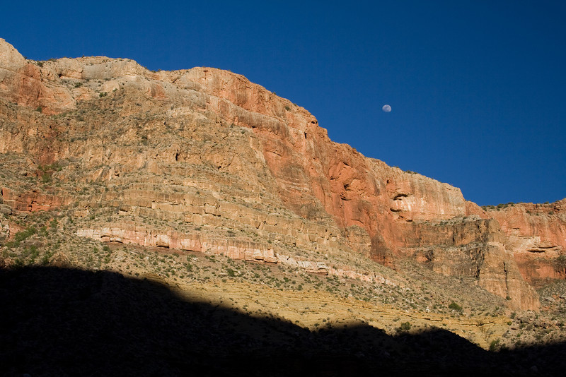
Sunset view from our first night's campsite, looking up at the western wall of Horseshoe Mesa. Every night we would enjoy clear skies, a full moon, and lots of bullfrogs.
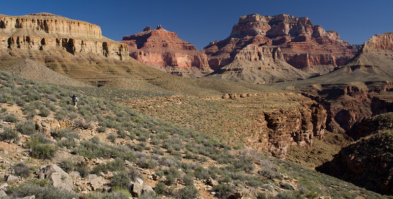
Second day, John hiking along the enormous never-ending Tonto Platform.
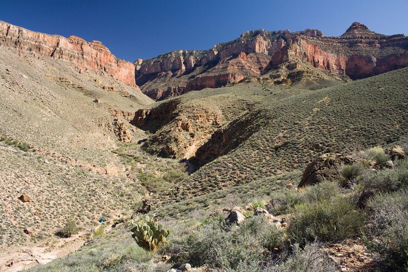
Second night's campsite in Grapevine Canyon. After setting up camp, I scrambled up a hill to get a good view of the area. Our tents are the tiny blue and green dots toward the lower left corner.
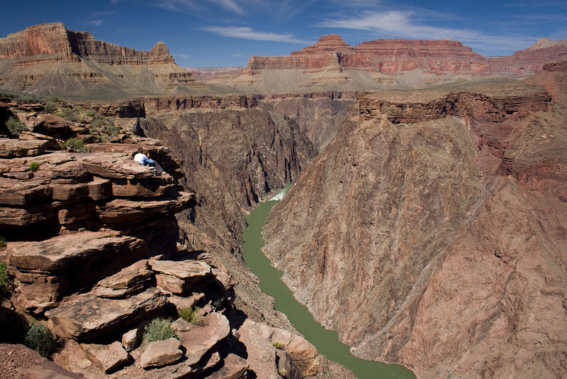
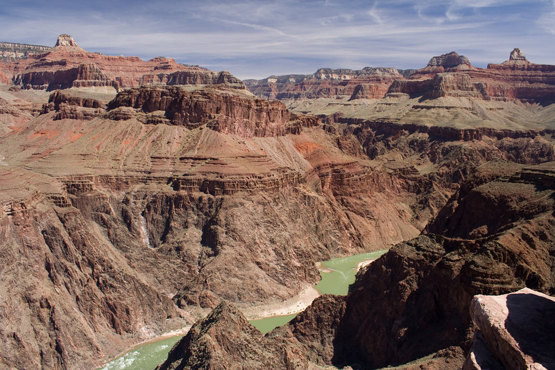
It's hard to describe the vastness and beauty of Grapevine Canyon, which is a side canyon of the main canyon. I think if it wasn't located in Grand Canyon it could be its own national park. But then again it's about one and a half days of hiking to get there, so maybe not. The tiny little green inverted triangle in the extreme bottom right of the photo is the Colorado River, about 1500 feet below the Tonto Platform.
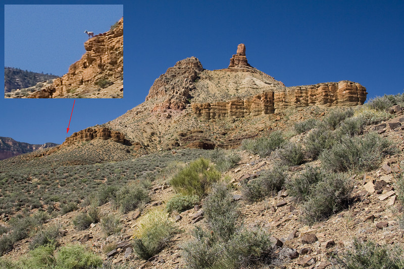
Baa...Baa
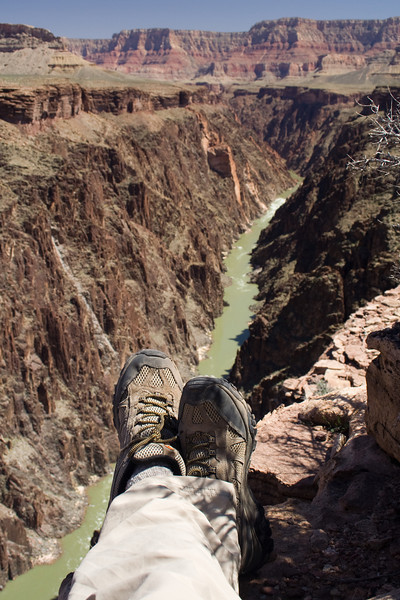
I'm so stressed out.
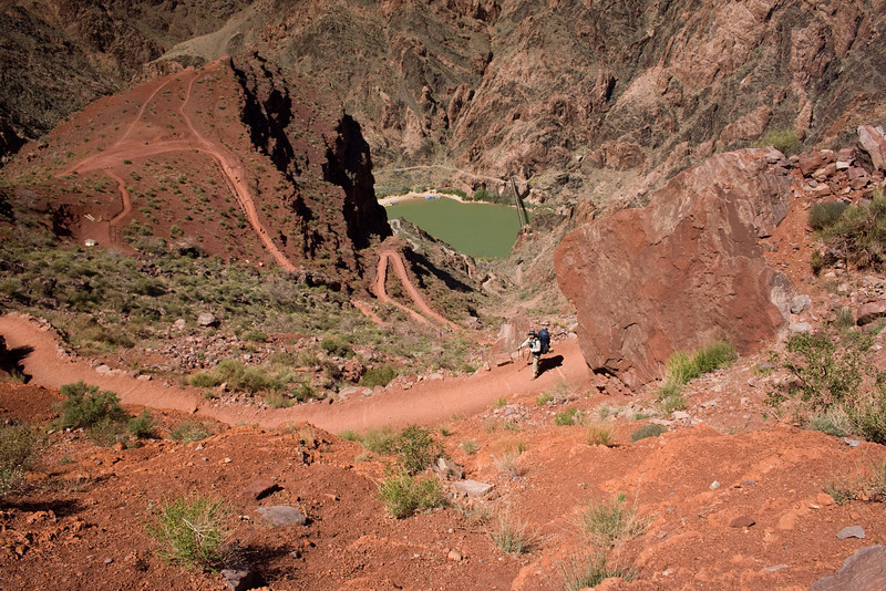
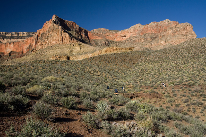
Hitting the trail early on day 4.
Plus, it's mud season, and we're sorely lacking trip reports.
Who: Five of us
What: Five day backpacking trip
Where: Grand Canyon (starting at Grandview Point and ending at Bright Angel Trail on the South Rim)
When: April 5th thru 9th
Why: Because it's not there
Day 0: Day before starting hike, we bought last minute supplies such as cooking fuel. We visited the Backcountry Office to get info on how the creeks were running; this is vital info as the distances between water sources for our route ranged two to eight miles from each other. And then we drove out to the Grandview trailhead (our starting point) to see how much snow/ice was on the trail; luckily it was minimal, so we wouldn't need crampons or any other type of traction.
Day 1: Grandview trailhead to Horseshoe Mesa to Cottonwood Creek (~3500 ft elevation loss)
Day 2: Cottonwood Creek to Grapevine Canyon (minimal net elevation gain/loss)
Day 3: Grapevine Canyon to Lonetree Canyon (minimal net elevation gain/loss)
Day 4: Lonetree Canyon to Bright Angel Campground at the bottom of the canyon (~1500 ft elevation loss)
Day 5: Bright Angel Campground to Plateau Point to Bright Angel trailhead (~4800 ft elevation gain)
Overall hiking distance was about 35 miles, plus the 3 mile side trip to Plateau Point on day 5.
Perfect weather all five days. Clear blue skies. Nights ranged from high 30s to low 50s. Days ranged from 60s to 80s. The deeper into the canyon you go, the hotter it gets. First three and a half days we saw a total of about 20 people. Last day and a half we were on the hiking highways (South Kaibab Trail and Bright Angel Trail), so we saw probably a couple hundred people.
First day, hiking down Grandview Trail. We would camp that night at Cottonwood Creek, which is the long thin trench seen left of center in this photo.
Sunset view from our first night's campsite, looking up at the western wall of Horseshoe Mesa. Every night we would enjoy clear skies, a full moon, and lots of bullfrogs.
Second day, John hiking along the enormous never-ending Tonto Platform.
Second night's campsite in Grapevine Canyon. After setting up camp, I scrambled up a hill to get a good view of the area. Our tents are the tiny blue and green dots toward the lower left corner.
It's hard to describe the vastness and beauty of Grapevine Canyon, which is a side canyon of the main canyon. I think if it wasn't located in Grand Canyon it could be its own national park. But then again it's about one and a half days of hiking to get there, so maybe not. The tiny little green inverted triangle in the extreme bottom right of the photo is the Colorado River, about 1500 feet below the Tonto Platform.
Baa...Baa
I'm so stressed out.
Hitting the trail early on day 4.