Papa Bear
New member
Last week I spent 5 days in Northern and Eastern Maine. When I returned my rental car, I had driven over 1200 miles in 5 days. Boy that country is big.
Sunday Aug. 2nd - Peaked Mountain (Aroostook Co.)
The peak is the high point of "The County" and so perhaps attracts a little more traffic than is deserved. It's far off the beaten path and although it's a nice climb, it has no special views. It's somewhere between "Just another viewless bushwhack" and "Not too bad".
Here's a Google Map Topo I put together: Map
The County High Pointer organization has a few trip reports Here, and my route was similar to but not quite the same as several recent climbs.
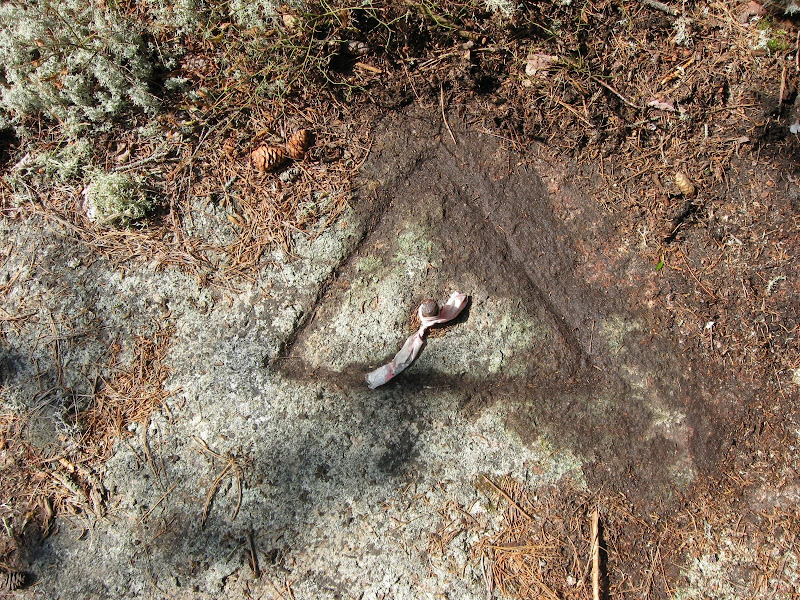
One thing in common in several reports is that no one had found the "Benchmark", a C&GS Triangulation Station set in 1960 which is supposed to be "On the highest point of the mountain". It was just the extra challenge I needed to get to the peak and find that survey marker.
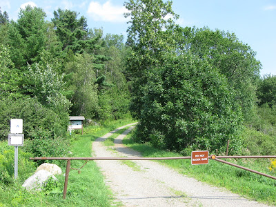
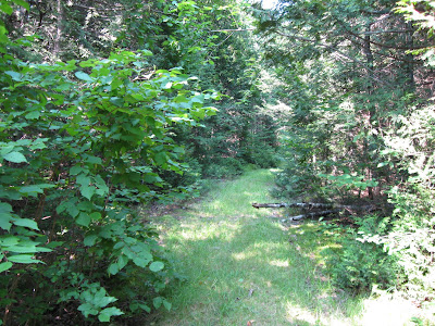
I took I-95 and Route 11 to Ashland and then 3 major logging roads: American Realty Road, Pinkham Road and Jake Mountain Road, for a total of about 25 miles (and a $10 day use fee) to get to the mountain. There is a relatively new logging road that goes north from Jake Mt. Rd just east of the mountain. This is actually totally drivable, by I was cautious and walked it since we had had so much recent rain and a small section near the turn off was flooded (only a few inches of water). I turned out this was the only bad spot, but what the hey, I didn't feeling like getting back in the car after I had started my hike. The "trailhead" is about .4 miles up this road, a short distance past a clear cut on the left (west) side of the road.
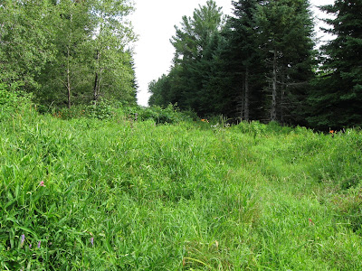
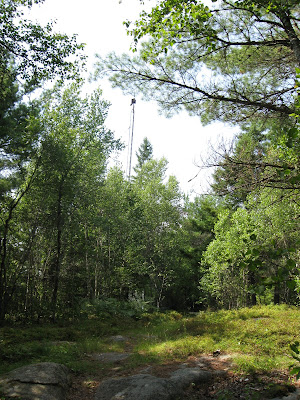
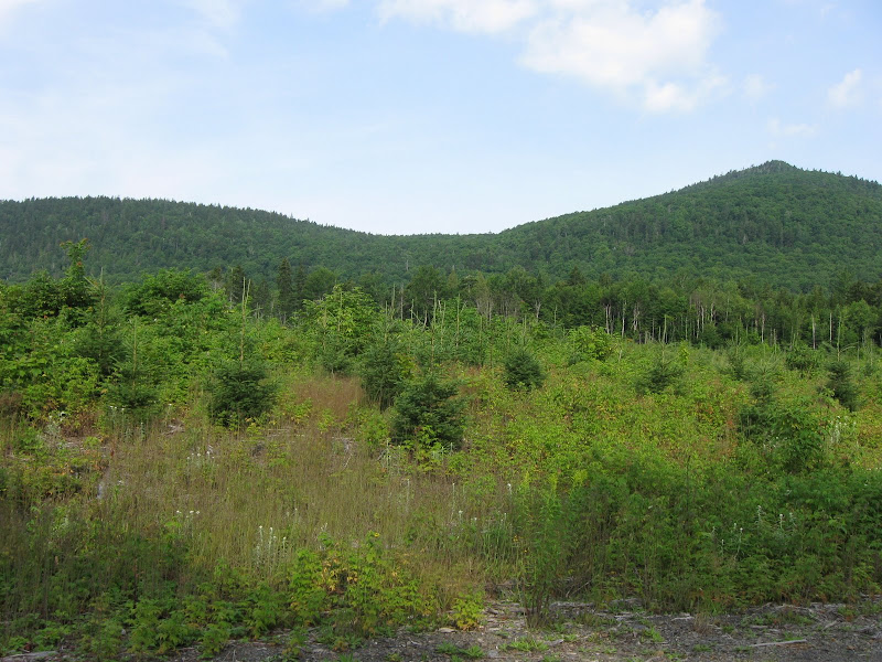
The peak across the clear cut from the logging road
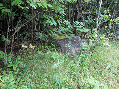
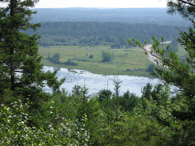
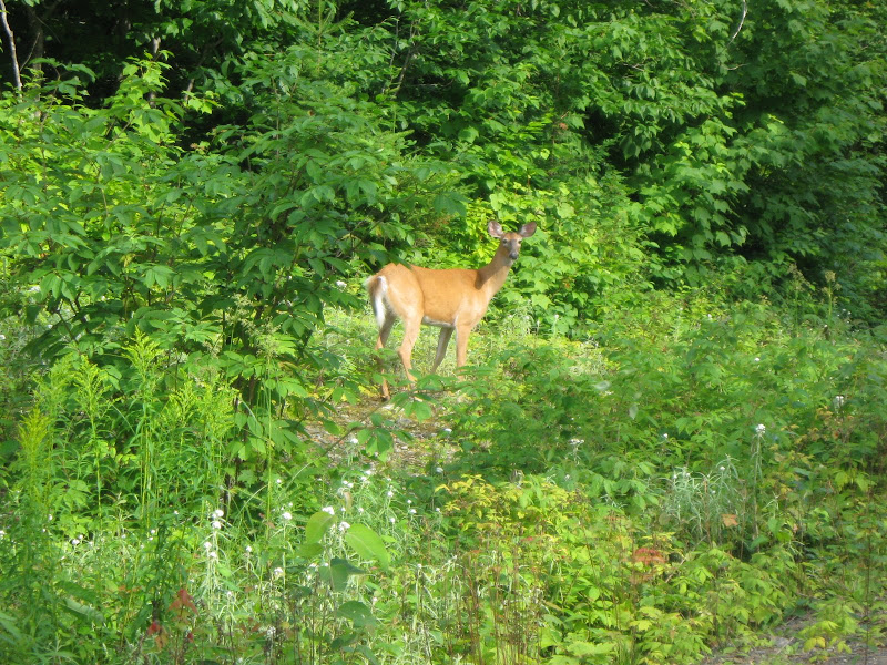
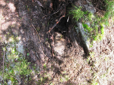
And here was a little extra treat
There's a road shown on the topo which goes up to the col, but it starts from another road a bit closer to the mountain which has been pretty much obliterated by logging. If you look at the topo, note the road going west from the point marked "1209T". In several reports from a few years back (2005 and 2006) the climber had found some flagging that went west from the new road over to that old road. Well, the flagging is long gone and the area is now covered by recent skid roads with lots of slash. I had put a GPS waypoint on the point where the road headed west towards the col, and I was able to find it without too much trouble.
If you switch the map in the link above to "Sat" (use the selector in the upper right), you will see the new logging road, the clear cut and the skid roads that lead across to the old road. If you zoom in a little, you can actually see the faint trace of the old road leading to the col.
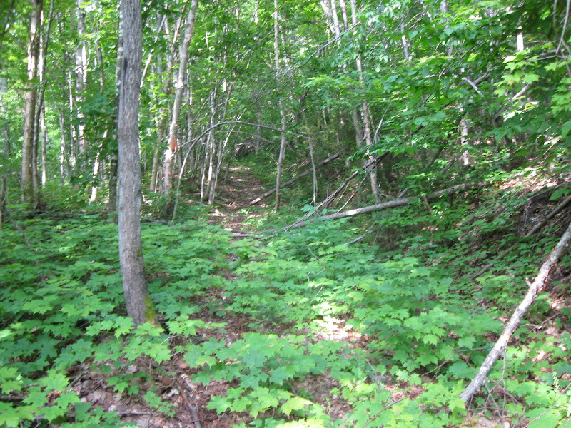
The old road to the col - not too bad
My original plan was to try and follow some of the roads shown on the topo which go up on the west side of the peak, so I had set various waypoints to mark these roads. But there was either too many roads, or too few, and so I gave up and just whacked from where I was to the top. It was honestly not too bad. If not for the heat and humidity, it would have been rather easy.
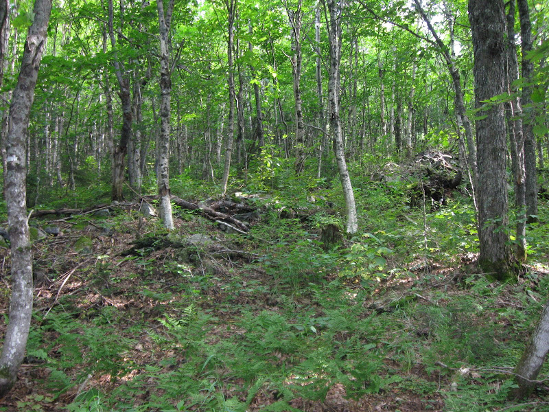
Too many woods roads? Or too few?
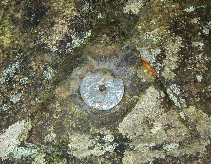
Once at the top, I set about digging for the marker. I had brought a metal detector since I knew it must be below the surface, and that helped. But it was a long process and I ultimately spent about two hours on the summit. Not all was doing work, I had to eat and rest some too, but clearly more time than your average bushwhacker would like to spend on such a peak. But of course I'm not your average bushwhacker - and come to think of it, I've never met your average bushwhacker .
.
Here's my report on the Benchmark hunting site for those interested in the gory details: Survey Marker report
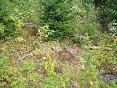
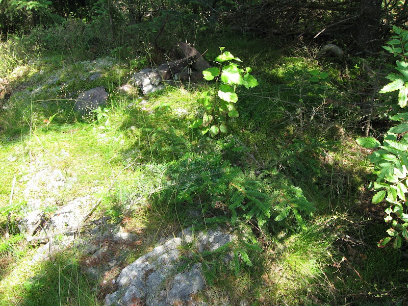
The top - before I started digging
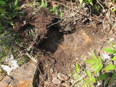
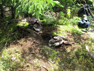
Left: the marker, about 6 inches down in a cleft in the bedrock
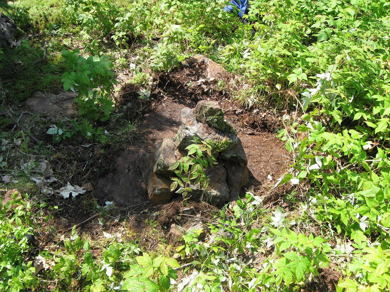
Right: I built a little cairn over the marker before leaving, a few feet from the existing cairn
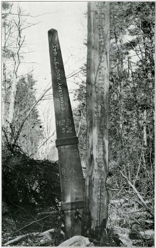
On the way down I decided 1) to forget about trying to find the county corner monument shown on the Topo near the peak, and 2) just to whack to the col and forget about those other woods roads. I managed to get down easier than up (which is usually the case as long as you head down the right side of the peak ), and my old road was also easier to follow. I got back to the car by about 2:20 and was done for the day, except for the minor detail of heading up to Hamlin Maine to look for some boundary monuments . If you want to learn about that, read my report Here
Next Page: Some lesser peaks in Aroostook and Washington Counties
Sunday Aug. 2nd - Peaked Mountain (Aroostook Co.)
The peak is the high point of "The County" and so perhaps attracts a little more traffic than is deserved. It's far off the beaten path and although it's a nice climb, it has no special views. It's somewhere between "Just another viewless bushwhack" and "Not too bad".
Here's a Google Map Topo I put together: Map
The County High Pointer organization has a few trip reports Here, and my route was similar to but not quite the same as several recent climbs.
One thing in common in several reports is that no one had found the "Benchmark", a C&GS Triangulation Station set in 1960 which is supposed to be "On the highest point of the mountain". It was just the extra challenge I needed to get to the peak and find that survey marker.
I took I-95 and Route 11 to Ashland and then 3 major logging roads: American Realty Road, Pinkham Road and Jake Mountain Road, for a total of about 25 miles (and a $10 day use fee) to get to the mountain. There is a relatively new logging road that goes north from Jake Mt. Rd just east of the mountain. This is actually totally drivable, by I was cautious and walked it since we had had so much recent rain and a small section near the turn off was flooded (only a few inches of water). I turned out this was the only bad spot, but what the hey, I didn't feeling like getting back in the car after I had started my hike. The "trailhead" is about .4 miles up this road, a short distance past a clear cut on the left (west) side of the road.
The peak across the clear cut from the logging road
And here was a little extra treat
There's a road shown on the topo which goes up to the col, but it starts from another road a bit closer to the mountain which has been pretty much obliterated by logging. If you look at the topo, note the road going west from the point marked "1209T". In several reports from a few years back (2005 and 2006) the climber had found some flagging that went west from the new road over to that old road. Well, the flagging is long gone and the area is now covered by recent skid roads with lots of slash. I had put a GPS waypoint on the point where the road headed west towards the col, and I was able to find it without too much trouble.
If you switch the map in the link above to "Sat" (use the selector in the upper right), you will see the new logging road, the clear cut and the skid roads that lead across to the old road. If you zoom in a little, you can actually see the faint trace of the old road leading to the col.
The old road to the col - not too bad
My original plan was to try and follow some of the roads shown on the topo which go up on the west side of the peak, so I had set various waypoints to mark these roads. But there was either too many roads, or too few, and so I gave up and just whacked from where I was to the top. It was honestly not too bad. If not for the heat and humidity, it would have been rather easy.
Too many woods roads? Or too few?
Once at the top, I set about digging for the marker. I had brought a metal detector since I knew it must be below the surface, and that helped. But it was a long process and I ultimately spent about two hours on the summit. Not all was doing work, I had to eat and rest some too, but clearly more time than your average bushwhacker would like to spend on such a peak. But of course I'm not your average bushwhacker - and come to think of it, I've never met your average bushwhacker
.Here's my report on the Benchmark hunting site for those interested in the gory details: Survey Marker report
The top - before I started digging
Left: the marker, about 6 inches down in a cleft in the bedrock
Right: I built a little cairn over the marker before leaving, a few feet from the existing cairn
On the way down I decided 1) to forget about trying to find the county corner monument shown on the Topo near the peak, and 2) just to whack to the col and forget about those other woods roads. I managed to get down easier than up (which is usually the case as long as you head down the right side of the peak
), and my old road was also easier to follow. I got back to the car by about 2:20 and was done for the day, except for the minor detail of heading up to Hamlin Maine to look for some boundary monuments . If you want to learn about that, read my report HereNext Page: Some lesser peaks in Aroostook and Washington Counties
Last edited: