
Kevin Judy and Emma
Well-known member
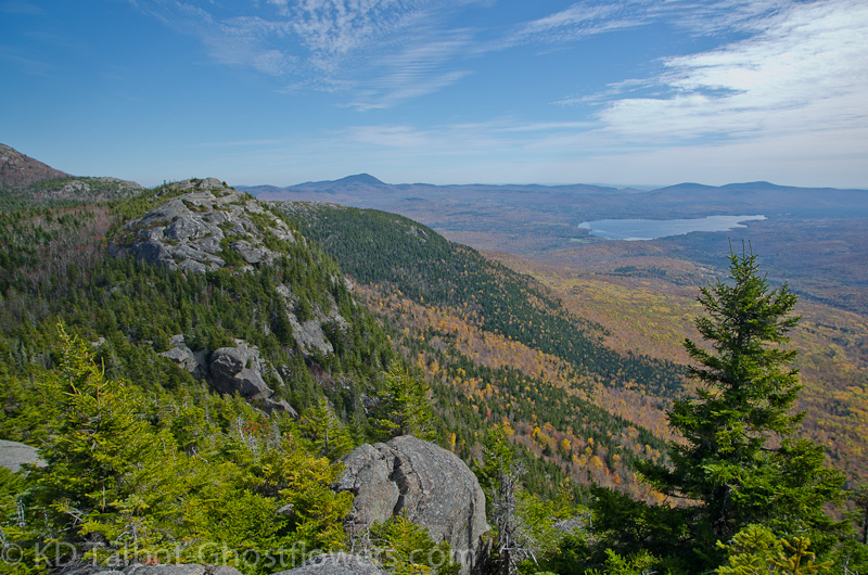
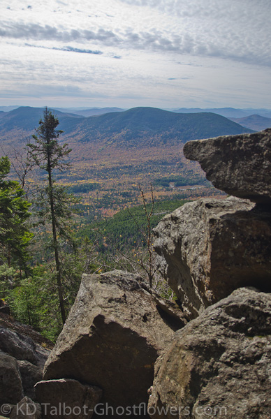
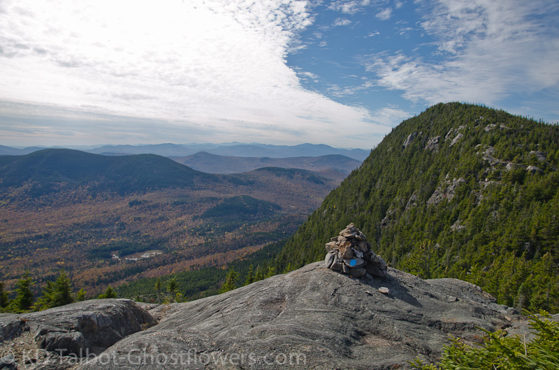
View from West Tumbledown of Mount Blue and Webb Lake
West and East Tumbledown Mountain 3068'
Loop Trail/Tumbledown Ridge Trail/Brook Trail/Roadwalk
5.6 Miles 1800' Elevation gain
Kevin and Judy
Jude had risen early and visited the fog enshrouded Webb Lake where we were camped. It had been cold the night before, but we had camped in colder. When she returned to camp I arose and we made the short hike to the beach again along the path beside our campsite. The fog had lifted and another beautiful, fall day was before us. We went back to camp and cooked a huge breakfast before setting out to find Byron Road and the trails to Tumbledown Mountain. As I spoke of in a trip report related to this hike describing our camping/paddling experience on this trip, I was led to this area by a postcard of "The Weld Area" of Maine. "There was a crude map of Mount Blue State Park and the Weld Area of Maine. It showed dotted-line routes to the summits of mountains with names like Mount Blue, Little Jackson and Tumbledown. Neither of us had ever heard of them, let alone been to this part of Maine. I photocopied the postcard, just the map part, for both of us." (The rest of the story is here: http://ghostflowers.smugmug.com/Category/Webb-Lake-Mount-Blue-State )
"I think we go up through that notch in the cliffs there."
So, I was finally here, Tumbledown Mountain. It took some detective work, but we found the trailhead. The bridge on Byron Road is out, but you don't know that until you're there if you're coming from the south on West Road. We had to turn around to find the road that served as the detour, further south along West Road than Byron Road. I believe it is Westbrook Road, but it is plainly marked if traveling south as the detour route, just not if you're traveling north. It is a one lane class VI with some dangerous blind corners, so take it easy. We were soon back on Byron Road and passed the well-marked Brook Trail before reaching the well-marked Loop Trail. The trail-signs are set back a little from the road, so perhaps the foliage covers them a bit during summer, but they were plain to see with the trees having already shed many leaves this fall. We started out along the gently rising trail through deciduous trees, some of which had shed their leaves while others still flashed their brilliant autumn color of choice.
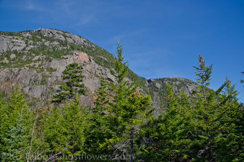
Impressive Cliff Face of West Tumbledown with Recent Avalanche
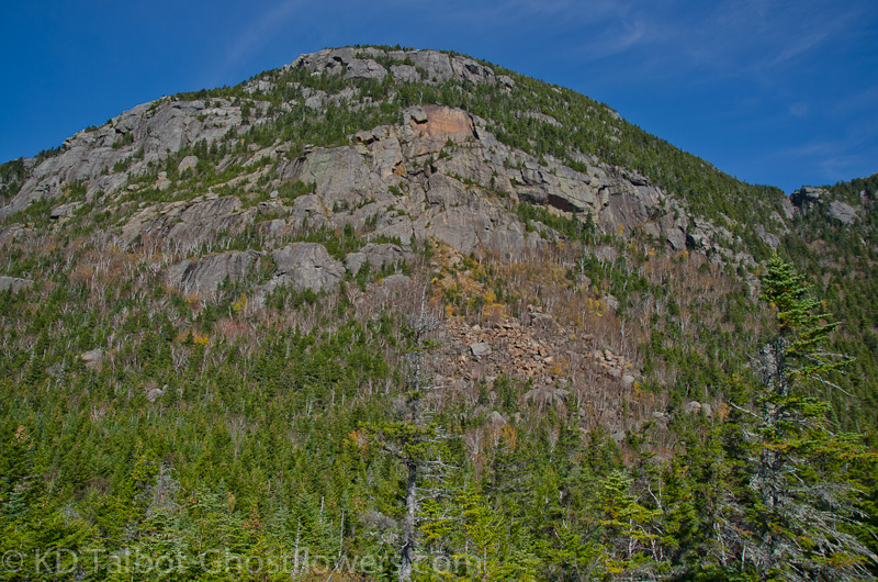
The trail began to rise and we soon found a short spur which gave us a view southeast towards Webb Lake. From there the trail rose again until we came out on some ledge where the south-facing cliffs of West and East Tumbledown Mountain stood as a wall to block our view to the north. We took a drink and a bite and gawked at the cliffs before us. "I think we go up through that notch in the cliffs there," I pointed. "Looks like all the climbing is still to be done," said Jude. My legs had been OK to this point, but I wished they were better, still trying to work them back into shape after August 1st right knee surgery, progressing slowly. I looked up at the cliff again. "Yeah, that little chink in the wall up there has got to be the only way up unless it goes way around," I thought. we set off again, first descending a bit from the ledge where we were, then briefly leveling before reaching the steep upward climb to the ridge. "What was that it said in the guide about "Fat Man's Misery"?" This was misery enough right now...
Steep Climb
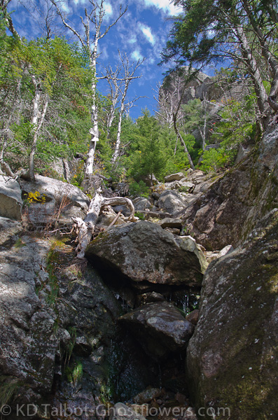
After winding our way around and over several rocks and ledges set as almost vertical steps for a race of beings with six foot legs, we stopped below some large boulders. Jude was in the lead, "I don't know where to go. Do I go under there?" She gestured to a very damp looking crawlspace below the boulders. "I think so... " was a all I could splutter. " I don't like this!" she returned. She had said it several times as we had skittered across wet, mossy stones and ledges to be stuck below these boulders. Looking up we were surrounded by ledges in the col at the top of the ridge, it was right above these boulders. Without another word Jude ducked under the boulders and stepped across the mossy ledge. "There's rungs, we have to climb up through." I ducked under to look, but Jude was already up, and trying to find foot and hand holds before she stepped from the rungs. "Ahh..." I thought to myself, "Fat Man's Misery" as I wondered if I'd make it through. It was a short climb, but would my leg be able to bend and push when I needed it too? I squeezed through after Jude, everything worked fine and after one or two more short boulder scrambles we were back in the trees on the ridge.
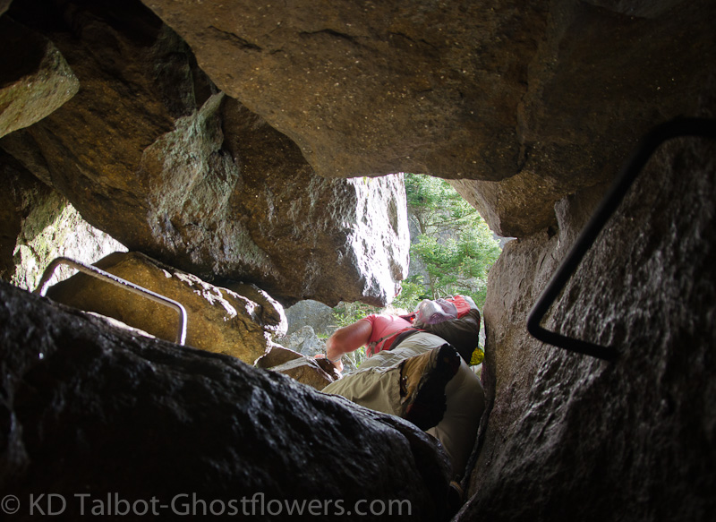
"Fat Man's Misery"
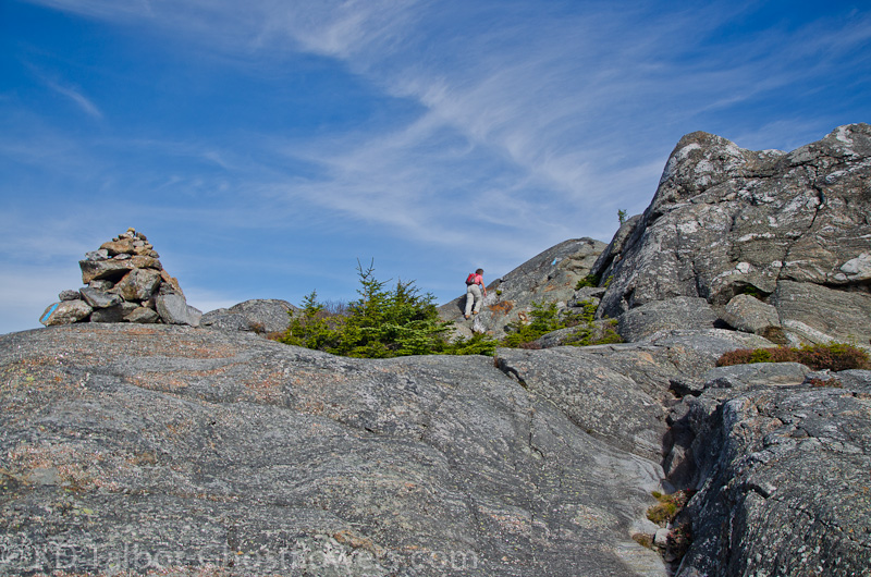
On the Ridge Above the Boulders and Cliffs
At that point we decided we would not descend by that route, so in my mind things began to change about what we would accomplish on this hike. I had first thought we would visit all the bumps, but the prospect of returning to the valley by a different route and having to road walk back to the car me a thinking a little more conservatively. I probably could have visited North Peak and not added all that much to the day, but we didn't. We sat on West Peak and had lunch as we stared at the surrounding hills to try to identify anything in this unfamiliar landscape. To the southeast was the mass of Mount Blue, and below that Webb Lake, but outside of my White Mountains I was hard put to decide what was what. I finally decided that I could make out Washington and Boott Spur, then deduced the Wildcats, Carter Dome, the Baldfaces and Kearsarge North, but had trouble picking out anything else.
We Came Up Through That Gap
Scrambling Up East Tumbledown
We hiked back down over the ledges where the trail to North Peak breaks off, then back to the col and past the Loop Trail, now following the Tumbledown Ridge Trail east towards East Peak and then down to Tumbledown Pond. after a quick, easy scramble up to East Peak we finally caught a glimpse of Tumbledown Pond below us. Some people call it "Crater Lake", and the tiny island in the middle of the pond brought to mind "Wizard Island" in the middle of the better known Crater Lake in Oregon. it was fun to think that it was conceivable that a huge asteroid which had burned up in our atmosphere was reduced to a tiny pebble which had slammed into earth with incredible velocity, destroying the mountainside and creating this tiny pool. NAHHH! Probably something boring, like a glacier. Anyway, it is a beautiful spot, and immediately added to our list of new favorites.
View Back to West Tumbledown Gives Some Idea of its Steepness (Mount Washington far horizon center)
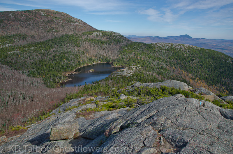
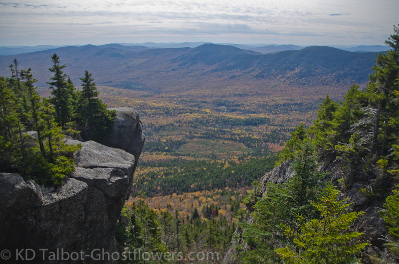
Tumbledown Pond
From the summit of East Peak we could see there were several people, in fact many people, down at the pond. I was hoping it was safe to assume that the Brook Trail was an easier trail to ascend than our chosen route had been, and therefore would be an easier descent. My hope panned out as this was true, and for the first hike since surgery I had a good hike down. I reasoned that I had not gained as much elevation or hiked as much distance as previous hikes on this hike, and it was so. Perhaps a little scaling back for awhile, though it seems I have been scaling back for a long time already. At any rate, I had a good hike out, and that was a plus as I knew I still had probably two miles of road walking before I got back to the car, but that would be a breeze I thought, remembering the road seemed to traverse flat terrain on the way here. Well, I don't know what road my mind was driving as we drove there this morning, but it wasn't flat. In fact it was uphill all the way to where we were parked. Mercifully, it was an easy grade and only a mile and a half, less than I had thought. We were soon done, and already discussing return trips to these hills...
Full set of pics HERE:
Related story and photos HERE:
KDT