We're just starting our 67 this year. We live in Maine, and when we hit VT, I want to do them in a week to minimize the four hour drives. I have plenty of AMC Whites maps, a Maine Rangley/Baxter map, but haven't seen too many maps that cover the VT 4k's. I'd like to order that maps that I will need quickly so I can begin planning our trip and hopefully do it at in mid to late July. Would someone that knows mind pointing me in the right direction? I'd prefer actual maps that you hold and fold rather than websites that just show topo.

You are using an out of date browser. It may not display this or other websites correctly.
You should upgrade or use an alternative browser.
You should upgrade or use an alternative browser.
Vermont 4K Maps
- Thread starter Randalls
- Start date
Help Support vftt.org:
This site may earn a commission from merchant affiliate
links, including eBay, Amazon, and others.
bignslow
Active member
We did all 5 on a long Labor Day weekend a few years ago.
This book was our guide (the 2003 edition):
http://www.amazon.com/Green-Mountain-Club-Trail-Guide/dp/1888021187/ref=sr_1_1?ie=UTF8&qid=1308824916&sr=8-1
I don't remember having a map besides the guide book, but they do sell a companion map for the book.
We worked our way North to South with the following itinerary
Mohammed's website was helpful in the planning as well:
http://home.earthlink.net/~ellozy/vt-4000-footer.html#tocref1
This book was our guide (the 2003 edition):
http://www.amazon.com/Green-Mountain-Club-Trail-Guide/dp/1888021187/ref=sr_1_1?ie=UTF8&qid=1308824916&sr=8-1
I don't remember having a map besides the guide book, but they do sell a companion map for the book.
We worked our way North to South with the following itinerary
- Mansfield & Camel's Hump
- Abraham & Ellen
- Killington
Mohammed's website was helpful in the planning as well:
http://home.earthlink.net/~ellozy/vt-4000-footer.html#tocref1
Buy a Delorme Atlas for VT. It shows most of the trails and more importantly it gives you a chance of finding the trailheads. For the majority of the VT 4 ks finding the trailhead is most of the work as they tend to be off of rural roads with minimal signage.
When planning a trip realize that many roads that should be state highways are not, so expect to get off the major highways and take rural roads. Be aware that GPS databases may not be accurate on these back roads.
If you are looking for an interesting place to camp near Killington, Gifford Woods State Park is nearby and has a nice patch of old growth forest.
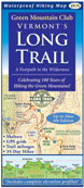
If you really want a map to carry, the Long Trail map of VT has all the 4 k's
https://www.greenmountainclub.org/products.php?catid=3
When planning a trip realize that many roads that should be state highways are not, so expect to get off the major highways and take rural roads. Be aware that GPS databases may not be accurate on these back roads.
If you are looking for an interesting place to camp near Killington, Gifford Woods State Park is nearby and has a nice patch of old growth forest.
If you really want a map to carry, the Long Trail map of VT has all the 4 k's
https://www.greenmountainclub.org/products.php?catid=3
Jazzbo
Well-known member
- Joined
- Jan 1, 2005
- Messages
- 1,197
- Reaction score
- 163
Map Adventures is good resource
Map Adventures is good resource. They offer two maps of VT that would answer your needs for the VT 4K's.
http://mapadventures.com/shop/?main_page=index&cPath=3
Map Adventures is good resource. They offer two maps of VT that would answer your needs for the VT 4K's.
http://mapadventures.com/shop/?main_page=index&cPath=3
Buy a Delorme Atlas for VT. It shows most of the trails and more importantly it gives you a chance of finding the trailheads. For the majority of the VT 4 ks finding the trailhead is most of the work as they tend to be off of rural roads with minimal signage.
When planning a trip realize that many roads that should be state highways are not, so expect to get off the major highways and take rural roads. Be aware that GPS databases may not be accurate on these back roads.
If you are looking for an interesting place to camp near Killington, Gifford Woods State Park is nearby and has a nice patch of old growth forest.
If you really want a map to carry, the Long Trail map of VT has all the 4 k's
https://www.greenmountainclub.org/products.php?catid=3
I came close to ordering a Delorme map book before posting this, but bringing a map book can be awkward, especially if the weather isnt favorable. Just ordered the Long Trail map.
We did all 5 on a long Labor Day weekend a few years ago.
This book was our guide (the 2003 edition):
http://www.amazon.com/Green-Mountain-Club-Trail-Guide/dp/1888021187/ref=sr_1_1?ie=UTF8&qid=1308824916&sr=8-1
I don't remember having a map besides the guide book, but they do sell a companion map for the book.
We worked our way North to South with the following itinerary:
- Mansfield & Camel's Hump
- Abraham & Ellen
- Killington
Mohammed's website was helpful in the planning as well:
http://home.earthlink.net/~ellozy/vt-4000-footer.html#tocref1
When you did all five peaks, did you hike each peak individual, or, after hiking Killington, did you have a car spot and hike all in a row?
The Long Trail guide (bignslow) combined with the Long Trail Map (peakbagger) is about as thorough as you can get. If you might go on to do the NE100, or are interested in other hikes in VT, consider the Day Hiker's Guide to Vermont, also published by the GMC.
You might appreciate a DeLorme for some of the dirt-road NE100 approaches, such as Stratton, Breadloaf/Wilson, and Dorset. Strictly speaking you could get to any of these just based on written description, they're not complicated, but I like seeing the overview of where I'm driving.
You might appreciate a DeLorme for some of the dirt-road NE100 approaches, such as Stratton, Breadloaf/Wilson, and Dorset. Strictly speaking you could get to any of these just based on written description, they're not complicated, but I like seeing the overview of where I'm driving.
Last edited:
bignslow
Active member
When you did all five peaks, did you hike each peak individual, or, after hiking Killington, did you have a car spot and hike all in a row?
We did all day hikes, we had 2 cars but only did 1 thru-hike.
Here was our basic plan:
Mansfield: Out and back from smugglers notch
Camel's Hump: Out and back from ??? on the west side of the mountain (shortest route I believe)
Abraham & Ellen: Thru-hike from Lincoln Gap to Jerusalem trail (car spot)
Killington: Out and back on the Bucklin trail
Your call on not buying a Delorme. I didnt suggest taking it with you on your hike, its just for locating the trailheads. A lot of the roads you will be taking have local 911 names and not neccessarily a nice sign that says this way to the trailhead, without a very good road guide, you will spend a fair time wandering. You would think they would have a sign denoting Camels Hump State Park with an arrow on it when turning off a main road, but that is not neccessariily the case. Same for Underhill State Park (mansfield), Wheelerville road (Killington) or the Lincoln Gap road (Abraham and Ellen), or the "Arlington-West Wardsboro Road/AKA Kelly Stand - the street sign reads Stratton-Arlington Rd" . (Stratton).
We did long day hikes from NH years ago and would cut hours off of driving by taking backroads (typical of Northern New England is that its a bear to go East to west). It was also an interesting day when we left Stratton from the east and discovered that although we could see the interstate, we actually couldnt get on it for 20 plus miles or back roads.
We did long day hikes from NH years ago and would cut hours off of driving by taking backroads (typical of Northern New England is that its a bear to go East to west). It was also an interesting day when we left Stratton from the east and discovered that although we could see the interstate, we actually couldnt get on it for 20 plus miles or back roads.
RoySwkr
New member
- Joined
- Sep 4, 2003
- Messages
- 4,467
- Reaction score
- 285
The GMC Long Trail Guide has page maps of all the peaks and a foldout map of Mt Mansfield. Unless you are taking some very obscure routes, that should be all you need. Beware of Map Adventures maps, the NH one is riddled with errors so if things look different on the ground believe the blazes.
I own a stack on DeLorme books but think that for these 5/6 peaks the free official VT highway map will get you to the usual trailheads. Both DeLorme and GPS may show roads you don't want to use, there are a number of "Don't Believe Your GPS" signs.
Oops, be sure to climb The Nose on Mt Mansfield as it will be added to the list whenever the AMC wakes up.
erugs
New member
Your call on not buying a Delorme. I didnt suggest taking it with you on your hike, its just for locating the trailheads. A lot of the roads you will be taking have local 911 names and not neccessarily a nice sign that says this way to the trailhead, without a very good road guide, you will spend a fair time wandering.
I agree that it seems much more difficult to find your way around to the trailheads in Vermont. Get as much detail as you can for traveling to the trailheads, especially. I love it, but Vermont is not New Hampshire -- a lesson that I have taken with me each time I've been there.
nartreb
Well-known member
The DeLorme was helpful for the road approach to Camel's Hump. To get to the Monroe Trail from exit 10 on rte 89, you have to head easterly on 2 / 100 southbound, and find River Rd (either via Main St [not to be confused with North Main St or South Main St] after the bridge on 100 south, or take a shortcut on Winooski St in downtown Waterbury, over the last bridge until Jonesville). These streets are marked, sort of. Once you're south of the river you've got around nine miles of dirt roads ahead. Not a whole lot of ways to get lost, but not a lot of markings either. A really detailed road map is helpful.
PS the last half-mile or so of the road to the Monroe trailhead is washed out; park at the View Trail parking area (or rather, on the side of the road near the overflowing parking)
PPS beware of software: there are two different Camel's Hump Roads, one on either side of Camel's Hump.
PS the last half-mile or so of the road to the Monroe trailhead is washed out; park at the View Trail parking area (or rather, on the side of the road near the overflowing parking)
PPS beware of software: there are two different Camel's Hump Roads, one on either side of Camel's Hump.
Amicus
Well-known member
- Joined
- Aug 28, 2005
- Messages
- 1,145
- Reaction score
- 112
Abraham & Ellen: Thru-hike from Lincoln Gap to Jerusalem trail (car spot)
An interesting variation on this route that I hiked just last Saturday with a friend is to continue on the Long Trail past the Jerusalem Trailhead over the summit of General Stark Mtn. (which is on the NE3K list), then down to "Stark's Nest," which is the top of the Mad River Glen ski area. You can then descend by ski trails with easy footing and great views to ample parking in the Mad River Glen lot. It lengthens the hike a little but shortens the car-spot.
We found the written descriptions in the Long Trail Guide sufficient to find both Lincoln Gap Road and, on Sunday, Camel's Hump Road (the eastern approach, from Couching Lion Farm in Duxbury.)
Incidentally, recent storms have wiped out the .4 mile stretch of road from the "Winter" to the two "Summer" lots on Camel's Hump Road, so you have to park in the Winter lot. The erosion damage is remarkable, such that I can't imagine them fixing it very soon.
Just ordered a Delorme. I guess that I could use multiple sources, like the Delorme and trail map, and try zooming on the road using google earth before we head out. Thanks for all the info. Hopefully I dont get too lost. Thanks for all the info.
We did all 5 on a long Labor Day weekend a few years ago.
This book was our guide (the 2003 edition):
http://www.amazon.com/Green-Mountain-Club-Trail-Guide/dp/1888021187/ref=sr_1_1?ie=UTF8&qid=1308824916&sr=8-1
I don't remember having a map besides the guide book, but they do sell a companion map for the book.
We worked our way North to South with the following itinerary:
- Mansfield & Camel's Hump
- Abraham & Ellen
- Killington
Mohammed's website was helpful in the planning as well:
http://home.earthlink.net/~ellozy/vt-4000-footer.html#tocref1
Just out of curiosity, do you remember which trails you took when you hiked Mansfield and Camel's Hump?
yvon
Active member
I found that the best map for Vermont is from The Wilderness Map Company, Vermont's Long Trail, Waterproof Trail Map - Third Edition
For Mansfield I did it twice, first time I took the Long trail and second time I take Sunset Ridge et Laura Colwles. Sunset Ridge is very nice, with a long part on a ridge.
For Camel Hump, we took Forest City Trail, Long Trail, Burrows Trail. Also we did it from Monroe Trail, Dean Trail, Long Trail / Long Trail, Monroe Trail.
Just out of curiosity, do you remember which trails you took when you hiked Mansfield and Camel's Hump?
For Mansfield I did it twice, first time I took the Long trail and second time I take Sunset Ridge et Laura Colwles. Sunset Ridge is very nice, with a long part on a ridge.
For Camel Hump, we took Forest City Trail, Long Trail, Burrows Trail. Also we did it from Monroe Trail, Dean Trail, Long Trail / Long Trail, Monroe Trail.
bignslow
Active member
Just out of curiosity, do you remember which trails you took when you hiked Mansfield and Camel's Hump?
To be honest I don't really remember (and I don't have the book anymore).
For Mansfield we left from smugglers notch area and we either took the LT or one of the other trails from that side. I do remember that it intersected the profanity trail on the climb (so that might help isolate what trail I'm talking about).
On Camel's Hump I believe we used the Burrow's trail (we were on the west side of the mountain because that's where our campground for the next night was going to be).
If you have the book just see what route is the shortest (with least gain) for each mountain and that's probably the route I took

Our itinerary was this:
Friday: Drive up, stay at underhill state park
Saturday: Hike Mansfield, Camel's Hump, Camp at a private place on the west side of the Abraham/Ellen ridge
Sunday: Spot car at Jerusalem trailhead, drive to Lincoln gap, hike the ridge, drive down to Gilford Woods to camp
Monday: Hike Killington via Bucklin, drive home
You probably have already found these, but you can download trail maps for Camel's Hump and Mansfield (Smuggler's Notch and Underhill) from the VT State Park site: http://www.vtstateparks.com/htm/publications.htm#pubs_trails
FWIW, I found the combination of the Long Trail Guide and Delorme more than adequate for planning and hiking.
FWIW, I found the combination of the Long Trail Guide and Delorme more than adequate for planning and hiking.
You probably have already found these, but you can download trail maps for Camel's Hump and Mansfield (Smuggler's Notch and Underhill) from the VT State Park site: http://www.vtstateparks.com/htm/publications.htm#pubs_trails
FWIW, I found the combination of the Long Trail Guide and Delorme more than adequate for planning and hiking.
Nice. Lots on here.
Similar threads
- Replies
- 0
- Views
- 857
- Replies
- 0
- Views
- 344
- Replies
- 7
- Views
- 906
- Replies
- 5
- Views
- 1K
Latest posts
-
-
-
-
-
Wapack trail Watatic to Windblown ski are NH 9.2 miles. The best laid plans of mice and men.
- Latest: Beckie and Prema