Research for a book

vftt.org

Help Support vftt.org:

This site may earn a commission from merchant affiliate links, including eBay, Amazon, and others.
A few in my area are:
Monadnock from the north behind Dublin Lake from 101
Monadnock from the south over Perkins Pond from 124
North South Pack Monadnock and Temple from 101 just west of Peterborough
Views from Miller state park on S. Pack(Vermon, Whites, Boston skyline)
panarama view from 123 near Pitcher Mtn west of Stoddard
 
A pyramid-like peak to the north from somewhere along 93 northbound.

I realize that’s not very descriptive. The viewpoint may be near Thornton.

I assume the peak is Liberty, but it seems to be standing out by itself, so I don’t know.


I think I have spotted that same pointy peak between exit 23 and 24 going north, perhaps around mile post 70-71. It is most obvious on a clear day in the fall when it has snow on top, and the rest of the landscape is brown and green. I also thought some part of Franconia Ridge.
 
I love lakes:

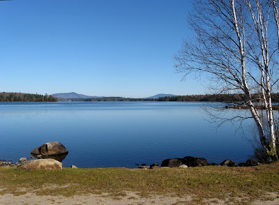
Umbagog from Route 26 as you come down off the ridge from Maine.


Maybe someone can ID those peaks behind the lake.

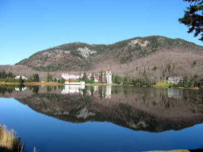
The Balsams Hotel across the Lake in Dixville Notch. Beautiful!


Magalloway across First Connecticut Lake from Route 3 in Pittsburg


The Columbia Covered bridge across the Connecticut south of Colebrook (a side road just off Route 3)


Here's the bridge with Vermont's Monadnock behind across the river This is a gorgeous shot if I do say so myself. Sorry I didn't have it on-line so I had to attach it here.
 
Last edited:
I wasn’t sure how serious the book idea was until I was informed by a fan of yours. ;) To answer your questions regarding my post and share some more details I offer:

Durgin Road (shown in previous post) [view of Tate (Ball), Black Snout peak, Shaw, Flagg] is in Tuftonboro (there is also a good spot on Tuftonboro Road in Ossipee – the two roads are a continuation of each other)
From Tuftonboro Road (shown below) [view of Black Snout peak, Shaw, Flagg, Canaan, Sentinel on horizon with Eldrigde Hill on right and Oak Hill on left near]


The view from 113 of the Ossipees (shown in previous post) [view of Little Larcom, Larcom, Black Snout Mtn] is across from Jackson Pond in Tamworth just a little north from Rt 25 at Bennett Corners.

Rt. 28 lookout is about midway between Alton and Wolfeboro [Rattlesnake Island on the left / Ossipee Range on the right]


This is a view of the Percy Peaks from Rt. 110 but another good view, maybe better, is to be had on the Emerson Road heading toward Nash Stream Road.


Magalloway across 1st Conn. Lake


Rt. 93 from the Flume parking area (I suggest here as you don’t have to pull over on the side of the highway)


Ridge Road (partial views shown in previous post) is in New Durham [view of Belknap Range, Chocorua, Presidentials plus peaks near and in between]

Another nice view is from the start of Iron Mt. trailhead before you ever hike (on a better day you will see more the the clouds lifting over the Wildcats)


I will also add that from Saunders Bay (Rt 11B in Gilford) you can see the Sandwich Rand and Washington along with the previously mentioned Ossipee Range)
 
Last edited:
Surely very obvious, but I don't think anyone's mentioned the views of Chocorua from the turnouts off rte 16 at Lake Chocorua. There's a little bridge you can walk onto, the handrail makes a good resting point for a camera.

t17.jpg
 
Rte. 26 east of Errol, on the height of land between Umbagog and Errol. No rest area or clear pull off, but a nice wide straight road for a breif stop. Look south over the Andro Valley with the Presidentials in the distance.

Stop in Evans Notch at the height of land, the mountains open to the south and you feel like you are peeking around the ridge, and the view up the ledges is fantastic, I can never just drive by.
 
Don't forget the spot in Lincoln where the UFO grabeed Betty and Barney Hill. What the hell, throw in the Kanc bigfoot sightings as well.
 
Another good viewpoint from Route 16 is about one mile North of Green Mountain Furniture in Ossipee. On the left (if you are heading North) is a great view Northwest, toward what I think is the Sandwich Range. I believe local conservation organizations are trying to purchase that land to protect the viewpoint from development (at one time it was a golf driving range). There are safe stopping/parking areas on the West (Southbound) side of the road.

Also, now that I think of it there is a pretty good view East to Green Mountain from the area of Green Mountain furniture.
 
Monadnock

The view of Mt. Monadnock across Perkins Pond from Route 124 in Jaffrey, NH.
 
Many thanks for the suggestions

I am delighted with all the responses that I am getting as regards to where the good views are. I could respond to each with PMs but I would like to make individual responses publicly so that the others in this thread can see where I've gone and where I need to go. If you did not get a response I have not forgotten you.

Responding to Quiet Man: I do need to get back down to the Monadnock region and seek the places you suggest. I have a view worked up from Miller State Park but need to revisit it to see what the trees have done with the view from the north. I need to look at the panoramic view from 123 near Pitcher Mountain. The view from the top of Pitcher itself will not be used because it is too far from the car.

Papa Bear enclosed some wonderful pictures. I need to get over to the Lake Umbagog region. I had to cut my trip short a month ago because the day was getting late. And I also need to get up into the Connecticut Lakes.
Thanks for your idea of the Balsams Resort across the pond with the lake in the background. However, I am doing the full panorama view from their golf course located about 3 miles northwest of there.

Carole also enclosed some wonderful pictures. I thank her for more closely describing the locations that she had suggested earlier and I plan to visit them. I have already photographed the view of Rattlesnake Island from Route 28 in Alton and plan to use it. I will have another look at the Percys from both Route 110 and Emerson Road. The view from the Ridge Road in New Durham looks interesting. Also the view from 11B in Gilford. I am doing the view from Ellacoya State park but from there you cannot see Mt Washington. So I will take a look from 11B.

Responding to Nartreb: Yes, the view of Chocorua across the lake is one of the prettiest in the state.

Andrew also suggested views in the Umbagog region and Evans Notch. I fully expect to get to those.

I will also have to look into Larry D's suggestions of the views along Route 16.

With three people suggesting Monadnock across Perkins Pond, I need to have a look.

Some the best viewing comes from a lake shore but I have to do it from either a state or town park, a public boat launch site or a wide place in the road where you can stop. There are over 100 public golf courses in New Hampshire and I am looking at the views from these. I don't want my public wandering too far from the parking lot and interfere with the golfing activities so I have to eliminate most of these courses. Yet I have found four with excellent views. Airports are another place with low horizons. This has not been too fruitful because the access roads don't always come to where the views are best. But I still have some airports to visit. High tension power line corridors are not a good place to look because the underbrush is often tall enough to render the view invisible. The Walmart parking lot in Plymouth has an excellent view as does the Merrimack County Nursing home in Boscowen.

Shincracker
 
Some of the best views of New Hampshire are in Vermont, though....

I 91 near Wells River looking east towards Franconia Notch.

There is a rest area off I-91 just north of Bradford, Vt that has an excellant view of Moosilauke and surroundings (and perhaps the Kinsman Ridge-it was too cloudy to be sure).
 
Carole, that is a good view! I believe you get the foreground of the Benton Range as well....

One other place I thought of, although it may not fall into the parameters of the book, is the top of Methodist Hill Rd in Lebanon, NH. There is a view into Vermont that takes in Ascutney, Killington, Pico, and much of the spine of the Greens to the north and south.
Maybe a short section on views of other states from New Hampshire roads? Although...a few years ago Killington tried to secede from Vermont, and become an incorporated town in New Hampshire!:eek: So maybe this view does fit in the book.;)
I wish I could find a picture of that view....amazing at sunset, or when a big storm is rolling in from the west, as you can watch it come across the valley from over 40 miles away.
 
Thanks Carole for the suggeston of the I-91 rest stop north of Bradford Vermont. I have already photographed that and am planning to use it.

As for Jason Beard, I will look into Methodist Hill Road in Lebanon. Perhaps it does look into Vermont, but I am doing views from the toll road up Ascutney from the turnout near the top and also the summit parking lot. Even though the Lebanon view may not look into New Hampshire, a close look at Ascutney could be an intro to that mountain.

One view I am working up is that from Mount Wachusett in Massachusetts looking towards New Hampshire. It has a fire tower, but I am disappointed that the public is not allowed into it, even to the floor below the cab as is the case in every tower I know in New Hampshire except for Prospect Mountain which can be locked at the base. The result is that for much of the view, one is looking at a horizon over the top of a lot of scrub trees that are going to obscure much of the view in five or ten years. As it is, you cannot see a full 360 degree horizon from the ground. If the park department wants to preserve this view it had better start hacking some trees or else construct a tower for viewers. A stone tower is pretty indestructible and it does not have to be terribly high.

Shincracker
 
Top