Weeknight Escapes from the City; Prospect Hill Park, Waltham MA

vftt.org

Help Support vftt.org:

This site may earn a commission from merchant affiliate links, including eBay, Amazon, and others.

una_dogger

Well-known member
Joined
Jul 29, 2005
Messages
4,517
Reaction score
638
Location
The Hinterlands of North Central MA
Seems these days there's more than a few of us living in the 'Ham, so I thought I'd post a little trip report from Prospect Hill Park, one of my favorite escapes and a quick walk from our house.

Prospect Hill Park is a 250 acre ridgeline preserve in Waltham, nine miles west of Boston. We access the park from the southern end, entering on the Wood Trail on Prospect Hill Rd.

The Wood Trail
ry%3D400


After a short walk on the Wood Trail, I headed east on the Boston Rock Trail. The trail climbs steeply for the first 0.25 mile.

ry%3D400


From Boston Rock, an excellent view of Waltham and Boston can be seen.
This overlook is also wheelchair accessible, from a small service road that runs through the park and is open May to November.

ry%3D400


Here I picked up the Ridge Trail, and continued north. The trail winds up and down gently, passing through deep ferny forest and out onto open slab. I saw many, many stands of Pink Lady Slipper. More than I have ever seen!

ry%3D400


The character of the Ridge Trail reminded me a bit of Harriman State Park in New York's Hudson Valley.
ry%3D400


Normally I return via the Fisk Trail (ferny, huge white pines), but today, I continued onward another quarter mile or so to the Fire Warden's Trail. With a name like that, I just had to check it out.
ry%3D480


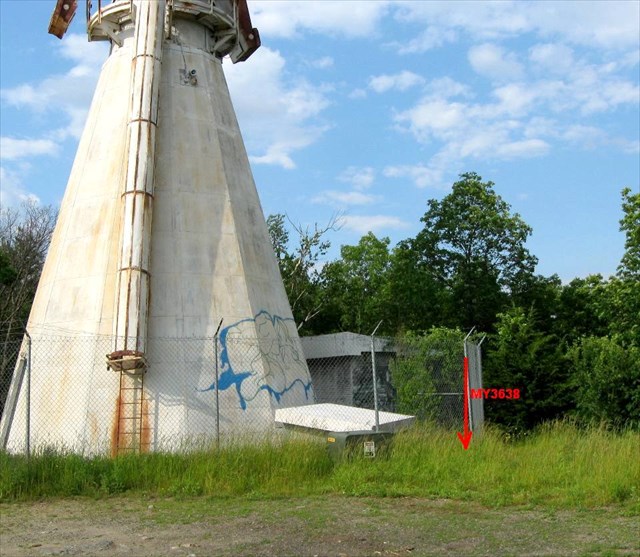
This trail leaves the Ridge Trail near a large cell tower. Its not as well travelled as the other trails, and a bit rockier. After a quick jog down from the top, and a few blocks through the 'Hood, I was back at home, one hour later, working in my gardens, my "other" weeknight city escape!:)

ry%3D400

ry%3D400


There are quite a few more trails to explore in this Park. If anyone local wants to check it out some night, drop a pm!
 
Last edited:
Lovely Pictures Sabrina.
Sàri,my wife, would like to know what kind of flowers those were. The tall purple ones with the round flower head looks a lot like chives but not sure.
What a great location you guys live in, not far from the city.
 
Wow! I really need to get up there. :)

If I'm ever an insomniac some morning, that would be a great spot from which to take sunrise photos over the city.
 
Nice job! I gotta check out that Boston Rock - when I hiked Prospect a few years ago, I only went to the summit, where there wasn't an easterly view.
 
Last edited:
I disagree completely with Sabrina. Prospect Hill is a terribly dangerous area, and I don't think anyone reading this should take the risk and walk, run, or bike there.

And my opinion has nothing to do with the fact that I want the park all to myself.

Jason
 
I disagree completely with Sabrina. Prospect Hill is a terribly dangerous area, and I don't think anyone reading this should take the risk and walk, run, or bike there.

Yeah, well, true, its only steps from the Projects....

And my opinion has nothing to do with the fact that I want the park all to myself.

Jason

Ha ha! It's mine!! I was here FIRST!!! Tee hee...actually, its generally pretty deserted...so I think we can share! You can have it in the morning...!

Prino, you are close! Those are in the Allium Family and they are Ornamental Onions. They are super easy to grow, they are perrenials from bulbs, just plant in the fall. They mature to about four feet tall, but these are first year plants and a bit small.

More information here:
http://www.hardyplants.com/Merchant...t_Code=AAPS-A&Category_Code=New&Store_Code=SP


Jeremy, most people enter the park from Totten Pond Rd and climb to the top of the former ski hill. But the best part of the park, IMHO, lies at the Southern End. There's no parking down there, so ya gotta have an "in"....but it also makes for a more private experience. I rarely see anyone on the trails I use. I have not been on the Western Trails behind the old Polaroid Corp yet...so maybe someone who has can expand...Jazzbo??
 
Last edited:
Very nice Pictures!!
I used to work in Lexington and would try to sneak out at lunch to the park. I thought that it was cool that I could see South & North Packs near my home in Peterborough from the western outlook, a distance that took me 1 1/2 hours to commute! I miss the park, but not the drive.
 
How is the parking ?
As compared to, the 19 mile brook TH ?:D

Well, I would never park there! I leave my car at home, in the driveway! As Jason pointed out, its a "transitional neighborhood". :D

Ok, I guess its about time we all start thinking about a Waltham Beer Night and PH Park Hike. Anyone?? Any dates come to mind??

, a distance that took me 1 1/2 hours to commute! I miss the park, but not the drive.

Ouch!! That hurts!! I can sympathize, had a long commute before moving here. Now its down to 4.5 miles each way.....:)
 
Prospect Hill Trailwork and more

My connection to Webshots is corrupted. So I'm restricted to text in this response. Otherwise I'd chime in with some photos. I just completed a lengthy process of submitting a proposal to the Parks and Rec Dept and obtained the City's permission to install some waterbars in two places on the hiking trails! Maybe we can get together some evening with picks and shovels to install some rock waterbars and celebrate with some cold brews on top of Boston Rock.

There's a pretty impressive range of ledges lining the east side of the ridge. If you venture east from the ski trail you can look down over it. I like to snowshoe there after snow storms and track animals. One time I came across a coyote in thick pines around Big Prospect. Big Prospect is tallest summit with remains of the radar tower and views to west ... Wapack Range and Cambridge Reservoir. Little Prospect is summit with Boston Rock.

Lastly there are some steep areas where I've seen snow boarders toying around. I think ski area and other spots in park are a secret powder stash for Boston Area snowboarders. Wonder if D Metsky has been here?

I agree with Ferrisjf though. It is a very dangerous area! Wouldn' go there without emergency gear, bivy, 200' of rope, crampons, sleeping bag, GPS, ice ax.... I'm forming up Waltham SAR group just for this very dangerous area.
 
Last edited:
Sabrina . . . I love that photo with the rugged “peaks” of the Boston skyline on the horizon. Not being sarcastic . . . I really like it!

Thanks for a very refreshing TR from a different locale!:)
 
Very nice! Great having a spot like this almost in your back yard. Our Boston area hikes are usually limited to Middlesex Fells or Blue Hills (OK, not exactly Boston). We're definitely going to have to check out Prospect Park.
 
Ha ha! It's mine!! I was here FIRST!!! Tee hee...actually, its generally pretty deserted...so I think we can share! You can have it in the morning...!
I think I was there before you, but I'm not using it anymore. Absolute gem of a park, and the redevelopment/recovery of it is very nice to see. Nice place for trail-running and certainly rugged enough for just about anyone.

I keep wanting to do a self-arrest practice on that main ski slope, but it's not "in" for very long, and of course it's much further from me now.
 
Great pictures Sabrina

When I was there I went from the north (just off 128) and only had time to hike to the summit. I missed the less traveled southern section.

But ... there's something very special at the summit next to that weird tower (what is that tower? anyone?). It's a survey marker from 1833 which was part of the original survey of Massachusetts by Simeon Borden done in the 1830s. This predated the US Coast Survey of the East Coast which didn't come through the area for another 10 - 15 years. It's a copper bolt embedded in bedrock (kind of squashed now) and has a triangle carved around it. Someone painted the triangle so it's easy to spot.

The station name is "Prospect Waltham" (makes sense, no?) and here's my log on the Geocaching Benchmark site: Prospect Waltham

Here's a picture showing where it is in relation to the tower:

e9c0df6c-7002-40e6-8dc4-6fb342a403a7.jpg


And here's the marker:

bb6e9a29-fb98-4b25-946d-483cf343c281.jpg


And here's a survey map of the greater Boston area from an early publication. You can see the centrality of this point, and also see important nearby points Blue Hill, Holt, Hasnabumskit, Watatick, Wachusett, Thompson. Manomet (those 2 off the map) etc. Even Pegan Hill in Natick.

982bd1ae-d06c-465f-8d94-6f1ec4359eb4.jpg


Survey markers tended to be set on prominent peaks for obvious reasons, and most of these are still great hiking destinations.

Since this is really about uncelebrated peaks in our own back yard, I recommend all of these.
 
Last edited:
My input on parking.

I found that by parking in the office park complex off of 5th Ave between the 2nd & 3rd office buildings, there is a short gated access trail to the main park road. Using this, I could go to the top of Big Prospect for the west view, then take the trail to Little Prospect for the east view, and be back to my car without overextending my lunch break.

It was also a "safe" place for my car.
 
Since this is really about uncelebrated peaks in our own back yard, I recommend all of these.

I agree - Mt. Auburn Tower and its surroundings remain the premier hiking destination in Cambridge, for instance. One thing about that map surprises me, however - of the two points between Prospect and Wachusett, the one to the south is "Marlboro Water Tower." I would have expected that to be Nobscot Hill (600 ft.) in NW Framingham, which I think is the high-point between Great Blue Hill and Wachusett. Would that "Marlboro Tower" be Mt. Ward, which is about 2.5 miles WNW of Nobscot? That would be odd, since it is 160 ft. feet lower. I note that both Nobscot and Ward have that little "survey" triangle on the current USGS topo. Nobscot has a tower, but not for water.
 
I agree - Mt. Auburn Tower and its surroundings remain the premier hiking destination in Cambridge, for instance. One thing about that map surprises me, however - of the two points between Prospect and Wachusett, the one to the south is "Marlboro Water Tower." I would have expected that to be Nobscot Hill (600 ft.) in NW Framingham, which I think is the high-point between Great Blue Hill and Wachusett. Would that "Marlboro Tower" be Mt. Ward, which is about 2.5 miles WNW of Nobscot? That would be odd, since it is 160 ft. feet lower. I note that both Nobscot and Ward have that little "survey" triangle on the current USGS topo. Nobscot has a tower, but not for water.
There are two points in Marlboro, one called "Marlboro" and the other "Marlboro, Water Tower". On the map they are jammed close together. Here's what the old report has for description:

Marlboro (Middlesex County, J. B. Trolley, 1895).-This station was established by the Massachusetts Topographical Commission and is in the city of Marlboro, on the southeast corner of tho bank of the reservoir, on property of the city. The station is marked according to note 16b and 16c. A gatepost is 74.95 meters (245.9 feet) southeast of the station, and the center of the Marlboro water tower is 33.6 meters (110.2 feet) southwest.

The water tower is not described since it was evidently obvious (and clearly at the reservoir).

Stations were selected for intervisibilty, which may not translate to height. So something may have blocked Nobscot Hill.

Edit: I would also point out that that map came from the US Coast and Geodetic Survey report from 1922 so it includes stations from the earliest up to about 1920. Here's a map of just the Borden Survey (1830s) and shows a much sparser set of points. The triangles are "triangulation stations", meaning they set up their equipment at these stations to measure angles to other stations. The little circles are "Intersection stations" which they observed to (like Church Steeples) but could not observe from. Borden Map
 
Last edited:
There are two points in Marlboro, one called "Marlboro" and the other "Marlboro, Water Tower". . . . The water tower is not described since it was evidently obvious (and clearly at the reservoir).

Well, that description doesn't enable me to solve this little mystery. There are two Reservoirs located in significant part in modern Marlborough. Fort Meadow Res., on its north border and sliding over the line into Hudson, lacks any significant hills within a half-mile of its SE perimeter. On the east shore of Sudbury Res., a little bit south of its modern mid-point, sits Pine Hill (450 ft.), a decent peak which, voila, sports a Water Tank even today. It might just be far enough south of Nobscot and whatever heights between it and Prospect barred its use. It is, alas, in Southborough, at least today, a quarter-mile south of the Marlborough line.

Stations were selected for intervisibility, which may not translate to height. So something may have blocked Nobscot Hill.

Duly noted, and thanks for the interesting Borden Map. Do you think those little circles are church steeples?
 
Well, that description doesn't enable me to solve this little mystery. There are two Reservoirs located in significant part in modern Marlborough. Fort Meadow Res., on its north border and sliding over the line into Hudson, lacks any significant hills within a half-mile of its SE perimeter. On the east shore of Sudbury Res., a little bit south of its modern mid-point, sits Pine Hill (450 ft.), a decent peak which, voila, sports a Water Tank even today. It might just be far enough south of Nobscot and whatever heights between it and Prospect barred its use. It is, alas, in Southborough, at least today, a quarter-mile south of the Marlborough line.
Marlboro still exists in the government database. Here's a map: Marlboro Survey station
It is on Stigo Hill just north of Williams Lake. It looks like a baseball field now. Looks like the tower is still there plus a big water tank. It was last recovered in 1938, but may well still be there underground.

Duly noted, and thanks for the interesting Borden Map. Do you think those little circles are church steeples?
Those are either church steeples or other man made towers that they could site on from a distance. Water tower, City Hall cupola, etc.
 
Last edited:
Top