Found the following
here
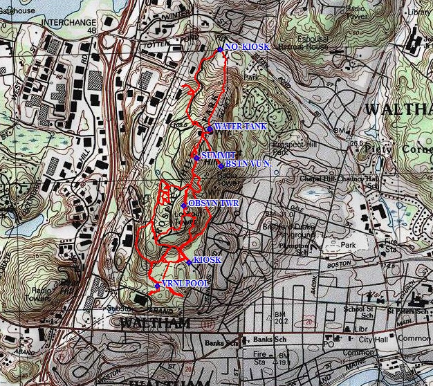
Circa 1963, the Air Force added a large antenna to their facilities. This antenna included
a 30 foot wide parabolic reflector dish that sat atop a 40 foot high tower. It was used to monitor
radio emissions from the sun. This would allow the Air Force to study sunspot activity and solar
storms which can be dangerous both to aircraft and space vehicles........
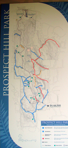
In 1997, as the city was beginning to make a commitment to the revitalization of Prospect
Hill Park (see the master plan discussion below), the Air Force vacated the site. By this time, the
site had been contaminated by lead, asbestos, semivolatile organic compounds and various
hydrocarbons. From 2000 to 2001, a contractor for the Air Force removed most of the structures
and replaced the contaminated soil. The one structure that remained was the 40 foot tower that
had supported the 30 foot parabolic antenna. Although the 1997 master plan for the park
(discussed below) had included the removal of all radio sites in the park, individuals with an
interest in continued use of radio in the park had acted to maintain the radio tower.

") .
.