1HappyHiker
Well-known member
There are probably about as many mountains named “Black” as there are “Bald”! So, just to be clear, the particular “Black” mountain that I visited was the one adjacent to Sandwich Dome.
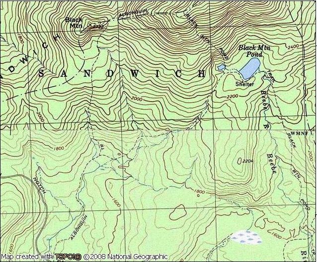
The recent Q&A posting by Pocahontas about the condition of Sandwich Notch Road got me to thinking about the fact that I’ve never hiked the Algonquin Trail and so I decided to try it out. But, since this was another day when I had a limited amount of time, my exploration of this trail was confined just to the general vicinity of Black Mountain.
Oh! And by the way, the condition of the Sandwich Notch Road from the Waterville Valley end to the Algonquin trailhead is rough. However, it’s probably doable for even a passenger car if you take it very slow and weave around some of the deeper potholes.
From the outset, I knew that the views would NOT be crystal clear since overcast conditions were predicted for the entire day. Therefore, I anticipated that my photos would not be great, but felt that I should at least be able to get a pretty good idea about the types of views that are available from the Black Mountain vicinity. Plus, the hike would enable me to experience a trail that I hadn’t hiked previously.
As everyone knows, the Algonquin Trail merely skirts the east side of Black Mountain and doesn’t go over the actual summit. But you get a great view of its picturesque summit from the trail as you climb high above it (photo below).
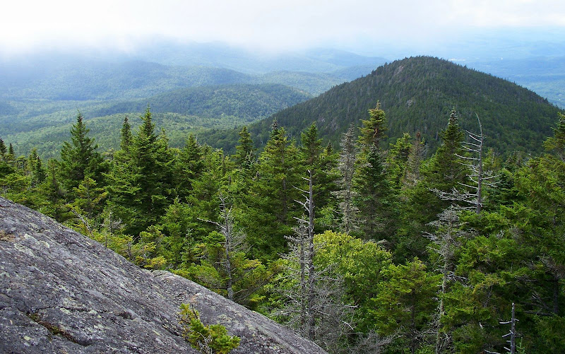
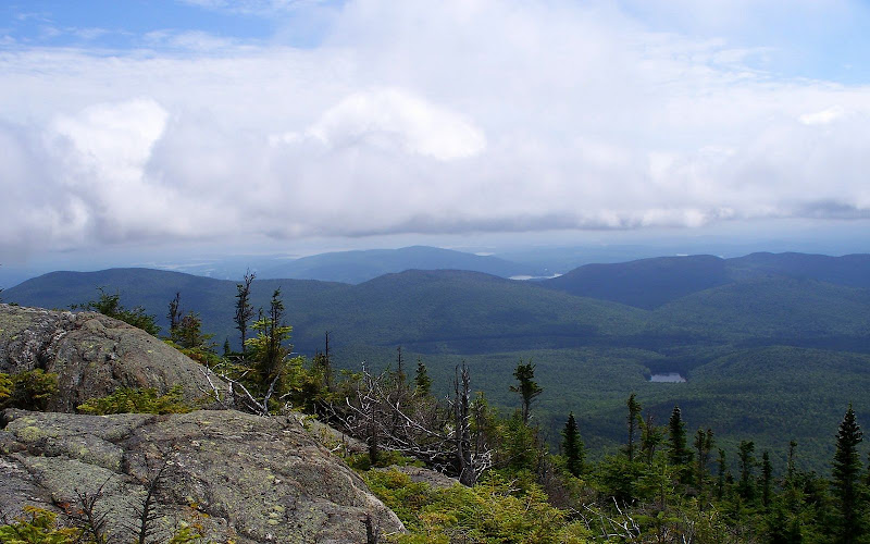
After you begin the climb away from Black Mountain, there is an abundance of viewing opportunities since it almost seems that there are open ledges around every corner. On a clear day, the views must be spectacular. But on this day, the views were merely mediocre. Below are just a few samples of the images captured on this particular trek.
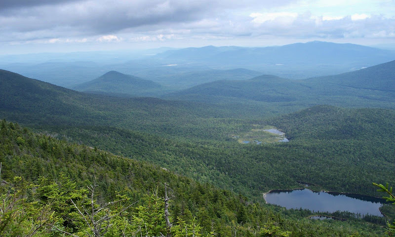
Black Mountain Pond . . . and Beyond
In the Foreground (A Portion of Acteon Ridge + Jennings Peak)
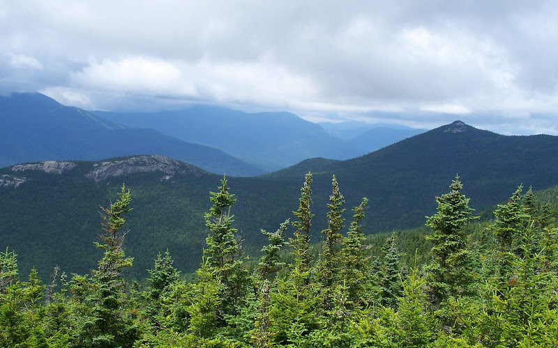
Looking Southward Toward the Lakes District
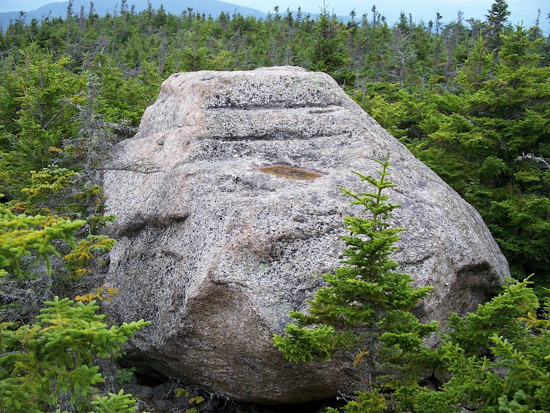
And, here is one last photo. Take a look at the parallel lines going across the top of this boulder. Would I be correct in assuming that these lines are the result of glacial action?
This was a great hike. I’m glad I did it. At some point in the future (on a better viewing day), I’ll likely do some sort of a loop that will involve retracing the segment of trail I did on this hike, plus perhaps adding in some other trails such as the Black Mountain Pond Trail, etc, etc.
1HappyHiker
The recent Q&A posting by Pocahontas about the condition of Sandwich Notch Road got me to thinking about the fact that I’ve never hiked the Algonquin Trail and so I decided to try it out. But, since this was another day when I had a limited amount of time, my exploration of this trail was confined just to the general vicinity of Black Mountain.
Oh! And by the way, the condition of the Sandwich Notch Road from the Waterville Valley end to the Algonquin trailhead is rough. However, it’s probably doable for even a passenger car if you take it very slow and weave around some of the deeper potholes.
From the outset, I knew that the views would NOT be crystal clear since overcast conditions were predicted for the entire day. Therefore, I anticipated that my photos would not be great, but felt that I should at least be able to get a pretty good idea about the types of views that are available from the Black Mountain vicinity. Plus, the hike would enable me to experience a trail that I hadn’t hiked previously.
As everyone knows, the Algonquin Trail merely skirts the east side of Black Mountain and doesn’t go over the actual summit. But you get a great view of its picturesque summit from the trail as you climb high above it (photo below).
After you begin the climb away from Black Mountain, there is an abundance of viewing opportunities since it almost seems that there are open ledges around every corner. On a clear day, the views must be spectacular. But on this day, the views were merely mediocre. Below are just a few samples of the images captured on this particular trek.
Black Mountain Pond . . . and Beyond
In the Foreground (A Portion of Acteon Ridge + Jennings Peak)
Looking Southward Toward the Lakes District
And, here is one last photo. Take a look at the parallel lines going across the top of this boulder. Would I be correct in assuming that these lines are the result of glacial action?
This was a great hike. I’m glad I did it. At some point in the future (on a better viewing day), I’ll likely do some sort of a loop that will involve retracing the segment of trail I did on this hike, plus perhaps adding in some other trails such as the Black Mountain Pond Trail, etc, etc.
1HappyHiker
")