
mtruman
New member
We were supposed to be spending the weekend camping at Cardigan but at the last minute our daughter decided she didn't want to go. The weather forecast was sounding iffy as well so we shifted our plans to a dayhike instead. Turned out to be a good decision...
Got up at 4:30 to have time to walk the dog, get ready and on the road by 6:30. No traffic (except for the about 1000 motorcycles on their way to the first day of Bike Week in Laconia). Made great time and were pulling into Cardigan at 9:45. Weather was absolutely beautiful - high 60s and sunny when we started. We'd never hiked Cardigan when it wasn't covered with snow (which is also great) and were really looking forward to this.
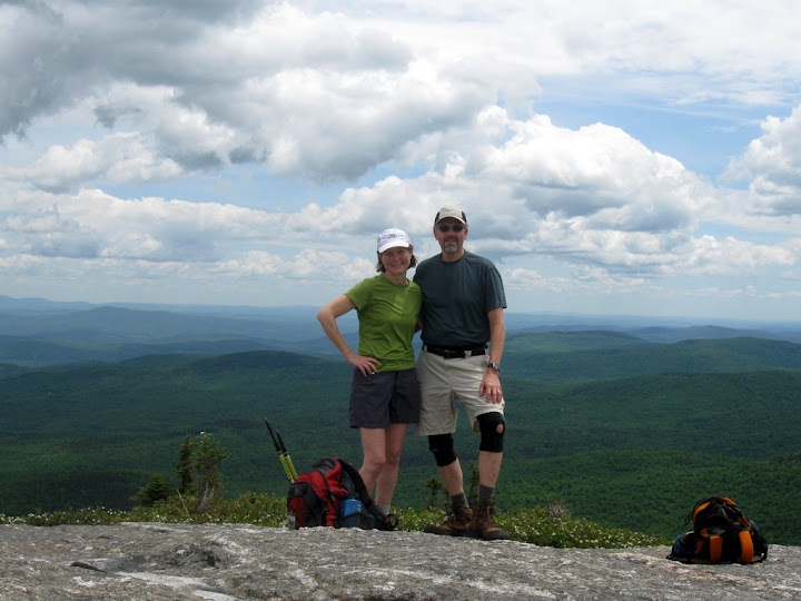
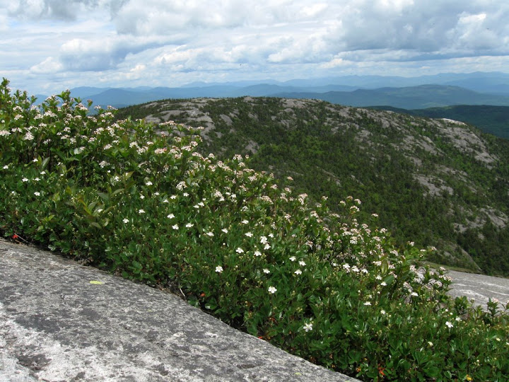
Decided to take the counterclockwise loop up Manning to Firescrew and then Mowglis to Cardigan and down Clark and Holt. We would up being glad we went that direction. The ledges on Firescrew were definitely better to be going up than down. Trails were all in great shape. A little muddy from all the rain lately but no big deal. Very few bugs (a pleasant surprise) other than a friendly group of black flies that decided to join us for lunch (or should I say have us for lunch) on Cardigan. Was getting pretty warm in the woods but once we reached the ledges below Firescrew we had a beautiful breeze the rest of the way. The view from the top was a little hazy but spectacular. The mountains to the north were laid out in green, blue and purple layers through the haze. We really love open ridge walking and this has to be one of the nicest places in New Hampshire for the effort. Being on top sort of has the feel of the mountains in Acadia (except without the ocean views).
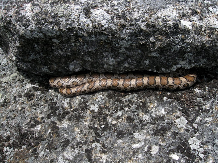
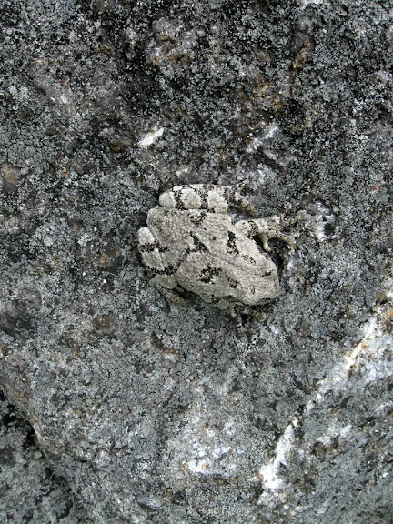
The wildflowers were all in bloom. The walk from the beginning of the ledges below Firescrew all the way to Cardigan were just covered with flowers. There were also some interesting fauna (see pictures below). Saw a very fresh bear print on the Manning trail (see the photo album link at the end). Wonder how long ago he was here...
On the way between Firescrew and Cardigan we met several people who were trying to find the Grotto Cave. I followed the cairns and make-shift blazes down with them from the sign but we never did find the cave. Anyone been there and have any hints for next time?
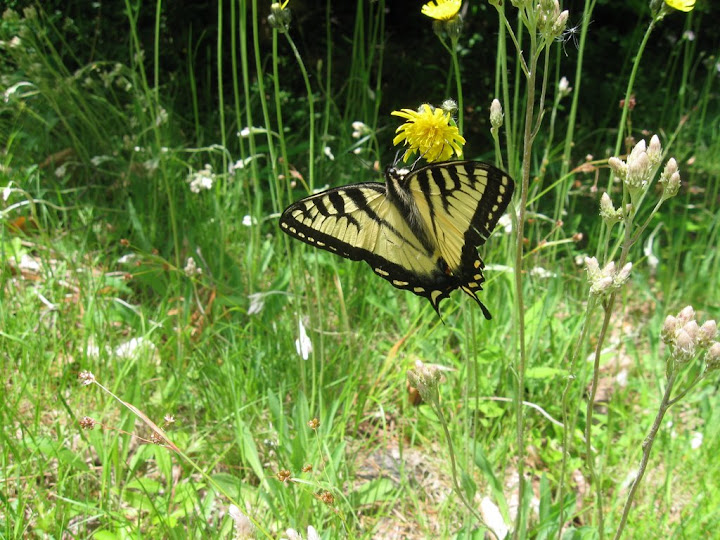
After a nice lunch and what seemed like way too short a stay on top we headed back down via the Clark and Holt Trails. Nice easy descent which happily didn't do my knees in (always an issue with the first few hikes of the season). We took the Nature Trail at the bottom which was a lovely way to end the hike. Wanting to check out the campsites we wandered around for a while and fond the one we want when we get back (sorry, can't give out the number - don't want any competition). The meadow and gardens around the lodge were beautiful and we got a couple of final treats with more flora and fauna. The thunderstorms that had been predicted never materialized and it was a beautiful drive back home. In the pool with a frost Sierra Nevada in hand at 6:30. Couldn't have found a better way to spend the day!!!
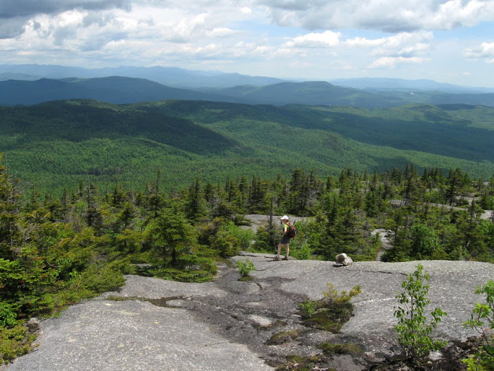
Nat surveys the views from Firescrew
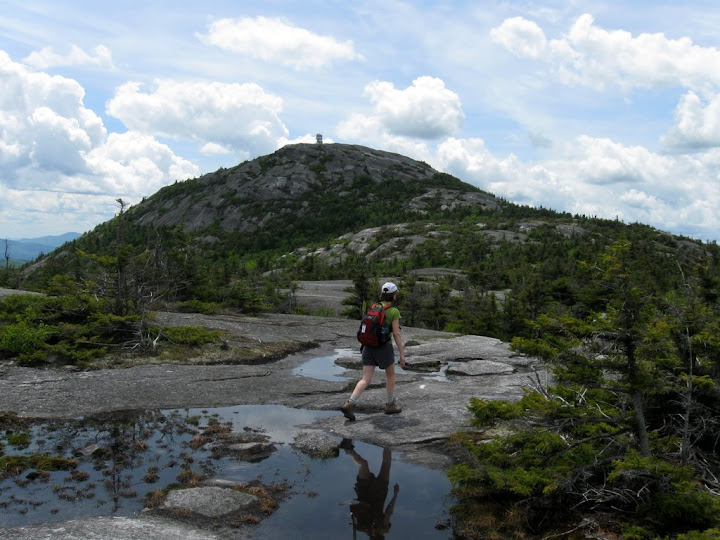
Enjoying the view
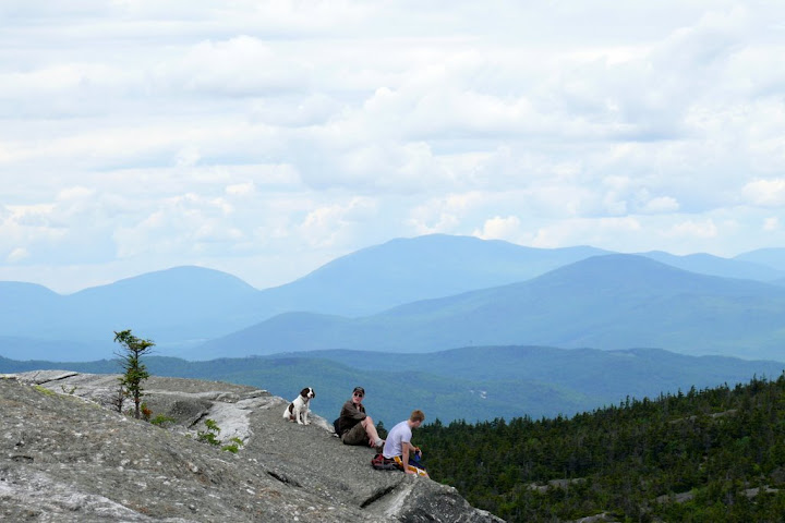
Great day to be on a mountain
Flora
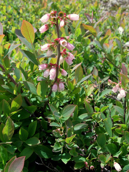
Blueberry
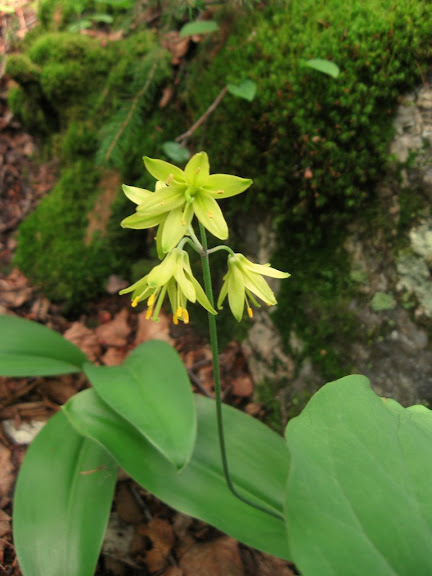
Blue Bead Lily
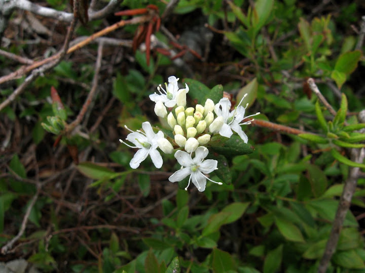
Labrador Tea
Help - can't identify these - they were everywhere!
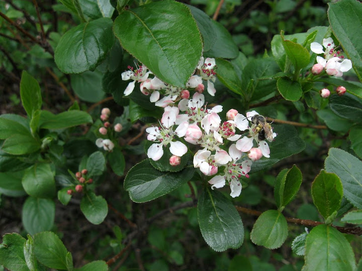
More of the mystery flower on Cardigan summit
Fauna
Milk Snake (right before he disappeared into the rock)
Pretty good camouflage (almost got him stepped on)
A final farewall in the meadow by the lodge
Rest of the pictures are here: http://picasaweb.google.com/mtruman42/Cardigan61309#
Got up at 4:30 to have time to walk the dog, get ready and on the road by 6:30. No traffic (except for the about 1000 motorcycles on their way to the first day of Bike Week in Laconia). Made great time and were pulling into Cardigan at 9:45. Weather was absolutely beautiful - high 60s and sunny when we started. We'd never hiked Cardigan when it wasn't covered with snow (which is also great) and were really looking forward to this.
Decided to take the counterclockwise loop up Manning to Firescrew and then Mowglis to Cardigan and down Clark and Holt. We would up being glad we went that direction. The ledges on Firescrew were definitely better to be going up than down. Trails were all in great shape. A little muddy from all the rain lately but no big deal. Very few bugs (a pleasant surprise) other than a friendly group of black flies that decided to join us for lunch (or should I say have us for lunch) on Cardigan. Was getting pretty warm in the woods but once we reached the ledges below Firescrew we had a beautiful breeze the rest of the way. The view from the top was a little hazy but spectacular. The mountains to the north were laid out in green, blue and purple layers through the haze. We really love open ridge walking and this has to be one of the nicest places in New Hampshire for the effort. Being on top sort of has the feel of the mountains in Acadia (except without the ocean views).
The wildflowers were all in bloom. The walk from the beginning of the ledges below Firescrew all the way to Cardigan were just covered with flowers. There were also some interesting fauna (see pictures below). Saw a very fresh bear print on the Manning trail (see the photo album link at the end). Wonder how long ago he was here...
On the way between Firescrew and Cardigan we met several people who were trying to find the Grotto Cave. I followed the cairns and make-shift blazes down with them from the sign but we never did find the cave. Anyone been there and have any hints for next time?
After a nice lunch and what seemed like way too short a stay on top we headed back down via the Clark and Holt Trails. Nice easy descent which happily didn't do my knees in (always an issue with the first few hikes of the season). We took the Nature Trail at the bottom which was a lovely way to end the hike. Wanting to check out the campsites we wandered around for a while and fond the one we want when we get back (sorry, can't give out the number - don't want any competition). The meadow and gardens around the lodge were beautiful and we got a couple of final treats with more flora and fauna. The thunderstorms that had been predicted never materialized and it was a beautiful drive back home. In the pool with a frost Sierra Nevada in hand at 6:30. Couldn't have found a better way to spend the day!!!
Nat surveys the views from Firescrew
Enjoying the view
Great day to be on a mountain
Flora
Blueberry
Blue Bead Lily
Labrador Tea
Help - can't identify these - they were everywhere!
More of the mystery flower on Cardigan summit
Fauna
Milk Snake (right before he disappeared into the rock)
Pretty good camouflage (almost got him stepped on)
A final farewall in the meadow by the lodge
Rest of the pictures are here: http://picasaweb.google.com/mtruman42/Cardigan61309#
")