Views from the Top and Bottom: Great Grand Canyon Day-Hikes

vftt.org

Help Support vftt.org:

This site may earn a commission from merchant affiliate links, including eBay, Amazon, and others.
DougPaul

Looking at my Trails Illustrated map, I thought that a long but interesting day-hike in cool weather would be South Kaibab-Tonto-Bright Angel, and it seems that you might have hiked that. I haven't calculated the miles, though.

Billy

Yoho must be really something. So many places....

Roxi

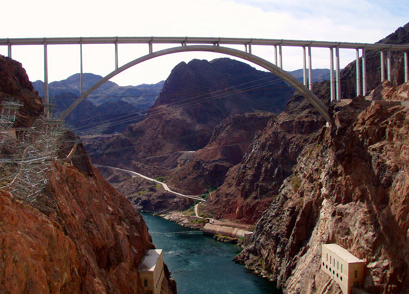
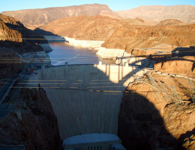
You're welcome! I'm no photographer, however, so all credit to the Colorado River and its tributaries, for 7 million years of assiduous and artistic carving.

max

I saw that creature too, but assumed it was just the tequila talking.
 
Last edited:
DougPaul

Looking at my Trails Illustrated map, I thought that a long but interesting day-hike in cool weather would be South Kaibab-Tonto-Bright Angel, and it seems that you might have hiked that. I haven't calculated the miles, though.
IIRC, that plus a quick jaunt out to Plateau Pt is 18 miles. There is a spot where one traverses across a slope leading to a drop-off which some might find a bit scary. And two (easy) stream crossings (Burro and Pipe Springs) where one can fall in...

I saw no one else between leaving SK tr and arriving at BA tr--just a trail and a few footprints.

Doug
 
I did that South Kaibab - Tonto - Bright Angel loop just a couple of weeks ago. The total mileage for this loop is 13.5, though you can add 3 more easy miles if you do the out-and-back to Plateau Point. No need to worry about falling into Burro Spring or Pipe Creek...the water flow in both is about 2 inches deep! It can be used for drinking if it's filtered first. Otherwise, the only water on this loop is at Indian Gardens, just above the Tonto-Bright Angel junction. At this time of year there is no water at the 1.5 mile and 3 mile rest housed on Bright Angel. They turn those water taps off due to the cold weather.
 
Amicus -

Not to distract from the theme of this TR but was you able to cross the new Mike O’Callaghan-Pat Tillman Memorial Bridge?

When I was there last year it was still under construction. It seemed like there would be some fantastic views while crossing it.
 
Not to distract from the theme of this TR but were you able to cross the new Mike O’Callaghan-Pat Tillman Memorial Bridge?

The Bridge opened just a couple of weeks before our trip, and is very impressive to look at, from the Dam:

1087218927_ur79i-L-1.jpg


and to look from, when you cruise its sidewalk, which is on the north side, overlooking the Dam:

1087219166_Q4ajm-L-1.jpg


When they opened it, they closed off the old road, a mile or so past the Dam, so that route is now a dead-end, used only by tourists visiting the Dam and people who work there. To reach the walkway that leads to the Bridge's sidewalk, you take the road to the Dam, turning off at the first parking lot, which is on the right.

A few more pictures of or from Bridge or Dam are here.
 
Last edited:
No need to worry about falling into Burro Spring or Pipe Creek...the water flow in both is about 2 inches deep!
Well, if you insist on full disclosure... :)

I stepped on a pebble which rolled out from under my boot while crossing Burro Spring and landed on my hip and camera... The water was 1-2 inches deep and the mud dried within 10 minutes.

Just a silly fall. (I haven't fallen in the mud in nice wet NE--I waited for the nice dry desert to try that maneuver.)

IIRC, there were no vicious pebbles waiting for me at the crossing of Pipe Creek.


A very nice loop--I recommend it. The only caveat is a short section after crossing Pipe Creek where one traverses a slope leading to a drop-off--an easy walk but not a spot where I would like to slip.

Doug
 
A very nice loop--I recommend it. The only caveat is a short section after crossing Pipe Creek where one traverses a slope leading to a drop-off--an easy walk but not a spot where I would like to slip.

Doug

Glad you brought that up too! There are a number of places in the canyon where you find this sort of situation. It took me a few hikes before I got over that feeling of "holy cow, I wouldn't want to lose my footing in this spot!" Parts of the Boucher trail are like this, and there is a long stretch of the Escalante Route that entail walking sidehill for the better part of a mile on a track that is no wider than a couple of boot widths!

I did have to chuckle at your unfortunate fall in the creek though. :D
 
Glad you brought that up too! There are a number of places in the canyon where you find this sort of situation.
Agreed. There are lots of trails/places where a slip or fall could be fatal. Harvey Butchart* (perhaps the greatest non-native explorer of the canyon) was a master at such terrain despite the fact that he was utterly incompetent at technical climbing.

I've also done a bit of the Nakoweap Tr (from the top). It involves a long sidehill traverse over a big drop. Not being used to such terrain (and solo), I found it to be very mentally wearing even though I turned back before the [in]famous spot where an overhang forces you out of balance...

* Note to any of you Canyon junkies: search out the writings of Butchart on the Canyon. You won't be sorry...

I did have to chuckle at your unfortunate fall in the creek though. :D
I thought it was funny too, once I determined that the camera was ok.

Doug
 
Amicus,

We may have crossed paths on BAT on Nov 9th. I was coming out of the canyon that morning after spending the last 6 days backpacking from Hermit's Rest (trailhead at the tail end of the West Rim drive).

We had wonderful weather (except late Nov 8th, at Indian Garden, and a chilly Nov 9th morning). A dusting of snow on the South Rim.

The canyon is a favorite of mine (even though I've been to Nepal 3 times and a few other places).

There was a sudden 20 degree drop in the temperature on Nov 8th. It was blue skies the entire week before, and 80-85 degrees at the river.

I'll post a short summary of my 3 week trip on VFTT (Sequoia, Yosemite, Death Valley, Grand Canyon), but for those who might be curious and like photos of the Southwest, check the most recent 11 photo albums on my Picasa web site:

http://picasaweb.google.com/RandonneesetAlpinismeGBLL

Sorry, the captions are in French. Only remaining photos left to upload are days 5 and 6 in the Canyon (Nov 8th and Nov 9th).

Audrey:

Thanks for the links to trails around Lake Mead.

Boucher and Tanner trail backpacks are next on our list in the Canyon.
 
Brew:

Le monde est petit (mais le canyon est grand)!

I much enjoyed your photos and GPS tracks of a terrific trek - so many views from the bottom! We checked out the Hermit's Rest trailhead Wednesday morning - I had hoped we could squeeze in a day-hike from there described in the Best Easy Day-Hikes volume, but we ran out of time.

As to meeting you Tuesday on the Bright Angel Trail, I started down around 8 am, lingered at Plateau Point until 11 am and was back at the BAT trailhead at 1:45 pm. I did pass quite a few back-packers, both climbing and descending, and your group might have been among them. I might also have missed you on my detour of over an hour on the Plateau Point Trail.
 
Boucher and Tanner trail backpacks are next on our list in the Canyon.

If you can cajole (or hire) someone to give you a ride out Pasture Wash Road, consider doing the South Bass trail, and multi-day hiking across the western part of the Tonto and coming out Boucher. That's on my "to do" list, as is the Tanner / Escalante Route and coming out either New Hance, or (better choice) via Grandview, or even perhaps South Kaibab!
 
Last edited:
Top