Waterfall Wanderings - Davis Brook and Beyond....

vftt.org

Help Support vftt.org:

This site may earn a commission from merchant affiliate links, including eBay, Amazon, and others.

NeoAkela

Active member
Joined
Jun 17, 2008
Messages
551
Reaction score
177
Location
Bethlehem, N.H.
Waterfall103.jpg


(What lies far upstream on Davis Brook in Crawford Notch? Keep reading below to find out….)​


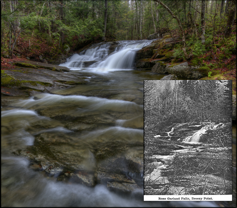
It may be of little interest to most folks, but I've always been intrigued by the quantity of White Mountain features that appear in old guide books, old maps, and old publications... some dating back into the 1800s. Features that, for some reason, are no longer mentioned in today’s guides, no longer marked on modern maps.

Have we become so jaded over the years so that we no longer marvel at the cascade that used to attract tourists and locals alike? When a trail becomes overgrown and fades into disuse, is there no one to jump in and save it before it fades into obscurity? Though, perhaps these features were of little significance, and only overly-romanticized by the simpler folks of those days. By today's standards, perhaps, they do not measure up.

Whatever the reason, each year I find a newborn passion to seek out a few of these "forgotten" places and let people decide for themselves. Often, results are somewhat disappointing, and I understand why such a place has faded quietly into the past. But sometimes, I find a pleasant surprise.

* * *​

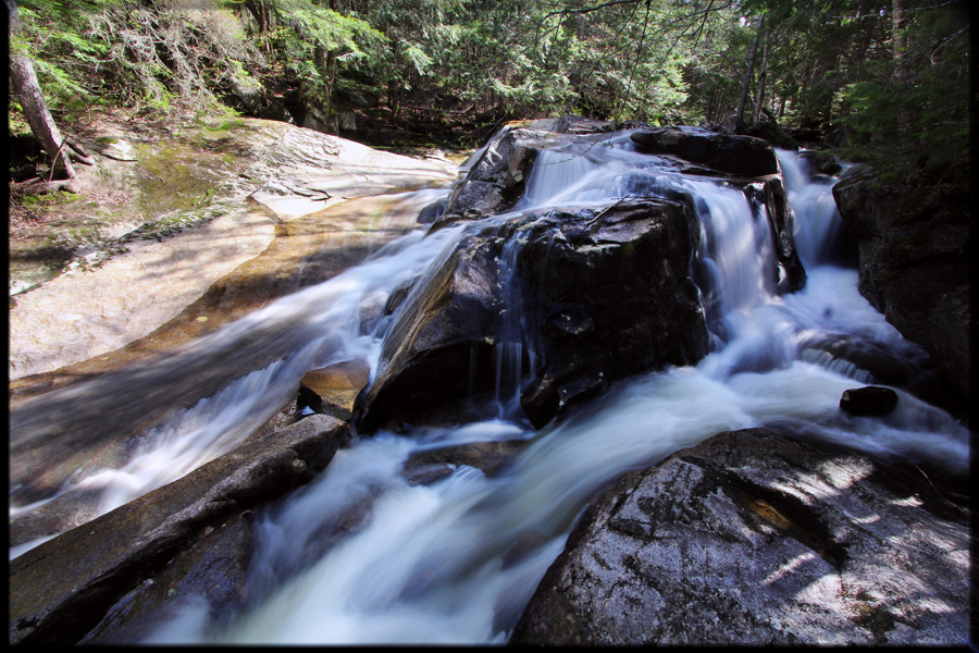
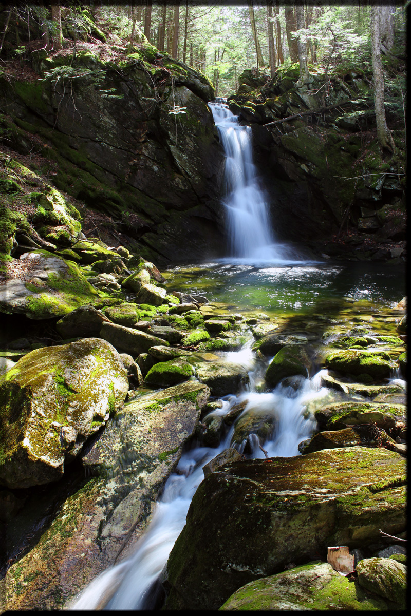
So…. first on my long list of places to visit in 2012 was long-forgotten Jackman Falls. This series of cascades on Jackman Brook in North Woodstock is mentioned in Ida and Walter James' excellent "Our Mountain Trips". They describe a marked trail heading into the woods near Aggasiz Basin back in 1905.

This turned out to be a rather pleasant trip. I had a friend help me spot a car at the junction of rte 112 and 116, then drop me off at the trailhead for the abandoned Mount Cilley trail. A short bushwhack took me down to Jackman brook, which I followed downstream. Within a short while, the brook dropped significantly over the next half mile, passing by many interesting drops and cascades. This series of falls was not overly beautiful – more boulders than carved ledges - but it still had a wonderful charm and is well worth a visit. Alongside the brook are many huge glacial erratics which also have much to offer the off-trail wanderer.

Waterfall601.jpg

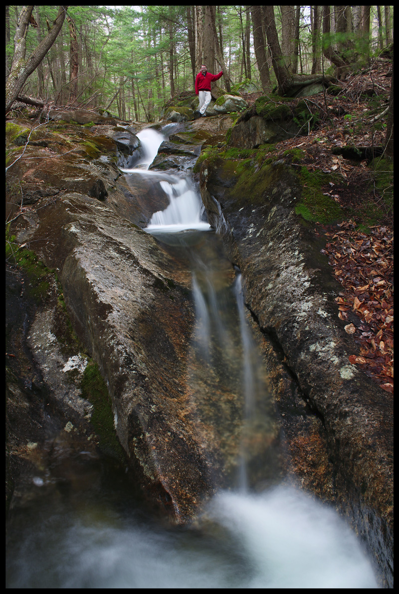
(An interesting ledge which created a three-sided waterfall)

Waterfall602.jpg

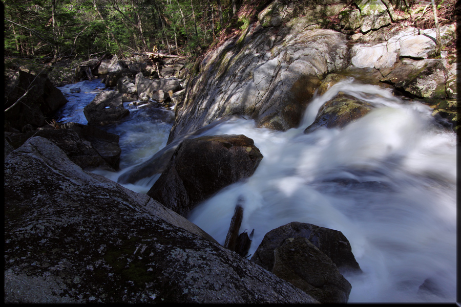
(Looking down from the top of another big drop)

Waterfall603.jpg

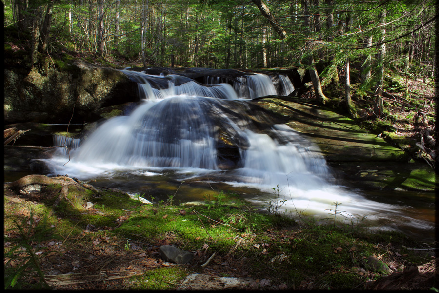
(Another nice fall further down the brook).


* * *​

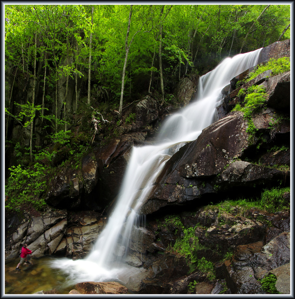
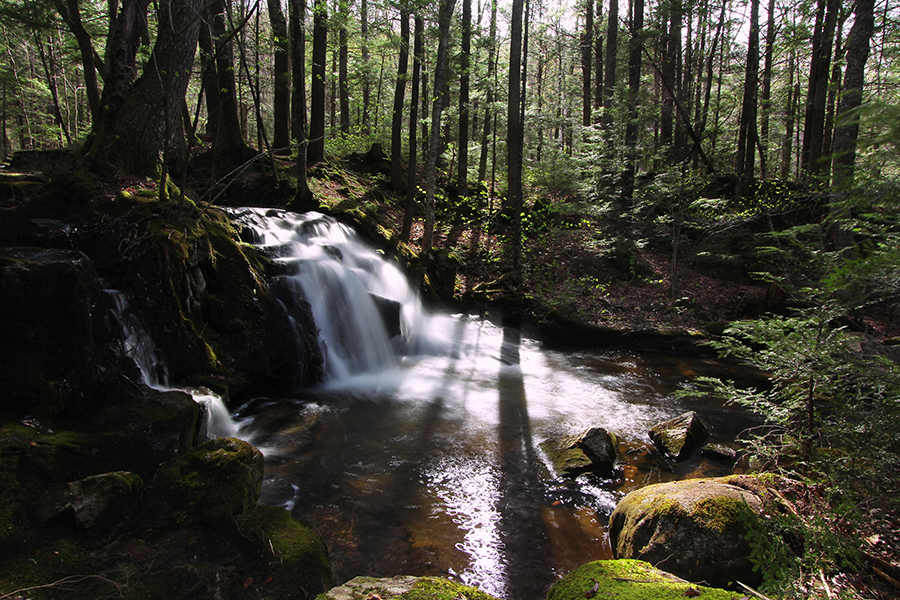
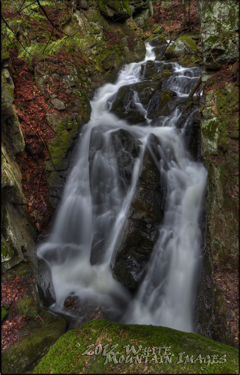
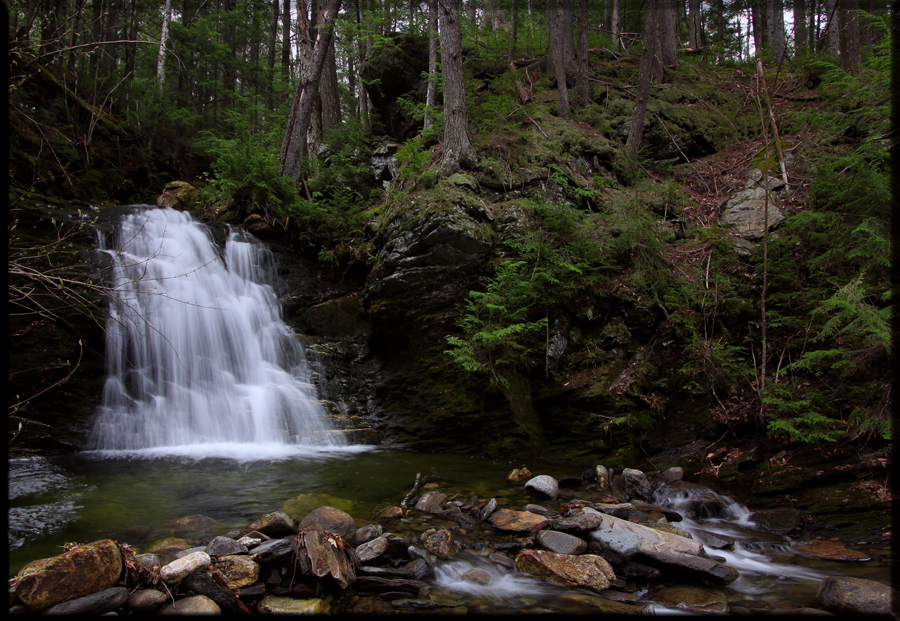
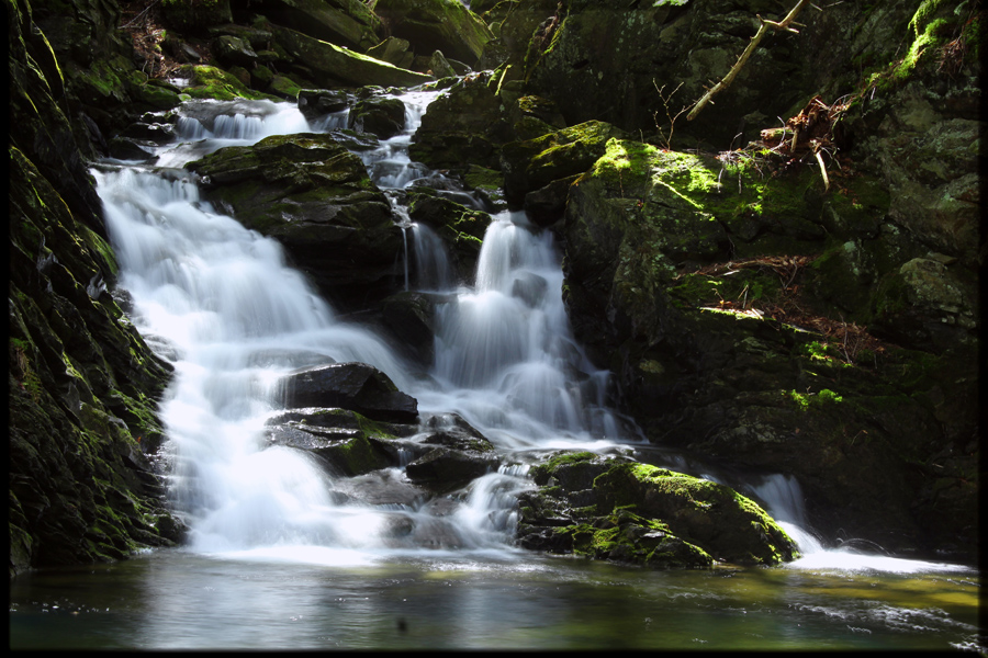
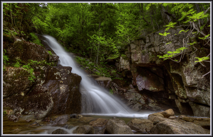
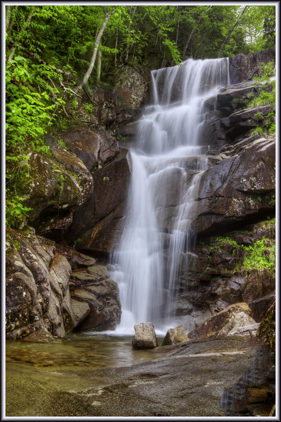
Next, a few trips to some “local” spots that I had read or heard about over the years. First up was “Moose Falls”, located just outside North Woodstock. Small, yet very pretty:

Waterfall701.jpg


* * *​

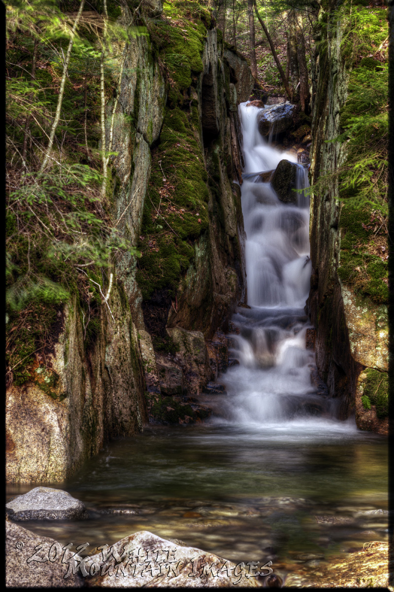
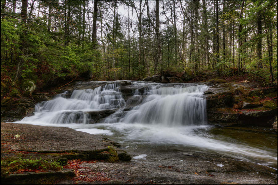
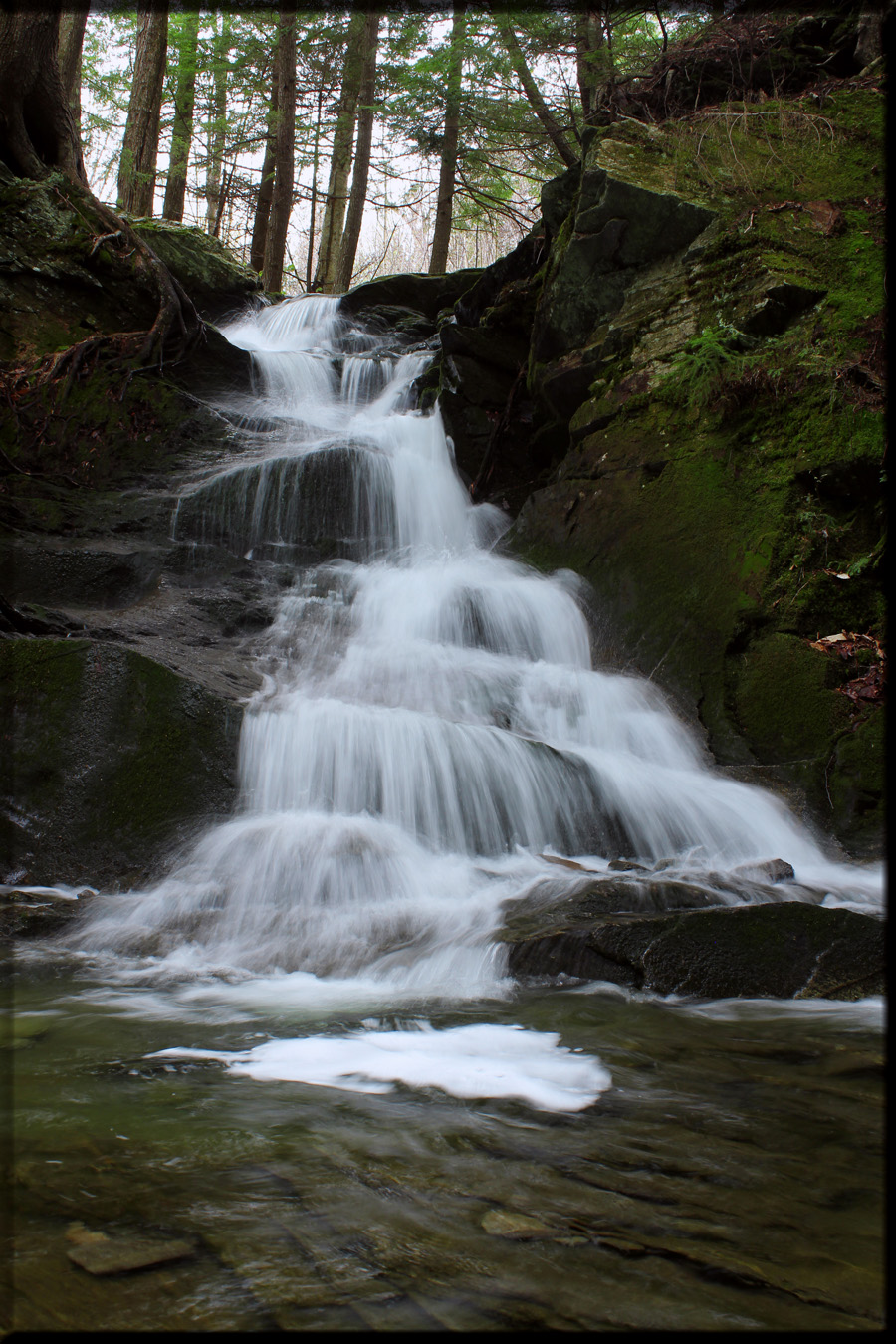
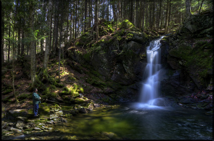
Next on my list of local spots was the “Mini Flume”, which was discovered by my father back in the 80’s. A miniature version of its larger cousin in Franconia Notch, the Mini Flume is quite a cool place, with walls about 20 feet high. On previous visits I have found the flume completely dry, while a nice brook and cascade flowed nearby. On this trip, however, I found that Irene had completely re-routed the brook, sending it once again surging through the flume as it once had long ago! Quite amazing!

Waterfall801.jpg


* * *​

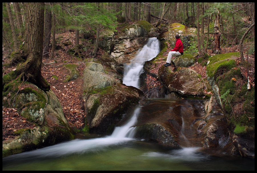
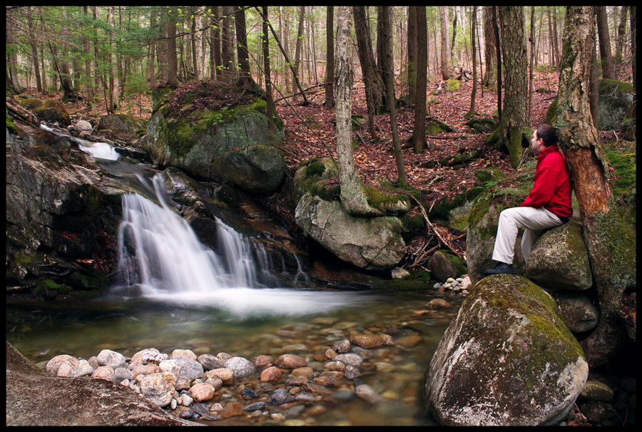
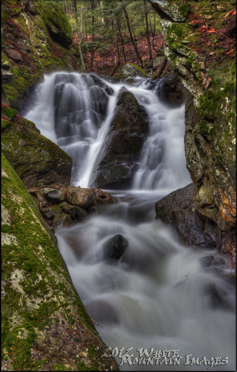
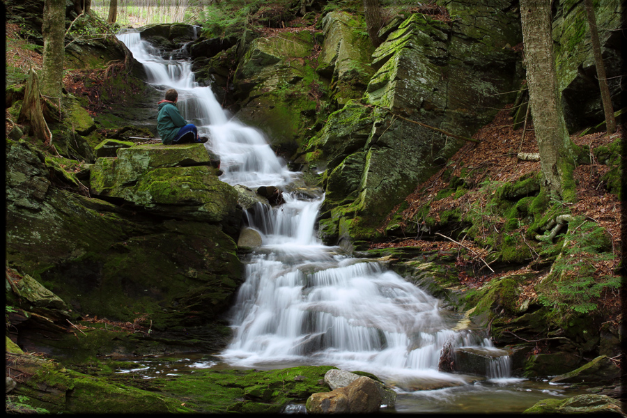
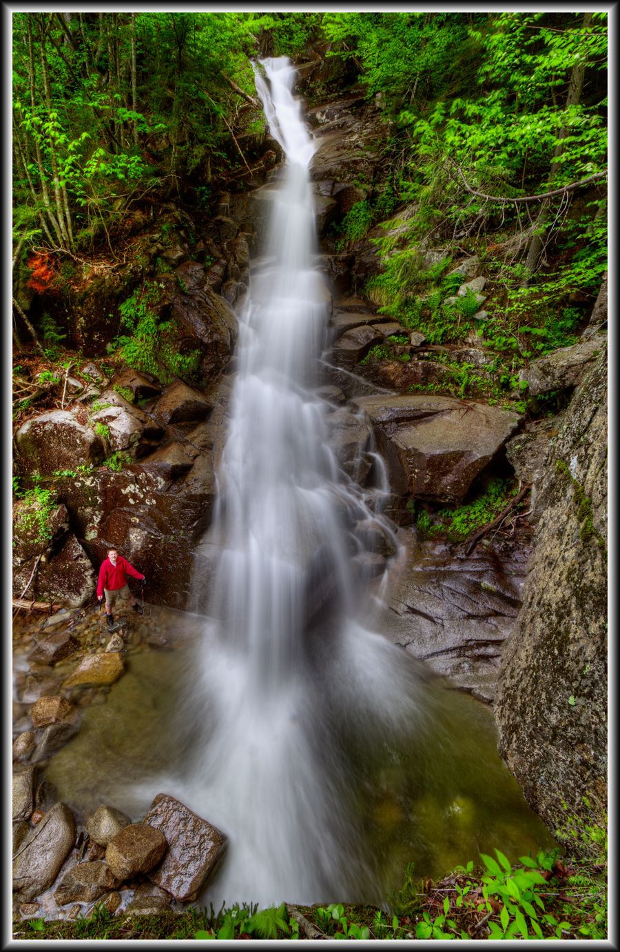
A story told to a friend by a co-worker about wandering in the woods during the early South Mountain construction days back in the 1980’s led us to yet another little-known drop – quite a nice little spot deep in the forests of Lincoln:

Waterfall401.jpg


Waterfall402.jpg


Waterfall403.jpg


……..continued
 
Last edited:
A late 1800's map of Lincoln and North Woodstock shows two odd features somewhat outside of town; a Natural Ice Cellar, and "The Cascades". While I did not have much luck finding the Ice Cellar, the cascades were a delightful treat and surprisingly easy to find. While the cascades are on the edge of non-residential private land, I was able to speak with two nearby landowners who assured me it was OK to venture in to photograph the falls. Hopefully they were correct in their assertions.

Waterfall201.jpg


Waterfall202.jpg


* * *​

An old railroad tourist guide from the late 1800s describes a feature near Breezy Point in Warren named "Rose Garland Falls". I was able to find this feature listed on several old AMC maps from the 1920s and 1930s, but not in later years. Searching Sweetser's books and other sources yielded nothing. So, armed with the old map and the tourist photo from the brochure guide, I tramped around the Breezy Point area, eventually locating a rather pretty Rose Garland, hidden deep in the woods. What caused this to be placed in a tourist guide alongside the Old Man of the Mountain and The Flume, only to vanish in later years? What means were there back then to visit such a place, now far off-trail in a spot that seldom sees a human face?

Waterfall301.jpg


Waterfall302.jpg


* * *​

My friend John (1HappyHiker) was led to another series of falls last year which he brought to my attention, located on the side of Mount Moosilauke. This year, I decided to follow the brook further up this rather ledgy ravine to see what else there was to see. Needless to say, there were many, many nameless gems to be found in this cool gorge of fractured rocks, far from any trail:

Waterfall502.jpg


Waterfall503.jpg


Waterfall504.jpg


Waterfall505.jpg


Waterfall506.jpg


Waterfall501.jpg
 
Finally, I wanted to tackle one of the bigger waterfall mysteries of the area: Davis Brook Falls. Davis Book lies on the western wall of Crawford Notch, alongside the brooks which bear Arethusa Falls, Ripley Falls, and Nancy Cascades, some of the largest in the state. It has been long rumored that within the deep gorge of Davis Brook may exist a drop to rival the other three, yet I have never been able to find someone else who has gone to confirm this. Waterfall guides, both printed and on the web, state the rumor, but no confirmation. Web searches reveal nothing. I had to check this out for myself!

It seems hard to believe that in the years of the late 1800s and early 1900s explorers, folks such as the Crawford Family and the many other guides and writers would not have ventured up Davis Brook at one point. Pages upon pages of prose from that era describe the beauty of different waterfalls in the notch - I am certain that there was an acute interest in cascading water during those times, and an urge to explore. These facts made me fairly certain that this trip would bring back little to tell about, as it certainly would have already been told.

Davis Brook takes a considerable effort to approach and enter, as it's lower extremities pass through posted private land, and it's upper section sits inside a steep-walled ravine bordered by thick, scrubby ridges. We had to hike using established trails and WMNF land, so the beginning of our trip consisted of a long slog up and around the private development, following boundary trees, scaling slopes and battling scrub and blowdowns. As we approached the ravine, the ground dropped suddenly and steeply down to the brook. It was a tricky descent as we sent large rocks and tree limbs, as well as ourselves at one point, tumbling below us.

At the brook, the water moved calmly over a rocky bed. There was a little bit of bank on one side or the other, which made us able to walk for a while on the shore. Above us, the sides of the ravine towered overhead, with large hanging boulders and overhanging cliffs at certain points. The further up the brook we went, the steeper the sides became. Broken trees were strewn about in areas, evidence that Irene caused quite a commotion here last year; I certainly would not have wanted to be here during that storm!

Finally, several miles up the brook from it's intersection with the notch, massive ledges appeared ahead of us. We came to stop upon the ledge of an overhanging cliff, looking down on what we would later call Lower Davis Brook Falls. A great sluice of water arced down a big slab of rock before plunging into a pool below us, carving a cave of sorts beneath the cliff. It was quite a sight, and reminded me a bit of Ripley Falls, further up the notch. We took turns posing below the cliff next to the base of the falls.

Waterfall101.jpg

Down at the base, the waterfall was a beautiful spot to sit and have a lunch.

Waterfall102.jpg

Far up above the falls, we could make out a wall of white behind the trees. It took a while to figure out a way up, but we eventually did. Hanging onto trees and pulling ourselves up the boulder-strewn, near-vertical slope, we attained the top of the falls only to find the massive "Upper Falls" before us. It was an awesome sight - a wide plume of water dropping down a near-vertical cliff. While not as tall as Arethusa, it was certainly a worthy foe!

Waterfall104.jpg


Waterfall103.jpg

Separating us from the pool below was a thin ledge and an 8-foot drop onto the top of the sluice which swirled straight down the Lower Falls. We hung onto trees and lowered ourselves carefully down to the pool. Above us, the massive waterfall showed no means of allowing us to go further; the walls of the ravine closed in around the cliff face, creating an amphitheater of sorts. While climbing along the sides may have been possible, the overhanging boulders and loose moss made that choice seem somewhat unnerving to consider!

We had quite a celebration for our discovery, and all too soon it was time to go. We retraced our steps back out of the ravine.

Why has such a beautiful spot not been recorded in guides, history, or literature of any sort? Perhaps it is because such a feature only appeals to a very few, and as such is not important enough to warrant any further question. Perhaps it has been visited many a time, yet those visits have gone unrecorded or lost over time.

Whatever the reason, I feel a significant excitement to confirm a long-standing rumor that I first read about in the Bolnick's fine Waterfall book over a decade ago. There are indeed some beautiful spots still hidden in the woods. Davis Brook Falls is one of the better ones.

-Neo
 
Last edited:
Mariah Gorge

Nice trip report. Have you ever explored Mariah Gorge just off the Wild River? It is another of those beautiful, unspoiled places to explore. At the top of the gorge where the old logging RR once crossed is the location of a massive steam engine explosion during the logging days. About the only thing left are the iron rods driven into the rocks where the trestle once was. I believe I have read that parts of the locomotive can still be found in the woods. Many sections of the gorge are accessable only by rope from above. Places in the gorge are deep, dark, and very spooky if exploring alone.
 
Excellent travelogue. The artistry of the pictures and prose put me right there. Aside from a few egregious "it's" errors, the writing is first rate. Nice that you lugged a tripod for those superb silky water slow shutter speed shots. How rewarding to find those long-forgotten waterfalls after such arduous bushwhacking!
 
Inspiring and beautiful! Pat and I, when pursuing the New England 100 and later 3K's (never finished), would always try to make a stream ascent or descent. Some were spectacular, others quite modest, but they always beat the alternative of slogging through featureless woods.

One of the first was Peak Above the Nubble: a hot day and a tedious ascent through logging clearings and balsams thickets, but we happily splashed our way down Haystack Brook on the way back.
 
Excellent TR!

Chris .... Excellent TR! You raised the bar pretty high with that one. I advise you quit your day job. The regular rain we've been getting has been good for waterfall hikes. You must be in your prime. It's all about timing when you go waterfall hunting. Even the greatest waterfalls can look pretty disapointing if you visit them in midst of a dry spell.

As for why Davis Brook has been forgotten, your narrative provides the answer. I would guess it has something to do with fact that most logical public acess is blocked by private land as indicated by the circuitous route you had to take to get there. Neighboring falls in are have well established trails, signage, parking etc. What makes this falls special is that it appears to provide what the other more popular falls would look like before they were discovered i.e. a magical rich lush mossy environment untrampled and eroded by heavy tourist traffic. The steep terrain of these waterfalls presents probably the hardest trail maintenance challange in the entire region. Perhaps it should remain not quite forgotten.
 
Last edited:
Top