
Kevin Judy and Emma
Well-known member
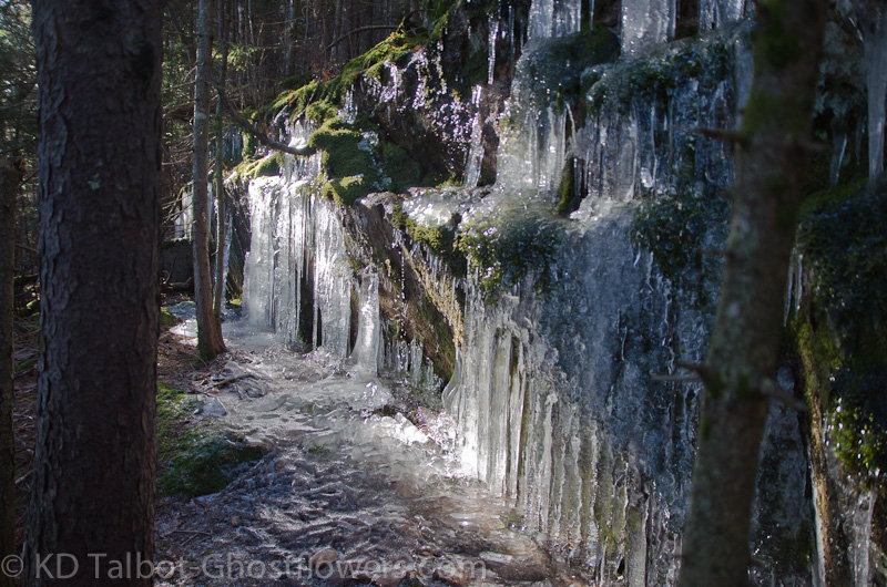
Ice Along Wonalancet Range Trail
Wonalancet 2760' /Hibbard 3140' /Square Ledge 2550'
Wonalancet Range Trail/Walden Trail/Square Ledge Trail/Old Mast Road
9.1 Miles 2900' Elevation gain
Kevin, Judy, Linda, David and Blue
Got a chance to get out with friends again. It promised to be a cold day in the mountains, and it was, but not all that bad considering. There were ice-flows along the trail, but all of the hike was under 3000' so there was little snow where we ventured, but when we caught glimpses of the higher elevations surrounding us they appeared to be firmly ensconced in winter. The parking area at Ferncroft was full when we got there, but we saw very few hikers along our chosen route. Blue had spent the night with us and did his usual happy romp when he realized Linda and David had pulled into the parking lot as well. As others gathered for hikes to the more popular summits of Passaconaway and Whiteface, we shouldered our gear and headed north along the Old Mast Road, quickly coming to the junction and turning west on the Wonalancet Range Trail.
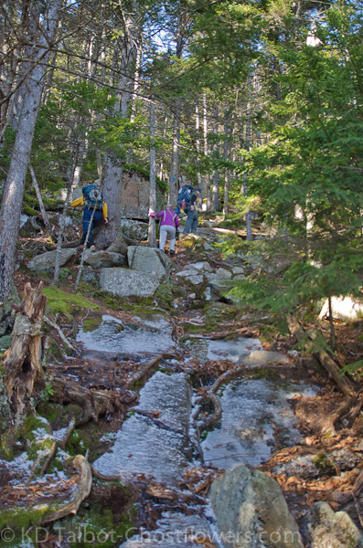
Some Icy Sections
Judy and I had been with Emma up and down this trail before, a long time ago in winter, our first snowshoe hike in the mountains. We had chosen this short loop over Wonalancet for its low altitude, length and proximity to our home on a less than stellar January day in 2003. Today we would lengthen the route considerably by visiting Mount Hibbard and Square Ledge to knock off a few of the 52 With A View summits left on our list, the others agreed to join us. The air was crisp and despite blue sky overhead we could see random, lonely snowflakes riding the gusting breezes. We started up through the open hardwoods and as we rose to steeper terrain we began to encounter ice-flows on many rocks along the trail. There had been a good deal of seepage from rain and freeze/melt over the past few days and things were now frozen up nicely.
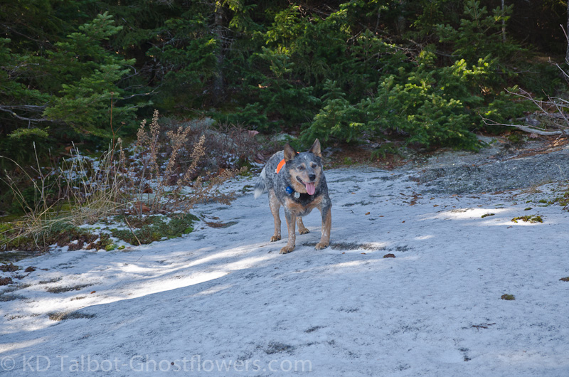
Blue Finds Some Snow to Roll In
Although prepared with microspikes we never donned them, each time facing an obstacle of ice covered trail we found a way to sneak around or over. Most notably descending eastward from Mount Hibbard on the Walden Trail which required a short 'whack to avoid an icy scramble. After the difficult descent along the Walden Trail we momentarily discussed whether to continue our course to Square Ledge as well, not knowing the trail and what else we might encounter, but we quickly decided to forge on. After the previous trail the Square Ledge Trail was a breeze and we soon saw the huge mass of Square Ledge looming before us. Although it appeared from our standpoint below that it would be a tough scramble it proved less taxing than anticipated. At the outlook I did my usual step to the edge to get an idea of the drop and as I quickly stepped backwards and away I tried desperately to swallow my heart. Unlike others I have been to, this one spooked me. A good 200' drop with maybe a bounce or two. We got our views and quickly slipped back down the scramble to level ground below the cliff. A really awesome spot!
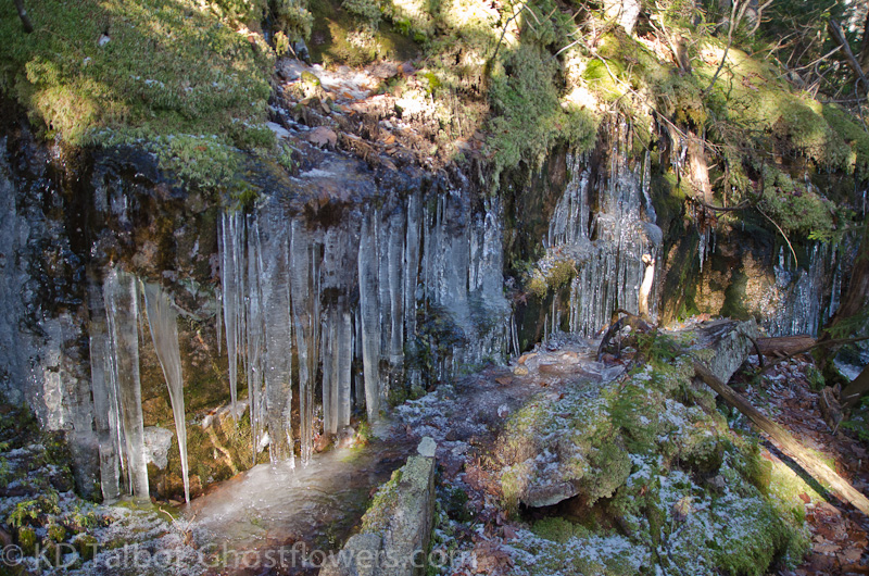
More Ice
Our trip back out went smoothly, though Blue had lost his blaze coat bounding off trail on one of his many forays into the woods earlier in the day. We soon had covered the mile and a half back to the junction with the Walden and Old Mast trails. As promised to me by a knowledgable fellow, the Old Mast Road was a dream to descend after a long day of cold ups and downs, literally, just a walk out of the woods. Five left on our 52WAV list, not that we're hiking for lists…
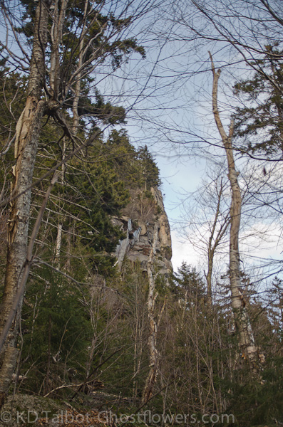
View Up to Square Ledge
Full set of pice HERE:
KDT
")