1HappyHiker
Well-known member
My friend Steve & I decided to make an adventure out of exploring some trailless regions of the Crescent Range. By so doing, we were rewarded with an outstanding and unique view of the entire Carter-Moriah Range, along with some other unique views.
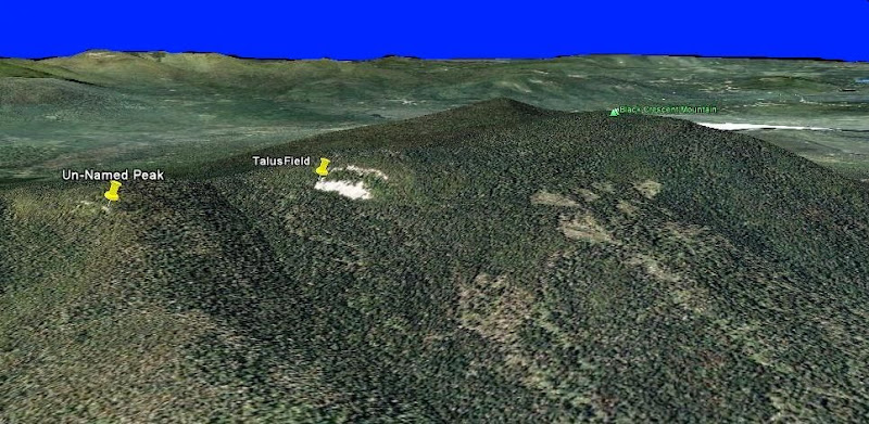
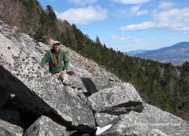
We took the Cook Path for 2.5 miles to the Hunters Pass area (top of the Ice Gulch), and then bushwhacked less than a mile to a SW spur of Black Crescent Mountain where there’s a massive talus field situated beneath an impressive set of cliffs. Our objective for this particular day was to just visit the talus field. The cliffs above this “rock-pile” will be left for some future adventure!")
The bushwhack took us through mainly open hardwoods. There was a lot of birch, and the tops of hobble bush could be seen poking up through the deep snow. With this combination of forest vegetation, it was no surprise that there was a lot of moose sign in this area.
Steve did some excellent research and discovered that the large talus field was visited by early explorers in the late 1800s and that it was then known as “Crescent Scar”. Also, on the 1896 USGS Mt. Washington quad, the talus field is labeled as "The Scar."
During our bushwhack, we checked out a couple of other areas of interest along the way. We visited a set of cliffs on an un-named 2,900 foot peak just a bit south of the talus field. Here we got some pretty darn good views a well, but the views from the talus field trumped these views. Also, to get some views toward the Pilot & Pliny Range, another short whack was done to an open spot on a ridgeline just a short distance west of the Cook Path (between Hunters Pass & Mt. Crescent).
Below is a GoogleEarth image of the area we visited, plus a small sampling of the views from our trek.
GoogleEarth image of the area of the hike
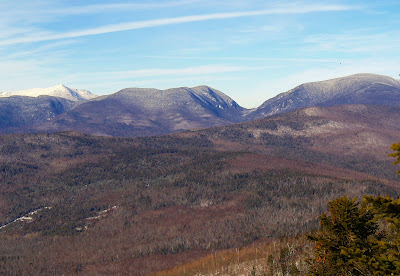
Unique juxtaposition of northern Prezies and Carter Notch
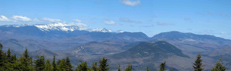
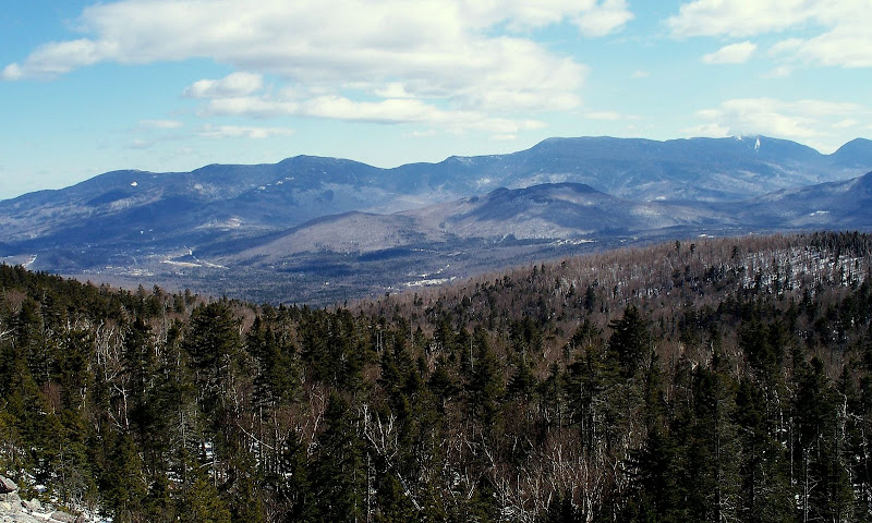
View of entire Carter-Moriah Range (from Shelburne-Moriah on left to Carter Notch on right)
View across the massive talus-field “rock-pile”
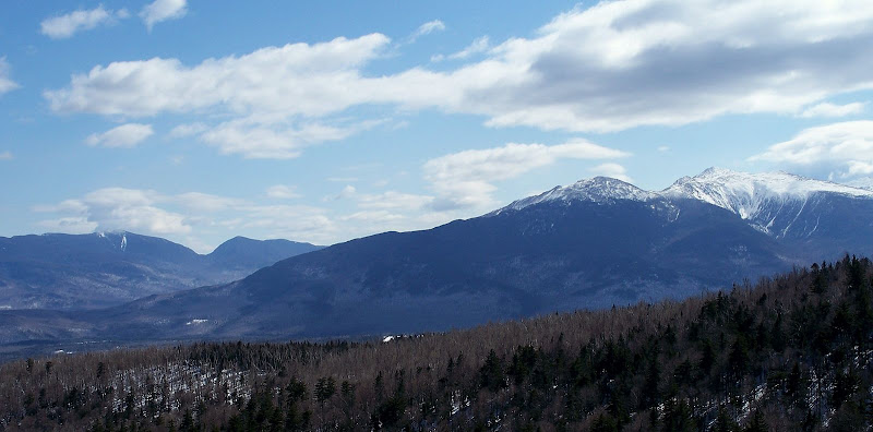
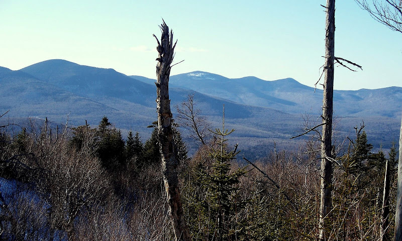
View toward Mt. Cabot, The Bulge, and The Horn (center of photo between 2 trees)
1HappyHiker
We took the Cook Path for 2.5 miles to the Hunters Pass area (top of the Ice Gulch), and then bushwhacked less than a mile to a SW spur of Black Crescent Mountain where there’s a massive talus field situated beneath an impressive set of cliffs. Our objective for this particular day was to just visit the talus field. The cliffs above this “rock-pile” will be left for some future adventure!
The bushwhack took us through mainly open hardwoods. There was a lot of birch, and the tops of hobble bush could be seen poking up through the deep snow. With this combination of forest vegetation, it was no surprise that there was a lot of moose sign in this area.
Steve did some excellent research and discovered that the large talus field was visited by early explorers in the late 1800s and that it was then known as “Crescent Scar”. Also, on the 1896 USGS Mt. Washington quad, the talus field is labeled as "The Scar."
During our bushwhack, we checked out a couple of other areas of interest along the way. We visited a set of cliffs on an un-named 2,900 foot peak just a bit south of the talus field. Here we got some pretty darn good views a well, but the views from the talus field trumped these views. Also, to get some views toward the Pilot & Pliny Range, another short whack was done to an open spot on a ridgeline just a short distance west of the Cook Path (between Hunters Pass & Mt. Crescent).
Below is a GoogleEarth image of the area we visited, plus a small sampling of the views from our trek.
GoogleEarth image of the area of the hike
Unique juxtaposition of northern Prezies and Carter Notch
View of entire Carter-Moriah Range (from Shelburne-Moriah on left to Carter Notch on right)
View across the massive talus-field “rock-pile”
View toward Mt. Cabot, The Bulge, and The Horn (center of photo between 2 trees)
1HappyHiker