
Kevin Judy and Emma
Well-known member
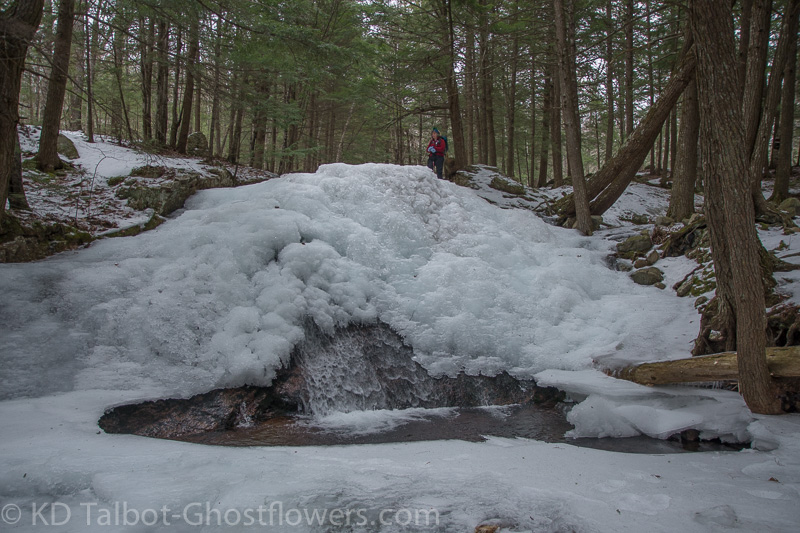
Frozen Field Brook
Black Snout 2803' and Mount Shaw 2990'
7.6 Miles 2300' Elevation gain
Mount Shaw Trail/Black Snout Trail
Kevin, Judy and Mark
(Sorry for the late post) Various complaints have kept us out of the mountains for most of the winter, but it was high time we got out and did something. With friend Mark visiting there was no more excuses, so we headed out to the Ossipees to tackle one he hadn’t been to. I started out with the increasingly nagging trepidations of what I have named my “bastard hip” and the worry it brings me that I will suffer through the hike, or worse, have to turn back.
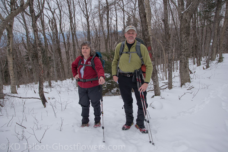
Judy and Mark
I have to get myself over the mental worry, as the fears have not yet panned out, and I was thankful to get through this hike with only a few “tweaks” and little of the pain I had anticipated. Obviously what I need to do is hike more, but it is hard to explain that to yourself when you are being driven from your bed each morning by intolerable pain. I have told myself over and over to just suck it up and be thankful because I know in my heart that there are millions a lot worse off than I am, but getting my head to realize this is a struggle.
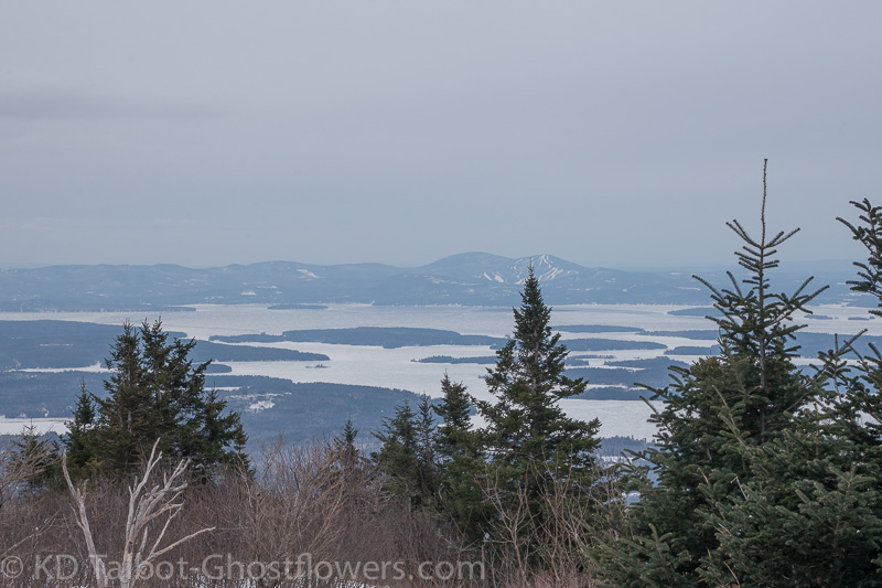
Across Winnepesaukee to Gunstock
Alright, enough of that! We started out in a few inches of snow which sometimes hid the treacherous ice beneath it. Micro-spikes were all we needed to survive the day, but there were some deep drifts on the eastern side of Black Snout, not enough to have carried the snowshoes all day, though. I’m guessing that conditions are changing rapidly today as I write this and the snow is coming down!
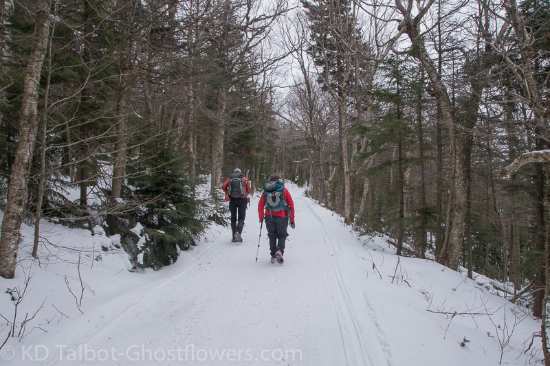
Along the Carriage Road
The ice bridges at the crossings of Field's Brook held up, but it was notable that most of the brook was wide open. The conditions seemed much more like what we would encounter in late March as opposed to early February, with little snow, an open brook, and temps holding right around thirty. Except for the lack of sun and overcast gray skies during the hike I would say we had pretty much ideal conditions!
The hike went smoothly and without much effort we found ourselves at the base of what I call “The Steeps”, about 3-4/10ths of a mile from the brook up to the junction with the first Carriage Road. With a bit more effort we were soon up to the junction and could now enjoy the relative ease of hiking along the gentle grades. As I mentioned before, when we reached the turn off for Black Snout we encountered some deep drifts and occasionally post-holed up to and over our knees, following the example of Mr. Moose and Ms. Coyote who had post-holed the trail before us.
Upon reaching the open summit we bundled up and had a brief lunch while taking in the expansive views to the west of Lake Winnepesaukee and beyond to the Belknaps. To our northwest and well below us the red roof of Castle in the Clouds appeared to be no more than the roof of a tiny farmhouse off in the distance. Rather than fight the snowdrifts again, we made the short bushwhack back down to the Carriage Road, a short distance from the junction, and we were soon on our way towards Mount Shaw.
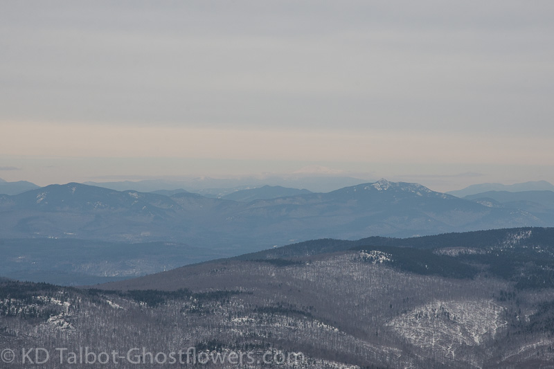
Views to the North: Chocorua and a Ghostly Washington on the Horizon
In a few tenths we came to the snow-fence which blocks snowmobiles from using the Carriage Road we were on, but stepping around the fence we were now on the groomed snowmobile trail which led us the rest of the way to the summit of Mount Shaw. I have always loved the view looking north from the summit of Mount Shaw and although this was not the best viewing conditions we could still make out each of the mountains from Mount Moosilauke to our northwest all the way to Pleasant Mountain to our northeast, and north to Mount Washington, the Wildcats, Carter Notch and Carter Dome.
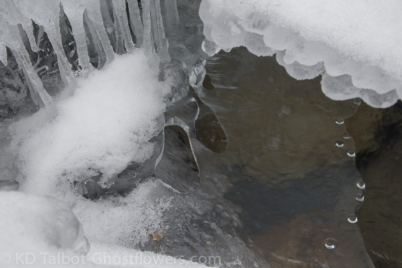
Ice on Field's Brook
We drank in the views for some time before once again donning our packs to make the trip back down. I popped some vitamin I in hopes of thwarting the bit of nagging pain in my hip from increasing and it worked well. I led as we descended “The Steeps” and was surprised to find the pain I had been dreading never materialized. The descent and trudge back out of the woods went well, and we were all satisfied we had had a good hike. Despite having had plenty to eat, I was starving... how unusual…
Complete set of pics here:
KDT