Border Slash Article

vftt.org

Help Support vftt.org:

This site may earn a commission from merchant affiliate links, including eBay, Amazon, and others.

TEO

Well-known member
Joined
Jun 23, 2005
Messages
1,043
Reaction score
110
Location
New England
Here's an article that might be of interest to those of us who hike the Northern Frontier:

http://www.7dvt.com/2013why-there-slash-trees-u-s-canada-border

The part about the "substantial fine" may or may not strike fear in the heart of peakbaggers. As for me, I've always thought that Pres. Clinton initially thought that this is what "Don't ask, don't tell" applied to when he signed that law.

--Matt K.
 
“We’re not law enforcement — our job is just making sure people know where it’s at.”

The substantial fine part is pure conjecture on his part. Check with US CBP as to the consequences.
 
The substantial fine part is pure conjecture on his part. Check with US CBP as to the consequences.
He said there could be a substantial fine, which is the law. I talked to a BP agent last summer who said you could walk on the line as long as you didn't go across, others have said they don't care if you dodge cliffs as long as you don't go far into the other country.

Note that the cruise boat in the article apparently crosses the border, I doubt that the passengers show passports or pay large fines.
 
Unless my memory is going, it's a lot more than 20' wide.
 
I would agree that the border swath is 40' in the few spots I have encountered it. I expect the Canadian Moose hunters probably help out the US by trimming it back on the US side to improve their killing ground ;)
 
I would agree that the border swath is 40' in the few spots I have encountered it. I expect the Canadian Moose hunters probably help out the US by trimming it back on the US side to improve their killing ground ;)

With very, very long trimmers so they don't cross the line.
 
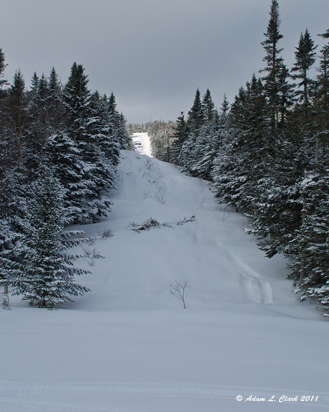
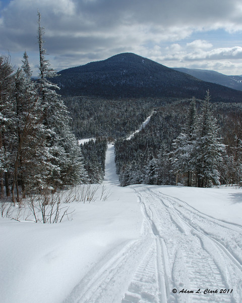
Approximately 40 feet wide would be pretty accurate where it runs along the northern border of NH. We snowmobile up on it in a few places most winters. There are some fun steep hills and feet of powder to ride in. Never seen anyone up there in winter checking things from either country, just a couple other snowmobilers.

Looking up (East) the "border swath" (as we call it) from Boundary Pond in Pittsburg (Note: The 5-6 foot tall stone post that says Canada/United States is completely under the snow here)
Snowmobiling8282-L.jpg


Looking back down from the top of the same hill. The small black dot at the right hand turn in the swath is my uncle and grandfather on snowmobiles
Snowmobiling8289-L.jpg
 
Do they watch it? Sure do. The lady who shuttled me from a B&B in North Jay to start my SOBO E to E told me about the day she picked up some LT finishers at the trailhead to Journey's End. On the way back to N Jay they noticed a helicopter that seemed to be following them. Sure enough it was. Somewhere near N Jay it landed at a road junction and the agents stopped her to see what she was up to. Once she told them she was shuttling hikers they took back off after checking IDs.
 
There was a posting on VFTT last winter about some folks bagging peaks around Boundary and WhiteCap last winter. They got quizzed twice in the course of a couple of days. There is a lot of border patrol activity in the area and I wouldn't be surprised if there wasn't some covert surveillance gear. Canadians get busted in the winter smuggling liquor over the line via snowmachines.
 
When I went up the border to head south on the Long Trail this summer, the clearcut seemed quite overgrown, while up at Boundary Peak (admittedly in winter) it felt just like a road.

I've never heard of anyone actually backpacking the clearcut. I suspect this is because there just isn't a trail that is capable of being followed, but maybe people do it and I just haven't learned of them doing so.

Brian
 
... Canadians get busted in the winter smuggling liquor over the line via snowmachines.
Smuggling? I'm totally shocked! Perhaps its was just their ration for an evening in that hotbed of nightlife known as Stetsontown ... at least to moose, wolf-coyote hybrids and great horned owls. Besides, who drinks Canadian whiskey?

A couple years ago I was surprised at the condition of Wiggle Brook Road leading to the border. Prior to 9-11 it was wide open, you could drive right up to the "gate". Now, the last mile or so is a bushwhack. The gate and rusty stop sign are still there with a few more bullet holes. Even the beavers pitched in to make access more interesting by damming the drainage ditches on the side of the old road. They must be working for INS.

When we hiked Boundary via the border swath we took a shortcut back via a logging road to Arnold Bog where another road led to Wiggle brook Road. Hiking the swath, or at least sections of it, would be interesting mostly because so much of it is remote and wild. It is not really a path except where hunting, fishing, hiking and snow machines have made it one so it would be good to know the cutting schedule.
 
I've never heard of anyone actually backpacking the clearcut. I suspect this is because there just isn't a trail that is capable of being followed, but maybe people do it and I just haven't learned of them doing so.

Brian

I haven't been on as much of the cut as some other friends, but I know you can snowmobile on it quite a ways at a time, but then all of a sudden to get to a completely vertical rock face and have to turn back. With no real "trail" on it and the fact that it needs to follow the border rather than an easy route, I imagine it would be quite hard to hike along or near it in some places. It could be a very thick or wet (swampy) bushwhack around difficult spots.
 
Top