
Jazzbo
Well-known member
- Joined
- Jan 1, 2005
- Messages
- 1,197
- Reaction score
- 163
Mount Oscar is mere 2760' tall and east side is dominated by highly commercial Bretton Woods Ski slopes. Why bother? Well I'd seen some impressive looking cliffs from East Hale and wanted to check them out in person. I figured the views must be pretty good and the weather we had last weekend could not have been better for a hike with great views. It did indeed turns out the real reason to visit Mount Oscar is to check out the feeling of WIDE open ledges and views of surrounding mountains!
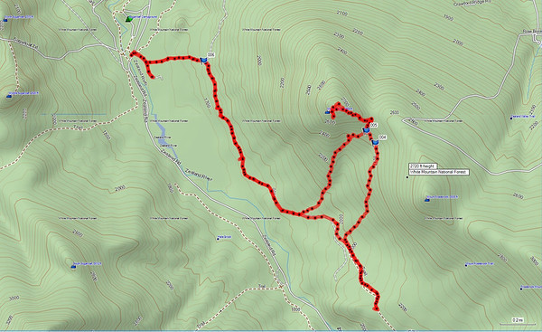
But not by traditional route via the ski trails or resort hiking trails. I did it from Zealand Road TH for the Sugarloafs. See image of my GPS track below. Not the most direct route to summit Mount Oscar, but I did want to go a ways up the logging road to see what I could see. If and when I go back I'll try something more direct. Perhaps a loop involving a ascent from west and descent the way I came down but also taking in base of the cliffs and working more directly west. I found references to the cliffs on various rock climbing web sites. One report talks about climbers trail to the cliffs that I did see some indications of.
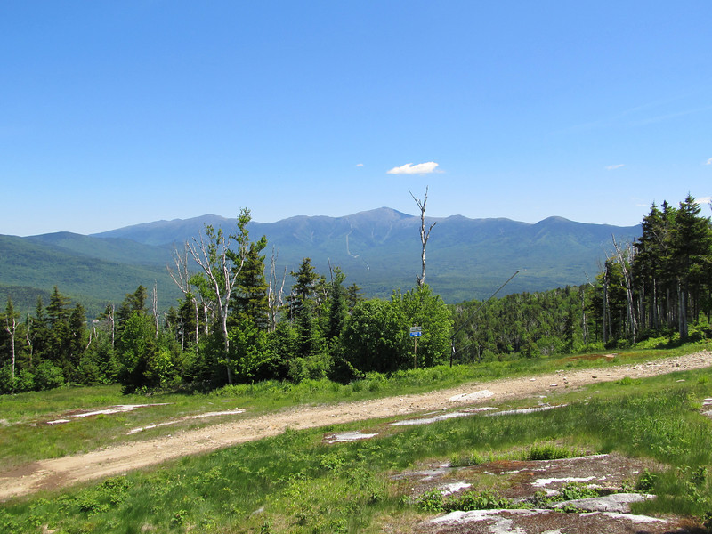
Further up the road I reached this high point where there is large landing area where you get this excellent full front view across the valley of the remarkable talus slopes on East Hale one of my favorite bush whack hikes. I turned back here, but the road keeps on going for quite a ways I think. I think this road is pretty nice. Have to come back here with the mountain bike some time.
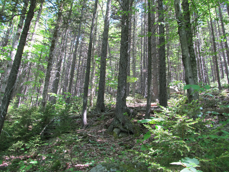
I picked a spot and bearing to get up to col between Oscar and Rosebrook. The whack up to the ridge went quickly. The forest transitioned to a majestic spruce forest about 400' below col. Very stable forest of mature spruce with only scattered blowdowns. Pure pleasure to travel.
I shortly came across a climber's route that took me up to the ridgeline where I picked up the snow shoe trail maintained by Bretton Woods? I was soon at the summit which presents vistas in all directions. Such as Presidential Range.
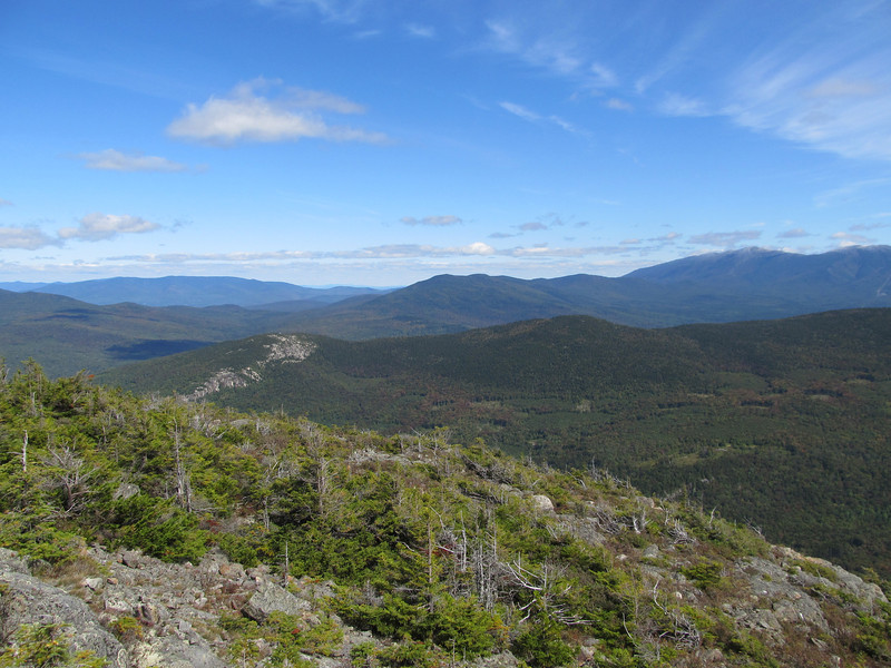
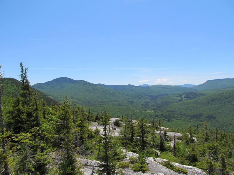
I prefer this side of the summit where there are wide open ledges form which you can see panarama views of Willey Range, Carrigain, Zealand Valley. There is a nice screen of spruce so you can forget you're right next to the ski area. I spent 1/2 hour here eating lunch. Just sample of few snaphots to give an idea.
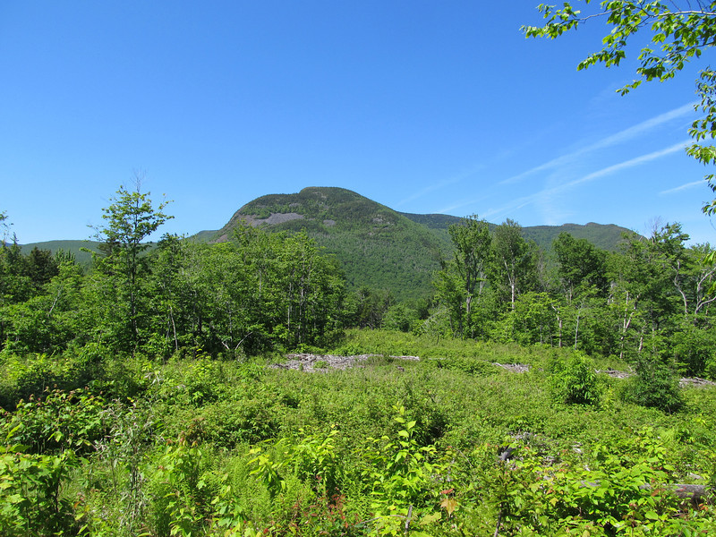
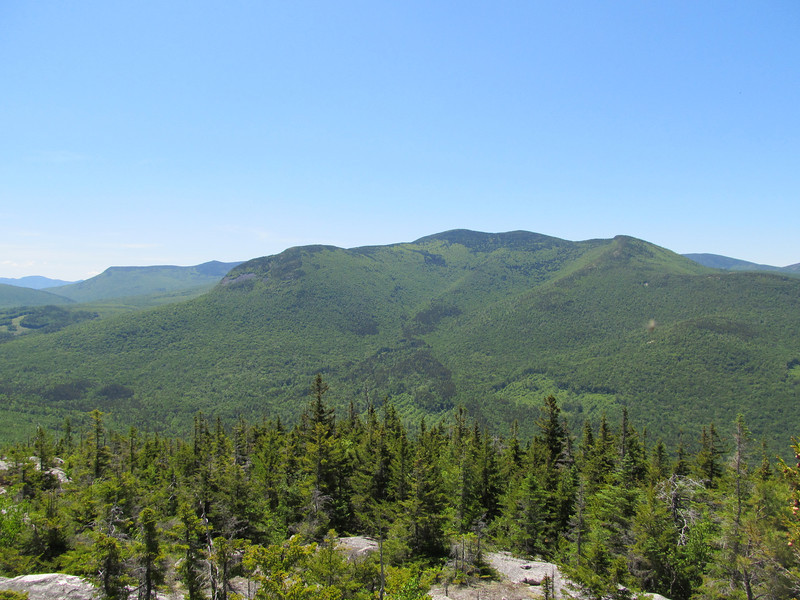
Mount Hale looks pretty good from this point of view.
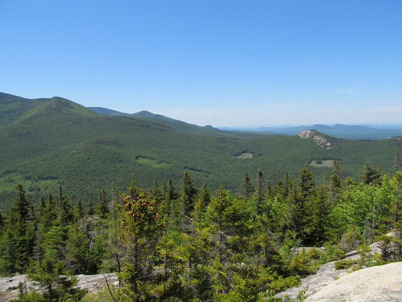
Last snapshot is this view towards Sugarloafs.
That's all folks! Hope you liked it. It's something different anyway.
But not by traditional route via the ski trails or resort hiking trails. I did it from Zealand Road TH for the Sugarloafs. See image of my GPS track below. Not the most direct route to summit Mount Oscar, but I did want to go a ways up the logging road to see what I could see. If and when I go back I'll try something more direct. Perhaps a loop involving a ascent from west and descent the way I came down but also taking in base of the cliffs and working more directly west. I found references to the cliffs on various rock climbing web sites. One report talks about climbers trail to the cliffs that I did see some indications of.
Further up the road I reached this high point where there is large landing area where you get this excellent full front view across the valley of the remarkable talus slopes on East Hale one of my favorite bush whack hikes. I turned back here, but the road keeps on going for quite a ways I think. I think this road is pretty nice. Have to come back here with the mountain bike some time.
I picked a spot and bearing to get up to col between Oscar and Rosebrook. The whack up to the ridge went quickly. The forest transitioned to a majestic spruce forest about 400' below col. Very stable forest of mature spruce with only scattered blowdowns. Pure pleasure to travel.
I shortly came across a climber's route that took me up to the ridgeline where I picked up the snow shoe trail maintained by Bretton Woods? I was soon at the summit which presents vistas in all directions. Such as Presidential Range.
I prefer this side of the summit where there are wide open ledges form which you can see panarama views of Willey Range, Carrigain, Zealand Valley. There is a nice screen of spruce so you can forget you're right next to the ski area. I spent 1/2 hour here eating lunch. Just sample of few snaphots to give an idea.
Mount Hale looks pretty good from this point of view.
Last snapshot is this view towards Sugarloafs.
That's all folks! Hope you liked it. It's something different anyway.
Last edited:
") If you mean the Sugarloafs....yes I parked at TH for Sugarloafs. The logging road starts right there across the road. On some maps a sand pit is indicated, but there is a wild life pond at location of sandpit. The wildlife pond is worth a visit. Early in morning I would bet you might see moose there. It offers nice closeup view of Sugarloaf. GPS indicated total distance was 7.2 miles. A loop doing more direct assault would much less mileage. Just a 1/2 day outing or less. I think it deserves a regular trail actually. Would make a nice local hike of moderate difficulty for Zealand camp ground visitors and provide great bang for the buck. Also be nice to have established route for the rock climbers.
If you mean the Sugarloafs....yes I parked at TH for Sugarloafs. The logging road starts right there across the road. On some maps a sand pit is indicated, but there is a wild life pond at location of sandpit. The wildlife pond is worth a visit. Early in morning I would bet you might see moose there. It offers nice closeup view of Sugarloaf. GPS indicated total distance was 7.2 miles. A loop doing more direct assault would much less mileage. Just a 1/2 day outing or less. I think it deserves a regular trail actually. Would make a nice local hike of moderate difficulty for Zealand camp ground visitors and provide great bang for the buck. Also be nice to have established route for the rock climbers.