
1HappyHiker
Well-known member
Perhaps I’m mistaken in thinking that a slightly “off-center” portion of Dickey Mountain is seldom visited. But regardless, since my friend Steve and I both had a limited amount of time for hiking on this particular day, we did the short 2.1 mile trek up to Dickey Mountain’s summit via the Dickey Branch of the Welch-Dickey Loop Trail. And from the summit, we followed a faint path for 0.2 mile to an unnamed multi-acre granite slab that is just north of the main summit of Dickey Mountain. From here, there are unobstructed views in nearly every direction.
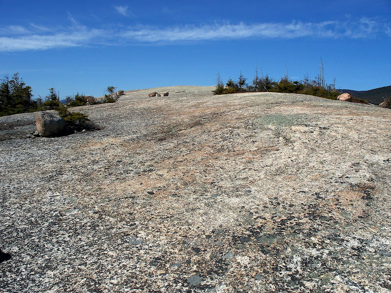
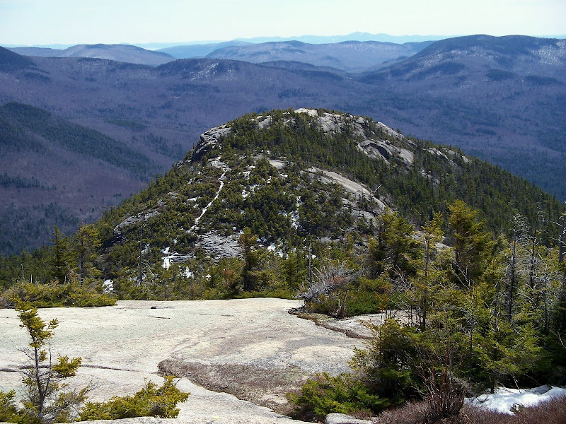
With some slight exaggeration, it is almost a hike unto itself to wander around to the various corners of this massive slab. Although the major vistas are essentially the same regardless of where you roam, many unique perspectives can be obtained by meandering around to different areas of this huge expanse of rock.
An aerial view would be the only way to show the magnitude of this spot. But for anyone who hasn’t been there, perhaps the photo below will give some glimmer of an idea about the general character of this place.
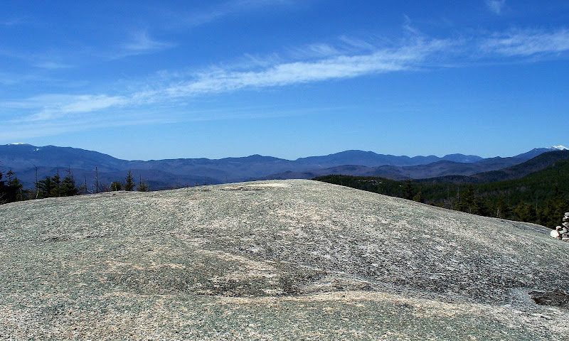
One of the star-attractions for this “off-center” spot is the BIG northwesterly view that encompasses Moosilauke on the far left of the photo below, all the way to the Franconia Range on the far right.
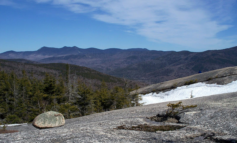
And, the next photo (taken from a different part of the slab) shows an isolated view of the Cannon Balls & Cannon Mountain (left) and the Franconia Range (right).
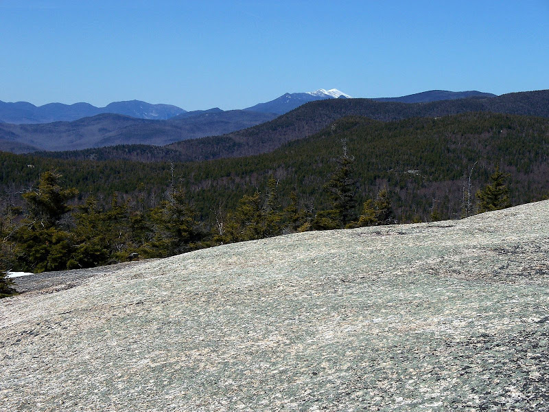
There is also a pretty impressive northeasterly view toward the Tripyramids.
And, an imposing view of near-by Welch Mountain can be seen from various points.
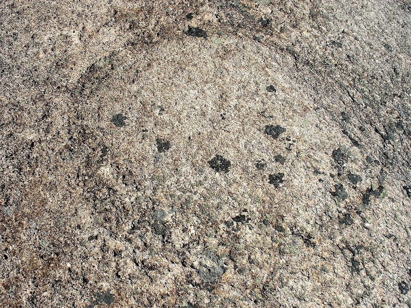
As everyone knows who has done the Dickey Branch of this loop trail, many rock slabs are encountered en route. On one of these slabs there is a circle carved in the bedrock. From what I can glean from the Internet, the origin of the circle is unknown, but supposedly if you stand inside the circle and point yourself in the direction of nearby large triangular-shaped rock, you are looking at the exact point of the sunrise at the summer solstice. Perhaps someone on this forum has other information about this? Below is a photo of the circle.
1HappyHiker
With some slight exaggeration, it is almost a hike unto itself to wander around to the various corners of this massive slab. Although the major vistas are essentially the same regardless of where you roam, many unique perspectives can be obtained by meandering around to different areas of this huge expanse of rock.
An aerial view would be the only way to show the magnitude of this spot. But for anyone who hasn’t been there, perhaps the photo below will give some glimmer of an idea about the general character of this place.
One of the star-attractions for this “off-center” spot is the BIG northwesterly view that encompasses Moosilauke on the far left of the photo below, all the way to the Franconia Range on the far right.
And, the next photo (taken from a different part of the slab) shows an isolated view of the Cannon Balls & Cannon Mountain (left) and the Franconia Range (right).
There is also a pretty impressive northeasterly view toward the Tripyramids.
And, an imposing view of near-by Welch Mountain can be seen from various points.
As everyone knows who has done the Dickey Branch of this loop trail, many rock slabs are encountered en route. On one of these slabs there is a circle carved in the bedrock. From what I can glean from the Internet, the origin of the circle is unknown, but supposedly if you stand inside the circle and point yourself in the direction of nearby large triangular-shaped rock, you are looking at the exact point of the sunrise at the summer solstice. Perhaps someone on this forum has other information about this?
Below is a photo of the circle.
1HappyHiker
Last edited: