
PETCH
New member
Date: October 23, 2011
Peaks/Trails: Mt Jefferson and Mt Adams via Castle Trail, Gulfside, Lowes Path, Spur Trail, Short line, Airline trails
Trail Conditions: Israel River crossing was running high, but we all made it across on the rocks. All trails below treeline were damp or muddy. No significant blowdowns that I can remember. Above treeline was a couple inches of snow on the rocks (shaken, not stirred). No icing noticed. None of us wore traction. Poles helpful for water crossing, and for staying upright when feeling faint.
Cast of Characters: Jorge, Kate, Shawn, John, CrazyBob, Keith, Ken, Jim, Dana, Myron, and me
Commentary
The Castle Trail over the Castellated Ridge has been high on my bucket list for a couple years now. I have read about it, seen it from Rt2 and the Caps Ridge trail.....We have been trying to save it for a clear day. The forecast for Sunday: Clear!!. Unfortunately, the clouds never rose high enough or dropped low enough to give us any views above treeline.........
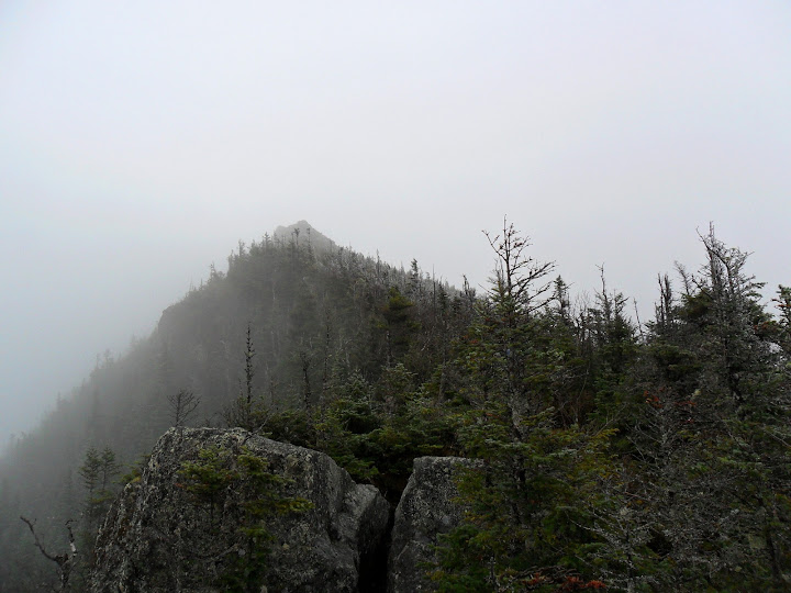
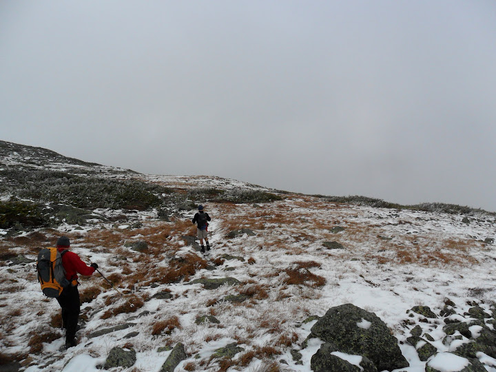
This was a sort of last minute throw together hike, but a gang of 11 started off on the Castle Trail at 8:45 on route to Mt Jefferson. The Israel river crossing was a little dicey, but we were all able to rock hop across, with just minor wetness. The Castle trail starts off fairly tame, and then sucks the life out of you as it steepens quite insanely for a good stint. This is where we lost our first hiker, Myron, who was battling a cold. The gang of 10 continued on.....After a decent amount of gain, the trail does level off for a bit allowing everyone to take a breather. As we ascended towards treeline, it started raining. Actually, that's not correct. Snow started melting from the trees making it look/feel like rain. We were all hoping the clouds would burn off. As we broke through the trees, we witnessed a milky view of the first Castle.
The first Castle
The velvet fog
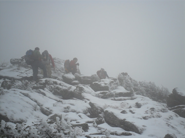
Above treeline, there was a couple inches of snow on the rocks. Temps were relatively warm, so there was no icing. We all continued on without adding any traction aids. Heck, 2 guys were still in shorts! We continued our ascent through the clouds/fog over the Castles and up to Jefferson, and summited just before 1pm.
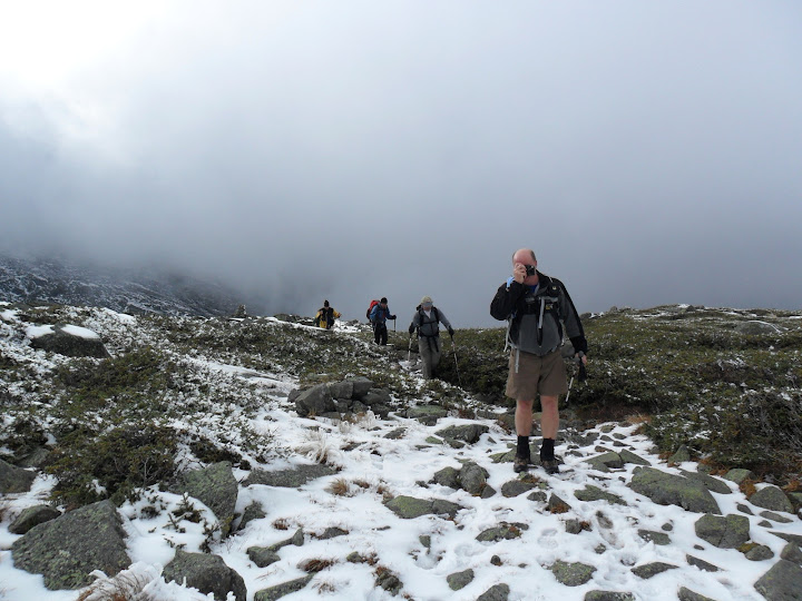
A lot of the day looked like this
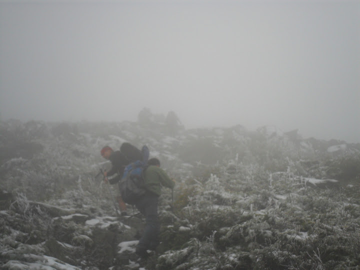
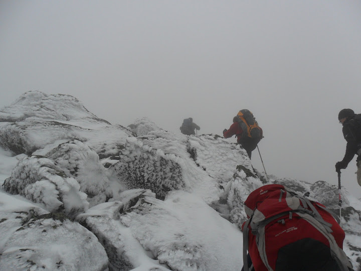
And this......
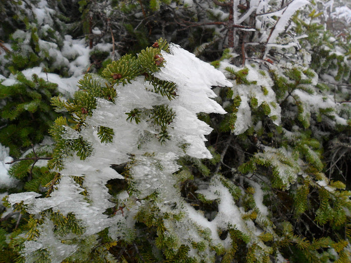
Rime time
We met Cath and Tim Seaver at the summit. We took a lunch break down by the huge cairn. Dana did what Dana does, and took out a bottle of whiskey and shot glasses! See, CrazyBob was celebrating his 21st birthday for the 25th time! So, we all did a celebratory shot. As CrazyBob says: "Hiking with us, is like 9th grade gym class" (Without the whiskey). He's referring to the level of immaturity and candor that generally riddles our conversations and behavior during hikes. We generally let loose on hikes, both physically and mentally. It's a decompression from the corporate world....... For the most part, everyone finds us entertaining. Or maybe they just feel sorry for us? I guess I prefer not to know......
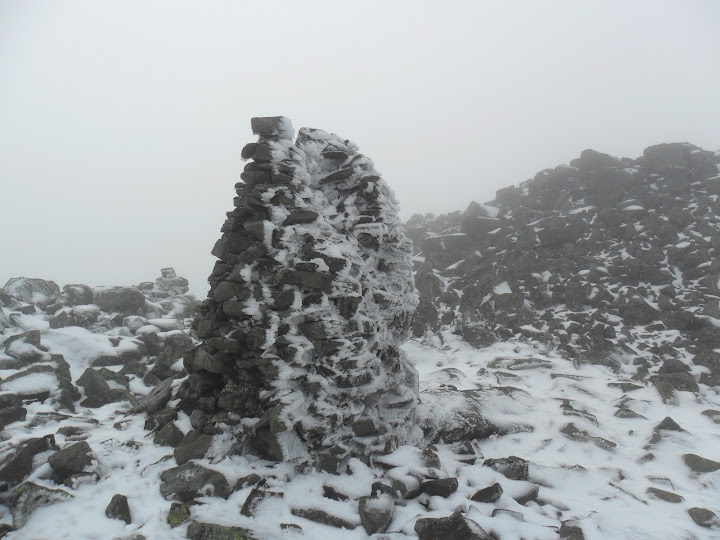
More rime on a bfc near Mt Jefferson
"Say cheese"
Off again we continued on the Gulfside trail. Still no views into the Great Gulf........I didn't remember this section of trail having so much elevation gain on the way towards Mt Adams. The original plan was to head down from Thunderstorm junction. 6 of the group wanted to tag Mt Adams. So we discussed the downward trail plan, and split into 2 groups. Both groups had GPS's and maps. So, Jim, Keith, Ken, and Dana began the hike down while the rest of us zipped up to Mt Adams. We ran into IQuest and Marlie coming down Adams. Time for a couple quick summit shots and back down to chase the others.
Final assault on Mt Adams
Heading down the Spur Trail near near Kings Ravine
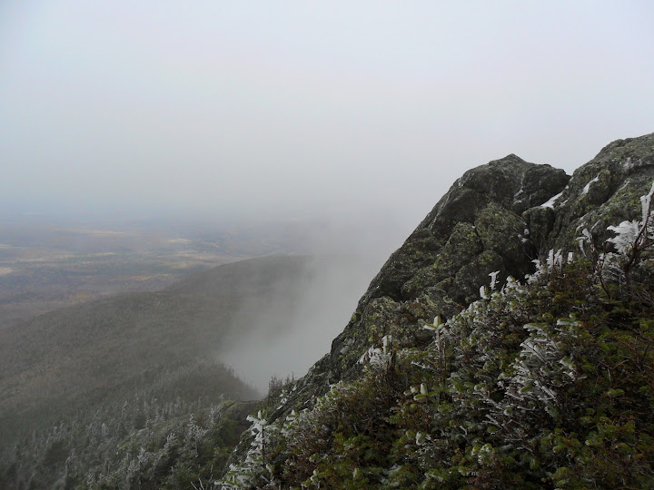
We stopped down at Crag Camp to check out the views down into King's Ravine. The cloud ceiling was about 2/3rds up the ravine wall. We had cell reception, and called the lead group to check on them. They were about a mile down below us and all was well. The rest of the hike down seem to take forever. I find this on most hikes- the last 1-2 miles always feels like 5.....Back down at Appalachia at 5:30pm, we regrouped for a quick adult beverage and parted ways. We saw Silverfox and friends down at the parking lot.
It was a long day with minimal views, but a good time. The beatings will continue until morale improves.
Stats: about 12 miles, 5200ft of ele gain, 8hrs 45 min

Slideshow from this trip
Petch
Peaks/Trails: Mt Jefferson and Mt Adams via Castle Trail, Gulfside, Lowes Path, Spur Trail, Short line, Airline trails
Trail Conditions: Israel River crossing was running high, but we all made it across on the rocks. All trails below treeline were damp or muddy. No significant blowdowns that I can remember. Above treeline was a couple inches of snow on the rocks (shaken, not stirred). No icing noticed. None of us wore traction. Poles helpful for water crossing, and for staying upright when feeling faint.
Cast of Characters: Jorge, Kate, Shawn, John, CrazyBob, Keith, Ken, Jim, Dana, Myron, and me
Commentary
The Castle Trail over the Castellated Ridge has been high on my bucket list for a couple years now. I have read about it, seen it from Rt2 and the Caps Ridge trail.....We have been trying to save it for a clear day. The forecast for Sunday: Clear!!. Unfortunately, the clouds never rose high enough or dropped low enough to give us any views above treeline.........
This was a sort of last minute throw together hike, but a gang of 11 started off on the Castle Trail at 8:45 on route to Mt Jefferson. The Israel river crossing was a little dicey, but we were all able to rock hop across, with just minor wetness. The Castle trail starts off fairly tame, and then sucks the life out of you as it steepens quite insanely for a good stint. This is where we lost our first hiker, Myron, who was battling a cold. The gang of 10 continued on.....After a decent amount of gain, the trail does level off for a bit allowing everyone to take a breather. As we ascended towards treeline, it started raining. Actually, that's not correct. Snow started melting from the trees making it look/feel like rain. We were all hoping the clouds would burn off. As we broke through the trees, we witnessed a milky view of the first Castle.
The first Castle
The velvet fog
Above treeline, there was a couple inches of snow on the rocks. Temps were relatively warm, so there was no icing. We all continued on without adding any traction aids. Heck, 2 guys were still in shorts! We continued our ascent through the clouds/fog over the Castles and up to Jefferson, and summited just before 1pm.
A lot of the day looked like this
And this......
Rime time
We met Cath and Tim Seaver at the summit. We took a lunch break down by the huge cairn. Dana did what Dana does, and took out a bottle of whiskey and shot glasses! See, CrazyBob was celebrating his 21st birthday for the 25th time! So, we all did a celebratory shot. As CrazyBob says: "Hiking with us, is like 9th grade gym class" (Without the whiskey). He's referring to the level of immaturity and candor that generally riddles our conversations and behavior during hikes. We generally let loose on hikes, both physically and mentally. It's a decompression from the corporate world....... For the most part, everyone finds us entertaining. Or maybe they just feel sorry for us? I guess I prefer not to know......
More rime on a bfc near Mt Jefferson
"Say cheese"
Off again we continued on the Gulfside trail. Still no views into the Great Gulf........I didn't remember this section of trail having so much elevation gain on the way towards Mt Adams. The original plan was to head down from Thunderstorm junction. 6 of the group wanted to tag Mt Adams. So we discussed the downward trail plan, and split into 2 groups. Both groups had GPS's and maps. So, Jim, Keith, Ken, and Dana began the hike down while the rest of us zipped up to Mt Adams. We ran into IQuest and Marlie coming down Adams. Time for a couple quick summit shots and back down to chase the others.
Final assault on Mt Adams
Heading down the Spur Trail near near Kings Ravine
We stopped down at Crag Camp to check out the views down into King's Ravine. The cloud ceiling was about 2/3rds up the ravine wall. We had cell reception, and called the lead group to check on them. They were about a mile down below us and all was well. The rest of the hike down seem to take forever. I find this on most hikes- the last 1-2 miles always feels like 5.....Back down at Appalachia at 5:30pm, we regrouped for a quick adult beverage and parted ways. We saw Silverfox and friends down at the parking lot.
It was a long day with minimal views, but a good time. The beatings will continue until morale improves.
Stats: about 12 miles, 5200ft of ele gain, 8hrs 45 min
Slideshow from this trip
Petch
Last edited:


