IQuest
New member
This past Sunday Marlie celebrated her 5th birthday. The week before she expressed to me that there was nothing that she would enjoy more to celebrate it than a long walk in the woods on some new trail with low traffic. This worked out perfectly as I only needed Mt Moriah to complete a 6th round :roll: and I had wanted to check out the Moriah Brook Tr for quite some time. What I was not looking forward to was the 2.5+ hr drive to Wild River Campground.
Since it was the last day of Dalight Savings Time the sun was quite late to rise and so there was no need to get on the trail any earlier that 7am. The drive took a little longer than I thought and we ended up with boots/paws on trail at 7:45am. We were the only car in the lot.
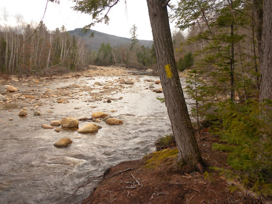
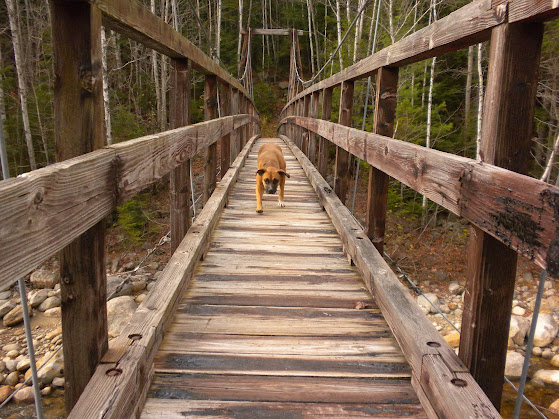
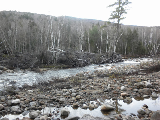
We headed up the Wild River Tr to the Moriah Brook Tr and crossed the Suspension Bridge over the Wild River. Without the bridge it would be impossible to cross without getting wet. As with the Pemi, leftover debris from Irene was present and impressive.
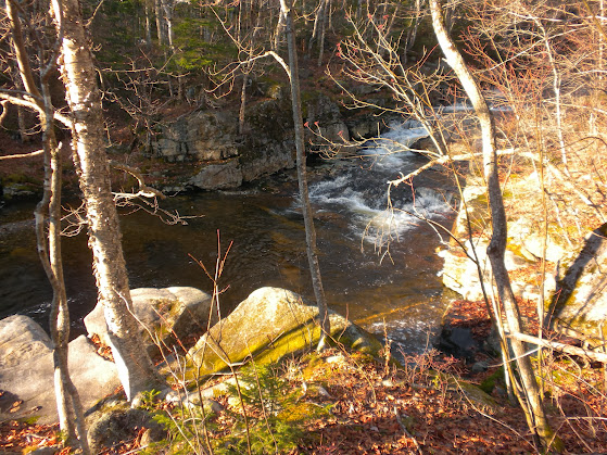
Wild River
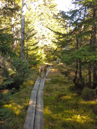
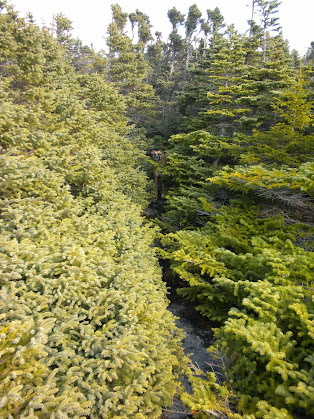
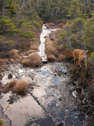
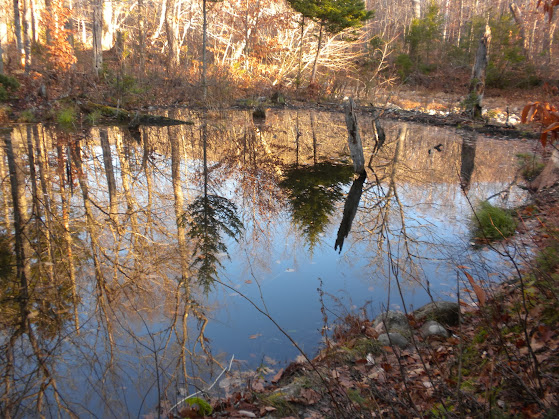
After joining and leaving the Highwater Tr the Moriah Brook Tr begins to climb up the valley gaining little elevation along the way. Just above Moriah Gorge we came to the first crossing of Moriah Brook. The gorge looked interesting from the trail, but with 15 miles still to go I didn't have any time to spare to explore. The water at the crossing was high from the previous day's rain and we had to go a short distance upstream ,to find a place to hop across. The trail follows an old railbed or logging road up the valley crossing Moriah brook and small tributaries several times as well as an area with extensive beaver activity. With the fresh coat of leaves, beaver activity, and being in a wilderness area it took extra care to follow the trail. It was good to have Marlie along to sniff out the correct route at crossings or when the old roads branched out. The trail never really gets steep but there were countless cascades and pools along the brook.
You have to use the beaver dam to cross here.
Followed by nice trail.
Moriah Brook
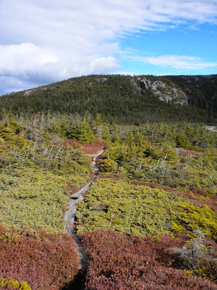
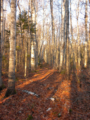
Over the last half mile the trail passes through a birch forest under the southern cliffs of Mt Moriah and climbs through a couple of wet areas and ends at the Carter Moriah Tr. I would highly reccommend this route for anyone who has already done Stony Brook Tr or the Carter-Moriah Tr from Bangor St.
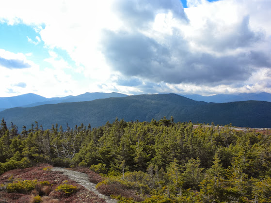
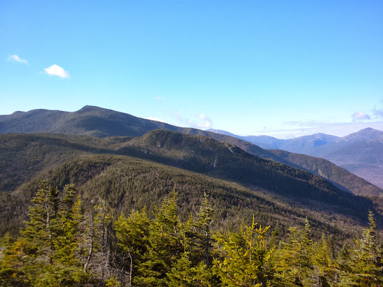
We then climbed the up the Cater-Moriah Tr breaking out onto the ledges after a short distance where we had excellent views to the south.
Imp Mtn and the Carters
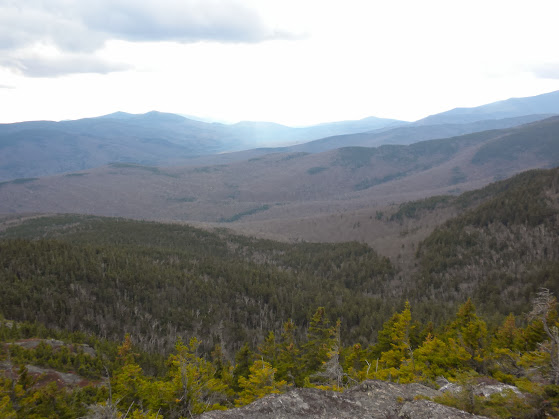
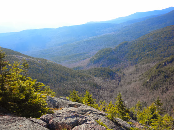
Moriah Brook Valley
We made it to the scramble where Marlie had to wait for me and we stepped on the summit at 11:00 am where we saw the first two people of the day. It was near 70, sunny, and no wind!
Marlie at the Summit of Mt Moriah
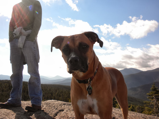
The two young men (early 20s) that I met were from CT and were planning a backpacking trip along the AT from US2 to Pinkham Notch. At first they told me that they had come up the Carter-Moriah Tr but later I discovered that they had come up the Rattle River Tr since thsy stayed the first night at Rattle River Shelter. They seemed a bit vague and confused about there route and said they wished they had a map like mine. (Mine is a 8.5 x 11 photo copy of my AMC map.) They only had something the printed off of Google and this was their first trip to the Whites. Notice the jeans and cotton shirt in the above pic. When I asked them if they had a car spot they siad that they were planning on walking back along the road then asked me if it was mostly flat across the ridge as they were already tired from lugging a 50 pond pack. :roll: I told them that other than the stiff climb up North Carter that we could see and the 1000+ foot climb up Wildcat A it wasn't that bad. :twisted: At this point they seemd unsure of what to do so I suggested maybe just heading back over to Shelburne Moriah Mtn or following the Carter-Moriah Tr down to Bangor St then walking the powerlines back to the Rattle River TH. I felt really bad about "busting their bubble" but I thought they should know what was in store. I even suggested Imp Campsite and told them that they could take any trail on the right to get down to NH16. I hope things went well for them.
Since it was the last day of Dalight Savings Time the sun was quite late to rise and so there was no need to get on the trail any earlier that 7am. The drive took a little longer than I thought and we ended up with boots/paws on trail at 7:45am. We were the only car in the lot.
We headed up the Wild River Tr to the Moriah Brook Tr and crossed the Suspension Bridge over the Wild River. Without the bridge it would be impossible to cross without getting wet. As with the Pemi, leftover debris from Irene was present and impressive.
Wild River
After joining and leaving the Highwater Tr the Moriah Brook Tr begins to climb up the valley gaining little elevation along the way. Just above Moriah Gorge we came to the first crossing of Moriah Brook. The gorge looked interesting from the trail, but with 15 miles still to go I didn't have any time to spare to explore. The water at the crossing was high from the previous day's rain and we had to go a short distance upstream ,to find a place to hop across. The trail follows an old railbed or logging road up the valley crossing Moriah brook and small tributaries several times as well as an area with extensive beaver activity. With the fresh coat of leaves, beaver activity, and being in a wilderness area it took extra care to follow the trail. It was good to have Marlie along to sniff out the correct route at crossings or when the old roads branched out. The trail never really gets steep but there were countless cascades and pools along the brook.
You have to use the beaver dam to cross here.
Followed by nice trail.
Moriah Brook
Over the last half mile the trail passes through a birch forest under the southern cliffs of Mt Moriah and climbs through a couple of wet areas and ends at the Carter Moriah Tr. I would highly reccommend this route for anyone who has already done Stony Brook Tr or the Carter-Moriah Tr from Bangor St.
We then climbed the up the Cater-Moriah Tr breaking out onto the ledges after a short distance where we had excellent views to the south.
Imp Mtn and the Carters
Moriah Brook Valley
We made it to the scramble where Marlie had to wait for me and we stepped on the summit at 11:00 am where we saw the first two people of the day. It was near 70, sunny, and no wind!
Marlie at the Summit of Mt Moriah
The two young men (early 20s) that I met were from CT and were planning a backpacking trip along the AT from US2 to Pinkham Notch. At first they told me that they had come up the Carter-Moriah Tr but later I discovered that they had come up the Rattle River Tr since thsy stayed the first night at Rattle River Shelter. They seemed a bit vague and confused about there route and said they wished they had a map like mine. (Mine is a 8.5 x 11 photo copy of my AMC map.) They only had something the printed off of Google and this was their first trip to the Whites. Notice the jeans and cotton shirt in the above pic. When I asked them if they had a car spot they siad that they were planning on walking back along the road then asked me if it was mostly flat across the ridge as they were already tired from lugging a 50 pond pack. :roll: I told them that other than the stiff climb up North Carter that we could see and the 1000+ foot climb up Wildcat A it wasn't that bad. :twisted: At this point they seemd unsure of what to do so I suggested maybe just heading back over to Shelburne Moriah Mtn or following the Carter-Moriah Tr down to Bangor St then walking the powerlines back to the Rattle River TH. I felt really bad about "busting their bubble" but I thought they should know what was in store. I even suggested Imp Campsite and told them that they could take any trail on the right to get down to NH16. I hope things went well for them.