1HappyHiker
Well-known member
Background:
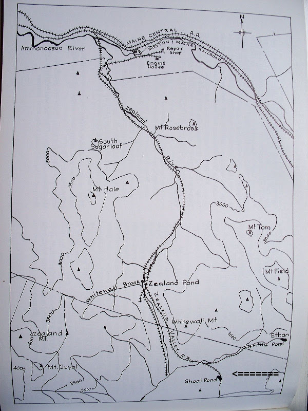
For whatever reason, I decided to do a “horizontal” hike to Shoal Pond and Thoreau Falls. BUT, I had this nagging temptation to go “vertical” when walking along the Ethan Pond Trail directly at the foot of Whitewall Mountain!
I managed to keep my “vertical” urges under control long enough to enable me to do Shoal Pond (which I had never done before), and to do Thoreau Falls (which I had already done once before). However, at the end of the hike, I eventually succumbed to “verticality” by bushwhacking to a place I nicknamed “Whitewall-Lite” (you know, sort of like Miller-Lite, or Bud-Light!).
The Journey:
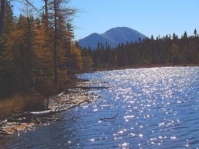
The views from Shoal Pond were more spectacular than I had imagined they would be. It’s so unique to view Zealand Notch with water in the foreground.
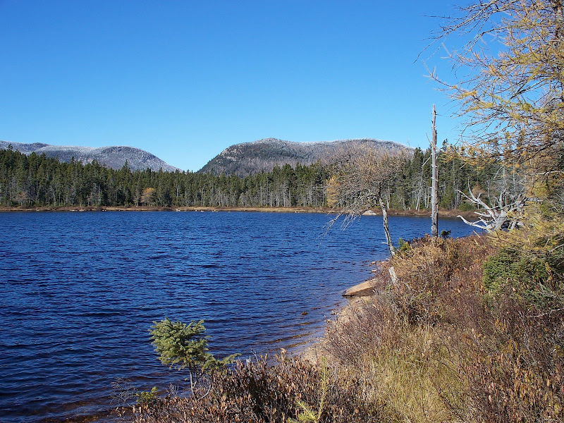
And, it’s equally as unique viewing Carrigain with water in the foreground.
The view from Thoreau Falls with Mt. Bond in the background was OK. However, taking good photos was a challenge since I’m lacking skills to deal with the shadows and lighting issues that were present when I was there. Plus, there was not a whole lot of running H20 to add to the “ambiance”!!
So, after having done Shoal Pond and Thoreau Falls, I began my return journey. However, as I approached the southwestern corner of Whitewall Mountain, I could no longer resist the urge to go “vertical”!! I strongly suspected that there might be a ledge somewhere on this end of Whitewall that was not too far off the trail where I could get some views without too much effort. I knew there wouldn’t be time to go all the way to the summit, but this wasn’t a big deal since I’d already gone to the summit about 2 years ago.
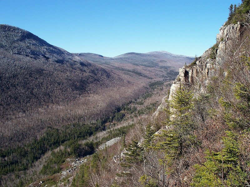
So, I took the plunge and headed off-trail and went “vertical” in a northeasterly direction. After about 30 minutes of “hunting & pecking” my way through mostly open woods, I came to a great little ledge which I called “Whitewall-Lite”.
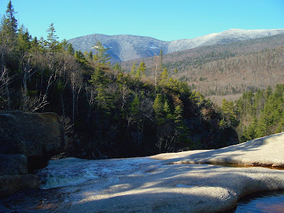
From “Whitewall-Lite”, there were some nice views looking northward up the Zealand Notch.
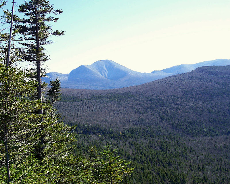
And, there were views looking southward toward Carrigain.
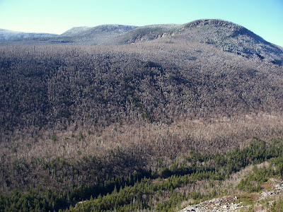
And, of course, there were views right “across the street” looking at Zeacliff and the Zealand Ridge.
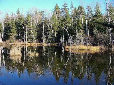
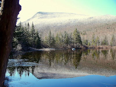
Besides the views from Shoal Pond, Thoreau Falls, and Whitewall-Lite, there were also nice “reflecting” views at the Beaver Ponds, as well as an interesting “reflecting” view at Zealand Pond.
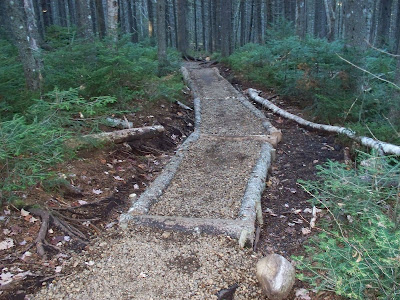
Just as side-note, I haven’t been on the Zealand Trail for awhile. When did the trail crew do the “scree-fill” for that badly eroded section of trail with all the exposed roots?? Very nice job!!
Bottom-Line To All This: I couldn’t resist the temptation to add some “verticality” to my horizontal hike to Shoal Pond and Thoreau Falls. And so, I did a short 30 minute bushwhack to a ledge on Whitewall Mountain which I dubbed “Whitewall-Lite”. The views from there were a big “bang for the buck” considering that it took so little time & effort to go there.
The views from Shoal Pond were much better than expected, and for anyone who has not been there, I’d recommend it. Also, there were also some nice “reflecting” views at the Beaver Ponds and at Zealand Pond.
Including the short bushwhack, the round-trip mileage for this hike was just a bit over 12 miles. However, since most of it is flat (horizontal) walking, it’s easy to cover a lot of ground very quickly. Including time for lunch, taking photos, bushwhack, etc, this entire trek took just over 6 hours.
1HappyHiker
For whatever reason, I decided to do a “horizontal” hike to Shoal Pond and Thoreau Falls. BUT, I had this nagging temptation to go “vertical” when walking along the Ethan Pond Trail directly at the foot of Whitewall Mountain!
I managed to keep my “vertical” urges under control long enough to enable me to do Shoal Pond (which I had never done before), and to do Thoreau Falls (which I had already done once before). However, at the end of the hike, I eventually succumbed to “verticality” by bushwhacking to a place I nicknamed “Whitewall-Lite” (you know, sort of like Miller-Lite, or Bud-Light!).
The Journey:
The views from Shoal Pond were more spectacular than I had imagined they would be. It’s so unique to view Zealand Notch with water in the foreground.
And, it’s equally as unique viewing Carrigain with water in the foreground.
The view from Thoreau Falls with Mt. Bond in the background was OK. However, taking good photos was a challenge since I’m lacking skills to deal with the shadows and lighting issues that were present when I was there. Plus, there was not a whole lot of running H20 to add to the “ambiance”!!
So, after having done Shoal Pond and Thoreau Falls, I began my return journey. However, as I approached the southwestern corner of Whitewall Mountain, I could no longer resist the urge to go “vertical”!! I strongly suspected that there might be a ledge somewhere on this end of Whitewall that was not too far off the trail where I could get some views without too much effort. I knew there wouldn’t be time to go all the way to the summit, but this wasn’t a big deal since I’d already gone to the summit about 2 years ago.
So, I took the plunge and headed off-trail and went “vertical” in a northeasterly direction. After about 30 minutes of “hunting & pecking” my way through mostly open woods, I came to a great little ledge which I called “Whitewall-Lite”.
From “Whitewall-Lite”, there were some nice views looking northward up the Zealand Notch.
And, there were views looking southward toward Carrigain.
And, of course, there were views right “across the street” looking at Zeacliff and the Zealand Ridge.
Besides the views from Shoal Pond, Thoreau Falls, and Whitewall-Lite, there were also nice “reflecting” views at the Beaver Ponds, as well as an interesting “reflecting” view at Zealand Pond.
Just as side-note, I haven’t been on the Zealand Trail for awhile. When did the trail crew do the “scree-fill” for that badly eroded section of trail with all the exposed roots?? Very nice job!!
Bottom-Line To All This: I couldn’t resist the temptation to add some “verticality” to my horizontal hike to Shoal Pond and Thoreau Falls. And so, I did a short 30 minute bushwhack to a ledge on Whitewall Mountain which I dubbed “Whitewall-Lite”. The views from there were a big “bang for the buck” considering that it took so little time & effort to go there.
The views from Shoal Pond were much better than expected, and for anyone who has not been there, I’d recommend it. Also, there were also some nice “reflecting” views at the Beaver Ponds and at Zealand Pond.
Including the short bushwhack, the round-trip mileage for this hike was just a bit over 12 miles. However, since most of it is flat (horizontal) walking, it’s easy to cover a lot of ground very quickly. Including time for lunch, taking photos, bushwhack, etc, this entire trek took just over 6 hours.
1HappyHiker
Last edited:
")