2 guys, 3 days, 4 Border Patrol encounters and 5 peaks to finish the NEHH

vftt.org

Help Support vftt.org:

This site may earn a commission from merchant affiliate links, including eBay, Amazon, and others.

Bombadil

Active member
Joined
Nov 5, 2009
Messages
322
Reaction score
42
Location
Groton, MA
3/14/13-3/16/13
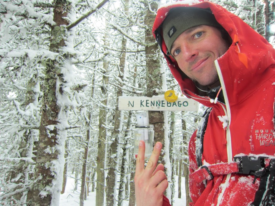
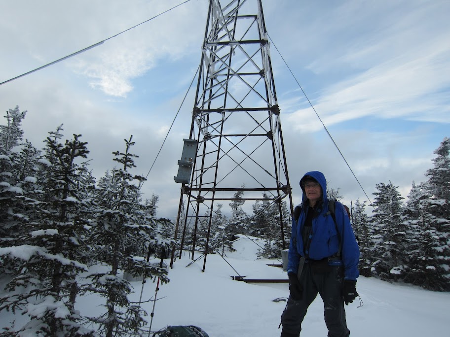
This is the summary of a trip Tom Caldwell and I did a few weeks back (written by Tom) to the Rangeley Six-Pack March 14-16 to complete the New England Hundred Highest List during the winter season. We had previously hiked one of the Six Pack, East Kennebago on February 7, so we had the remaining five to do...Cupsuptic Snow, Boundary Peak, White Cap, North Kennebago Divide (NKD) and Chain-of-Ponds Snow.

Tom’s take:
I'd called Maine Fish & Game the previous week to inquire about road conditions, as the only roads approaching these peaks are logging roads, and only are plowed in winter if the logging companies are active. We knew that friends had been up there six weeks ago and managed to get close to the summer trailheads on most of these peaks. A game warden named Reggie called me back and we had a nice chat. Among the things I learned was that most logging had ended for the season (March is known as "snow month", he said) and the dirt logging roads weren't plowed, as far as he knew. Although when logging stops, snow berms are plowed up to block vehicle access and the roads are given over to the snowmobile clubs, which travel most of the roads and beat down the snow to a pretty firm base. Also, he said that the Border Patrol was cracking down on people who crossed to the Canadian side of the border swath on the way to Boundary Peak and one should be careful to stay on the US side of the mid-swath markers. He gave me his private cell phone number and invited me to call him for an update as we firmed up our plans. He wasn't familiar with the logging roads on the west side of the drainage, so I should call Jerry, the owner of Rivers Edge Sports in Oquossoc. He'd know, as he rents and services the snowmobiles over there. "If Jerry said a road's open, it's open", he said.

So I'd visited Jerry the previous week after Bryan Cuddihee and I'd hiked South Horn. Jerry said Burnt Mountain Road was plowed....the only one. There was no road access to the east side of the drainage, the customary way of approaching White Cap and NKD in the summer. After visiting Rivers Edge Sports I'd driven about 1.5 miles up Morton Cutoff towards Burnt Mtn Rd in the Toyota, but the combination of ice and mud made me skittish about going further. Better to do this in a 4wd with clearance.

I rented a Nissan Pathfinder and Pat met me in Stratton where we stayed Wednesday night at the Spillover Motel. With breakfast at the Looney Moose we drove to Rangeley and then on through Oquossoc, turning onto Morton Cutoff and 3.1 miles later making the quick right and then left turns at the four way intersection with Lincoln Pond and Tim Pond Roads to get on Burnt Mountain Road. Tim Pond Rd had a big snow berm blocking anyone from traveling east. We drove up Burnt Mtn Rd over an inch or two of fresh powder. This road is about 11.5 miles long and connects to Big Canyon Road where we expected to stop and start hauling our pulks (sleds) of gear further north.

After 9.6 miles, the plowing ended with another big berm. This was right at the junction with East Branch Road, which was plowed. Since East Branch is the customary summertime approach to Cupsuptic Snow, we figured we were in luck and we'd do Cup-Snow this way instead of from the north from our campsite we'd establish later today. Heading up East Branch over a rise, we quickly encounter an active logging operation, just before the fork where the road splits into the North and South branches. After waiting 10-15 minutes for the operator of the tracked hydraulic claw vehicle to finish stacking a load of logs on one side of the road, I approach and ask him if we can get by. Sure. So we drive by and proceed only about 300 yards before the plowing ends. So now the hiking starts.
zoomed%2520out.png

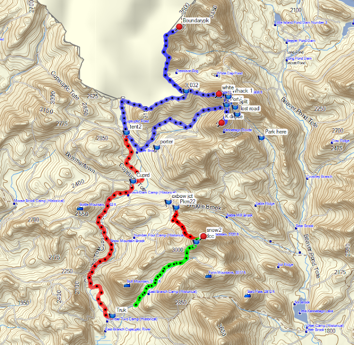
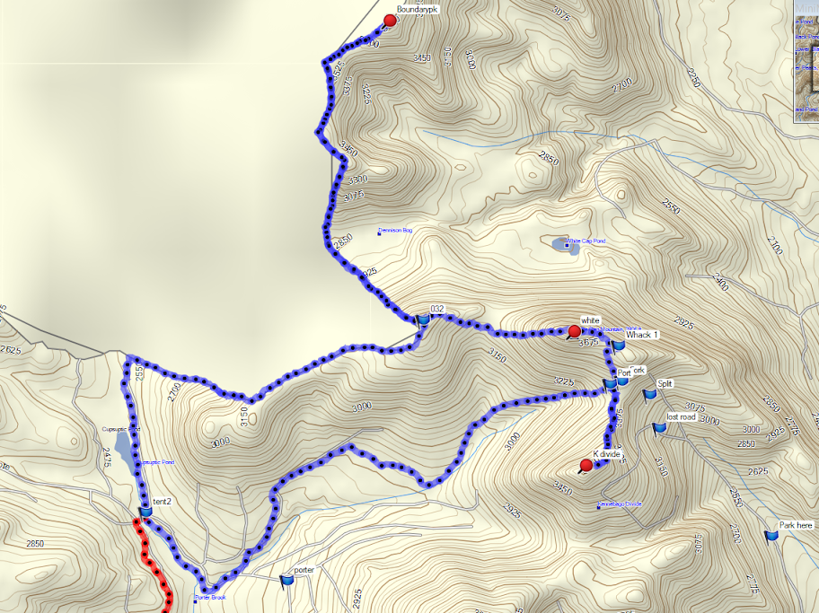
Green and red are the two routes Pat used for Snow this winter. We parked at the "truk" waypoint and hauled sleds some 8 miles up to "tent2"

IMG_6754.JPG

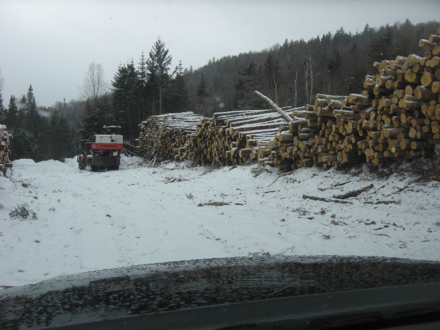
active logging area on E Branch Rd

map.png

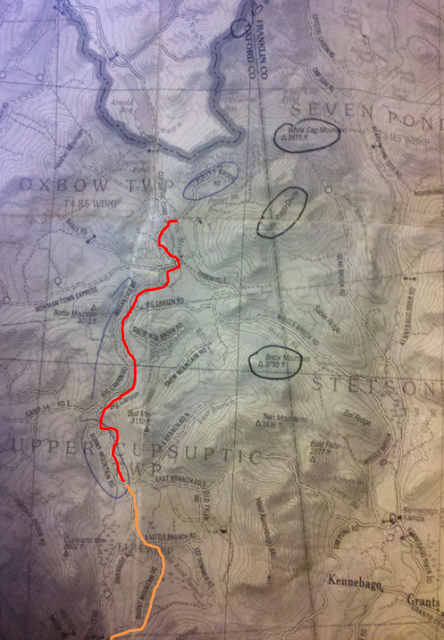
Not a very good map but orange is the route we drove and red where we pulled sleds. We relied on the 24k map purchased from the Mountain Wanderer, this was just a quick reference

IMG_3361.JPG

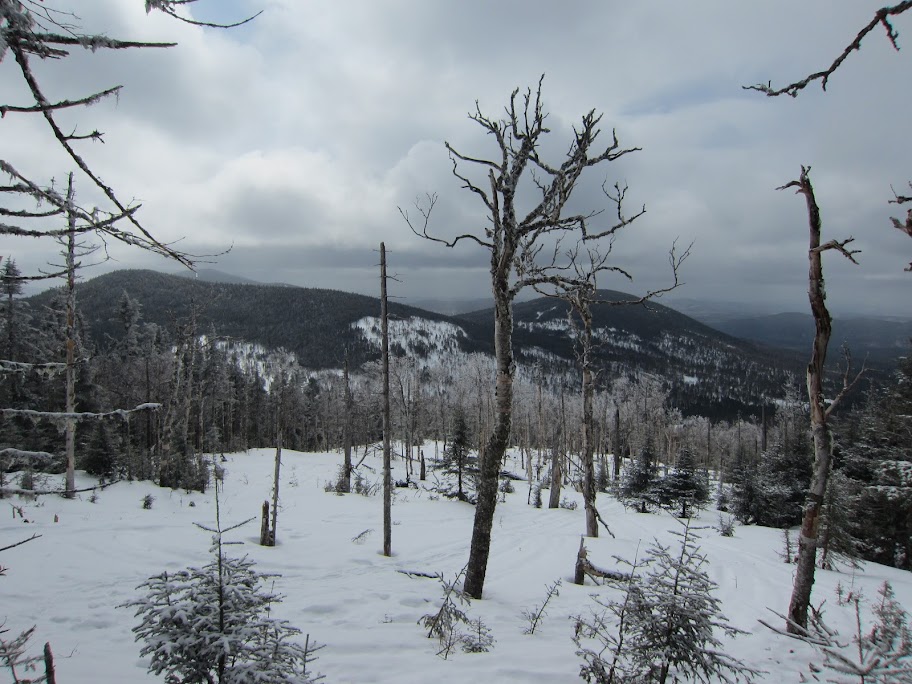
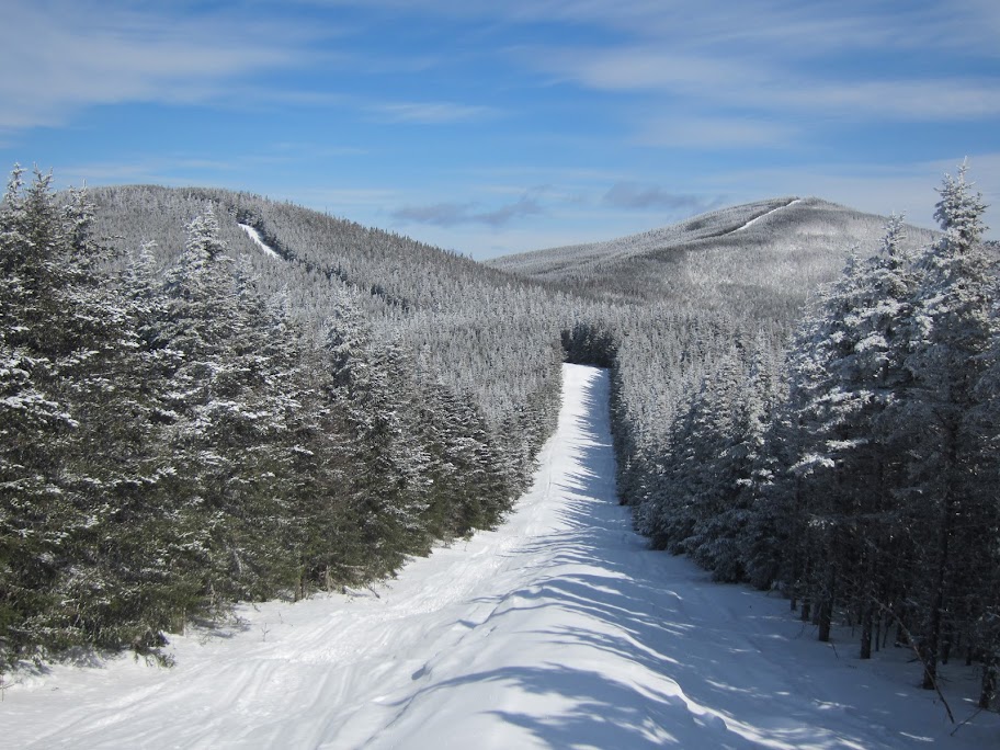
I'm not sure which side of Snow is easier. Having never done it from the south I was shocked at how wide open it was. This old clear cut ended at almost 3500 ft, just a couple hundred feet below the summit. It doesn't get any easier...

Here's what Pat posted under trail conditions:.
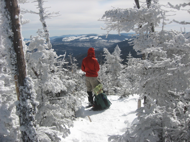
"Followed E Branch Rd N to the end, then ascended NE through some nice open glades. From there a brief stretch of open old softwoods which led to an old clear cut. We followed that to its end, punched through a 50 foot section of thicker softwoods and was open old softwoods from there to the summit. Cake! Lucky me had back to back winter entries in the logbook since no one had been there since I had in February. Tom needed this one and it was on our way to Boundary/WC/KD."

We descended quickly for a nice mellow 6.9 mile round trip and backed the SUV down to the north/south junction and waited for the logging guy to finish another stack and move off the road again into the cut area. We drove the quarter mile or so to the turnout formed by the plowed end of Burnt Mtn Rd and parked, putting a note on the instrument panel saying where we were going and returning Saturday. Reggie the game warden asked us to do so, as people wonder why a vehicle's parked on a logging road in winter, and whether they should be organizing a search party.
 
<continued>
It's about 2:00 and we start out along Burnt Mtn Rd, heading NW for a couple miles and pick up Big Canyon Rd at a junction. Making good time on the snowmobile packed road with an inch or so of new powder, we heading north on it, being passed by a couple snowmobilers coming south. Since we just did Cup-Snow, we don't have to consider it when we place our camp, so we decide to head north from Big Canyon to Megantic Road and continue north on that and see how far we can go before dark, getting closer to the border than our original plan.

Still on Big Canyon, four snowmobiles approach us from the north, stopping about twenty feet from us. They all have identical olive drab jackets and pants. As we walk toward them I notice a round patch over their left chest pockets...."US Border Patrol". Ok, this will be interesting. We exchange quick hellos with the leader, who takes off his helmet. Probably about 35, his military style sewn name strip over his right pocket. The others stand on or beside their sleds and lift up their visors. It's about 20F and little wind.

They ask where we're going, so we list the peaks and our intended route. Where we started from, so we told them what we'd done today and where the SUV was parked. We ask about streams being open or not, as that'll save time and fuel over melting snow. They ask about our gear, so we recite what we've got, which seems to assure them that we know what we're doing. The talk turns to chatting about gear (our snowshoes are nicer than theirs), where they're from, we're from, and what the Border Patrol does to keep busy. Not much smuggling remains up here, but there's more in the winter.....sled travel is easier. Also, they get pulled into search and rescues, which is probably why they were so curious about our gear. They let me take their picture.

Then we're on our way again. We find that Megantic is sledded out as well, so we head up that, figuring we'll find a way across the Cupsuptic River at the confluence of roads a bit south of Cupsuptic Pond and camp on the other side. It's about 6:00 and we come across a clearing with what looks like an old road or track due east. We start along that, figuring it crosses the river, but discover open water, too deep and wide to cross. Back to what is Cupsuptic Pond Road and along that for another 20-30 minutes until we find a bridge and sign saying "Gray's Connector", which takes us across the river to a confluence of roads, the main one being Porter Brook Road, according to the map. Just where we want to be for tomorrow. We spot a small clearing, about 20x20 feet, twenty-five yards into the spruce and we establish camp there. It was getting colder (we had slowly climbed to 2500 ft) and we quickly made dinner and snuggled into our bags. I keep my expedition weight parka on....a first for me while snow camping. It's going to be zero or below.

Pat posted this under trail conditions:
Tom and I camped out at a pretty nice spot across the last bridge over the Cupsuptic River (fyi did not look drivable in summer as there were large gaps in it) coming over from Cupsuptic Pond Rd. We had hoped to cross further south but the spot we had hoped to cross at didn't have a bridge and the river was open and deep, so we wound up pushing further north which made for an easier hike on the 15th.

We got an early start and headed north to the boundary on what I presume is Gray's Connector which runs due north from the river crossing to the boundary but is nothing more than a tight hiking trail but just wide enough to get a snowmobile through. We hit the swath/ slash and made the long trek out to Boundary. It was a rather chilly trip with nights around 0 or slightly negative (camp was at 2500 ft) and highs struggling into the high teens during the day even when the sun came out. The slash was very firm rain crust which fully supported our weight and along the ridges we hit a few pockets of windblown snow from the snow showers the day before.

The canister at Boundary was frozen solid but we stopped and basked in the sun on the cold morning. Great views from Katahdin to the Bigelows and even the Presidentials were easily visible.
We doubled back to the sub peak of Whitecap due west of Whitecap where the slash is the closest to the summit and pushed through a couple small thick sections but for the most part connected old woods roads with open softwoods to easily reach the summit of Whitecap in less than an hour.


When we got back to the sub peak of White Cap on the boundary swath at 3520', we headed due east into the woods towards White Cap. Immediately we come across a jar tied to a tree with an "AMC 3000" sign and a notebook inside. Hmmm, must be on the Maine or New England 3000 Footer list. The last person to sign it was Pat's friend Jason Beaupre. Small world.
Coming off the sub peak we got some views of White Cap.

IMG_3375.JPG

hiking the slash

IMG_6763.JPG

nice views from Boundary on a brisk day

Pat's report continues:
We were generally on the south side of the ridgeline but not by much. We followed the usual route down to the col to Kennebago Divide then bushwhacked up through a bunch of moderately thick garbage with the occasional small patch of open woods. Gradually as we ascended the ridge the woods opened up especially by the summit.
Rather than bushwhacking straight off the summit we smartly opted to double back to the saddle and follow an old woods road which we hoped was the remnants of Porter Brook Rd/ its extension. We were correct in our hunch and having a good map helped tremendously with these seemingly small decisions as we followed it straight down the fall line to our camp with one minor turn south away from camp where it hits Oxbow and become a solid snowmobile road.


zoomed%2520in.png

our route with some old waypoints from a summer visit

In looking at a map of our route it does look tempting to head W/SW off KD to pick up one of the old logging roads and head back to camp via the roads on the south side of Porter Brook. But since we knew where to pick up the start of the road on the north side of the brook, coupled with the fact that we could see parts of the road, looking easy and open in sections, from above by the summit of KD we elected to head back north to the saddle and descend that way. Maybe there’s an easier route to the west but we opted for the (relatively) known versus the unknown.

We started at 8:45 and got back to camp at 6:42. Ten hours for what Pat later calculated was 17.9 miles. Not bad considering the bushwhacks from the swath to the old Porter Brook Road remnant in the NKD/White Cap saddle. Pat was first into the tent site, and noticed snowmobile tracks which stopped at the clearing in front of our tent and post holing from the clearing to our tent. Nothing seemed to be missing, although the duffel bag I'd left outside the tent had been opened. Hmmm. So we prepare for another cold night, getting to sleep about 9:00. We set the alarm for 6:00 as we had to break camp, tow our gear 8.5 miles to the SUV , drive for about ninety minutes to Stratton, have a quick lunch then up Rt. 27 to pick up North Rd and hope that it's plowed some distance for our approach to Chain of Ponds Snow, otherwise known as COP Snow.
 
<continued>
IMG_3397.JPG

dos peaks left for Pat on the nehh-ss

I woke up about 5:30 and dozed in my bag, not wanting to get out of it. At 5:45, we heard a voice and saw a flashlight being trained on our tent. I don't remember his exact words except "United States Border Patrol". The leader asked us to open the tent, which we did, and started asking questions...."was I Thomas Caldwell? " Yes. "What was my DOB?" Then the other guy said "so you're 62?" I was going to say something snappy, but decided in a nanosecond to be polite and replied that I was 64 1/2. The leader asked Pat his name, age, residence, and asked him to slide forward so he could be seen as well. Then they asked what we'd done yesterday, so I recited the route. They asked how long it took; I said 8:45 to 6:45. They would ask that again later, evidently not believing us. They asked if it was our SUV at Burnt Mtn Rd. Yes. Why did we rent a vehicle? Because we both own 2wd cars. Then the other guy asked what I did to keep in shape. So that's it....they ran the plate number, found it was a rental, called Enterprise, got my name and license and found my age, figuring someone else was driving the SUV, not some senior citizen romping around 8+ miles away.

Then they explained. A game warden had seen our tracks and followed them to our camp while we were hiking yesterday. Our presence was called in to the Border Patrol, which turns out to have had no knowledge of our presence because the patrol agents who spoke with us Thursday hadn't reported the encounter. The concern was that we'd hiked into Canada to summit a peak names Gosford, which is in the Gosford Provincial Park that borders this area. Going a couple miles into Canada without passing through a border checkpoint and reentering the USA is a Big No No. They asked if we'd gone to Gosford. No, we're after the New England Hundred Highest in Winter. They informed us that they would have to follow our track from yesterday and determine if we had detoured into Canada, and if we were lying we'd be in serious trouble. Again for a nanosecond I was going to ask how'd they follow our tracks with the 6" of new powder that appeared to have fallen overnight, but I refrained. They informed us that an agent was waiting at our SUV. Maybe they'd impound it if they found we'd crossed into Canada. We didn't ask.

They left and we proceeded to get up, have breakfast and break camp. By 8:00 we were just starting out. Pat was waiting for me 50 yards out across the Cupsuptic River bridge as I was leaving the tent site, when the two agents returned. The leader said "Thanks for not lying to us." They'd evidently followed the swath (slash, as they call it) and checked the slash edge for the remnants of tracks heading into Canada, and found none. Now they were much friendlier. The leader's with me while the other one is talking to Pat. The leader asked again "Ten hours, huh? I hope I can do that when I'm your age" Then he asks if we'd get together for a photo. I presume they wanted one for their report, so he and I move up to Pat, and they take our photo and let us take theirs. They asked us about the four agents we'd met and I scrolled through the images in my camera to show them. While scrolling through the images, they saw that we'd summited Boundary, and not just the 3520' sub peak of White Cap, which they'd thought we'd meant. So they realized we'd hiked even farther yesterday than they'd thought. We proceeded to chat about life in the Patrol (and their stress over possibly losing 40% compensation due to the sequester), hiking gear, etc. They said there was a woman hiking up here last year, but it's evidently uncommon in winter. With that, we began our tow back to the SUV.

About two plus hours into the hike, Pat's ahead and out of sight. Two more Border Patrol agents come down behind me and stop. The lead one pops his visor and asks if I'm Thomas Caldwell. Yaaah. He introduces himself as the Supervisor, and wanted to see for himself these guys out in his woods. Said seeing us was a good excuse to get off the desk and on a machine. He asked if I knew a hiker that had posted in 2010 about taking a forest road north from Cupsuptic Pond to the boundary slash and then continuing into Gosford Park to pick up the dirt road there that hikers use in the summer to approach Boundary Peak from the Canadian side and then returning to the USA via this forest road....illegal entries into Canada and the USA. We knew the hiker but had no thoughts of going for Gosford. We never strayed from the US side of the slash just to be sure—good thing.

I mentioned how nice all his agents were, and he said there was some surprise and confusion when the game warden (not Reggie) reported our camp, without any report from the Thursday patrol. He went on to say that search and rescue is a big part of what they do in the winter, and mentioned the teenager who'd skied off the backside of Sugarloaf a couple weeks ago, and also two guys who skied off the back of Saddleback...and those two were illegal aliens. He chuckled and I said that probably added several pages to his report.

One of the main reasons for our writing of this trip report, besides the sharing of beta, was that Border Patrol asked us to relay that hikers can call the Border Patrol for info about logging road status and where logging was occurring, as they keep track of that. I presume they have a self-interest, because of their role in rescues.

Pat's waiting for me at the SUV, and we boogie back to Stratton, pick up a sandwich and move out to COP Snow, turning on to North Road for what would in summer be about a 4.9 mile drive to the trailhead.

Pat's trail conditions on COP Snow:
Snow showers hit the area overnight and the road wasn't plowed out but had been driven. Thankfully we were able to park right at mile marker 3 on the shoulder of the road. We then walked to the trailhead on the heavily trafficked road. The ATV/snowmobile trail was well traveled to the start of the Snow Mtn. Trail. We then broke trail through 5" of powder on top of the crunchy rain crust. We briefly followed a branch of the snowmobile route around 3100 ft. Surprisingly someone had ventured up to the small cliffs on a snowmobile that day so we didn't have to break that out. Not surprisingly they turned around there and we broke trail the rest of the way. The last 1/3 of a mile was a nonstop push through snow-laden trees leaning over the trail but it was such a treat to have a trail to follow after our last bushwhacks. Tom and I both finished our winter NEHH lists on the summit.

IMG_3402.JPG

NEHH-W victory

On the way down, just after hitting the snowmobiled forest road, the foot plate of my MSR Lightning snowshoe broke.....a fatigue fracture clear through the metal plate. Tied it on with parachute cord and kept going, without further incident. But a good thing it hadn't happened 24 hours prior!

We hiked 53+ miles over three days, two nights tenting in zero F weather, and summited five peaks. A great way to finish the NE Hundred Highest in Winter. Thanks Pat!

Pat- Thanks for the company Tom, it was a blast! It was pretty neat doing a couple dozen nehh peaks together this winter after not crossing paths since I did my 2nd winter 4k footer with you some 3 years ago on a meetup hike.
 
Last edited:
Awesome! I'll remember this if I ever get the CRAZY idea of doing the W-NE-HH! :eek:

...
From the ashes a fire shall be woken,
A light from the shadows shall spring;
Renewed shall be blade that was broken,
The crownless again shall be king.
 
Quite an adventure. Thanks for the information about your encounters with Border Patrol.
Congratulations on NEHH-W!
 
Very, very interesting! Congratulations folks! Amazing job getting all that done. Very ambitious and determined you must both be.
 
If they asked me how old I am and expected a quick reply, I would definitely fail that test. I really don't keep track of that knowing I can always subtract to get my age! If I head near the border, I'll be sure to do the math ahead of time.
 
Thanks for the post, I guess the former AMC Labor day route that cut into Canada past the burned out greenhouses and then back down the road to the Cupsuptic Pond is no longer legit. More than a few canadians have been caught poaching moose from the US side of the border over the years and dragging them back over the line, I expect border patrol presence is going to cut back on this practice.

I expect in addition to the border patrol folks you met, you were also caught by some unmanned surveilance gear. What the heck if they are willing to supplybackcountry and road conditions its a nice find.

When I make it up there again I guess I had better bring my US passport and my canadian citizenship ID just in case. ;)
 
Your bit about staying on the US side of the border monuments is interesting. It implies that going to the canister (US side) from the Canadian side, after legally entering Canada, is illegal. Many folks will tell you to say that you're hiking Gosford and not to mention Boundary Peak. I told both the Canadian and US border agents what I planned / had done and neither blinked and eye about it - it appeared to me that they were used to people doing exactly this, and the foot path in summer wanders back and forth. Do the wardens watch to make sure any animal shot from Canada is shot on the north side of the swath? And what if you have to cross the line to retrieve the animal? All reasonable things for people to do up there, all with the best of intentions, and all possibly illegal strictly speaking.

I prefer to think that the swath ("slash") would be like the blue line in hockey (part of the zone you are in) rather than split right down the middle (but only because it suits me to do so.)

Tim
 
awesome report and congratulations to you both again on your winter nehh finishes. glad i could join you guys on a few peaks this past winter.

as far as the conversation about the border is concerned i personally wouldn't go near there without some valid id. i got a passport card last year which is much cheaper than a passport and it's convenient to carry.
i like to think that while i was up on boundary this past winter there was a drone hovering above me wondering what i was doing banging on a pvc pipe with a ski pole for 5 minutes.....

bryan
 
Your bit about staying on the US side of the border monuments is interesting. It implies that going to the canister (US side) from the Canadian side, after legally entering Canada, is illegal. Many folks will tell you to say that you're hiking Gosford and not to mention Boundary Peak. I told both the Canadian and US border agents what I planned / had done and neither blinked and eye about it - it appeared to me that they were used to people doing exactly this, and the foot path in summer wanders back and forth. Do the wardens watch to make sure any animal shot from Canada is shot on the north side of the swath? And what if you have to cross the line to retrieve the animal? All reasonable things for people to do up there, all with the best of intentions, and all possibly illegal strictly speaking.

I prefer to think that the swath ("slash") would be like the blue line in hockey (part of the zone you are in) rather than split right down the middle (but only because it suits me to do so.)

Tim

I can understand fully that the Border Patrol would not want hikers to go from the American side all the way to Gosford and back. I would think the Canadian patrol would feel the same way. But certainly the Border patrol must have more important things to do than to nail people who walk a little too far to the left or right while hiking up on the swath itself.:confused: My experience when doing it was the same as yours Tim. I actually stopped at the American side on the way in to make sure I had the right papers to get Duffy back in at which time I told them what I was doing. Stopped there on the way back and they made me empty my back pack but had relatively little interest in the hike. Both sides did their job but were otherwise cordial.
 
The more I learn about the Winter SS NEHH, the more I'm blown away. Incredible accomplishment!
 
I neglected to include in my report what the Border Patrol Supervisor said: Technically, legally entering Canada at Coburn Gore and then hiking up to the swath via Gosford Park and then crossing the midpoint of the swath to the US side to sign the canister is illegal, but they have no interest in hikers who do that. In fact, he said they don't mind if snowmobilers or hikers detour off the swath 10-20 feet to get around an obstacle (this probably applies more to snowmobilers if there's icy sections on the steeps). It's the purposeful crossing of the border any material distance that's their concern.

He added that there's a move on in Canada to connect some Canadian trail to the AT, which would probably cause more work for the Patrol.
 
Congratulations Tom and Pat. Great getting a hike in with you Tom on your quest, and reading the adventures of both of you. SS (and not even a full one) is an incredible feat.
Ken and Karen
 
Congrats to both of you for a job well done.Nice job keeping calm talking to the man.I would have mouthed off once they started grilling me about everything.I do not mind local cops or fish and game,but would have had a problem with border patrols line of questioning.I imagine they have a job to do and I respect that,but they should be able to tell who is smuggling contraband across the border and who is poaching moose[in winter?].Would assume that contraband smugglers would use a snowmobile to move their wares?Maybe the lack of action on the northeast maine front is not as much fun as working the southern border[mexico].
 
Last edited:
Great TR. You probably had more contact with the Border Patrol in that area than all winter recreationists combined in the five decades before 9/11. :D

BTW, the Maine Warden Service actively patrols the slash for Canadian poachers coming across to shoot or retrieve a moose. I just watched an episode of "North Woods Law" in which the multiple shooting towers erected on the Canadian edge of the slash were quite disgusting for this hunter to see.
 
awesome report and congratulations to you both again on your winter nehh finishes. glad i could join you guys on a few peaks this past winter.

as far as the conversation about the border is concerned i personally wouldn't go near there without some valid id. i got a passport card last year which is much cheaper than a passport and it's convenient to carry.
i like to think that while i was up on boundary this past winter there was a drone hovering above me wondering what i was doing banging on a pvc pipe with a ski pole for 5 minutes.....

bryan
Thanks Bryan, it was fun teaming up to do a few peaks this winter. Congrats on finishing the w-nehh as well! It was pretty valuable being able to share beta back and forth a few times this winter. We couldn't get that darn cannister open up on Boundary either. Looking forward to catching up at the awards night and on future hikes!


The more I learn about the Winter SS NEHH, the more I'm blown away. Incredible accomplishment!
Thanks Jeff, I appreciate it! I'm intrigued with your idea for a big hike next winter; we should team up for some big long hikes this summer.


I neglected to include in my report what the Border Patrol Supervisor said: Technically, legally entering Canada at Coburn Gore and then hiking up to the swath via Gosford Park and then crossing the midpoint of the swath to the US side to sign the canister is illegal, but they have no interest in hikers who do that. In fact, he said they don't mind if snowmobilers or hikers detour off the swath 10-20 feet to get around an obstacle (this probably applies more to snowmobilers if there's icy sections on the steeps). It's the purposeful crossing of the border any material distance that's their concern.

He added that there's a move on in Canada to connect some Canadian trail to the AT, which would probably cause more work for the Patrol.
Thanks Tom for clarifying this point before I had a chance to. I didn't mean to imply that we had to stay on one side of the slash, we were just being conservative.

Great TR. You probably had more contact with the Border Patrol in that area than all winter recreationists combined in the five decades before 9/11. :D

BTW, the Maine Warden Service actively patrols the slash for Canadian poachers coming across to shoot or retrieve a moose. I just watched an episode of "North Woods Law" in which the multiple shooting towers erected on the Canadian edge of the slash were quite disgusting for this hunter to see.
Thanks Sardog. Tom and I were wondering aloud as I'm sure others have when walking the slash--anyone know why the blinds are so common on the Canadian side but there isn't a single one on the US side? Do we just have that different a view of what is sport?
 
anyone know why the blinds are so common on the Canadian side but there isn't a single one on the US side? Do we just have that different a view of what is sport?

Gosford ZEC is a hunting preserve with easy road access nearby, while the land on the Maine side is mostly timberland. I suspect ME may also have more restrictive regulations on huniting blinds.
 
Maine has a permit system for moose with a limited number of tags spread out geographically all over the state. The odds are low to get a tag to begin with and I think once a hunter has gotten one, they have to wait a few years before they can apply again. From the hunters I have talked to the biggest challenge is hauling the moose out of the woods so the major effort is shooting a moose in an acessible location. As discussed, the Maine side of the border is normally very unaccessable so hunters would tend to find better locations. I have also heard that there is a subtle effort to try to thin out the moose near roads to reduce moose collisions but expect that is not really effective.

There have been recent studies that if moose populations get too high in a particular area, they can impact forest regeneration and other studies that show that if moose density gets too high, the losses of moose to winter tick and some other parasites increase substantially. Maine NH and VT all try to manage the herd so that the moose heard stay healthy barring the lack of high level predators which hevent returned to the region.
 
Top