Concerning NH 4000 footer peak bagging

vftt.org

Help Support vftt.org:

This site may earn a commission from merchant affiliate links, including eBay, Amazon, and others.
On a somewhat related note, when I climbed Carrigain last week, there was a bicycle parked at the Signal Ridge Trail sign by Sawyer River Road. I don’t know if the cyclist was making a first ascent or not, but it doesn’t seem kosher to use a bicycle if the road is closed to automobile traffic. Yes, ordinarily the road would be open to all traffic, but if it’s not, wouldn‘t the Appalachian Mountain Club’s Four-Thousand Footer Committee prohibit bicycle riding for peakbagging purposes? I spent some time mulling that over while I walked, and I’m not sure what the right answer is. I think I’m against the bicycling in this circumstance, but if instead it was Route 302 that was blocked to autos but open to bicycles, I’d probably allow them to be ridden there. So I don’t know. Well, maybe Eric will weigh in with a ruling.

..or maybe the hiker didn't really care if it "counted" and simply wanted to get past the road walk quickly so they could take a nice walk in the woods.
 
On a somewhat related note, when I climbed Carrigain last week, there was a bicycle parked at the Signal Ridge Trail sign by Sawyer River Road. I don’t know if the cyclist was making a first ascent or not, but it doesn’t seem kosher to use a bicycle if the road is closed to automobile traffic. Yes, ordinarily the road would be open to all traffic, but if it’s not, wouldn‘t the Appalachian Mountain Club’s Four-Thousand Footer Committee prohibit bicycle riding for peakbagging purposes? I spent some time mulling that over while I walked, and I’m not sure what the right answer is. I think I’m against the bicycling in this circumstance, but if instead it was Route 302 that was blocked to autos but open to bicycles, I’d probably allow them to be ridden there. So I don’t know. Well, maybe Eric will weigh in with a ruling.

Not everyone who hikes the trail does it in order to qualify for the 4000 footer club, just as not everyone who climbs North Twin is thinking about that list.

I met someone once at the Carrigan summer trailhead who pulled a bike out of his car and rode it in to the steep section. He said he was just out for a few hours of recreation and had to get back for work. As long as he doesn't count it that's his business.

What you saw, though, may be something quite different. I think we're in a bit of a gray area here as nothing has been stipulated for roads temporarily out of commission which normally at this time of year would be open. We already have the whole question of those who ski in and out in the winter which to me is a great advantage over having to walk that same distance.
 
Hmmm...

I've often pondered: Is the pile of rocks where the summit marker is truly the summit of Mount Washington, or just a pile of boulders moved their from various building projects? The answer, though probably unknown, won't change my opinion of Mount Washington, it's just something I always wondered about.

KDT
 
A note for those pursuing the AMC 4000-footer list: You may *not* ride a bicycle on Sawyer River Road right now. The rule is very explicit - you may not take a bike on the road if the road is not open to vehicle traffic *that day*. It doesn't matter why.

This came up in a separate discussion to which I was a party. A decade ago, during the last road washout, you had to walk it for it to count for the 4K list.
 
I've often pondered: Is the pile of rocks where the summit marker is truly the summit of Mount Washington, or just a pile of boulders moved their from various building projects? The answer, though probably unknown, won't change my opinion of Mount Washington, it's just something I always wondered about.

KDT

Ha, excellent point! As many know, at one point the summit of W was referred to as Trinity Heights, as there were 3 small "summits" before the building projects began (hence the name Trinity Heights Connector). As far as we know, there was a fair amount of earth movement atop the summit when the building campaigns kicked into gear.
 
Why is there a cairn at the intersection of the North Twin trail and North Twin Spur when the summit is obviously higher and there is a maintained trail going right over that summit? Why not put the cairn where it belongs, right on the top?

No idea, but I will ask the maintainer of N Twin Spur and see what he says about it. Only think I can think of is that is where the N Twin Trail ends and the N Twin Spur Trail begins -- I don't know if the cairn has anything to do with the Four Thousand Footers Club and peak bagging N Twin. :confused:
 
I've often pondered: Is the pile of rocks where the summit marker is truly the summit of Mount Washington, or just a pile of boulders moved their from various building projects? The answer, though probably unknown, won't change my opinion of Mount Washington, it's just something I always wondered about.

KDT

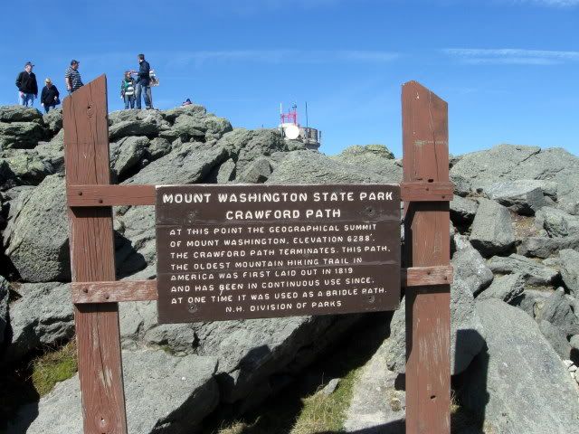
Good question. The same question came to my mind with I saw this sign up there the other day. If the sign is to be taken literally, and it is the geographical high point it is a bit removed from the summit sign.

024-4.jpg
 
At one point there was a plan to build a hotel on the summit. Literally *over* the summit, so that in the lobby would be the high point rocks. You could "climb" to the top right there inside. Fortunately, this did not happen, but it surely would have meant a lot of rock relocation had it been built.

*I believe this was mentioned in "Not Without Peril"
 
Since someone started the thread drift re washington.

I heard a comment from a summit employee once that the state park hauls up truckloads of crushed rock of various types and sizes every season for general maintenance of the roads, lots and walkways. They speculated that many tourists that visited Mt Washington, proudly have a rock from Pike Industries in Gorham NH in their collection of mementos.
 
Some people are content to claim a peak as long as they figure they've come close enough so that their head is above the true summit.

Personally, I never claim a peak unless I can stand on the exact summit on one foot facing due east and recite the 200-foot-col rule.
 
Good question. Maybe Roy S. knows - otherwise, next time you're in Lincoln, ask Steve Smith.
I don't know why or by whom every cairn was built and I'm not sure how long that one has been there, of course only a small percent are even supposed to be on summits.

But there used to be a more egregious error - one sign at the junction used to say "North Twin Mtn" and somebody with an old set of photos can probably produce it. I think we all agree that the spur is slightly higher.

I personally try to tag every potential highpoint which adds a few minutes to a typical trip, but I would never claim that anybody who went only to the sign and not the N viewpoint of Cabot shouldn't count it [although I would claim that anybody who went only to the clifftop on Osceola couldn't read a topographic map.]

One summit not yet mentioned is the twin summit of South Carter, an easy bushwhack and not yet enough travel for a herd path.
 
No idea, but I will ask the maintainer of N Twin Spur and see what he says about it. Only think I can think of is that is where the N Twin Trail ends and the N Twin Spur Trail begins -- I don't know if the cairn has anything to do with the Four Thousand Footers Club and peak bagging N Twin. :confused:

FWIW, I was the trail maintainer of North Twin Spur from 1993-1999. The cairn was there when I first began to maintain this trail.

My guess is that it is there as a trail intersection marker. Its proximity to treeline would probably allow for its existence.
 
FWIW, I was the trail maintainer of North Twin Spur from 1993-1999. The cairn was there when I first began to maintain this trail.

My guess is that it is there as a trail intersection marker. Its proximity to treeline would probably allow for its existence.

Thanks, Wardsgirl!
That makes a lot of sense :)..I bet the trees that are there now are also a fair bit taller than they were even ten years ago, making the cairn an important marker.
 
Personally, I never claim a peak unless I can stand on the exact summit on one foot facing due east and recite the 200-foot-col rule.

Thanks for this interjection Bob - this topic has a way of getting way too serious. I think it's one of the reasons that I've sworn off lists in the past. The best reason for the lists (in my opinion) is to give us a nudge to get to places that we might not go otherwise. Whether our feet (or foot as the case may be) are on the "true summit" somehow doesn't seem to matter all that much in the end.
 
I think this might be the "real" North Kinsman summit:


Man on a Mountain


Of course, I'm basing that on a description in a trail guide somewhere. At least when I was standing on this pointed rock last fall I couldn't see anything higher.

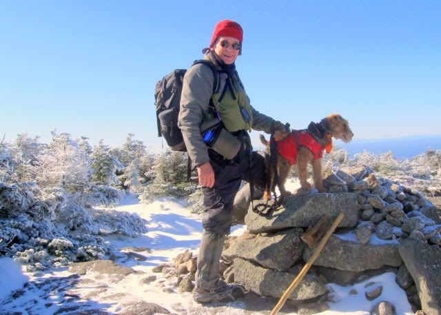
I was really wondering about this question yesterday. Lauky and I arrived at the summit of South Kinsman at the same time as a number of others. Some in the group insisted that the high point was this cairn where Lauky is posing.

IMG_3025.jpg


On the other hand, my GPS indicated that a spot to the left of the trail on the previous knob was higher. The GPS topo also indicated that the summit was located at that high point.

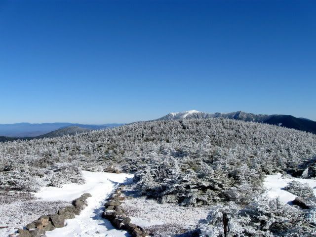
Standing were we were and looking back at the knob I would have said that it looked higher.

IMG_3027.jpg


Any thoughts?
 
Last edited:
Any thoughts?

Ed - as you approach South from the North, I've always felt the second bump was a few feet higher than the one you encounter shortly after leaving the trees. However, I must confess that once or twice in truly nasty conditions I've declared the first bump the summit and got the hell back into the trees.'

I would tend to trust your GPS, however. I don't recall ever consulting mine on either bump.
 
Some in the group insisted that the high point was this cairn where Lauky is posing.

On the other hand, my GPS indicated that a spot to the left of the trail on the previous knob was higher. The GPS topo also indicated that the summit was located at that high point.
Note that the MyTopo map incorrectly shows the trail dropping off the dogbone summit instead of following it to the SW bump.

The cairn is where the original survey point was, now hidden under the cairn. The NE point which also used to have a cairn is where the spot elevation is shown on the current USGS map hence is marked as the summit on the AMC and perhaps your GPS map. Of course neither a survey marker nor a spot elevation necessarily indicates a summit - it is just where somebody put a survey point.

Brent Scudder of view-finder fame is convinced that the cairn summit is substantially higher, I think it's slightly higher but in any case always hike to both since they're so close. I don't think an ordinary altimeter or GPS is accurate enough to prove the difference. For a couple years I've hoped to do a rough level survey but it hasn't happened yet - maybe somebody more agile would like to take on the project. Basically you need some sort of sighting level and a marked pole to sight against, the taller the pole the fewer steps you need across the col. The FOT48 folks are already carrying a pole or a backpacker could fasten together a couple tent poles then attach say a 16' tape to it for readings.
 
Thanks for the reply Kevin and Roy. I find that all very interesting. I haven't checked back but I think I may have a photo of the NE point cairn you mentioned.

Personally I tend to think the NE point is higher but as you say they're not that far apart.
 
Top