
You are using an out of date browser. It may not display this or other websites correctly.
You should upgrade or use an alternative browser.
You should upgrade or use an alternative browser.
Mount Clay Name Change Up Again
- Thread starter Waumbek
- Start date
Help Support vftt.org:
This site may earn a commission from merchant affiliate
links, including eBay, Amazon, and others.

psmart
Active member
It seems to conflict with the Forest Plan, at least for the A.T. which is to have signs at significant points?
Are there any signs on the AT within the WMNF that would be affected? Most of the existing signs on the AT, if not all, would be navigational signs at junctions that would be preserved under the new sign plan.
Ed'n Lauky
Well-known member
- Joined
- Feb 15, 2007
- Messages
- 1,802
- Reaction score
- 168
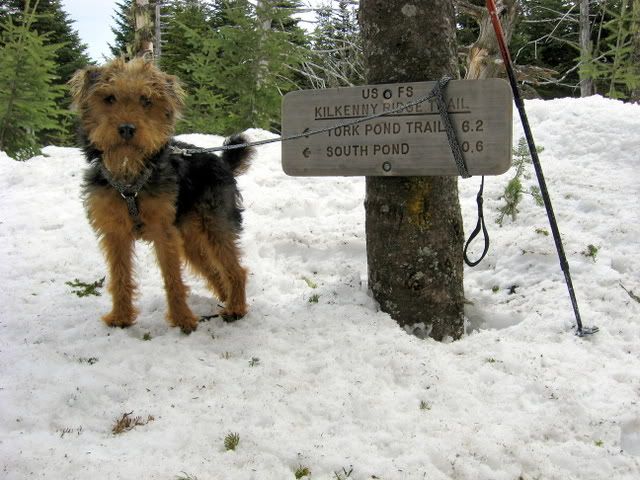
What NH4Ks still have signs with the peak name and/or elevation? Scanning my summit photos I can find only 4
Tim
Looking back through the photos I've already posted in the past and for which I have the img code here are a few of the signs:
The Waumbek sign doesn't say Waumbek, but at least it sits at the summit.
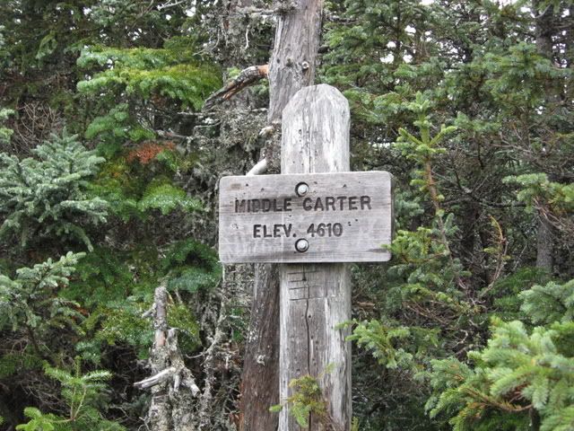
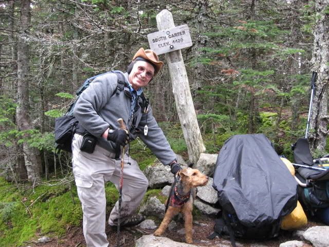
The Carter signs came down just after I took the pictures. I crossed paths just after middle Carter with the ranger who took them down. As you can see there was nothing wrong with the Middle Carter sign, and if MJ hadn't been leaning so hard on the South Carter sign it wouldn't have been leaning either.
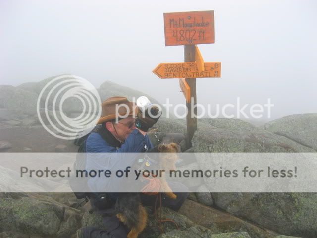
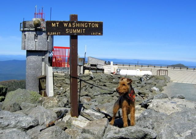
Waumbek is a navigational sign, like North Twin and dozens of others. Aside from the occasional semi-concealed stick sign, we still only have the following "permanent" summit signs:
Washington (in a state park)
Moosilauke (privately owned)
Cabot
Zealand (not an official sign)
Of those, Cabot is the only one which appears to be an official sign.
Tim
Washington (in a state park)
Moosilauke (privately owned)
Cabot
Zealand (not an official sign)
Of those, Cabot is the only one which appears to be an official sign.
Tim
RoySwkr
New member
- Joined
- Sep 4, 2003
- Messages
- 4,467
- Reaction score
- 285
Are there any signs on the AT within the WMNF that would be affected? Most of the existing signs on the AT, if not all, would be navigational signs at junctions that would be preserved under the new sign plan.
Several notes here refer to S & M Carter for starters, and I think there might be signs on Webster and Little Haystack among others
And I'm sure the A.T. hikers here will agree that summit signs are common on other parts of the A.T. hence it is the WMNF that is out of step
I would say that Washington and Moosilauke are official signs placed by representatives of the peak owner, just like CabotWashington (in a state park)
Moosilauke (privately owned)
Cabot
Zealand (not an official sign)
Of those, Cabot is the only one which appears to be an official sign.
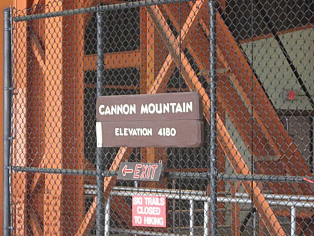
Hopefully somebody will post a photo of the Cannon sign which is similarly official
I would say that Washington and Moosilauke are official signs placed by representatives of the peak owner, just like Cabot
By official, I meant USFS signs - Cabot's looks like other USFS signage in the area while Moosilauke's and Washington's do not.
Roy, where do you recall the Cannon sign to be located? I've never seen it, but that doesn't mean it does not exist.
Tim
Ed'n Lauky
Well-known member
- Joined
- Feb 15, 2007
- Messages
- 1,802
- Reaction score
- 168
Hopefully somebody will post a photo of the Cannon sign which is similarly official
This sign is located at the lift entrance up on top but not at the actual summit. I don't know if there is another one up there.
Ed'n Lauky
Well-known member
- Joined
- Feb 15, 2007
- Messages
- 1,802
- Reaction score
- 168
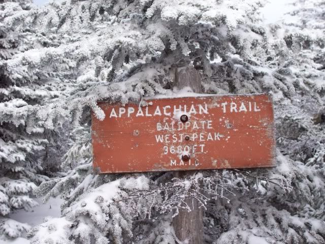
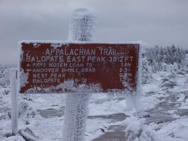
Here are a couple of Maine AT summit signs:
RoySwkr
New member
- Joined
- Sep 4, 2003
- Messages
- 4,467
- Reaction score
- 285
I remember a sign on the tower structure itself, probably at the bottom but maybe higher upRoy, where do you recall the Cannon sign to be located? I've never seen it, but that doesn't mean it does not exist.
If this is true, 100% of the non-WMNF 4k have summit signs which may be an indication that the Forest Service is out of touch
arghman
New member
- Joined
- Sep 1, 2004
- Messages
- 1,352
- Reaction score
- 153
not to change the topic, but does anyone know when the USGS comment period ends?
Moderator Note: As hard as it may be, please do not make this discussion political.
Tom Rankin
Well-known member
I don't know who makes them, but there is one on Wildcat A as well. Somewhat concealed, not far from the view point overlooking the Hut.nice stick sign..wonder who makes those....very cool...
Mt Clay Remains Mt Clay from NHPR.org
“The proposal to change the name of Mount Clay to Mount Reagan was disapproved at a vote of 11 against and one absention.”
That’s Lou Yost. He’s the Executive Secretary of the board’s Domestic Names Committee.
Tim
“The proposal to change the name of Mount Clay to Mount Reagan was disapproved at a vote of 11 against and one absention.”
That’s Lou Yost. He’s the Executive Secretary of the board’s Domestic Names Committee.
Tim
Elizabeth
New member
Hooray!
So glad to see that the name has not been changed (not that I ever would have called it Reagan anyhow). The name of the person making the announcement - Lou Yost is a riot. At first I though it was a joke and a play on "You Lost" to those who wanted the change.
So glad to see that the name has not been changed (not that I ever would have called it Reagan anyhow). The name of the person making the announcement - Lou Yost is a riot. At first I though it was a joke and a play on "You Lost" to those who wanted the change.
Last edited:
Ed'n Lauky
Well-known member
- Joined
- Feb 15, 2007
- Messages
- 1,802
- Reaction score
- 168
Now, just to be contrary I think I will schedule one of my next hikes up to MOUNT REAGAN
DreamFarmer
Active member
Whew ! Good News!
-Clay
-Clay
Fisher Cat
New member
- Joined
- Jul 27, 2007
- Messages
- 789
- Reaction score
- 109
Now let's find an unnamed peak and name it after NH's First Son and arguably one of the most able military commanders of the Revolution, John Stark, who after assuming command for a second time insisted on NH boys in his regiments, or else. Heck, while we're at it, name one for his wife, Molly, as well.
Kevin Rooney
New member
- Joined
- Sep 15, 2003
- Messages
- 3,667
- Reaction score
- 354
Ed Hawkins is probably in mourning...