Jazzbo
Well-known member
- Joined
- Jan 1, 2005
- Messages
- 1,197
- Reaction score
- 163
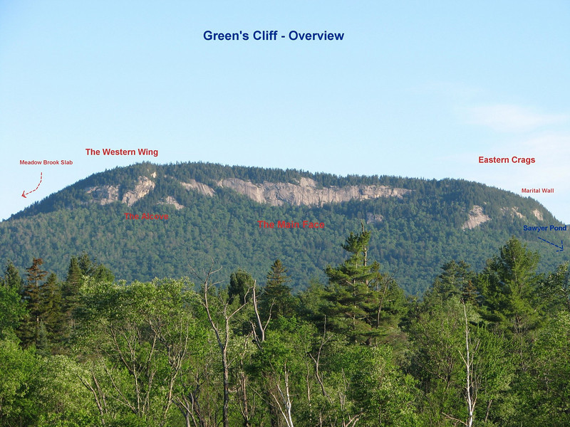
Greens Cliff is another place I’ve wanted to visit for years. I decided this was going to be the year. I tried to interest some other bushwhacking types to join me on this, but we could not get schedules to mesh so it was decided to just do solo. Greens Cliff just isn’t on most people’s peak bagging lists. I later learned Greens Cliff is on a NH200 list so there is some motivation. Greens has always been an attraction for me. The bold cliffs looks so inviting when viewed from Kancamangus highway not far from Sabbaday Brook TH, but in particular when viewed from Mount Tremont. This is photo I took a couple of years ago from Mt Tremont. Greens Cliff is a classic Roche Moutonnee.
Now the question was which way to go. I wanted to get there a different way from normal. Standard routes take usually involve starting from Sawyer River Road or Sawyer River Trail TH. I wanted to pass by Church Ponds to see what the view of Greens Cliff looked like from there and then approach from the south side thinking I could find a way up via the forested areas around the so-called eastern crags. This photo from Mountain Project rock climber’s web site shows forested area near the Eastern Crags I had in mind.
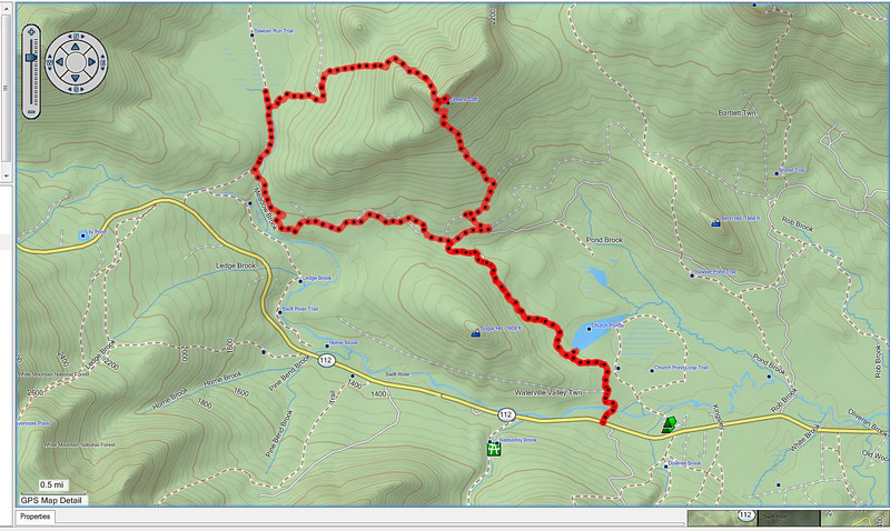
The GPS track shown here shows way I ended up taking. It can be seen I passed just west of the main wall. This was a nice route through open woods all the way and I would recommend it to others. However I might recommend starting from Sawyer River Trail TH instead of going by Church Pond.
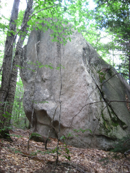
So that’s what I tried to do, except actual conditions always get in the way. I planned to follow snow mobile trails (actually logging roads) leading to someplace called Swans Junction where I would catch skidder trails that approach the upper cliffs. I got off to bad start by not finding the right skidder trail. I had to whack up slope to catch the right skidder trail. Skidder trails were pretty overgrown so I decided to just attack the slope and attempt reaching the cliffs. I encountered lots of big boulders like this one plucked off the cliffs from above. Classic example of glacial plucking off downstream sides of Rouch Moutonnee.
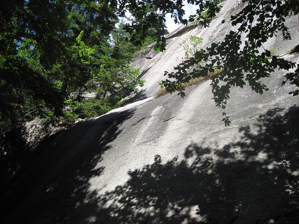
I ended up going up, up, up until I topped out above some ledges at 2500 feet elevation or so. Just below 2500' I encountered some of the smaller ledges.
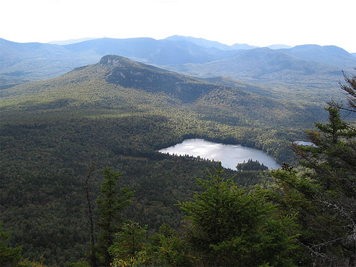
I headed west and shortly reached a narrow ridge which led up to upper level up above the main wall. The narrow ridge offered some nice views to the south of Tripyramids etc. I located the summit canister and stopped for lunch and to rest.
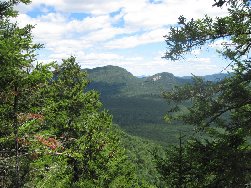
The summit of Greens Cliff has one small view of Owls Cliff and Mount Tremont.
I found that JR Stockwell, a noted bush whacker, had signed into the register earlier that day. Marchowes had signed in 1 week earlier.
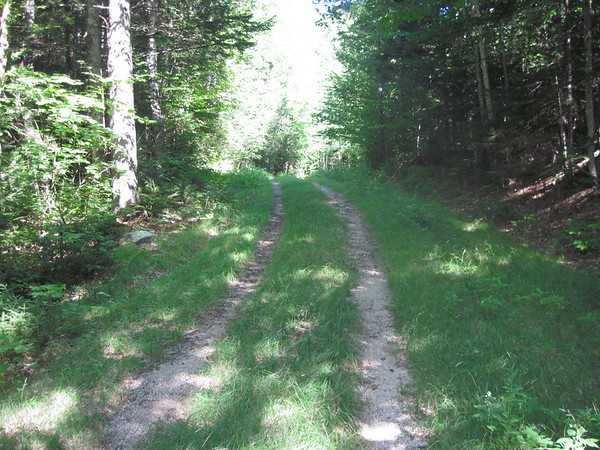
I made good time getting to the peak and decided to return the way I came. If I could find my original route I would make it back with plenty of time. I made a wrong turn and ended up heading down the north slope. I decided to keep going this way and to work my way over to the Sawyer River Trail which lay towards the west. Woods weren’t too bad and I lost elevation quickly. I started to work my way westward and crossed two skidder road before reaching FR 83. FR 83 appears to dead end on my map, but I thought it might keep going. It does indeed come to a dead end so I resumed working my way westward. This time the woods were not so friendly. In fact I reached one point just before reaching the Sawyer River Trail that was downright nasty and I got scratched up pretty badly. I crossed Meadow Brook and was very pleased to be on Sawyer River Trail. I walked north to check out the bridge and boggy area and then started hiking at a brisk pace so as not to get back too late.
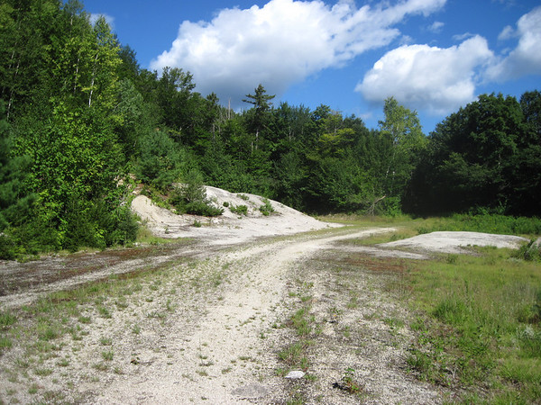
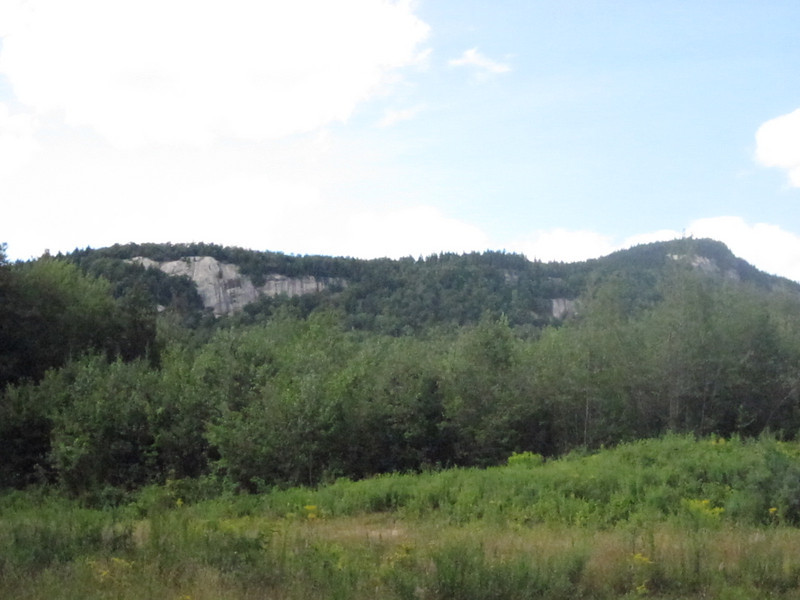
I reached junction with Nanamocomuck Ski Trail / Snowmobile Trail and turned left. I crossed another big wooden bridge and reached a junction where the snowmobile trail leaves the ski trail. I left the ski trail and continued on the snowmobile trail. It might have been shorter to take the ski trail, but what the heck! I did pass by a logging yard that offered this nice view of the cliffs.
I was soon at the ford of the Swift River which was easy to cross what with the drought conditions and all. I changed into sandals and the cold water felt good on my bare feet. The GPS track indicates I hiked 12 miles and was out for 9 hours. Sort of long day for minor peak like Greens, but I was glad to have visited some new trails and seldom visited areas. I really enjoy having the GPS. It's really adding new dimensions to my travels.
Now the question was which way to go. I wanted to get there a different way from normal. Standard routes take usually involve starting from Sawyer River Road or Sawyer River Trail TH. I wanted to pass by Church Ponds to see what the view of Greens Cliff looked like from there and then approach from the south side thinking I could find a way up via the forested areas around the so-called eastern crags. This photo from Mountain Project rock climber’s web site shows forested area near the Eastern Crags I had in mind.
The GPS track shown here shows way I ended up taking. It can be seen I passed just west of the main wall. This was a nice route through open woods all the way and I would recommend it to others. However I might recommend starting from Sawyer River Trail TH instead of going by Church Pond.
So that’s what I tried to do, except actual conditions always get in the way. I planned to follow snow mobile trails (actually logging roads) leading to someplace called Swans Junction where I would catch skidder trails that approach the upper cliffs. I got off to bad start by not finding the right skidder trail. I had to whack up slope to catch the right skidder trail. Skidder trails were pretty overgrown so I decided to just attack the slope and attempt reaching the cliffs. I encountered lots of big boulders like this one plucked off the cliffs from above. Classic example of glacial plucking off downstream sides of Rouch Moutonnee.
I ended up going up, up, up until I topped out above some ledges at 2500 feet elevation or so. Just below 2500' I encountered some of the smaller ledges.
I headed west and shortly reached a narrow ridge which led up to upper level up above the main wall. The narrow ridge offered some nice views to the south of Tripyramids etc. I located the summit canister and stopped for lunch and to rest.
The summit of Greens Cliff has one small view of Owls Cliff and Mount Tremont.
I found that JR Stockwell, a noted bush whacker, had signed into the register earlier that day. Marchowes had signed in 1 week earlier.
I made good time getting to the peak and decided to return the way I came. If I could find my original route I would make it back with plenty of time. I made a wrong turn and ended up heading down the north slope. I decided to keep going this way and to work my way over to the Sawyer River Trail which lay towards the west. Woods weren’t too bad and I lost elevation quickly. I started to work my way westward and crossed two skidder road before reaching FR 83. FR 83 appears to dead end on my map, but I thought it might keep going. It does indeed come to a dead end so I resumed working my way westward. This time the woods were not so friendly. In fact I reached one point just before reaching the Sawyer River Trail that was downright nasty and I got scratched up pretty badly. I crossed Meadow Brook and was very pleased to be on Sawyer River Trail. I walked north to check out the bridge and boggy area and then started hiking at a brisk pace so as not to get back too late.
I reached junction with Nanamocomuck Ski Trail / Snowmobile Trail and turned left. I crossed another big wooden bridge and reached a junction where the snowmobile trail leaves the ski trail. I left the ski trail and continued on the snowmobile trail. It might have been shorter to take the ski trail, but what the heck! I did pass by a logging yard that offered this nice view of the cliffs.
I was soon at the ford of the Swift River which was easy to cross what with the drought conditions and all. I changed into sandals and the cold water felt good on my bare feet. The GPS track indicates I hiked 12 miles and was out for 9 hours. Sort of long day for minor peak like Greens, but I was glad to have visited some new trails and seldom visited areas. I really enjoy having the GPS. It's really adding new dimensions to my travels.
")