Old Pictures - Can you identify locations?

vftt.org

Help Support vftt.org:

This site may earn a commission from merchant affiliate links, including eBay, Amazon, and others.

Kurchian

Member
Joined
Sep 3, 2003
Messages
68
Reaction score
8
Location
Reading, MA
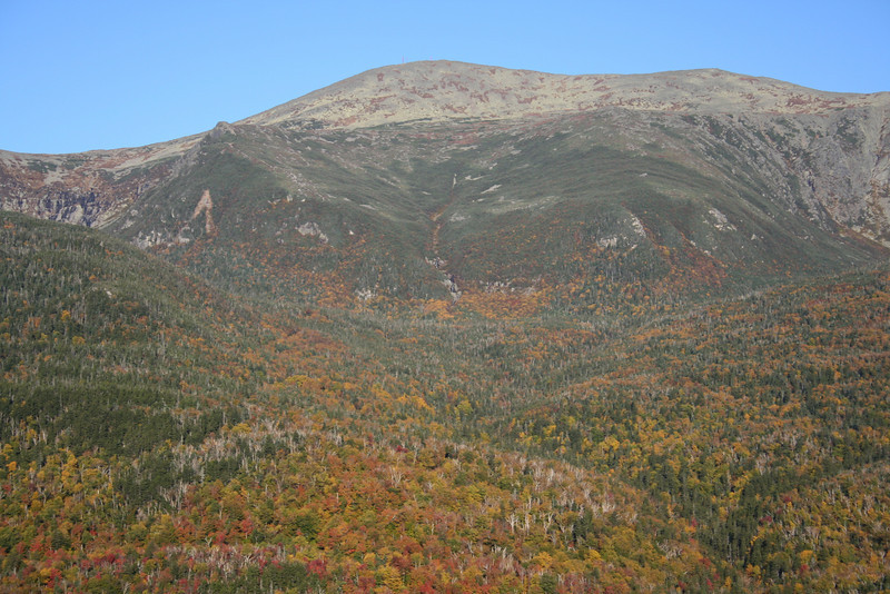
This is the third set of old family pictures from the 1950's/60's that I have recently discovered.

Can you identify the locations?
 
The 3rd and 4th pictures are of the old Cannon Mountain Tram.

If you scroll down on THIS page, you'll see one of the old Trams in front of the NE Ski Museum at Cannon.

It was the first aerial tram built in North America, and was replaced in 1980 with the current tram.
 
Last edited:
thanks for sharing. I thought the same as the others. #2 on rt 16 but did not know it had a name.

my parents have a slides of me riding the old tram. I must of been 3 yrs old.
 
thanks for sharing. I thought the same as the others. #2 on rt 16 but did not know it had a name.

It was a bit hairier before they did the widening in recent years. when I was a kid there was the "legend" about a Jeep accident in the mid to late 60's, where the driver was heading southbound, couldn't negotitate the curve, busted through the guardrail, and the Jeep got caught in the treetops and it was supposedly sometime before the bodies were found. Never, in fact, found out anything about it when I got older, but parents loved to play with our minds....just like the story of a dead body found in the ol' Mascot Mine......

In fact, there was one accident where a driver went through the guardrail on Dead Man's Curve, but not at the steepest point, and he escaped with minor injuries, pretty sure it was early to mid 90's.
 
Back in the early 2000's there was a rockslide on what I think is that curve. They detoured the road up and over, nearly straight. You can still see this today as the vegetation grows back.
 
The Curve

I didn't realize that curve had a name, but it seems appropriate. I was riding shotgun in an International Scout heading southbound in the snow. We hit that curve, spun wildly, and flipped over on our side. I thought for sure we were going over the guard rail.

:eek:

A few other cars stopped and with some helpful hands we righted the Scout and drove on home like nothing happened.

:cool:
 
I'm attaching 4 more pictures that I recently discovered. These were taken around 1960. These appear to be taken from the Mt. washington auto road. ANy guesses on what mountains we are looking at?NH13.jpgNH14.jpgNH15.jpgNH16.jpg
 
#13: Jefferson's Knees, Adams, Madison; #14: Adams, JQ Adams, Madison; #15: looks to be looking into Tucks with Boott Spur (Doubleheads etc in back); #16; Lion's Head and Tucks with Mt Washington summit; in 13 I always get confused by that bump before Adams, would that Abigail or Sam or another one???
 
Last edited:
Guessing #16 is taken from Square Ledge across the street.
It looks similar to this photo I took in 2007

IMG_2097-L.jpg
 
Agreed.

13 is looking north across the great gulf from near the summit of Mt Washington. Those boulders in the foreground and gravel at bottom right could be the edge of the auto road. Visible are the eastern slopes of Jefferson, Adams, and much of Madison. A few peaks in the distance are surely identifiable as well, but I'm too lazy.

14 pans a little further east than 13, from a spot on the auto road rather lower and farther east than the first one. Could be the southerly loop of the road east of Nelson Crag, where the Nelson Crag trail almost touches. Mt Quincy Adams is now visible, along with more of Madison (Osgood ridge).

15 is way back up on the summit cone - I'm not completely certain but I think Lefty's right: that's looking southeasterly over Tuckerman Ravine at Boott Spur.

16 - Billy nailed it.
 
It was a bit hairier before they did the widening in recent years. when I was a kid there was the "legend" about a Jeep accident in the mid to late 60's, where the driver was heading southbound, couldn't negotitate the curve, busted through the guardrail, and the Jeep got caught in the treetops and it was supposedly sometime before the bodies were found. Never, in fact, found out anything about it when I got older, but parents loved to play with our minds....just like the story of a dead body found in the ol' Mascot Mine......

In fact, there was one accident where a driver went through the guardrail on Dead Man's Curve, but not at the steepest point, and he escaped with minor injuries, pretty sure it was early to mid 90's.

These things can happen. I was told about a motorcyclist who wasn't found for a while because his body was up in a tree. Not in the Whites but in Yosemite not that long ago. Unsettling, for sure.
And maybe a good message for kids to think about.
 
OK, without looking at other answers:

1. is Glen Ellis Falls. I took a pic or two from the same spot last July 21.

2. is looking NE-ward at the western end of Wildcat from Rt. 16, maybe a mile south of Pinkham Notch.

3. is looking NE-ward into the north end of Franconia Notch and beyond from near or at Cannon's summit.

4. is decending the skilift on Cannon.

For the second round of pics:

1. Is across the Great Gulf to Adams and Sam Adams at center, Madison at right, and eastward shoulder of Jefferson to the knees.

2. Adams, JQ Adams and Madison (L to R)

3. Nelson Crag and into Gorham, with north end of Moriahs top right.

4. Up to Washington from the Cow Pasture? Not as sure about this one.

(On Edit: I agree with the others who posted before about the last two. I was thrown off by the Auto Road reference and was looking for angles from that area. Clearly incorrect, I can see, looking back at them. Fun exercise. :) )
 
Last edited:
OK here are a few more...some easy, some kinda difficult...ranging from 25 - 35 years ago:

001.jpg 002.jpg 003.jpg 004.jpg 005.jpg

Answers below on post #23 if you'd rather not have them spoil the fun.
 
Last edited:
I couldn't put more than 5 images per message so here's another batch:

006.jpg 007.jpg 008.jpg 009.jpg 010.jpg

Answers below on post #23 if you'd rather not have them spoil the fun.
 
Last edited:
1 & 5: Dunno these shelters.
2: Nubble Peak, based on elevation - I've never been there.
3: Ammonoosuc Ravine Trail at about 4500'.
4: Lafayette Summit.

6. Dunno.
7. Carrigain from Zeacliff?
8. Dunno, but I want to!
9. Mt. Jackson summit?
10. Mt. Willey view across Crawford Notch to the Presidentials.
 
Top