
1HappyHiker
Well-known member
The primary goal of this "route less-traveled" loop-hike was to enable my hiking buddy Steve to redline the Parapet Trail. Since we were already going to be doing one of the less-traveled trails in the Whites, it was decided to throw in a couple more while we were at it!
We began the loop on the Great Gulf Trail, and then joined the Madison Gulf Trail to hook up with the Parapet Trail. We used the Daniel Webster Scout Trail as our descent route. We could have ended the loop at the same trailhead where we began our trek by incorporating the Great Gulf Link Trail. However, we opted to spot a car in the Dolly Copp Campground (trailhead for the Daniel Webster Scout Trail).
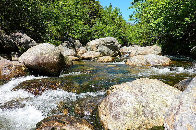
Since the Madison Gulf Trail is a rugged trail (especially at the upper end), it was a nice warm-up to begin the hike on the mild-mannered lower segment of the Great Gulf Trail. We made a couple of quick stops along the Peabody River West Branch to snap a few photos such as the one shown below.
It seemed like no time at all before we came to the junction with the Madison Gulf Trail. Although Steve had previously hiked this trail, it was my first time. I was truly awed by the beauty, the wildness, and the challenging rock-scrambles that this trail provides.
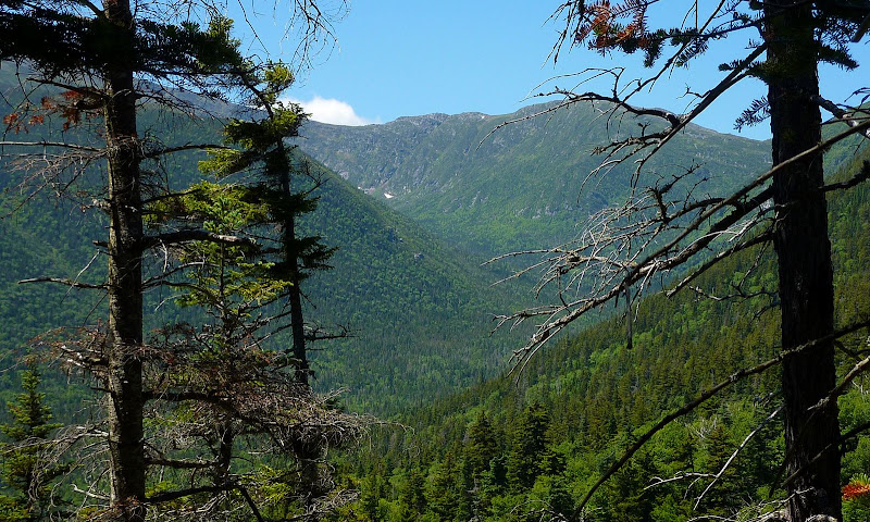
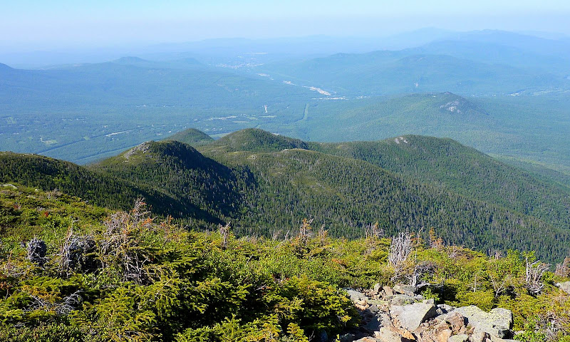
Below tree-line on the Madison Gulf Trail, there are many tantalizing "peek-a-boo" views such as shown in the photo below.
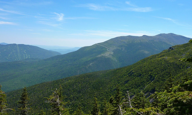
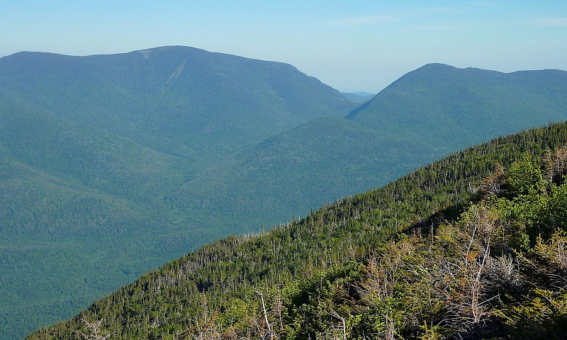
And once you break out above tree-line, there are abundant unobstructed views, such as the vista shown in the photo below.
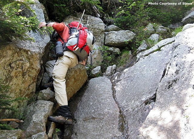
Yes, climbing the headwall of Madison Gulf does involve some rock scrambling (me scrambling in the photo below).
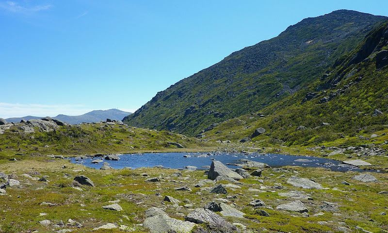
Upon reaching the Parapet Trail, we took a very short side-trip to snap a few photos of Star Lake. This diminutive pool of water is only about a half-acre in area. But, it's a rare treat to see a body of water at nearly 4,900 ft elevation which is surrounded by peaks towering over it which are even higher!
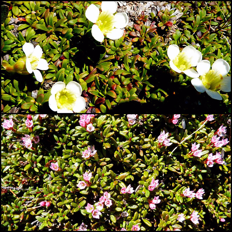
In the general vicinity of Star Lake and The Parapet were scatterings of alpine flowers such as those shown in the photo collage below.
The summit of Madison was tantalizingly close. However, in the interest of time and practicality, we had already decided to exclude this as a side-trip destination. And besides, we'd both been there many times before. So, after having our lunch at the Parapet viewpoint we began our hike on the Parapet Trail to complete Steve's redlining mission.
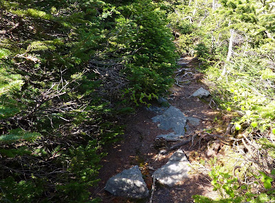
There are constant views from the Parapet Trail, which are simply marvelous. However, it is a trail that you probably wouldn't want to hike on any regular basis. Large segments of the trail consist of huge chunks of uneven talus which makes for challenging footing. However, there are some segments that are relatively mild-mannered such as shown in the photo below.
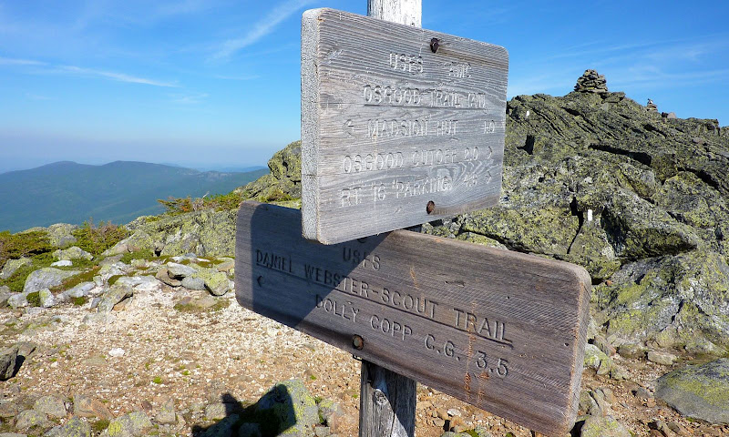
Upon arriving at the Osgood Trail this signaled the end of the redlining mission. Also at this same trail junction is the western terminus of the Daniel Webster Scout Trail which is the route we'd use for our descent. This trail was also brand new to me, but Steve had hiked it once before several years ago.
Just as the WMG indicates, the upper portion of this trail is challenging. There is nearly a mile's worth of trekking over large, uneven talus, which is complicated by a very steep terrain. However, this upper portion of trail does provide nice views of the Howker Ridge with the unique bumps known as the "Howks". One of the Howks (unofficially known as the Fourth Howk) has an elevation of 4,315 ft, but an insufficient depth of col prevents it from being recognized as one of the NH 4K peaks.
Below is a photo of the "Howks" along the Howker Ridge.
Also from the upper portion of the Daniel Webster Scout Trail, there are also some pretty good views of the Carter Notch area, as shown in the slightly zoomed photo below.
This was a very enjoyable adventure with the added attraction of Steve completing his mission to redline the Parapet Trail. Plus, it provided me with the opportunity to hike 3 trails that were completely brand new to me, i.e. the Madison Gulf Trail, the Parapet Trail, and the Daniel Webster Scout Trail.
1HappyHiker
________________
P.S. More photos and additional narrative about this hike can be found at my hiking buddy's blog (Click HERE).
We began the loop on the Great Gulf Trail, and then joined the Madison Gulf Trail to hook up with the Parapet Trail. We used the Daniel Webster Scout Trail as our descent route. We could have ended the loop at the same trailhead where we began our trek by incorporating the Great Gulf Link Trail. However, we opted to spot a car in the Dolly Copp Campground (trailhead for the Daniel Webster Scout Trail).
Since the Madison Gulf Trail is a rugged trail (especially at the upper end), it was a nice warm-up to begin the hike on the mild-mannered lower segment of the Great Gulf Trail. We made a couple of quick stops along the Peabody River West Branch to snap a few photos such as the one shown below.
It seemed like no time at all before we came to the junction with the Madison Gulf Trail. Although Steve had previously hiked this trail, it was my first time. I was truly awed by the beauty, the wildness, and the challenging rock-scrambles that this trail provides.
Below tree-line on the Madison Gulf Trail, there are many tantalizing "peek-a-boo" views such as shown in the photo below.
And once you break out above tree-line, there are abundant unobstructed views, such as the vista shown in the photo below.
Yes, climbing the headwall of Madison Gulf does involve some rock scrambling (me scrambling in the photo below).
Upon reaching the Parapet Trail, we took a very short side-trip to snap a few photos of Star Lake. This diminutive pool of water is only about a half-acre in area. But, it's a rare treat to see a body of water at nearly 4,900 ft elevation which is surrounded by peaks towering over it which are even higher!
In the general vicinity of Star Lake and The Parapet were scatterings of alpine flowers such as those shown in the photo collage below.
The summit of Madison was tantalizingly close. However, in the interest of time and practicality, we had already decided to exclude this as a side-trip destination. And besides, we'd both been there many times before. So, after having our lunch at the Parapet viewpoint we began our hike on the Parapet Trail to complete Steve's redlining mission.
There are constant views from the Parapet Trail, which are simply marvelous. However, it is a trail that you probably wouldn't want to hike on any regular basis. Large segments of the trail consist of huge chunks of uneven talus which makes for challenging footing. However, there are some segments that are relatively mild-mannered such as shown in the photo below.
Upon arriving at the Osgood Trail this signaled the end of the redlining mission. Also at this same trail junction is the western terminus of the Daniel Webster Scout Trail which is the route we'd use for our descent. This trail was also brand new to me, but Steve had hiked it once before several years ago.
Just as the WMG indicates, the upper portion of this trail is challenging. There is nearly a mile's worth of trekking over large, uneven talus, which is complicated by a very steep terrain. However, this upper portion of trail does provide nice views of the Howker Ridge with the unique bumps known as the "Howks". One of the Howks (unofficially known as the Fourth Howk) has an elevation of 4,315 ft, but an insufficient depth of col prevents it from being recognized as one of the NH 4K peaks.
Below is a photo of the "Howks" along the Howker Ridge.
Also from the upper portion of the Daniel Webster Scout Trail, there are also some pretty good views of the Carter Notch area, as shown in the slightly zoomed photo below.
This was a very enjoyable adventure with the added attraction of Steve completing his mission to redline the Parapet Trail. Plus, it provided me with the opportunity to hike 3 trails that were completely brand new to me, i.e. the Madison Gulf Trail, the Parapet Trail, and the Daniel Webster Scout Trail.
1HappyHiker
________________
P.S. More photos and additional narrative about this hike can be found at my hiking buddy's blog (Click HERE).
Last edited:
