Temporary Closure of Lincoln Woods trail

vftt.org

Help Support vftt.org:

This site may earn a commission from merchant affiliate links, including eBay, Amazon, and others.
What would work far better then venting on an internet forum is if someone with media skills got an article published about the impact of such a significant trail closure would have on the general public, folks like Steve Smith or Mike Dickerman could do it but they both need to be careful on what fights to pick. Hikers bagging summits are only a small percentage of those who use Lincoln Woods and we don't tend to spend enough money to get a lot of attention. Franconia falls is quite a popular tourist attraction for the general tourist and they are the ones with economic impact, get the Lincoln businesses cranked up that they are losing business due to the trail being closed and then there may be far more attention paid.

Bullseye, you got that one right. Two excellent points. Folks with pull do have to pick which battles to fight, no sense in a Phyrric victory with some many land issues juggling in the air at any given time. Spend some time ( this is my 25th, almost 26th, year of volunteer trailwork) volunteering on trails and see what it is like wading through the tides of change on all levels, local, state, and federal government, PLUS- the wave of public opinion.

Second point is usage, the one with big economic impact matters. Go and watch the amount of bikers, strollers, and runners on LWT.

Nice job peakbagger, input from a true local.
 
Yes, lots of excellent points of view.

==The Forest Service is doing its job; it should be praised. Could it do it better? Of course, and it's great to lobby them to do so. But it beats the heck out of the alternatives (like Dry River or ... The Bridge). I'm glad that they're taking care of such an important resource.

==We shouldn't mix the maintenance of the Lincoln Woods Trail with other issues without understanding that that's what we're doing: They should be praised for Lincoln Woods maintenance; they should be held accountable for (and should own in every respect) what they did with The Bridge and (to date) the lack of response in the Dry River area. I would disagree heartily that the destruction of The Bridge as a resource was the work of one person. She ("Molly," I don't even know her full name -- and that's fine) may have thought it all up and done it all herself, but she wore a uniform during the process and the FS must own its output. Should they one day agree that they acted foolishly, they should make such amends as a borg-like creature is capable of and try harder next time.

=="That's Just the Way It Is (some things will never change)": If the act of Congress makes it difficult/impossible (in high water) to keep important pieces of the sandbox for us all to use, then the act should be amended. It shouldn't be impossibly hard to tweak an important work in progress. I'm fairly certain Thomas Jefferson would agree on this.

==Agree on the tremendously valuable input of several posters here: great work!

=="Peace and love, peace and love." --Ringo Starr
 
Last edited:
If you've planned a trip for early/mid august with friends and you're coming from afar and you were planning on using the LWT, then to you, it is a big deal.

I guess that applies to me too since I'll be driving over 1000 miles to get to NH and I just happen to need Bondcliff and Owls Head to complete the 48. Hard to believe they are probably closing LWT just before I get there. But hey, life is full of obstacles and ironies abound. In the overall scheme of things, its not that big a deal. We will ford the river if its safe, bushwhack if we have to, or simply hike another mountain.
 
I walked past the 50' section they're working on today, and can't believe they're closing the trail at all, much less for any length of time. Your tax dollars hard at work.
 
Unfortunately we live in a day and age that many people are eager to sue someone due to their own ignorance and that leaves the workers no choice but to shut down trails entirely while they work. I'm no rocket scientist but I know to step out of the way of a 20,000 pound dump truck or stay away from heavy machinery. Why do you think they had to close Greeley Ponds Tr/Dry River Tr/Rocky Branch Tr? Someone may fall into a washout or have trouble finding the trail and get lost. G-- for bid should anyone have to pay attention to the natural environment.

It could be worse, it looks like the current plan for Dry River is just abandon the trail network after making a justification that it cant effectively be done with volunteer labor as the FS has decided its too costly to do repairs "the right way" (rather than using mechanized equipment which is perfectly legit in this case).

This is sad. How hard would it be to limb up a few trees to make a path around the washouts? This IS a wilderness area. I thought primitive conditions are what to expext? Note: I don't want a thread drift here, I'm just venting.
 
from a peak bagging perspective i don't see any reason people cannot still hike owls head, bondcliff, etc. were i looking to hike those peaks in aug or sept after construction began i wouldn't let this dissuade me. i would simply hike out and back from the north. for owlshead use twin brook trail and lincoln brook trail to the slide (or get more creative with some sort of bushwack from the north). for bondcliff just out and back from zealand or twins. a bit more elevation gain to either summit, but in terms of overall distance not all that different.

bryan
 
I guess that applies to me too since I'll be driving over 1000 miles to get to NH and I just happen to need Bondcliff and Owls Head to complete the 48. Hard to believe they are probably closing LWT just before I get there. But hey, life is full of obstacles and ironies abound. In the overall scheme of things, its not that big a deal. We will ford the river if its safe, bushwhack if we have to, or simply hike another mountain.

If you're driving that far for just those two peaks, there are other options even if more difficult. One thing to check on at the time of arrival is the flow of the Pemi. At the time the bridge was taken down Lauky and I went up the East side to take a look. At the point where the trail was closed up to the bridge we simply whacked up to the bridge. There, to our surprise, we met a ranger who promptly wrote us up, although no fine, and sent us on our way. We continued up stream and without any difficulty rock hopped across and went back on the west side. All that being said, there are times, especially above where Franconia Brook enters, that you can cross without too much trouble.

You can also approach both Owls Head and Bondcliff from the other side. You can get to Owls Head by going up and over Galehead and down Twin Brook and Lincoln Brook. Sure it's more difficult, but it can be done. An out and back to Bondcliff from the Zeeland trailhead is also quite possible.

Probably not the number one choice for either one but if you're driving a 1000 miles just to get them it could be done.
 
Last edited:
Frankly, if the Forest Service thought like a road construction crew, they would find a way to keep the 'lane' open such as using orange survey tape/sign on the side of the trail to direct hikers away from the working area. They are not working on the 'entire' trail. That's why it makes me wonder if they are really being sensitive to everyone's needs and instead, want to remind everyone of their 'authority' to close trails at will.

Road construction crews also have much more open real-estate to work with. Parking heavy equipment on a two lane road with breakdown lanes leaves plenty of room. Parking it on a trail no more than the width on one lane on that road doesn't leave much if any room. And then it is still going to need to move around, pivot, swing arms out, etc. They aren't working on the entire trail, but the equipment probably will take up the entire trail.
 
... At the point where the trail was closed up to the bridge we simply whacked up to the bridge. There, to our surprise, we met a ranger who promptly wrote us up, although no fine, and sent us on our way. We continued up stream and ...

I am curious as to why you were written up-- was it because you were on a closed trail or was it because they were doing work in the area?
 
I guess that applies to me too since I'll be driving over 1000 miles to get to NH and I just happen to need Bondcliff and Owls Head to complete the 48. Hard to believe they are probably closing LWT just before I get there. But hey, life is full of obstacles and ironies abound. In the overall scheme of things, its not that big a deal. We will ford the river if its safe, bushwhack if we have to, or simply hike another mountain.

Sounds like a perfect opportunity to bushwhack down West Bond. Getting down to the Franconia Brook Trail from W. Bond is a very enjoyable bushwhack. I've never bush whacked up the Eastern side of OH... but have been told its very doable if you hit the right line.

If I were in your shoes, I'd straight-line it. Stay the night at Greenleaf hut, bushwhack down Lincoln Slide, hike up OH from its "official" trail, then either bushwhack down and up W Bond, or Bushwhack down the North side of OH to 13 falls tent site.

The Lincoln Woods trail closure simply makes alternate routes more desirable.
 
I am curious as to why you were written up-- was it because you were on a closed trail or was it because they were doing work in the area?

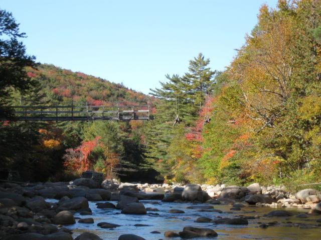
At the time we were there, there was no work going on, however, while the cables were still up half of the wooden structure had been taken down. No doubt that is why the young ranger was posted there reading his book. We never set foot on the closed trail, there was nothing that said not to approach the work site or even that there was a work site, and we approached through the woods. We were never charged with anything but he wrote down all our (I guess I should say my--Lauky got off without so much as a paw print) info--name address etc. Because we were alone we had come up quietly and we really caught the young fellow by surprise. He had an extremely "startled" almost "worried" look on his face. We talked for a moment then he sent us on our way, we started off then suddenly as if it were an after thought he called us back, pulled out his book and wrote down the info. At the time the thread about the bridge demolition was getting really hot. I posted about our visit and made the comment that it was a waste of time to argue about it because the bridge was almost down. I didn't mention getting written up because I didn't want to add any unnecessary fuel to the fire. :) While out in the middle of the river I did get some good pictures of the half demolished bridge.

Here's a picture of the half demolished bridge. It also shows how relatively easy it was to rock hop across.

 
Last edited:
Maybe I'm crazy ( my shrink say's I am not) but isn't the Whites about 800,000 acres? They close one trail to do much needed work, that will no doubt make it a better trail and people cant stop complaining. This is the time of year to do large reconstruction, they have to keep people away to keep them safe. Find another route to use, jees.
 
Once one finishes the 48, the Grid, or what-have-you :) one realizes there are many more inviting areas within driving distance that are not so overly controlled/over-regulated and over-populated as the Pemi District and seem much more happy to get my tourism $$$

:)
 
Maybe I'm crazy ( my shrink say's I am not) but isn't the Whites about 800,000 acres? They close one trail to do much needed work, that will no doubt make it a better trail and people cant stop complaining.

We're not talking about a simple trail closure (like the Flume Brook Trail, for instance). We're talking about one of the widest and most heavily used trails in the forest, serviced by a massive parking area that fills up even during the week.

By tearing down two bridges and abandoning the final western segment of the Wilderness Trail, the Pemi district made the Lincoln Woods Trail the central artery of area.

I agree, it is a very important trail. I also think it will be a lot better after the work is completed. Maybe it has to do with manpower, right now the forest service has a full staff, including seasonal worker's. I'm just saying that projects like this need to happen, does it suck to have the trail closed? I guess for some yes, but the peaks can be accessed from other points, ie. Zealand, Galehead. As for the tourist just walking to the falls or out for a stroll, I wont lose sleep over it. There are many many other places to go, and if Lincoln woods is the place you love, maybe this is a good excuse to try somewhere new.

P.S. I never would have signed off on the suspension bridge removal, imo, that might be the biggest mistake the FS has made in my 30 plus years in the Whites.
 
Maybe I'm crazy ( my shrink say's I am not) but isn't the Whites about 800,000 acres? They close one trail to do much needed work, that will no doubt make it a better trail and people cant stop complaining. This is the time of year to do large reconstruction, they have to keep people away to keep them safe. Find another route to use, jees.

I agree. Kind of like whining about soggy cheerios IMO.
 
We're not talking about a simple trail closure (like the Flume Brook Trail, for instance). We're talking about one of the widest and most heavily used trails in the forest, serviced by a massive parking area that fills up even during the week.

By tearing down two bridges and abandoning the final western segment of the Wilderness Trail, the Pemi district made the Lincoln Woods Trail the central artery of area.

Seems like another good reason to get it repaired. It's got to get done sometime.
 
Last edited:
Top