PETCH
New member
Peaks/Trails: Mt Monroe, Mt Washington via Ammonoosuc, Monroe Loop, and Crawford Path
Date of Hike: April 16, 2011 (Saturday)- Don't forget: DO YOUR TAXES !!!!
Trail Conditions: Ammo trail was bare bootable to Gem Pool, then traction/light traction required up the steeps. Full traction needed above treeline.
Special Equipment: Crampons, full face gear, poles and axes, Optional: Flame thrower, Case of Sterno, Bags of Salt, and other Ice melting equipment
Cast of Characters: CrazyBob, Kate, Jorge, and Petch
Commentary:
We started our hike just before 9am- (yes, a gentlemen's start) and began our ascent up the Ammo trail. Snowshoes stayed in the vehicle. Our plan for the day was to get up above treeline, bag a peak or two, and maybe go watch the crazies skiing in Tuck's Ravine. But as we ascended, we could tell the winds may have other plans in store for us. The Ammo trail is fairly level up to Gem Pool, and we were able to bareboot without issue on the hard packed trail.
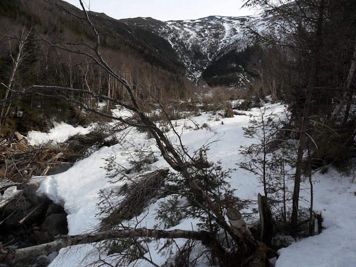
Blowdown damage from last Spring still evident in the Ammonoosuc Ravine
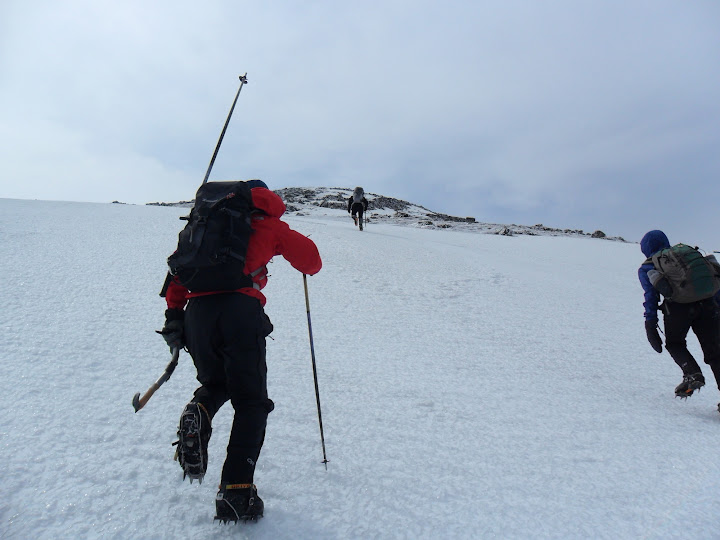
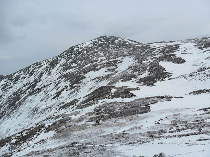
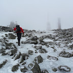
Then the trail steepens immediately and doesn't let up. We all put on some traction and eventually all switched to crampons as we cleared the trees. Then we decided to take the direct route up to Monroe. Ice had taken over the snow. Crampons strongly recommended on this slope:
The climb towards Monroe on hard packed snow/ice
We ran into BigEarl, Sue, and KevinMac just blow the summit of Monroe. The wind and head gear made it difficult for us to hear each other. They mentioned another hiker had headed down (turned out to be Bobby, but we never saw him). The winds were pretty brutal making walking near the summit of Monroe very difficult. We summited and headed back down towards Lakes of the Clouds. Congratulations to Kate on 4K #21! Whooohoooo
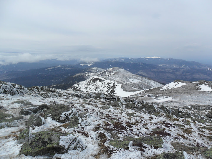
The rest of the Southern Presi's looking quite Presidential
The next target: Big George
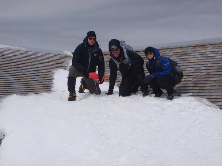
A brief stop at the Lakes hut to pose with the native habitat. "It's the Bird-en, I must carry"
Down at the Lakes hut we got out of the wind and had a snack. A completely frozen Snickers bar, and some frozen Shock Blocks- Yum! It was still plenty early (wasn't getting my pedicure until after suppa), and we all still had gas in the tank. The winds were out of the South East and we would have a fairly protected traverse towards the bottom of the summit cone of Washington. So, we took off past the Lakes and did plenty of ankle wrenching side stepping across the snow/ice fields in this section of the Crawford Path.
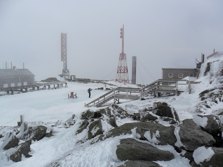
We exposed ourselves...EEEK, I mean we became more exposed to the wind as we hit the junction with the Westside trail. The final .6miles to the top seem to take forever (at least to me- stagger, stagger, crawl, crawl), and we summited Washington about 1pm. There were some hikers roaming around the area- like semi-frozen sheep in a hurricane, and about 6-8 hikers taking a break out of the wind near the entrance of the Visitors building. We took a quick break there as well. One hiker was drinking Sake! We politely declined a taste. If he had only had some Makers Mark, well......
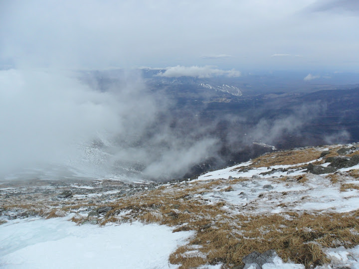
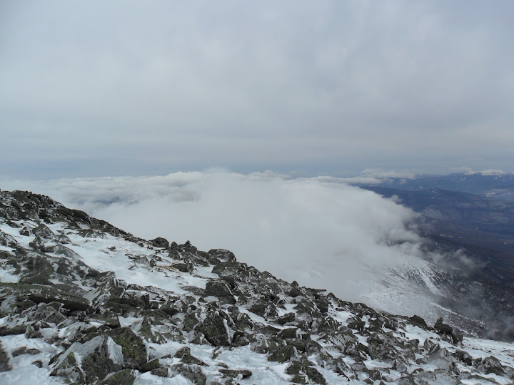
Some summit photos and then time to head down. The undercast was really cool. Never get tired of being above the clouds.....
A view towards Bretton Woods from the summit cone
Undercast rolls in
Ice Station Zebra....
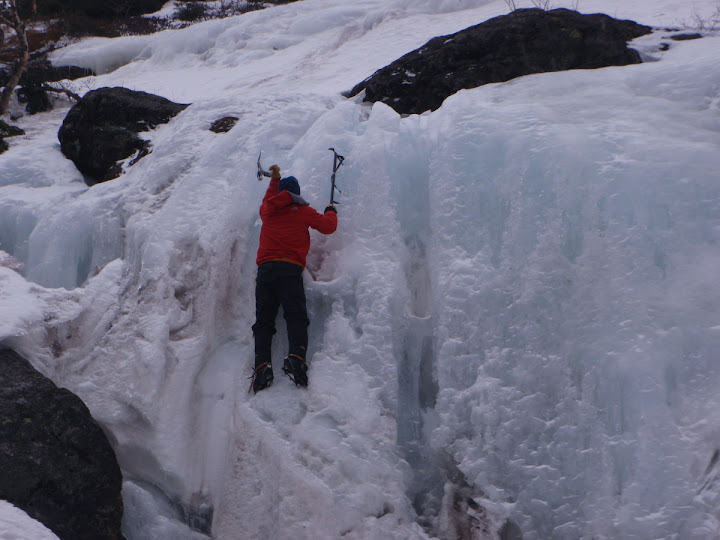
The descent went fairly quickly, but we did stop so Jorge (Now called Sherpa Tenzing Jorge) could play on the ice a little:
By Jorge, I think he's done it!
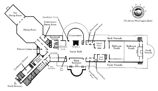
Back at the vehicle by about 3:30pm. Time for a celebratory beverage at the Mount Washington Hotel. Sipping a drink while looking at a great view of the Presidentials is a simply stately way to cap off the day.
Great hike folks!
Petch
Trip stats: About 9.7 miles, 4200ft of gain, 6hrs 40min
GPS track: http://www.wikiloc.com/wikiloc/view.do?id=1621440
Slideshow from this trip^
Ascent List:http://peakbagger.com/climber/climblistc.aspx?cid=1767
All Hiking Pictures:http://picasaweb.google.com/mpetcher/[/QUOTE]
Date of Hike: April 16, 2011 (Saturday)- Don't forget: DO YOUR TAXES !!!!
Trail Conditions: Ammo trail was bare bootable to Gem Pool, then traction/light traction required up the steeps. Full traction needed above treeline.
Special Equipment: Crampons, full face gear, poles and axes, Optional: Flame thrower, Case of Sterno, Bags of Salt, and other Ice melting equipment
Cast of Characters: CrazyBob, Kate, Jorge, and Petch
Commentary:
We started our hike just before 9am- (yes, a gentlemen's start) and began our ascent up the Ammo trail. Snowshoes stayed in the vehicle. Our plan for the day was to get up above treeline, bag a peak or two, and maybe go watch the crazies skiing in Tuck's Ravine. But as we ascended, we could tell the winds may have other plans in store for us. The Ammo trail is fairly level up to Gem Pool, and we were able to bareboot without issue on the hard packed trail.
Blowdown damage from last Spring still evident in the Ammonoosuc Ravine
Then the trail steepens immediately and doesn't let up. We all put on some traction and eventually all switched to crampons as we cleared the trees. Then we decided to take the direct route up to Monroe. Ice had taken over the snow. Crampons strongly recommended on this slope:
The climb towards Monroe on hard packed snow/ice
We ran into BigEarl, Sue, and KevinMac just blow the summit of Monroe. The wind and head gear made it difficult for us to hear each other. They mentioned another hiker had headed down (turned out to be Bobby, but we never saw him). The winds were pretty brutal making walking near the summit of Monroe very difficult. We summited and headed back down towards Lakes of the Clouds. Congratulations to Kate on 4K #21! Whooohoooo
The rest of the Southern Presi's looking quite Presidential
The next target: Big George
A brief stop at the Lakes hut to pose with the native habitat. "It's the Bird-en, I must carry"
Down at the Lakes hut we got out of the wind and had a snack. A completely frozen Snickers bar, and some frozen Shock Blocks- Yum! It was still plenty early (wasn't getting my pedicure until after suppa), and we all still had gas in the tank. The winds were out of the South East and we would have a fairly protected traverse towards the bottom of the summit cone of Washington. So, we took off past the Lakes and did plenty of ankle wrenching side stepping across the snow/ice fields in this section of the Crawford Path.
We exposed ourselves...EEEK, I mean we became more exposed to the wind as we hit the junction with the Westside trail. The final .6miles to the top seem to take forever (at least to me- stagger, stagger, crawl, crawl), and we summited Washington about 1pm. There were some hikers roaming around the area- like semi-frozen sheep in a hurricane, and about 6-8 hikers taking a break out of the wind near the entrance of the Visitors building. We took a quick break there as well. One hiker was drinking Sake! We politely declined a taste. If he had only had some Makers Mark, well......
Some summit photos and then time to head down. The undercast was really cool. Never get tired of being above the clouds.....
A view towards Bretton Woods from the summit cone
Undercast rolls in
Ice Station Zebra....
The descent went fairly quickly, but we did stop so Jorge (Now called Sherpa Tenzing Jorge) could play on the ice a little:
By Jorge, I think he's done it!
Back at the vehicle by about 3:30pm. Time for a celebratory beverage at the Mount Washington Hotel. Sipping a drink while looking at a great view of the Presidentials is a simply stately way to cap off the day.
Great hike folks!
Petch
Trip stats: About 9.7 miles, 4200ft of gain, 6hrs 40min
GPS track: http://www.wikiloc.com/wikiloc/view.do?id=1621440
Slideshow from this trip^
Ascent List:http://peakbagger.com/climber/climblistc.aspx?cid=1767
All Hiking Pictures:http://picasaweb.google.com/mpetcher/[/QUOTE]
Last edited: