Amicus
Well-known member
- Joined
- Aug 28, 2005
- Messages
- 1,145
- Reaction score
- 112
I hiked over 540 miles, in 39 day-hikes, to complete today a trail that will be just 200 miles long when it is finally finished - the Bay Circuit Trail, which with recent additions is now up to 180 officially open miles. I owe this dubious distinction to hiking most of it in both directions, and to pursuing many of the alternate routes, proposed sections and adjacent trails that give the BCT a large part of its charm.
"First proposed in 1929 as an outer 'emerald necklace,' linking parks, open spaces and waterways from Plum Island to Kingston Bay," the BCT got a boost when Al French and others organized the Bay Circuit Alliance in 1990. Al remains the BCA's energetic Chairman and leads the struggle to protect the linked jewels that run through some three dozen cities and towns in a giant semi-circle, between Routes 128 and 495. These jewels comprise a wealth of parks, forests, wetlands and reservations maintained by entities and organizations such as the Federal Government, the Mass DCR, the Trustees of Reservations (TTOR) and many of the Towns through which the Trail passes.
The BCT is nothing if not diverse. I've hiked through and by cemeteries - Colonial and modern, village greens, cranberry bogs, marshes, swamps, uncranberry bogs, mires, fens, two National Historical Parks - one preserving a rich slice the 19th Century textile industry and the other celebrating the Shot Heard 'Round the World, sloughs, glades deciduous, evergreen and mixed, three model aircraft flying fields, rivers, streams and brooks beyond measure, and the occasional morass. Eastern Massachusetts is even more verdant than I knew. Those retreating glaciers 10,000 years ago (which is about 5 minutes ago, speaking cosmically relatively) left a sandy, soppy web of green eskers, potholes and the occasional jutting highland - green and beautiful, I thought.
I brought my point-and-shoot for memory's sake, snapping some of those beautiful swamps:
Wildlife:
The Rude Bridge That Arched the Flood:
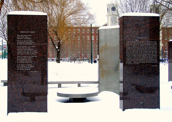
Kerouac Park and the Boott Cotton Mill:
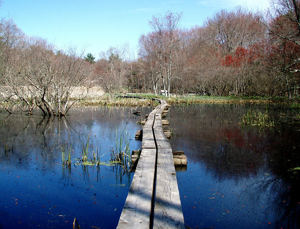
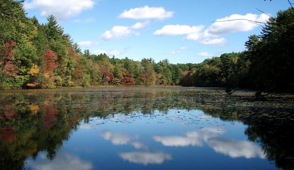
About 1,000 ponds, like this one:
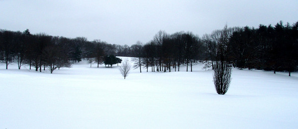
Great snowshoeing terrain:
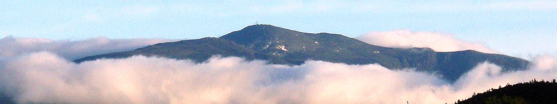
And of course some of the mountain scenery for which Eastern Mass. is renowned, as in this view of Nobscot Hill in Framingham:
Today's hike took me through Pembroke, in Map 13. (I'd leapfrogged ahead to the southern terminus at Kingston Bay last week, in order to hike that stretch with Maureen T., its Trail Maintainer.) Highlights were Pembroke Town Forest, Great Sandy Bottom Pond and the Tubbs Meadow Preserve - a representative hike.
The BCT has been great fun, and for the first time, I begin to think I'm learning my own backyard.
"First proposed in 1929 as an outer 'emerald necklace,' linking parks, open spaces and waterways from Plum Island to Kingston Bay," the BCT got a boost when Al French and others organized the Bay Circuit Alliance in 1990. Al remains the BCA's energetic Chairman and leads the struggle to protect the linked jewels that run through some three dozen cities and towns in a giant semi-circle, between Routes 128 and 495. These jewels comprise a wealth of parks, forests, wetlands and reservations maintained by entities and organizations such as the Federal Government, the Mass DCR, the Trustees of Reservations (TTOR) and many of the Towns through which the Trail passes.
The BCT is nothing if not diverse. I've hiked through and by cemeteries - Colonial and modern, village greens, cranberry bogs, marshes, swamps, uncranberry bogs, mires, fens, two National Historical Parks - one preserving a rich slice the 19th Century textile industry and the other celebrating the Shot Heard 'Round the World, sloughs, glades deciduous, evergreen and mixed, three model aircraft flying fields, rivers, streams and brooks beyond measure, and the occasional morass. Eastern Massachusetts is even more verdant than I knew. Those retreating glaciers 10,000 years ago (which is about 5 minutes ago, speaking cosmically relatively) left a sandy, soppy web of green eskers, potholes and the occasional jutting highland - green and beautiful, I thought.
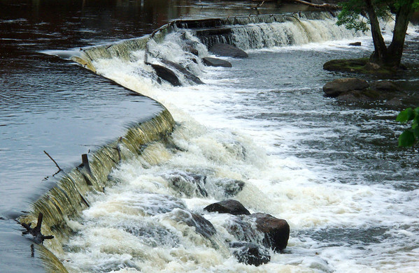
I brought my point-and-shoot for memory's sake, snapping some of those beautiful swamps:
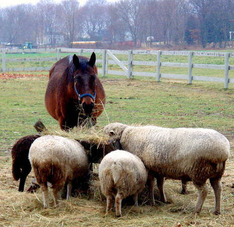
Wildlife:
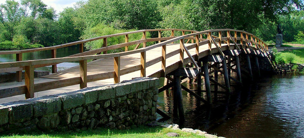
The Rude Bridge That Arched the Flood:
Kerouac Park and the Boott Cotton Mill:
About 1,000 ponds, like this one:
Great snowshoeing terrain:
And of course some of the mountain scenery for which Eastern Mass. is renowned, as in this view of Nobscot Hill in Framingham:
Today's hike took me through Pembroke, in Map 13. (I'd leapfrogged ahead to the southern terminus at Kingston Bay last week, in order to hike that stretch with Maureen T., its Trail Maintainer.) Highlights were Pembroke Town Forest, Great Sandy Bottom Pond and the Tubbs Meadow Preserve - a representative hike.
The BCT has been great fun, and for the first time, I begin to think I'm learning my own backyard.
Last edited: