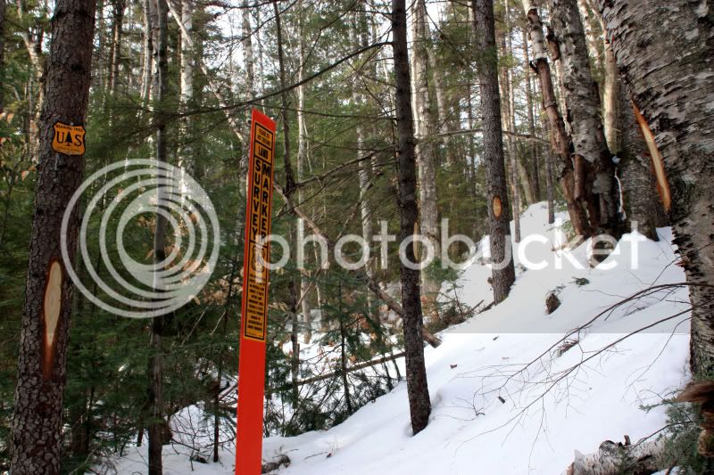
Upcoming Pine Bend Brook, UNH, Potash, and Oliverian Brook Trail Closures - Kanc7

vftt.org

Help Support vftt.org:

This site may earn a commission from merchant affiliate links, including eBay, Amazon, and others.

rocket21

Well-known member
Joined
Jan 29, 2007
Messages
2,256
Reaction score
308
I heard a bit about this logging project a few months ago, but found this file today describing the impact:

BIG .pdf of an earlier document describing this project: http://www.fs.fed.us/r9/forests/whi...rojects/assessments/kanc_7/kanc7_final_ea.pdf - trail information starts around page 50, apparently alternative 4 is what's going to be followed starting in 2009.

Main page for Kanc7: http://www.fs.fed.us/r9/forests/white_mountain/projects/projects/assessments/kanc_7/kanc_7.htm

Perhaps most striking for winter peakbaggers is that the Pine Bend Trail, a popular way to the Tripyramids for the Winter 48, may be closed for one or more winters.
 
I'm kind of surprised more people haven't commented on this yet. If you look at the maps (I believe the map on page 24 of the big PDF is pretty close to the approved proposal), you'll see that most of the logging (including clearcuts) will be adjacent to the trails. It looks like the Pine Bend Trail is going to be heavily affected by the logging (including being closed for multiple seasons of the year, including winter, for 2 or more years).
 
Is any body sure this project is still a go or the purpose of the logging ? Saw timber ? pulp ?

Lumber prices and demand are really really low with the housing market in a slump. I would not be surpised to see a large logging project put on hold untill better times
 
Is any body sure this project is still a go

My understanding is that it's been approved and is a go, once the (45?) day waiting period passes, unless someone files suit.

I don't mind logging, but this project seems poorly located and excessive.
 
Perhaps a deal could be made whereby other logging operations potentially help create additional trails? The act of creating a logging road often includes bridges and other erosion control methods.
 
One of the objectives is to sustain wildlife food sources

Kanc7 is has extensive wilderness areas to the north and south. Not really wilderness areas since forest fires are prevented thus eliminating important early successional forests or burned areas providing important food sources for wildlife.

Timber harvests create important wildlife habitat and food sources:

Quoting from the Final Report page 15,

" Field visits to proposed treatment areas by foresters and biologists, and
review of the inventory data identified the following needs:
• There are currently no acres of early successional habitat present in MA
2.1 lands within the HMU. Based on Forest Plan objectives, this HMU
ought to have 295 acres in this age category. Early successional forest
is defined as a 0–9 year old age class. This age class provides essential
nesting and foraging habitat for a wide variety of wildlife that depend
on it."

Further down on page 16

"Table 1 shows a difference between existing conditions habitat objectives
within the HMU analysis area. These opportunities include 1) establishing
up to 295 acres of early-successional aged stands in northern hardwood
forest type;...."

I happened to hike Livermore Trail this year in response to a TR by Forest Gnome who observed our favorites the moose on his hike. One reason this particular area is good for moose is the extensive cuts in Treatment Unit #46 portiions of which border the trail with thin screen of forest to hide it. I for one see these areas as good opportunity to spot moose. Not that I ever have any luck seeing them, but I did venture into TU#46 area and did indeed observe an impressive number of tracks, moose scat, herd paths, browsed hobble bush so I know this area is prime. It's still pretty good early sucession terrain, but it continues to mature past where it provides good eating. So I look at timber cuts as opportunities to observe wildlife and perhaps even get a good view.
 
Great thread topic, Rocket!

I agree with Jazzbo.

I think the project will have little to no effect on the general hiking population. Most hikers are oblivious to the many logging projects that have happened in the past that are just as close to trails. Most hikers hike on weekends when loggers aren't working(?). Even if a hiking group heard logging in the distance during the first leg of their hike they will soon be beyond that and on to their peak of destination. The peaks that are of interest to peakbaggers can be reached from the south if the logging would indeed bother them.

I find that not very many people actually hike through the forest. Most who bushwack do so in a straight line to a peak and don't generally explore vast areas of forest. ICBW, but it doesn't look like peakbagging bushwackers will ever see these cuts either.

This is the very heart of my "home" hiking area, since I live close to the east end of the Kancamagus. I do alot of exploring through this very area and I'm not too upset about it. As Jazzbo states, this does increase wildlife habitat for many species. There is so much land to explore that I can still bushwack all around Blue Mtn. or Steam Mill Brook drainage for example, while logging is underway, then come back into these areas in future years and watch things progress. As a whole, the WMNF has vast areas for people to explore off-trail far away from the Kanc-7.

Even clearcuts ain't so bad as long as they are surrounded by forest and they aren't too big. I spent alot of time this year in a meadow that was created by clearcutting. It's about 10 acres. I observed many species who enjoy the meadow. The moose love the pincherries. There are flocks of songbirds and northern flickers. Northern Harriers were hunting the flickers and the many rodents that like the wildflower habitat. I heard owls at the edges, though I could never see them. Deer were eating something in there as well.


This was taken on Saturday on the Oliverian Brook Trail. Is this related to the project? There is a trail of these cuts leading west but I didn't have the energy to follow them.

obt12608.jpg


happy trails :)
 
Great links and topic rocket. forestgnome I admire your upbeat attitude. "The Whites"....Land of many uses. Appropriate cutting paired with appropriate Research and Land Mangement is an interesting process to watch. Especially the regeneration process. I especially find the proposed "Cutting Maps" interesting as there are many different types of cuts proposed as part of the Forest Management process. psmart what is the avenue for viewing already filed public comment if any? Thanks
 
ForestGnome,

The marks in your photo looks like boundary blazes that haven't been painted yet. Were you down low on the Oliverian Brook Trail?

I was on Oliverian Brook Trail on Monday and recognize forestgnomes photo. I have an almost identical photo. This is just after the sign for "Entering the Sandwich Range Wilderness", about a quarter mile north of the junction with the Passaconaway Cutoff Trail.
 
Not really wilderness areas since forest fires are prevented
Prevented? How? That sounds like regular drops of fire retardant or something.

The Forest Plan states "The Wilderness Fire Management Plan must recognize natural fires as a natural ecological process. Lightning-ignited fires will be managed as wildland fire use..." I don't know if either the forest-wide Fire Management Plan or the Wilderness FMP have been written yet...they're not listed under "Planning" on the WMNF website.
 
I think I wrote a letter on some previous version of this project where they claimed it wouldn't even be visible from PBB Trail, they were forced to admit it would. I hadn't caught on to the trail closure which must have been added. You would think this was the sort of thing the AMC would monitor and send out alerts to hikers so they could submit comments but I guess not.
 
what is the avenue for viewing already filed public comment if any? Thanks

You'll find the comments (plus the USFS response) starting on page 239 of the Environmental Assesment This is the same link Rocket21 included is his original post.

As far as impact on trails and the public, I expect this project to be far more significant than most. There will be substantial logging activity (skidding) across a number of trails, including UNH, Downes Brook, and Pine Bend Brook. This will involve temporary trail closures, and could have lasting impacts. Although the closures are planned for seasons of "low use" on the trails, this probably means mid-winter, when many VFTT folks are on these trails.
 
As far as impact on trails and the public, I expect this project to be far more significant than most. There will be substantial logging activity (skidding) across a number of trails, including UNH, Downes Brook, and Pine Bend Brook. This will involve temporary trail closures, and could have lasting impacts. Although the closures are planned for seasons of "low use" on the trails, this probably means mid-winter, when many VFTT folks are on these trails.

Actually your point is well taken, and hiking will be impacted during those closure times and it would leave a skidder trail across the hiking trail until it blended back in.

Here's a question: "Closed" means different things. Does it mean that hiking is forbidden or discouraged? Are there fines for hiking on the closed trail? Is it the same as Tuckerman Ravine Trail that always has hikers on the headwall section when the sign says "closed"?
 
"Closed" means different things. Does it mean that hiking is forbidden or discouraged? Are there fines for hiking on the closed trail?

It's pretty rare for a hiking trail to be closed during a timber project, so I don't know how it will be handled in this case. Given the very real danger of skidders crossing the trail, there may be some enforced closures. I'll let you know if I can get any futher details.
 
It certainly seems like they snuck these trail closures through - between the posts here and the conversations I've had offline with folks who knew about this project earlier, this aspect wasn't disclosed.

Even with it disclosed now, it's still rather vague and troubling in the least. I'd understand if it were private property (such as with the logging around North Straightback in the Belknaps), but since this is technically taxpayer property, it seems odd that people would be forbidden to enter for entire seasons.
 
Top