Whitewall Mtn. on October 10th

vftt.org

Help Support vftt.org:

This site may earn a commission from merchant affiliate links, including eBay, Amazon, and others.

forestgnome

New member
Joined
Dec 3, 2004
Messages
2,625
Reaction score
600
Location
..Madison, NH
BeccaM and I hiked Whitewall Mtn. via the slide that intersects the Ethan Pond Trail.

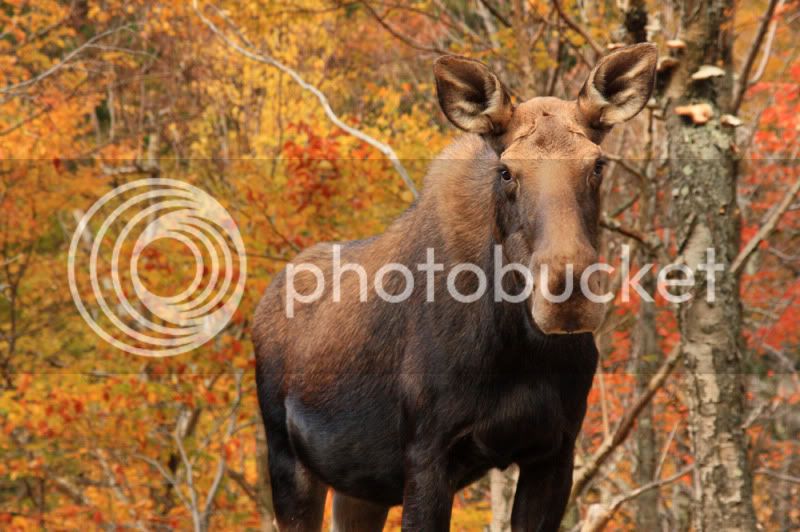
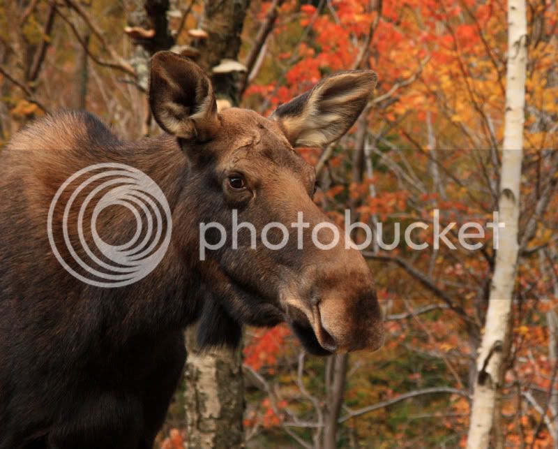
There was a nice young cow moose holding court at the Silver Cascade area
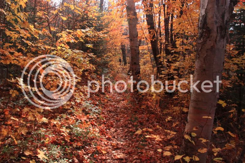
IMG_1146aaa.jpg


IMG_1162aaa.jpg


Ethan Pond Tr.

IMG_1215aaa.jpg


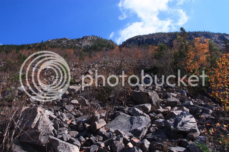
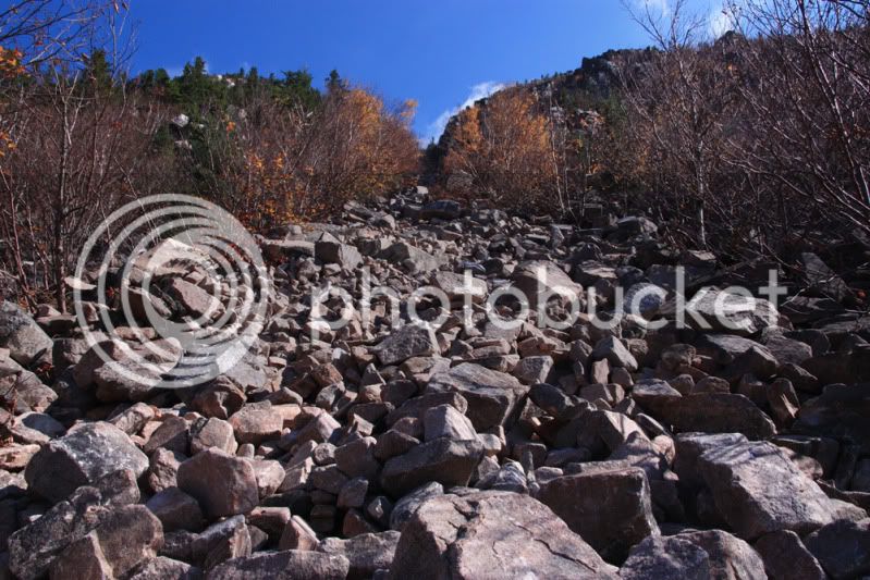
looking up the slide from the EPT

IMG_1218aaa.jpg


This is the 4th or 5th time for me on this route. I noticed that things looked a little different.

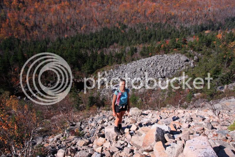
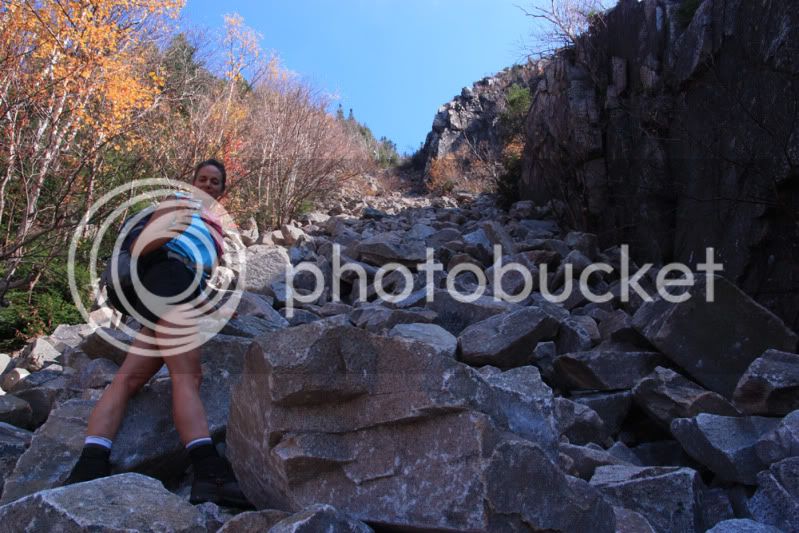
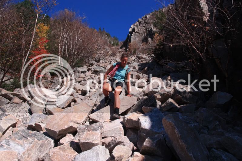
Becca starting the climb up the slide

IMG_1219aaa.jpg


IMG_1222aaa.jpg


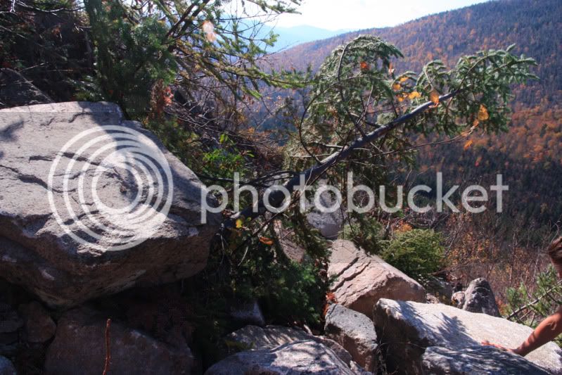
Then we noticed many signs telling the tale of recent slide activity caused by Hurricane Irene. There were trees freshly buried with boulders.

IMG_1236aaa.jpg


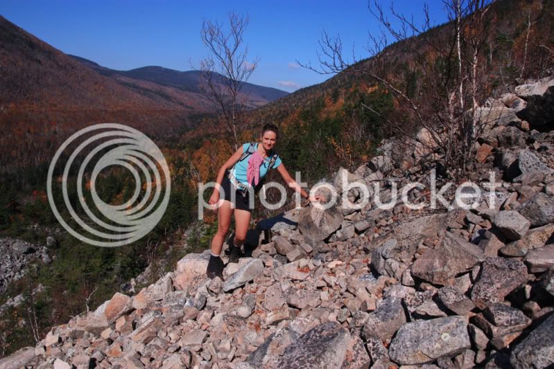
Becca noticed that a long stretch of the rocks were very light in color and had lots of fresh scars. It was clear that a lot of avalanche happened.


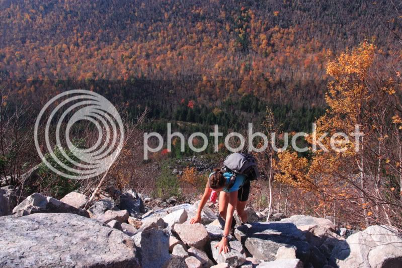
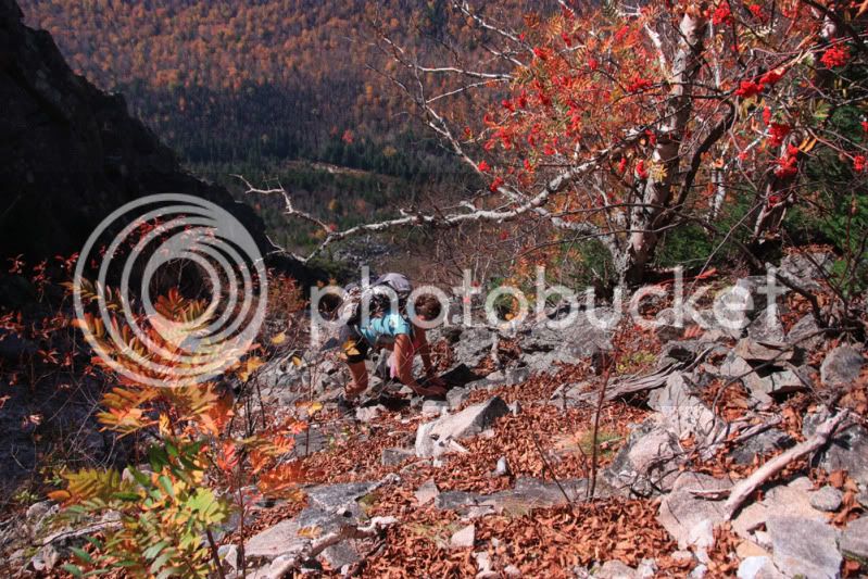
We did well climbing the slide without dislodging many rocks. We were on all fours much of the time...


IMG_1240aaa.jpg


IMG_1243aaa.jpg


IMG_1255aaa.jpg


IMG_1264aaa.jpg


IMG_1277aaa.jpg


continued...
 
Last edited:
Beautiful views toward Carrigain Notch from the open ledges on the summit

IMG_1298aaa.jpg


The descent of the slide was tricky. We had a much harder time. We both had a boulder roll onto our feet. First Becca had one pinning her foot but she was able to remove it and had no injury other than superficial scratches. Then I had a ~150# rock on my foot that caused a considerable bruise.

IMG_1311aaa.jpg


Please consider the unstability of this slide if you venture on it!!!

happy trails :)
 
Last edited:
Awesome

great pix and great terrain! looking @ doing this @ some point.. if u had to put a rough # on slope angle?? looks like a very fun hike/climb!:)
 
Last edited:
Patrick,

Great report and picks! That slide looks rediculous, like an old river bed going straight down the mountain. Great shots of the moose, as usual. Geez, if I don't see a moose soon (I have never seen one in the Whites), I'm going to have to hire you as a guide to bring me to one!:)

Looks like you and Becca had a great time. Thanks for sharing!
Karl
 
Wow, I'm glad you're all right! I found it spicy enough a few years ago without having Irene loosen it up. Did you stay out of the narrow section near the top of the slide? That's the part where we dislodged the most boulders.

The mountain ash is putting on a particularly beautiful display this year.
 
You sure that wasn't just all the result of that boulder that got dislodged out from under me when we climbed it? :)
 
Wow, what a great day!

I love the lighting on the moose shots - it's so rare to get all the colors of their hair. Great background color too!
 
Where's that picture of your bruised ankle? :(

Awesome day, but, the descent was the scariest.... marbles, marbles everywhere.
 
From the USGS 24K topo, I get an average gradient of 77% (38 degrees) and a steepest section of 95% (44 degrees) for the center of the three gullies shown.

For comparison, I get 70% (35 degrees) average and 77% (38 degrees) peak for the N slide on N Tripyramid. However, the footing and surface stability are very different.

These numbers are highly dependent upon exactly where one draws the path. The DEMs (digital elevation maps) used by many current digital maps are based upon 90 meter squares resulting in reduced altitude accuracy on steep slopes. Thus these slope estimates may not be very accurate.

Doug
 
That moose has been hanging out there for about two weeks...seen lots of shots of it...none better than yours! Nice hike too!
 
That moose has been hanging out there for about two weeks...seen lots of shots of it...none better than yours! Nice hike too!

The moose stood in the middle of the fenced-in area looking like it was a penned farm animal. The tour buses kept pulling into the lot adjacent as it stood there and chewed its cud. Aside from the Star Lake Moose, this one takes the cake for the most pictures!!!!! :)
 
The views are awesome - particularly Carrigain notch - but that slide is crazy! 77% is OK, but not when everything is moving! :eek: Glad you escaped with nothing worse than bruises and scrapes.
 
Isn't that what the 3000-footer bushwhackers call West Field?
 
Has anyone ever been to the unnamed peak (3691) between Whitewall and Field ?
I'm eyeballing this one for for mid week and wonder how the whacking would be from Whitewall summit over there.

That is West Field. There is a logging road that crosses the A-Z trail at 2.2 Miles that leads in the direction of 3528 Ft (west) West field and would be your easiest route to both peaks. The whack from here to Whitewall was one of my favorites as it passes through a birch glade with waist high ferns. See attached topo showing the logging road.

w field.JPG
 
Ah yes, West Field.

I think we determined that we would be a little short on water for the whack over from Whitewall.
The 4 hour summit time on Whitewall wasn't to tough to handle though...

We'll be back !
 
Top