
You are using an out of date browser. It may not display this or other websites correctly.
You should upgrade or use an alternative browser.
You should upgrade or use an alternative browser.
NH 48 Direttissima North to South 8/13 - 8/23
- Thread starter Mats Roing
- Start date
Help Support vftt.org:
This site may earn a commission from merchant affiliate
links, including eBay, Amazon, and others.
Mats Roing
New member
Day 7 - Wednesday 8/19/09
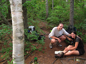
Slept in a little since a long day yesterday.......sun was trying to peak through the trees in the morning. MEB went back to her car to take it easy with her feet and would meet me in Waterville Valley later today.
I started up Oliverian Brook Trail to the Passaconnaway cutoff which showed up in a few minutes......
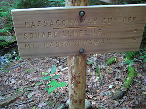
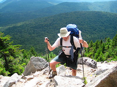
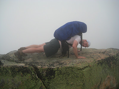
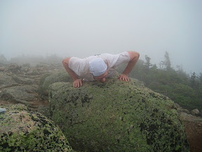
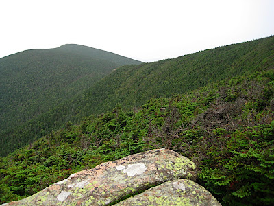
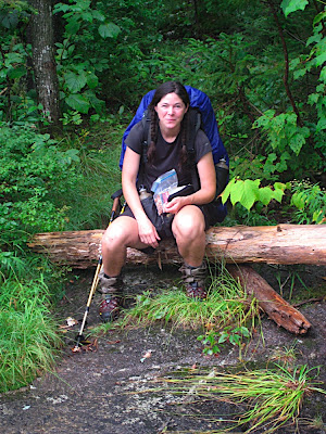
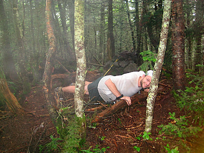
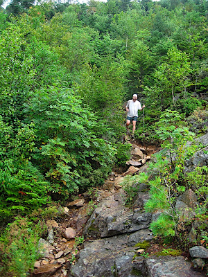
.....pretty soon the trail entered a steady uphill stretch and since it's north west facing it's mostly in the shade which was nice. Another warm day seemed to loom. The Square Ledge Trail came in from the left and the trail took a little dip before resuming it's upward path. Once at the Walden Trail intersection I took the pack off for a break. Once starting up the last bit to the summit of Passaconnaway I realized I was out of fuel so to speak and sat down again and ate a cliff shot and a Lära bar. Amazing how important refueling is.....with a tiny 15 lbs daypack you can probably get by with just water and salt for a day and burn fat and still move at a decent clip.....it's usually in the uphills you feel the difference when not being fuled up properly - the breathing gets harder pretty easily and the pace goes down considerably and the light headedness sets in. After refueling I felt a lot better and soon I saw the sign for the summit.....nr 22.....26 to go......some summits you hike a whole day to get to and some come with less than an hour's effort......charming isn't it? Pushups on the summit and then down towards the Rollins Trail.
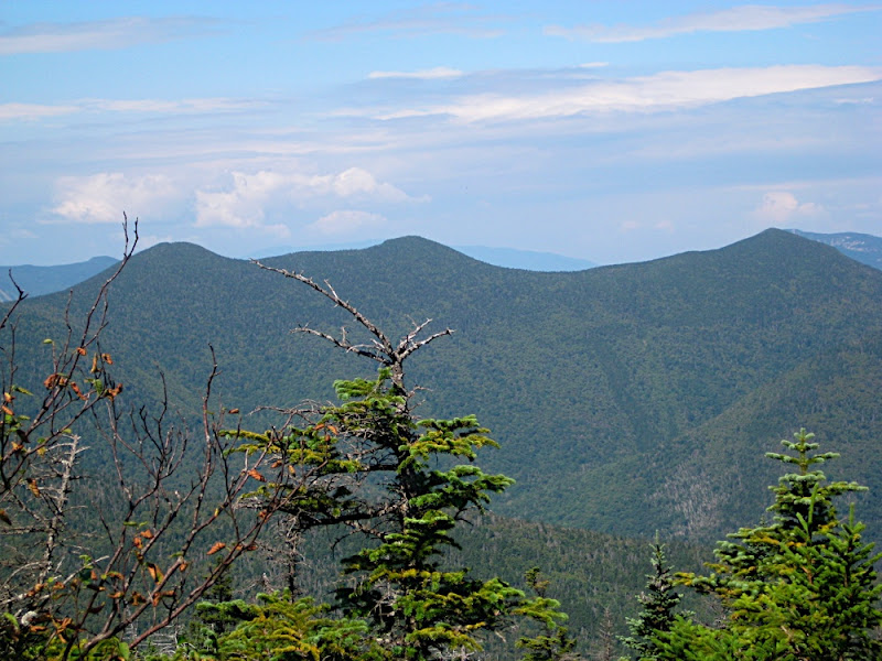
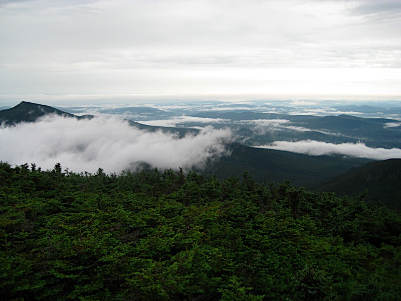
Had a great view of the Tripyramids on the way down:
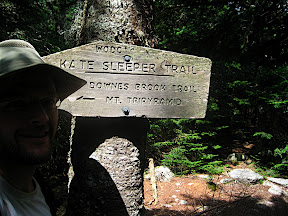
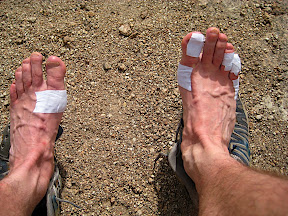
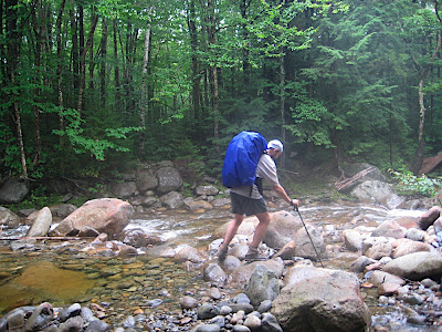
Used my foldable cup to scope up some of the water from the spring crossing the trail over the sand around 3,500 feet........nice cold water it was. Had a water filter with me but during my 8 years of hiking in the Whites I only filtered water once (2 years ago at Ethan Pond). It's probably not recommended to do things that way and maybe one of these days I will pay the price for it but so far so good.......knock on wood. Met a dude on the Rollins Trail who told me he was happy the trail was actually going downhill now. I was happy it was uphill......maybe if he hiked a few more days he would also appreciate the uphills more.....I had a blister developed on each heel by now so I couldn't really set my heel down on the down hills. Right pinkie toe was also partially demolished as well as exposed flesh on the next door toe. A couple of other blisters added some more charm to the hike. When I got to the Kate Sleeper Trail intersection I took my shoes off and aired things out, retaped and changed socks to a pair which had dried out on my pack during the day.
http://lh6.ggpht.com/_QZn2o1WVqaA/SpTLI5duQwI/AAAAAAAABtg/DMWYCMT6xWs/s288/IMG_0118.JPG
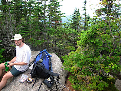
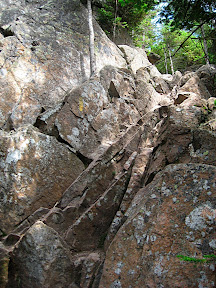
My third time on the Kate Sleeper Trail......never met anyone on this trail.....maybe because I did it once in winter and the times in the summer was during mid-week. A beautiful trail it is. Recognized a tree trunk I sat on two years ago switching socks........finally entered into the rocky section where you go sideways up to the South Tripyramid Slide......sun was trying to fry me but some clouds came to rescue")
Up on the south summit and onward to the Middle for the half-way mark - 24! Shake and Half-Baked!
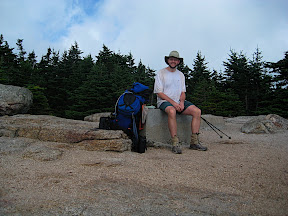
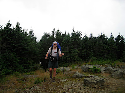
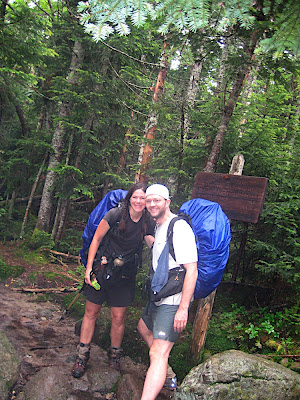
I had done more than half the miles though. I think that happened slightly before Passaconnaway. The big question was whether or not going down the North Slide or Scaur Ridge........Some rain started on the North summit which made the choice easy.......put on the pack cover and went down the extra mile over Scaur Ridge......then 4 miles of gravel road walking before hitting the TH.....feet were getting unhappy on the gravel road walk but I busied myself with communicating a bit on the phone. MEB was waiting at the TH and we conferred about what to do next. It was 6pm now.....we could go to Osceola Vista for the night but I wanted to get Tecumseh over with so she was going to drive to the other side on Tripoli Road and head up and see if there were any campsites on Tripoli Road. I went up the regular route next to the ski area and ran into Rocket 21 who had already been up on the summit. He went back up with me for 1/4 mile or so which was nice of him. At the big creek crossing before hitting the straight away I took my shoes off and cooled them off in the creek for 20 minutes or so......nice.....it started to get darkish though and I hurried up the trail in the twilight.....barely made it to the ridge before I had to put the head lamp on. Took the western loop to the summit since it doesn't dip down so much. Observe the pack is getting considerably smaller compared to the early days on the trail
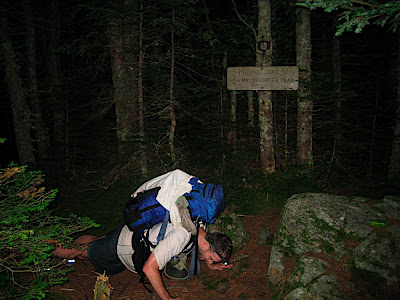
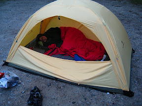
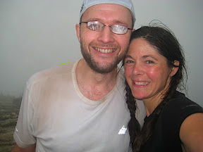
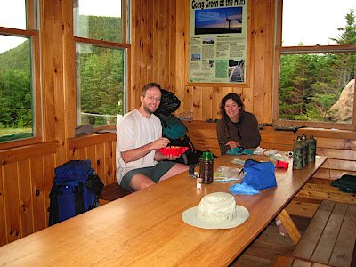
MEB had been on the summit for a long time since she blitzed up the other side. In good shape she is.....(Yoda voice)......26 done....22 to go.....my feet was getting mighty tender on the way down.......MEB asked if I wanted advil....but I thought we would be down soon anyway......it seemed to take forever but finally the trailhead showed up and we decided to set camp right on the trailhead......simple and easy....no impact on the environment......there was water closeby also......it was around 11pm now....a long day but Tecumseh was done......tomorrow the march northward towards the Bonds will start.......it was good to get horizontal......zzzzzzzzzz
Slept in a little since a long day yesterday.......sun was trying to peak through the trees in the morning. MEB went back to her car to take it easy with her feet and would meet me in Waterville Valley later today.
I started up Oliverian Brook Trail to the Passaconnaway cutoff which showed up in a few minutes......
.....pretty soon the trail entered a steady uphill stretch and since it's north west facing it's mostly in the shade which was nice. Another warm day seemed to loom. The Square Ledge Trail came in from the left and the trail took a little dip before resuming it's upward path. Once at the Walden Trail intersection I took the pack off for a break. Once starting up the last bit to the summit of Passaconnaway I realized I was out of fuel so to speak and sat down again and ate a cliff shot and a Lära bar. Amazing how important refueling is.....with a tiny 15 lbs daypack you can probably get by with just water and salt for a day and burn fat and still move at a decent clip.....it's usually in the uphills you feel the difference when not being fuled up properly - the breathing gets harder pretty easily and the pace goes down considerably and the light headedness sets in. After refueling I felt a lot better and soon I saw the sign for the summit.....nr 22.....26 to go......some summits you hike a whole day to get to and some come with less than an hour's effort......charming isn't it? Pushups on the summit and then down towards the Rollins Trail.
Had a great view of the Tripyramids on the way down:
Used my foldable cup to scope up some of the water from the spring crossing the trail over the sand around 3,500 feet........nice cold water it was. Had a water filter with me but during my 8 years of hiking in the Whites I only filtered water once (2 years ago at Ethan Pond). It's probably not recommended to do things that way and maybe one of these days I will pay the price for it but so far so good.......knock on wood. Met a dude on the Rollins Trail who told me he was happy the trail was actually going downhill now. I was happy it was uphill......maybe if he hiked a few more days he would also appreciate the uphills more.....I had a blister developed on each heel by now so I couldn't really set my heel down on the down hills. Right pinkie toe was also partially demolished as well as exposed flesh on the next door toe. A couple of other blisters added some more charm to the hike. When I got to the Kate Sleeper Trail intersection I took my shoes off and aired things out, retaped and changed socks to a pair which had dried out on my pack during the day.
http://lh6.ggpht.com/_QZn2o1WVqaA/SpTLI5duQwI/AAAAAAAABtg/DMWYCMT6xWs/s288/IMG_0118.JPG
My third time on the Kate Sleeper Trail......never met anyone on this trail.....maybe because I did it once in winter and the times in the summer was during mid-week. A beautiful trail it is. Recognized a tree trunk I sat on two years ago switching socks........finally entered into the rocky section where you go sideways up to the South Tripyramid Slide......sun was trying to fry me but some clouds came to rescue
Up on the south summit and onward to the Middle for the half-way mark - 24! Shake and Half-Baked!
I had done more than half the miles though. I think that happened slightly before Passaconnaway. The big question was whether or not going down the North Slide or Scaur Ridge........Some rain started on the North summit which made the choice easy.......put on the pack cover and went down the extra mile over Scaur Ridge......then 4 miles of gravel road walking before hitting the TH.....feet were getting unhappy on the gravel road walk but I busied myself with communicating a bit on the phone. MEB was waiting at the TH and we conferred about what to do next. It was 6pm now.....we could go to Osceola Vista for the night but I wanted to get Tecumseh over with so she was going to drive to the other side on Tripoli Road and head up and see if there were any campsites on Tripoli Road. I went up the regular route next to the ski area and ran into Rocket 21 who had already been up on the summit. He went back up with me for 1/4 mile or so which was nice of him. At the big creek crossing before hitting the straight away I took my shoes off and cooled them off in the creek for 20 minutes or so......nice.....it started to get darkish though and I hurried up the trail in the twilight.....barely made it to the ridge before I had to put the head lamp on. Took the western loop to the summit since it doesn't dip down so much. Observe the pack is getting considerably smaller compared to the early days on the trail
MEB had been on the summit for a long time since she blitzed up the other side. In good shape she is.....(Yoda voice)......26 done....22 to go.....my feet was getting mighty tender on the way down.......MEB asked if I wanted advil....but I thought we would be down soon anyway......it seemed to take forever but finally the trailhead showed up and we decided to set camp right on the trailhead......simple and easy....no impact on the environment......there was water closeby also......it was around 11pm now....a long day but Tecumseh was done......tomorrow the march northward towards the Bonds will start.......it was good to get horizontal......zzzzzzzzzz
Mats Roing
New member
Day 8 - Thursday 8/20/09
Another morning where we slept in a little since it got late last night.......packed up and went out before any hikers showed up though......
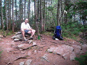
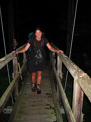
Normal morning....I'm up and about and MEB sleeps in......somehow she's usually ready before me though:
It takes half hour or so for the feet to get adjusted to hiking every morning. Carried enough water to get me to the Hancocks.......started up Tripoli Road eat bound towards Osceola TH. Sun was shining.......it was a beautiful day.......after about 45 min on the trail I heard voices......a mother and daughter caught up with me and I stepped aside........either I was moving slow or they were moving fast.......doesn't matter.....eventually we all ended up on the summit....some dramatic cloud movements I took as a sign that the hurricane remnants might be approaching.......did some retaping of feet again sitting on one of them rocks.
On to the East Peak.......throught the "crux"
....and another break on the East Peak......28 done.....20 to go........the summit count starts to sounds favorable
Long descent next.......at one point I got a whif of perfume and figured a woman must be down trail.......a couple of turns later a woman was sitting with her boyfriend and she asked me if the summit is far away.......none of them looked particular excited.......met a few more hikers as I went down......it was nice to get to the Greely Pond Trail and an easy hike to the TH where MEB was waiting and ready to join me on the trail!
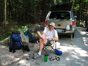
A break in the shade and onto Kancamagus Highway for a 0.7 mile section of it. We moved pretty quickly along the flat trail and we dropped our packs by the the creek crossing 0.1 miles east of Cedar Brook Trail to head up towards the Hancock loop. Took my top lid of the pack with me and some snacks and water....and remembered the camera this time
Went up North Hancock first and we made good time and MEB even broke a good sweat! It was a bit on the warm side but nice to be up on the ridge......
.......looped around and made summit nr 30 on the South Hancock......and down back to the packs...thoroughly enjoying being packless.....shoulders could breathe a little
We tooka nother break once back at the packs and filled up some water to last to Bondcliff Trail.....
.....we thought it was maybe 4:30 or so.....but when I checked the cell phone it was 6pm.....oh oh......we have a lot of miles on Cedar Brook Trail now.....so we strapped on the packs and kept going over the col to the Pemi Wilderness and about a mile of sloppy trail before the trail turned mostly dry and nice so we could make good time......at one point there are a bunch of logging camp remnants and several meadows along the trail which seems to be man-made.........probably logging camp #24 which was the biggest logging camp built......and one of the last ones which they used into the 1940's I believe. We kicked in a good gear here on the downhill and unfortunately MEB rolled her ankle bad when within a mile of the bridge over Pemi River.....some swear words later she was good to go.......
Over the bridge and we had a discussion why they want to remove the beautiful bridge.......bridges are a better focus to maintain and build than removing summit signs and destroying summit cairns I think.....but that's another story......it's gonna be tough to get to Cedar Brook from the Bonds soon......
Turned on the headlamps after crossing the bridge.......and we decided to camp a bit into Bondcliff Trail instead of slugging much uphill in the dark.......a nice and dry night and no condensation inside the tent.......in dry conditions the BD Lighthouse is the best tent there is.....if raining cats and dogs it's not the best we figured later......but that's another story.......some tabasco in the freeze-dried and they become close to a heavenly experience ;-) The water in the creek was really cold.....good for cooling the feet
Big day tomorrow........zzzzzzzzzzzz.........
Another morning where we slept in a little since it got late last night.......packed up and went out before any hikers showed up though......
Normal morning....I'm up and about and MEB sleeps in......somehow she's usually ready before me though:
It takes half hour or so for the feet to get adjusted to hiking every morning. Carried enough water to get me to the Hancocks.......started up Tripoli Road eat bound towards Osceola TH. Sun was shining.......it was a beautiful day.......after about 45 min on the trail I heard voices......a mother and daughter caught up with me and I stepped aside........either I was moving slow or they were moving fast.......doesn't matter.....eventually we all ended up on the summit....some dramatic cloud movements I took as a sign that the hurricane remnants might be approaching.......did some retaping of feet again sitting on one of them rocks.
On to the East Peak.......throught the "crux"
....and another break on the East Peak......28 done.....20 to go........the summit count starts to sounds favorable
Long descent next.......at one point I got a whif of perfume and figured a woman must be down trail.......a couple of turns later a woman was sitting with her boyfriend and she asked me if the summit is far away.......none of them looked particular excited.......met a few more hikers as I went down......it was nice to get to the Greely Pond Trail and an easy hike to the TH where MEB was waiting and ready to join me on the trail!
A break in the shade and onto Kancamagus Highway for a 0.7 mile section of it. We moved pretty quickly along the flat trail and we dropped our packs by the the creek crossing 0.1 miles east of Cedar Brook Trail to head up towards the Hancock loop. Took my top lid of the pack with me and some snacks and water....and remembered the camera this time
Went up North Hancock first and we made good time and MEB even broke a good sweat! It was a bit on the warm side but nice to be up on the ridge......
.......looped around and made summit nr 30 on the South Hancock......and down back to the packs...thoroughly enjoying being packless.....shoulders could breathe a little
We tooka nother break once back at the packs and filled up some water to last to Bondcliff Trail.....
.....we thought it was maybe 4:30 or so.....but when I checked the cell phone it was 6pm.....oh oh......we have a lot of miles on Cedar Brook Trail now.....so we strapped on the packs and kept going over the col to the Pemi Wilderness and about a mile of sloppy trail before the trail turned mostly dry and nice so we could make good time......at one point there are a bunch of logging camp remnants and several meadows along the trail which seems to be man-made.........probably logging camp #24 which was the biggest logging camp built......and one of the last ones which they used into the 1940's I believe. We kicked in a good gear here on the downhill and unfortunately MEB rolled her ankle bad when within a mile of the bridge over Pemi River.....some swear words later she was good to go.......
Over the bridge and we had a discussion why they want to remove the beautiful bridge.......bridges are a better focus to maintain and build than removing summit signs and destroying summit cairns I think.....but that's another story......it's gonna be tough to get to Cedar Brook from the Bonds soon......
Turned on the headlamps after crossing the bridge.......and we decided to camp a bit into Bondcliff Trail instead of slugging much uphill in the dark.......a nice and dry night and no condensation inside the tent.......in dry conditions the BD Lighthouse is the best tent there is.....if raining cats and dogs it's not the best we figured later......but that's another story.......some tabasco in the freeze-dried and they become close to a heavenly experience ;-) The water in the creek was really cold.....good for cooling the feet
Big day tomorrow........zzzzzzzzzzzz.........
mookie
New member
i love the Mats and MEB show!
cant wait for day 9!
cant wait for day 9!
i love the Mats and MEB show!
Me too! Though I hope Episode 9 has more car chases and explosions.
mookie
New member
Me too! Though I hope Episode 9 has more car chases and explosions.
i am hoping episode 9 has booze,guns,strippers and drugs!
Rik
New member
i am hoping episode 9 has booze,guns,strippers and drugs!
I find no use for the guns.
Tom Rankin
Well-known member
Seen on a T-shirt
"Alcohol, Tobacco and Fire Arms - Somebody pass the chips!"
BTW, Mats, the water at "the trail over the sand around 3,500 feet......." is pure enough that I've had it 4 times w/o ill effects. It issues from the ground just above that spot.
"Alcohol, Tobacco and Fire Arms - Somebody pass the chips!"
BTW, Mats, the water at "the trail over the sand around 3,500 feet......." is pure enough that I've had it 4 times w/o ill effects. It issues from the ground just above that spot.
Mats Roing
New member
Day 9 - Friday 8/21/09
Had an early start today since we knew we might get hit by rain and it's always nice to break camp in dry conditions. We were up and hiking while still dark enough to justify headlamp usage......we soon turned them off though.......filled up water at 2,250 feet crossing since we weren't sure if it was dry further up.....it wasn't of course Met a father and son at the 3,000' waterhole and the father was giving a lecture about hydration spots around the pemi loop.....they had some rain overnight on top of Bondcliff where they camped.....some small rain drops appeared on the long leftward section.......very foggy.......took a break before the steep steps and timberline crossing.......didn't stay too long on Bondcliff and continued down to the col and up the Bond face for nr 32.......16 to go......
Bondcliff:
Bond:
West Bond:
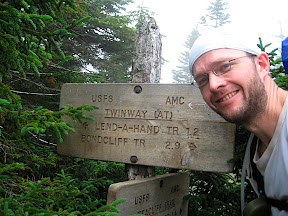
....dropped the packs at West Bond intersection and went to West Bond. Conditions still decent but no views......maybe 100 feet at the most.......33 and 15 to go.......those were three pretty quick ones.......MEB decided to head directly to Galehead Hut while I looped around Zealanda and Hale and North Twin.......met a few hikers on the Twinway trail and went in to Zealand without a lot of celebration other than the pushups.......weather still holding up.......14 to go......down towards Zealand Hut and Lend a Hand Trail.....
.....feet were ok for being in such a rough shape.....refilled water shortly before the Lend a Hand Trail.......filtering.....nah......still have teeth......
Changing over to uphill mode on Lend a Hand Trail......little muddy here and there but decent.....met some more hikerson the way to Hale......everything was grey and damp...but no rain yet......over the sub summit 1/2 mile from the real summit and I could smell nr 35 getting closer.......up the last part and a woman was sitting by the cairn with a cooler......she just finished her 14th peak and told me she just need 10 more to be able to guide for AMC. I congratulated her and she took a photo of me.
When she asked what I was hiking I told her I'm heading to the Twins and down to Galehead Hut........I heard some rumbling in the air and some rain drops started......I told her it sounds like thunder in the distance......she said it was airplanes......and she's heard it for a while......
I took me 5 minutes to locate the Old Firewarden Trail....went in too soon from cairn first.....passed the old rusty drums before the little uphill to the sub peak......and then around it and out on the switch backs on the west side.......nice trail.......rumbling came closer....oh oh......soon some little rain drops started.......toads all over the trail.....getting down to the North Twin Trail when the rain starts.......trying to figure out on which side the thunder is going........definitely closer now.....not very hard rain so I just keep hiking.....back cover is on at least.....the rain increases in strength and the lightning and thunder gets more intense.....I stop under a somewhat sheltered tree to hope it's just a 15 minute T-shower.......rain gets horizontal and I get soaked....and cold.......so I might as well continue hiking.........water in Little River turns brown and it seems the water level increases......I sense I need to cross the river before it gets too high......can't refill water here either now in the muddy river......oh well......totally drenched I reach the last crossing and just wade over in my shoes.....the water reaches my shorts but not my waist......no more water in my bladder.....continued up the trail turned into creek......rain keep pouring and the lightning and thunder keeps going......it must stop at some point........ I drink the water pouring down my face.......
About half hour later the rain and thunder diminishes and I find a clear little stream on my left where I fill up a bottle and pour Propel in it......that should get me over the Twins......the rain was kind of refreshing actually and I keep truckin' up the trail.......making the lefthand turn and a bit later I estimate I must be at 4,000' again.....no more rain......just hoping there won't be another wave when on the Twins........nice view from the first lookout.....
Heading to the high point on North Twin for the push ups and down towards the col between the summit.........36 done...12 to go.......the trail is waterfilled all the way basically....but no rain and I can see a few miles.....it's a beautiful late afternoon......looks like 5:30pm and been on the trail for 12 hours......starting the uphill towards South Twin which takes a while but soon the timberline is approaching and the summit bump.....
......pushups and heading down the steep portion towards Galehead Hut.....taking it nice and slow on the wet rock.....it's probably 6:30 when arriving at the hut......dinner is just being served and MEB and some thru-hikers are waiting outside.....MEB told me we can have bunkbeds for $80/person or sleep on the floor for $10/person.....it started to rain on the way down South Twin and we decided to stay at the hut for the night instead of hiking in the rain and dark. I go and tag Galehead while the dinner is taking place......pushups on nr 38 and 10 to go......mighty wet...MEB and I occupy a corner in the eating area and spread stuff around to dry....soaking the floor real good.....feet are in bad shape......but drying them up and and retaping.......would have been nice to be a few miles further up the trail but we are safe and sound in the hut and it keeps raining outside.....much better to camp out in here.........didn't need much of a shower since the rain pretty much cleaned me out......nice to put on dry stuff though.....
Talked a bit with a guitar-playing thru-hiker in his 50's.......interesting dude......slept well.........zzzzzzzzzzz
Had an early start today since we knew we might get hit by rain and it's always nice to break camp in dry conditions. We were up and hiking while still dark enough to justify headlamp usage......we soon turned them off though.......filled up water at 2,250 feet crossing since we weren't sure if it was dry further up.....it wasn't of course
Met a father and son at the 3,000' waterhole and the father was giving a lecture about hydration spots around the pemi loop.....they had some rain overnight on top of Bondcliff where they camped.....some small rain drops appeared on the long leftward section.......very foggy.......took a break before the steep steps and timberline crossing.......didn't stay too long on Bondcliff and continued down to the col and up the Bond face for nr 32.......16 to go......Bondcliff:
Bond:
West Bond:
....dropped the packs at West Bond intersection and went to West Bond. Conditions still decent but no views......maybe 100 feet at the most.......33 and 15 to go.......those were three pretty quick ones.......MEB decided to head directly to Galehead Hut while I looped around Zealanda and Hale and North Twin.......met a few hikers on the Twinway trail and went in to Zealand without a lot of celebration other than the pushups.......weather still holding up.......14 to go......down towards Zealand Hut and Lend a Hand Trail.....
.....feet were ok for being in such a rough shape.....refilled water shortly before the Lend a Hand Trail.......filtering.....nah......still have teeth......
Changing over to uphill mode on Lend a Hand Trail......little muddy here and there but decent.....met some more hikerson the way to Hale......everything was grey and damp...but no rain yet......over the sub summit 1/2 mile from the real summit and I could smell nr 35 getting closer.......up the last part and a woman was sitting by the cairn with a cooler......she just finished her 14th peak and told me she just need 10 more to be able to guide for AMC. I congratulated her and she took a photo of me.
When she asked what I was hiking I told her I'm heading to the Twins and down to Galehead Hut........I heard some rumbling in the air and some rain drops started......I told her it sounds like thunder in the distance......she said it was airplanes......and she's heard it for a while......
I took me 5 minutes to locate the Old Firewarden Trail....went in too soon from cairn first.....passed the old rusty drums before the little uphill to the sub peak......and then around it and out on the switch backs on the west side.......nice trail.......rumbling came closer....oh oh......soon some little rain drops started.......toads all over the trail.....getting down to the North Twin Trail when the rain starts.......trying to figure out on which side the thunder is going........definitely closer now.....not very hard rain so I just keep hiking.....back cover is on at least.....the rain increases in strength and the lightning and thunder gets more intense.....I stop under a somewhat sheltered tree to hope it's just a 15 minute T-shower.......rain gets horizontal and I get soaked....and cold.......so I might as well continue hiking.........water in Little River turns brown and it seems the water level increases......I sense I need to cross the river before it gets too high......can't refill water here either now in the muddy river......oh well......totally drenched I reach the last crossing and just wade over in my shoes.....the water reaches my shorts but not my waist......no more water in my bladder.....continued up the trail turned into creek......rain keep pouring and the lightning and thunder keeps going......it must stop at some point........ I drink the water pouring down my face.......
About half hour later the rain and thunder diminishes and I find a clear little stream on my left where I fill up a bottle and pour Propel in it......that should get me over the Twins......the rain was kind of refreshing actually and I keep truckin' up the trail.......making the lefthand turn and a bit later I estimate I must be at 4,000' again.....no more rain......just hoping there won't be another wave when on the Twins........nice view from the first lookout.....
Heading to the high point on North Twin for the push ups and down towards the col between the summit.........36 done...12 to go.......the trail is waterfilled all the way basically....but no rain and I can see a few miles.....it's a beautiful late afternoon......looks like 5:30pm and been on the trail for 12 hours......starting the uphill towards South Twin which takes a while but soon the timberline is approaching and the summit bump.....
......pushups and heading down the steep portion towards Galehead Hut.....taking it nice and slow on the wet rock.....it's probably 6:30 when arriving at the hut......dinner is just being served and MEB and some thru-hikers are waiting outside.....MEB told me we can have bunkbeds for $80/person or sleep on the floor for $10/person.....it started to rain on the way down South Twin and we decided to stay at the hut for the night instead of hiking in the rain and dark. I go and tag Galehead while the dinner is taking place......pushups on nr 38 and 10 to go......mighty wet...MEB and I occupy a corner in the eating area and spread stuff around to dry....soaking the floor real good.....feet are in bad shape......but drying them up and and retaping.......would have been nice to be a few miles further up the trail but we are safe and sound in the hut and it keeps raining outside.....much better to camp out in here.........didn't need much of a shower since the rain pretty much cleaned me out......nice to put on dry stuff though.....
Talked a bit with a guitar-playing thru-hiker in his 50's.......interesting dude......slept well.........zzzzzzzzzzz
Mats Roing
New member
Day 10 - Saturday 8/22/09
Woke up when it got light outside.......we slowly got organized and out of the way for the breakfast set-up.
Feet were hurting a lot going downhill towards the Gale River Trail junction.......at this point I had figured that advil helps a lot to alleviate some of the pain......took the first pills heading towards Hancocks two days ago.....
Had the pack covers on since trees were dripping and sometimes rain decided to greet us. Dropped the packs by Franconia Brook intersection and went up the steep section up Garfield....Windy and foggy and some rain on the summit....didn't stay long........then down to the spring by the tentsite cut-off......met a couple of brothers there who got caught yesterday in the storm when they came off Lafayette.......drank a liter and filled up one bottle. Then downclimbing the water ridden steep section towards the packs......
......no idea what time it was but we started down towards 13 Falls and a mile into it or so I saw something moving 100 feet off to the left.....I was sure it was a moose - but it turned out to be a trail crew dude taking care of business in the woods.....met his team mates further down the trail. The trail got easier and leveled out a bit before hitting 13 Falls.......crossed the ledges where I filled up my water bottle again......
......a group of five including a barefoot hiker showed up......last time I saw a barefoot hiker in the whites as on exactly the same trail a couple of miles up.....the shoeless must like Lincoln Brook Trail........MEB figured out we were gonna run out of advil soon.... oh oh........
...we followeded Lincoln Brook Trail up towards the height of the land which was full of water......an ordeal to cross.....feet were soaking wet of course.......finally hit dry land on the other side and started the downhill descent towards Owl's Head Slide. Got lost at some point but 3 minutes later we found the trail. We heard a lot of stories about the dead moose at the base of Lincoln Slide.......we wondered where exactly we would find it.....dropped our packs at the intersection - no smell of moose yet.......
Up the hill we went and soon a sharp stench hit our noses........I told MEB to hold her nose......we walked straight over the remants which looked like a fury carpet.......we didn't vomit but close.......the stench stopped right after we passed over the remnants.....then the step part started......met a dude coming down.....rocks were slick so we took it easy......slowly but surely we made our way up and into the woods.........up on the ridge and to the true summit....40 done....8 to go...
...got lost on the herd paths coming back.......met three guys and then two bikini-dressed women/girls (probably high school age). They asked how far to the summit........down the steep section......
..MEB took a fall shortly before the moose but not bad........from above we saw the rib cage of the moose on the right side.....looked like a pretty small moose.......we figured he/she probably fell and broke a leg or so coming down the slide and then starved to death on the spot since unable to move......
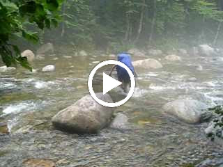
A little break down by the packs and off we went.......the rain started again.......sigh......filled water bottles further down on the right side......not water coming from the dead moose.....the plan was to bush whack up to the col between Flume and Liberty.......it was now raining and it's steep and slippery in there....MEB was going out Lincoln Woods and not do the Franconia Ridge so I decided to go around with her.....passed the logging road which goes in a bit.....hmmm.... still decided to take the safer long road around.......first big creek crossing.......
and there was a hiker on the other side who had gotten his pack swarmed by hornets.....he got stung a few times himself.....but he was not allergic so we went on......to the next crossing......just went through with shoes on...
Video of MEB crossing....not sure if it will work:
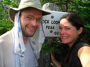
...lots of water......walk walk walk walk walk.......great to see Wilderness Trail and Lincoln Woods Trail and lots of people going in to swim......Once at Osseo Trail it was maybe 5:15pm.....took abreak....filled up water and I went up towards Flume.......MEB was going to hitch hike to her car........Arm somehow drove by and picked her up and she found a tentsite at Lafayette Place.......myself I headed up Osseo Trail.....moved pretty quick and was on top of Flume by 7:30pm.......41 done........
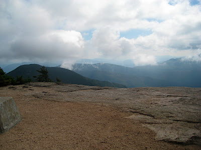
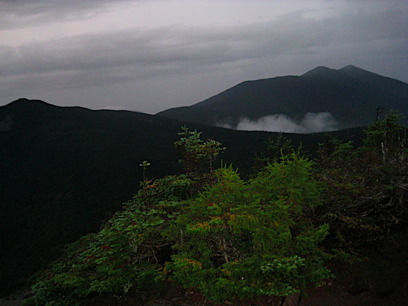
View towards Liberty, Haystack, Lincoln and Lafayette from Flume:
...turned on headlamp in a dark section between Flume and Liberty......pushups on Liberty for 42......very foggy......took it nice and easy towards Little Haystack......it was raining now.......went by Haystack without even seeing it.....much fog it was.....wind picked up so I put on a rain jacket to prevent hypothermia.....changed batteries in the headlamps so I could see better.....it kept pouring and I hoped there won't be lightning......the fog made it difficult to see the trail sometimes........very slow I went......It was around 9:30 when I left Little Haystack I believe. Lincoln took a while to get over......then a couple of slick sections....rain continued.......up towards Lafayette and it was 11:18pm when I reached summit nr 44......
......and it kept raining so the descent took a long time....about an hour to Greenleaf Hut........then my feet started to complain....advil wore out and no more to take......oh well.......I'll tough it out......MEB was waiting down by Lafayette Place. At least we had a tent site.......the pace went slower and slower with the increased level of pain in my feet......2:45am I finally reached Lafayette Place TH and MEB greeted me and she drove to the campsite and I had to walk sinc I can't set my feet in a vehicle during this. It probably took 20 minutes to get to the tent site.....I realized the chances of continuing tomorrow had diminshed drastically......but I could maybe recover overnight.......shower and food.....and zzzzzzzzzzzzz
The next morning the feet told me not to continue.......went for breakfast with some cool hikers instead.......
Thanks everyone for your support during this hike.......hope we put on a decent show for you guys
Oh by the way the pre-hike weight was 205.2 lbs (276 lbs with pack).........this morning I weighed in at 192.0 lbs (pack less).......if you ever wanna lose weight
Cheers, Mats and MEB
Woke up when it got light outside.......we slowly got organized and out of the way for the breakfast set-up.
Feet were hurting a lot going downhill towards the Gale River Trail junction.......at this point I had figured that advil helps a lot to alleviate some of the pain......took the first pills heading towards Hancocks two days ago.....
Had the pack covers on since trees were dripping and sometimes rain decided to greet us. Dropped the packs by Franconia Brook intersection and went up the steep section up Garfield....Windy and foggy and some rain on the summit....didn't stay long........then down to the spring by the tentsite cut-off......met a couple of brothers there who got caught yesterday in the storm when they came off Lafayette.......drank a liter and filled up one bottle. Then downclimbing the water ridden steep section towards the packs......
......no idea what time it was but we started down towards 13 Falls and a mile into it or so I saw something moving 100 feet off to the left.....I was sure it was a moose - but it turned out to be a trail crew dude taking care of business in the woods.....met his team mates further down the trail. The trail got easier and leveled out a bit before hitting 13 Falls.......crossed the ledges where I filled up my water bottle again......
......a group of five including a barefoot hiker showed up......last time I saw a barefoot hiker in the whites as on exactly the same trail a couple of miles up.....the shoeless must like Lincoln Brook Trail........MEB figured out we were gonna run out of advil soon.... oh oh........
...we followeded Lincoln Brook Trail up towards the height of the land which was full of water......an ordeal to cross.....feet were soaking wet of course.......finally hit dry land on the other side and started the downhill descent towards Owl's Head Slide. Got lost at some point but 3 minutes later we found the trail. We heard a lot of stories about the dead moose at the base of Lincoln Slide.......we wondered where exactly we would find it.....dropped our packs at the intersection - no smell of moose yet.......
Up the hill we went and soon a sharp stench hit our noses........I told MEB to hold her nose......we walked straight over the remants which looked like a fury carpet.......we didn't vomit but close.......the stench stopped right after we passed over the remnants.....then the step part started......met a dude coming down.....rocks were slick so we took it easy......slowly but surely we made our way up and into the woods.........up on the ridge and to the true summit....40 done....8 to go...
...got lost on the herd paths coming back.......met three guys and then two bikini-dressed women/girls (probably high school age). They asked how far to the summit........down the steep section......
..MEB took a fall shortly before the moose but not bad........from above we saw the rib cage of the moose on the right side.....looked like a pretty small moose.......we figured he/she probably fell and broke a leg or so coming down the slide and then starved to death on the spot since unable to move......
A little break down by the packs and off we went.......the rain started again.......sigh......filled water bottles further down on the right side......not water coming from the dead moose.....the plan was to bush whack up to the col between Flume and Liberty.......it was now raining and it's steep and slippery in there....MEB was going out Lincoln Woods and not do the Franconia Ridge so I decided to go around with her.....passed the logging road which goes in a bit.....hmmm.... still decided to take the safer long road around.......first big creek crossing.......
and there was a hiker on the other side who had gotten his pack swarmed by hornets.....he got stung a few times himself.....but he was not allergic so we went on......to the next crossing......just went through with shoes on...
Video of MEB crossing....not sure if it will work:
...lots of water......walk walk walk walk walk.......great to see Wilderness Trail and Lincoln Woods Trail and lots of people going in to swim......Once at Osseo Trail it was maybe 5:15pm.....took abreak....filled up water and I went up towards Flume.......MEB was going to hitch hike to her car........Arm somehow drove by and picked her up and she found a tentsite at Lafayette Place.......myself I headed up Osseo Trail.....moved pretty quick and was on top of Flume by 7:30pm.......41 done........
View towards Liberty, Haystack, Lincoln and Lafayette from Flume:
...turned on headlamp in a dark section between Flume and Liberty......pushups on Liberty for 42......very foggy......took it nice and easy towards Little Haystack......it was raining now.......went by Haystack without even seeing it.....much fog it was.....wind picked up so I put on a rain jacket to prevent hypothermia.....changed batteries in the headlamps so I could see better.....it kept pouring and I hoped there won't be lightning......the fog made it difficult to see the trail sometimes........very slow I went......It was around 9:30 when I left Little Haystack I believe. Lincoln took a while to get over......then a couple of slick sections....rain continued.......up towards Lafayette and it was 11:18pm when I reached summit nr 44......
......and it kept raining so the descent took a long time....about an hour to Greenleaf Hut........then my feet started to complain....advil wore out and no more to take......oh well.......I'll tough it out......MEB was waiting down by Lafayette Place. At least we had a tent site.......the pace went slower and slower with the increased level of pain in my feet......2:45am I finally reached Lafayette Place TH and MEB greeted me and she drove to the campsite and I had to walk sinc I can't set my feet in a vehicle during this. It probably took 20 minutes to get to the tent site.....I realized the chances of continuing tomorrow had diminshed drastically......but I could maybe recover overnight.......shower and food.....and zzzzzzzzzzzzz
The next morning the feet told me not to continue.......went for breakfast with some cool hikers instead.......
Thanks everyone for your support during this hike.......hope we put on a decent show for you guys
Oh by the way the pre-hike weight was 205.2 lbs (276 lbs with pack).........this morning I weighed in at 192.0 lbs (pack less).......if you ever wanna lose weight
Cheers, Mats and MEB
Tuco
New member
Really compelling stuff. Thanks for the report and pix.
Soounds like you two had a great adventure; you know it sounds good when it makes you want to go out and do the same (I got over it quickly).
Most intriguing, MEB- those Dunham Waffle Stompers you are wearing? Ok, not most intriguing but...........
Soounds like you two had a great adventure; you know it sounds good when it makes you want to go out and do the same (I got over it quickly).
Most intriguing, MEB- those Dunham Waffle Stompers you are wearing? Ok, not most intriguing but...........
Great effort, Mats and MEB. You two really got punished by the weather gods this year, I think. Sorry that I missed MEB at Lafayette campground around 8:30 pm on Saturday (would have not hung around until 2:30 am for Mats ), but I did not think to ask for a site under MEB's name, and the camground host only had a reservation in the computer for a visit by Mats back in April or May.
I am wondering about the relative energy expeditures between carrying a full pack over the Tri's, Tecumseh, and the Osceola's as opposed to covering more miles doing out and backs without the heavy pack (i.e., leaving the pack at the Kate Sleeper - South Tri junction for the Tri's, at the south end of Greely Ponds Trail for Tecumseh, and at the foot of the East Osceola Trail for the Osceola's; seems like that alternative should be allowed in the "rules"?). But, given the weather conditions, not sure anything could have saved your feet this year.
Best wishes on your recoveries. You did our human species proud.
), but I did not think to ask for a site under MEB's name, and the camground host only had a reservation in the computer for a visit by Mats back in April or May. I am wondering about the relative energy expeditures between carrying a full pack over the Tri's, Tecumseh, and the Osceola's as opposed to covering more miles doing out and backs without the heavy pack (i.e., leaving the pack at the Kate Sleeper - South Tri junction for the Tri's, at the south end of Greely Ponds Trail for Tecumseh, and at the foot of the East Osceola Trail for the Osceola's; seems like that alternative should be allowed in the "rules"?). But, given the weather conditions, not sure anything could have saved your feet this year.
Best wishes on your recoveries. You did our human species proud.
Last edited:
una_dogger
Well-known member
i love the Mats and MEB show!
!
LOL, I agree....
I love your writing style, Mats, its just how I feel when I am backpacking, minimal words, leaving out everything but the good stuff...
Mats Roing
New member
I am wondering about the relative energy expeditures between carrying a full pack over the Tri's, Tecumseh, and the Osceola's as opposed to covering more miles doing out and backs without the heavy pack (i.e., leaving the pack at the Kate Sleeper - South Tri junction for the Tri's, at the south end of Greely Ponds Trail for Tecumseh, and at the foot of the East Osceola Trail for the Oseola's; seems like that alternative should be allowed in the "rules"?).
The thing is that by the Tripyramids a week's worth of food is consumed already and the pack weight is not that significant as it was in the early days. Dropping packs and bag peaks is done at several places like Moriah, Hancocks, Washington, Cabot, Tom, Cannon, Owl's Head etc. But when adding extra distance to drop the pack the cost most of the time would exceed the benefit I'm thinking.....
Bobby
Active member
Great job by both Mats and MEB. You two did more in ten days than most people do in a lifetime. Congrats!
The thing is that by the Tripyramids a week's worth of food is consumed already and the pack weight is not that significant as it was in the early days. Dropping packs and bag peaks is done at several places like Moriah, Hancocks, Washington, Cabot, Tom, Cannon, Owl's Head etc. But when adding extra distance to drop the pack the cost most of the time would exceed the benefit I'm thinking.....
Thanks for your thoughts on this question, Mats; I figured that you had given all of these choices a lot of consideration. BTW, how heavy was your pack at the end (not counting weight from rain-soaked stuff
)?Mats Roing
New member
Thanks for your thoughts on this question, Mats; I figured that you had given all of these choices a lot of consideration. BTW, how heavy was your pack at the end (not counting weight from rain-soaked stuff
Towards the end the water was the biggest individual item in the pack. Without water I think my pack was maybe 20 lbs towards the end and 35 with water.......let's see
Sleeping gear: 6lbs (tent, sleeping bag, pad)
Clothing: 4 lbs
Cooking stuff 3 lbs
Electronics 1 lbs
Hygien 1 lbs
Pack itself 5 lbs (with wet and dry rib)
Misc. stuff 2 lbs (some stuff I dropped along the way like a knife and solar panel)
Water and containers 1 - 16 lbs
I guess it makes it 23-39 lbs although I never filled up water completely so never above 32-33 lbs the last two days.
Figure about 3 lbs of food per day so add 32-33 lbs or so to the beginning pack weight. Food can easily be cut by 10 lbs but then it's a really boring diet so I rather carry 10 lbs more food and have some goodies like sardine cans and chocolate along......
You pack 5 cliff shots per day and you need 55 for the trip......that's like 5 lbs and similar with bars.....and then you're up to 10 lbs.....food adds up easily....and then adding breakfast and dinner.....
That's why we fell behind the schedule from 2 years ago considerably in the early days. Then after 5 or 6 days you start to gain on the schedule from 2 years ago. At one point we were about 30 miles behind (end of day 5). But then by day 10 those 30 miles had been regained and was equal to the schedule of two years ago......if the feet were fine we would probably have shaved off a few hours of the time as well by the finish.
A 20-mile day with 25 lbs on your back is not that big of a deal but when you kick in a 50-70 lbs pack it's a whole different ball game and you can't count on more than 1.5 miles/hr regardless how fast you do the Pemi-loop. Foot and pain management are the most important things to master.....and you basically need to be on the trail from dusk until dawn every single day to pull it off.....sometimes longer........it's doable and it's beautiful......can't wait until next year....
A 20-mile day with 25 lbs on your back is not that big of a deal but when you kick in a 50-70 lbs pack it's a whole different ball game and you can't count on more than 1.5 miles/hr regardless how fast you do the Pemi-loop. Foot and pain management are the most important things to master.....and you basically need to be on the trail from dusk until dawn every single day to pull it off.....sometimes longer........it's doable and it's beautiful......can't wait until next year....
I could not agree more. Back in August 2000, the Wonderland Trail around Mount Rainier really kicked by butt (and feet), although it was all worth it (the views were spectacular, especially for a glacial geologist). I did not have a vehicle so I could not cache provisions at the usual two drop points, so I began with a 70 pound pack (5+ pounds of camera gear
), hoping to complete the 95+ mile route in 5+ days (began CW at Longmire after getting dropped off by the bus late in the afternoon). I got behind and was threatened twice by the rangers that I would need to leave the park (and hitchhike out from the nearest trailhead) if I could not pick up the pace and get back on schedule to reach my registered campsites. Fortunately, I met someone who let me share his registered campsites for the remainder of the circuit, which only required me to ration food a little and finish in 7+ days. [Yes, I know that some folks run the WT in one push with a fanny pack.] Another nice aspect of the WT is that water is readily available for the entire loop, so one can get by with just a couple of liter bottles (I carried a pump).I would love to try the NH4s Diretissima (still seems like a weird term to me, as looking at a map, the route appears to be more more like an "anti-Diretissima"
), but I would need to try it in cooler weather, such as during the fall season, when I am not free. Mats Roing
New member
I would love to try the NH4s Diretissima (still seems like a weird term to me, as looking at a map, the route appears to be more more like an "anti-Diretissima"
It was the "Good Reverend" Henry Folsom who came up with the name back in 1971 so I thought it would be good to respect his innovativeness. He took about three months to do it with 19 effective hiking days. His goal was the shortest route on foot for all 48 without aid in between. The spelling has two "t's" and two "s's" in it......
Sasquatch
New member
Great job Mats and Meb!Truly inspirational.Hard work and dedication in the face of adversity,too bad about the feet.But that's the beauty of the mountains,life almost makes sense there.
Similar threads
- Replies
- 5
- Views
- 3K
- Replies
- 4
- Views
- 2K
- Replies
- 4
- Views
- 3K
- Replies
- 19
- Views
- 4K